The best walks and hikes in Sespe Wilderness
5.0
(10)
146
hikers
31
hikes
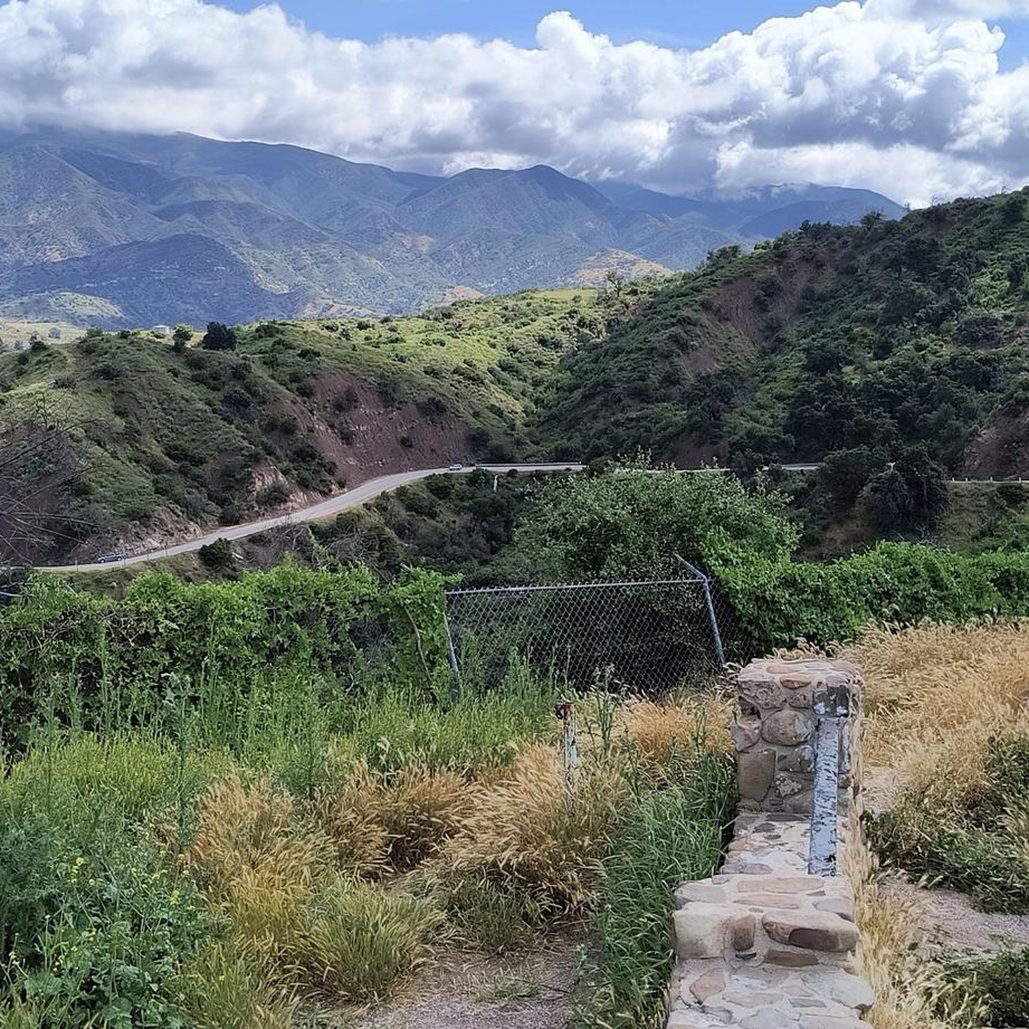
Hikes in Sespe Wilderness traverse a rugged landscape within the Los Padres National Forest. The region is characterized by deep canyons, prominent sandstone cliffs, and the free-flowing Sespe Creek. Its trail network offers routes through chaparral and oak woodlands, with some leading to natural hot springs.
Best hiking trails in Sespe Wilderness
- The most popular hiking route is Willett Hot Springs via Sespe River Trail — Sespe Wilderness, a 20.1 mile (32.3 km) trail that takes about 9 hours 7 minutes to complete. This challenging backpacking route follows the Sespe River to a natural hot spring.
- Another top favourite among local hiking enthusiasts is Ryes Peak & Haddock Mountain via Reyes Peak Trail — Los Padres National Forest, a moderate 7.6 mile (12.3 km) path. The trail features steady elevation gain leading to views from the mountain ridges.
- Local hiking enthusiasts also love the Potrero John Creek Trail — Los Padres National Forest, a 3.5 mile (5.7 km) trail leading through a shaded canyon, often completed in about 1 hour 42 minutes.
- Hiking in Sespe Wilderness is defined by long river canyons, white sandstone formations, and chaparral-covered hills. The trail network includes short day hikes along creeks as well as multi-day backpacking loops.
- The routes in Sespe Wilderness are highly rated by the komoot community with an average score of 4.9 stars from 10 reviews. More than 100 hikers have used komoot to explore Sespe Wilderness's varied terrain.
Last updated: June 25, 2026
11
hikers
16.4km
04:38
290m
370m
Embark on a moderate hike along the Sespe River Trail to Willett Hot Springs, a journey spanning 10.2 miles (16.4 km) with an elevation gain of 941 feet (287 metres). You can expect to spend around 4 hours and 38 minutes exploring the diverse and picturesque scenery of the Sespe Wilderness. The trail takes you through varied terrain, from sandy sections to rolling hills, all framed by dramatic canyon walls. Keep an eye out for the striking white granite outcroppings known as Piedra Blanca near the trailhead, and look forward to a relaxing soak in the natural hot springs at your destination.
This route is suitable for a challenging full-day outing or a comfortable overnight backpacking trip. Be prepared for multiple creek crossings along the Sespe Creek, which can range from simple rock-hopping to wading through knee-deep water. While the trail is generally accessible, always check local regulations for the Sespe Wilderness regarding permits or any seasonal closures before you head out. Planning ahead ensures a smooth and enjoyable experience.
The Sespe River Trail follows the Sespe Creek, which holds the distinction of being a designated National Wild and Scenic River. This designation highlights its unique ecological and scenic value within the rugged wilderness. The journey offers a chance to connect with a pristine natural environment, culminating in the unique reward of the Willett Hot Springs. It's a notable trail in the region for its blend of wilderness challenge and natural relaxation.
9
hikers
7.03km
01:54
40m
120m
Embark on the Sespe River Trail to Bear Creek Camp, a moderate hike spanning 4.4 miles (7.0 km) with a gentle elevation gain of 141 feet (43 metres). You can expect to complete this route in about 1 hour and 54 minutes. As you follow the path, you will wind alongside the beautiful Sespe Creek, passing through rugged wilderness with green trees and distinctive red sandstone formations, particularly as you approach Bear Creek Camp. This journey offers a rewarding experience within the Sespe Wilderness.
When planning your visit, be aware that this trail involves multiple river crossings, typically 4 to 5, to reach Bear Creek Camp. These crossings can be challenging, especially after heavy rains, so consider bringing river sandals or water shoes. The route is also largely exposed to direct sunlight, so make sure to carry plenty of water and sun protection, as temperatures can get quite warm. Starting early in the day is often a good strategy to avoid the midday heat.
The Sespe River Trail is notable for following the Sespe Creek, which holds the special designation of a National Wild and Scenic River. Bear Creek Camp itself is a popular destination, offering a welcoming sandbar, a refreshing swimming hole, and shade from cottonwood trees, making it an ideal spot for a break. You will also catch glimpses of dramatic rock formations and distant views of the Sespe Condor Sanctuary, highlighting the unique natural environment of this area.

Sign up for free
2
hikers
4.79km
01:54
280m
60m
The Gene Marshall-Piedra Blanca National Recreation Trail offers a moderate hiking experience through diverse landscapes. You will cover 3.0 miles (4.8 km) and ascend 928 feet (283 metres), typically completing the route in about 1 hour and 53 minutes. Along the way, you'll pass through lush riparian areas, dense chaparral, and mixed conifer forests. A defining feature of this trail is the striking white sandstone formations known as Piedra Blanca, which you can see for much of your journey. As you gain elevation, you'll also enjoy broad views of the Topa Topas to the south and Pine Mountain to the north.
When planning your visit, be aware that conditions can vary. During the winter months, snow may be present at higher elevations, which could affect your hike. The trail can also become overgrown in certain sections, especially with chaparral, so be prepared for varied terrain. Always check local conditions before heading out to ensure a pleasant and safe experience on the route.
This trail is located within the Sespe Wilderness, offering a true immersion into the natural environment. The unique Piedra Blanca rock formations are not just a visual highlight but also a key geological feature of the area. The route provides a great opportunity to observe the transition between different ecosystems, from water-dependent riparian zones to drier chaparral and higher-elevation forests. It's a notable trail for experiencing the rugged beauty of the region.
1
hikers
9.61km
02:39
160m
160m
Embark on a moderate 6.0-mile (9.6 km) hike along the Lion Canyon Trail to Falls, a route that takes about 2 hours and 38 minutes to complete. You will gain 534 feet (163 metres) in elevation as you explore diverse terrain, starting flat before a gradual ascent. The trail follows Lion Creek, providing continuous scenic views of the canyon walls and leading you past charming small waterfalls and pools, especially near the East and West Fork Lion Camps. As you climb higher, keep an eye out for potential views of the Channel Islands and Pine Mountain.
To begin your hike, head to the trailhead accessible via the Middle Lion Campground, situated north of Ojai on Highway 33. Be aware that parking at the trailhead requires a valid recreation pass, such as an Adventure Pass. This pass serves as your day use permit for visiting the Los Padres National Forest, so ensure you have it ready before your trip.
This trail offers a rewarding outdoor experience within the Los Padres National Forest. It stands out for its journey through varied chaparral and riparian vegetation, showcasing the natural beauty of the canyon. The presence of Lion Creek throughout the route adds to the serene atmosphere, making it a notable option for those seeking a blend of scenic views and a moderate physical challenge.
1.55km
00:41
150m
0m
Embark on the Reyes Peak Trail for a moderate hike that quickly immerses you in the rugged beauty of the Los Padres National Forest. This route, spanning 1.0 miles (1.5 km) with an elevation gain of 491 feet (150 metres), leads you through varied terrain, from rocky sections to groves of Jeffrey and ponderosa pines. You can expect to reach the summit in about 40 minutes, where you'll be rewarded with expansive 360-degree panoramas, including views of the Cuyama Badlands, the Pacific Ocean, and on clear days, even the distant Channel Islands.
When planning your visit, remember that dogs are welcome on the Reyes Peak Trail, provided they are kept on a leash. The trailhead is easily accessible, but it is always a good idea to check current local conditions before you head out, especially regarding weather or any potential advisories for the Sespe Wilderness area. While no specific permits are typically required for this particular section, staying informed ensures a smooth and enjoyable experience.
This trail is notable for its unique position within the serene Sespe Wilderness, offering a glimpse into a diverse ecosystem. Beyond the stunning vistas, keep an eye out for distinctive large sandstone boulders scattered along the path. If you visit in the spring, you might also catch a vibrant display of wildflowers, such as lupine, adding another layer of natural beauty to your journey up Reyes Peak.
Get access to more routes and recommendations from other explorers.
Sign up for free
Already have an account?
Our route recommendations are based on thousands of hikes, rides, and runs completed by other people on komoot.
Start today with a free account
Your next adventure awaits.
Login or Signup
Popular around Sespe Wilderness
Tips from the Community

Lion Canyon Trail follows Lion Canyon Creek until the trail is divided in a fork. Both sides of the fork end up in waterfalls, with paid campsites close to the waterfall, named East Fork Camp and West Fork Camp. If you take the middle fork, the trail goes to Sespe Wilderness, ending at Nordhoff Road Ridge. The road that gives access to this trail is closed as of winter 2023 due to storm damage. For up-to-date closure information, check: https://www.fs.usda.gov/detail/lpnf/alerts-notices/?cid=stelprdb5309152
0
0
Reyes Peak is a 7493 ft summit surrounded by pine trees and chaparral vegetation. The peak has two access trails: an easy one via Reyes Peak Trail, and a difficult one via Chorro Grande Trail.
0
0
Deep within the Sespe Wilderness is Willett Hot Springs, a natural hot spring surrounded by nature. The Willett Camp backcountry campsite is nearby if you decide to spend the night. Highway 33, which gives access to the trail, has been closed since winter 2023, but the hot springs remain open. For more information on road closures, visit fs.usda.gov/detail/lpnf/alerts-notices/?cid=stelprdb5309152
1
0

You reach the Willett Hot Springs after a about 15 kilometer long hike through the Sespe Wilderness. Nearby you can find the Willett campsite. A great place in the middle of the pure nature!
0
0
From this parking spot you can hike the Sespe River Trail which leads you through the Sespe Wilderness to the Willet Hot Springs. Beside the trail you find several camping sites and stunning nature. Make sure you take everything with you that you need during a two to three day hike without any public entities.
0
0
Frequently Asked Questions
What should I know before hiking in the Sespe Wilderness?
The Sespe Wilderness is a rugged and remote area. Trails can be challenging with significant elevation changes and potentially overgrown sections. Water is scarce, especially in summer, so carry more than you think you'll need. The weather can be extreme, with very hot days and cool nights. Always check conditions before you go, bring a map and compass or GPS device, and be prepared for a true wilderness experience with limited cell service.
When is the best time of year to hike in the Sespe Wilderness?
The best times to hike are in the spring and fall. Spring offers milder temperatures and the landscape is often green with wildflowers. Fall also has pleasant weather for hiking. Winter can be a good time, but be prepared for cold nights and the possibility of rain or snow at higher elevations. Summer is generally very hot and dry, making long hikes difficult and increasing the risk of heat-related illness.
Are there any easy day hikes in the Sespe Wilderness?
Yes, while the area is known for its challenging backpacking routes, there are shorter options. The Potrero John Creek Trail — Los Padres National Forest is a great choice. It's a relatively short 3.5-mile (5.7 km) hike through a shaded canyon with several creek crossings, making it a pleasant outing.
Are there any trails that lead to hot springs?
Yes, the Sespe Wilderness is famous for its natural hot springs, which are a popular destination for backpackers. The most well-known route is the challenging trek to Willett Hot Springs. Be aware that reaching these springs requires a multi-day backpacking trip and careful planning.
What are the trail conditions like, especially creek crossings?
Trail conditions vary greatly. Some trails are well-maintained, while others can be faint or overgrown. Creek crossings are a key feature of many hikes. During the spring or after recent rains, Sespe Creek and its tributaries can be high and swift, requiring careful navigation. In the dry season, many smaller creeks may be completely dry. Always check recent reports on water levels before you start your hike.
Do I need a permit to hike or camp in the Sespe Wilderness?
For overnight camping in the Los Padres National Forest, you typically need a California Campfire Permit, even if you only plan to use a stove. For day hiking, permits are not usually required. However, regulations can change, so it's always best to check with the Ojai Ranger District office for the most current information before your trip.
Are dogs allowed on the trails?
Dogs are generally permitted on trails in the Los Padres National Forest, but they must be on a leash or under strict voice control. Keep in mind that the terrain is rugged, water can be scarce, and wildlife such as rattlesnakes are present. Ensure your dog is prepared for the challenging conditions and that you pack enough water for them.
Where can I find a challenging hike with great views?
For experienced hikers seeking a strenuous challenge with rewarding vistas, the Topatopa Bluff via Lion Canyon Trail — Los Padres National Forest is an excellent option. This 14.9-mile (24 km) route involves significant elevation gain, leading you up to the impressive bluffs for panoramic views of the surrounding wilderness.
How many hiking trails are in the Sespe Wilderness?
There are nearly 20 designated hiking routes in and around the Sespe Wilderness. These range from short, easy walks along creeks to strenuous, multi-day backpacking loops that explore the deep canyons and high ridges of the region.
What do other hikers enjoy about the Sespe Wilderness?
The komoot community rates the area very highly. Hikers often praise the sense of solitude and true wilderness adventure. The dramatic sandstone cliffs, the beauty of the free-flowing Sespe Creek, and the unique experience of soaking in natural hot springs after a long trek are frequently mentioned as highlights.
What kind of wildlife might I see?
The Sespe Wilderness is a rich habitat for wildlife. It's possible to see deer, coyotes, and bobcats. The area is also home to black bears and mountain lions, so it's important to be bear-aware and store food properly. The region is particularly significant as it includes the Sespe Condor Sanctuary, a critical protected area for the endangered California condor. While public entry to the sanctuary is prohibited, you may be lucky enough to spot one of these magnificent birds soaring overhead.
Most popular routes in Sespe Wilderness
Most popular attractions in Sespe Wilderness

Get inspired with the komoot mobile app


Explore more
Browse the best Hikes in other regions.
