The best road cycling routes in Twin Peaks Wilderness
5.0
(10)
1,441
riders
26
rides
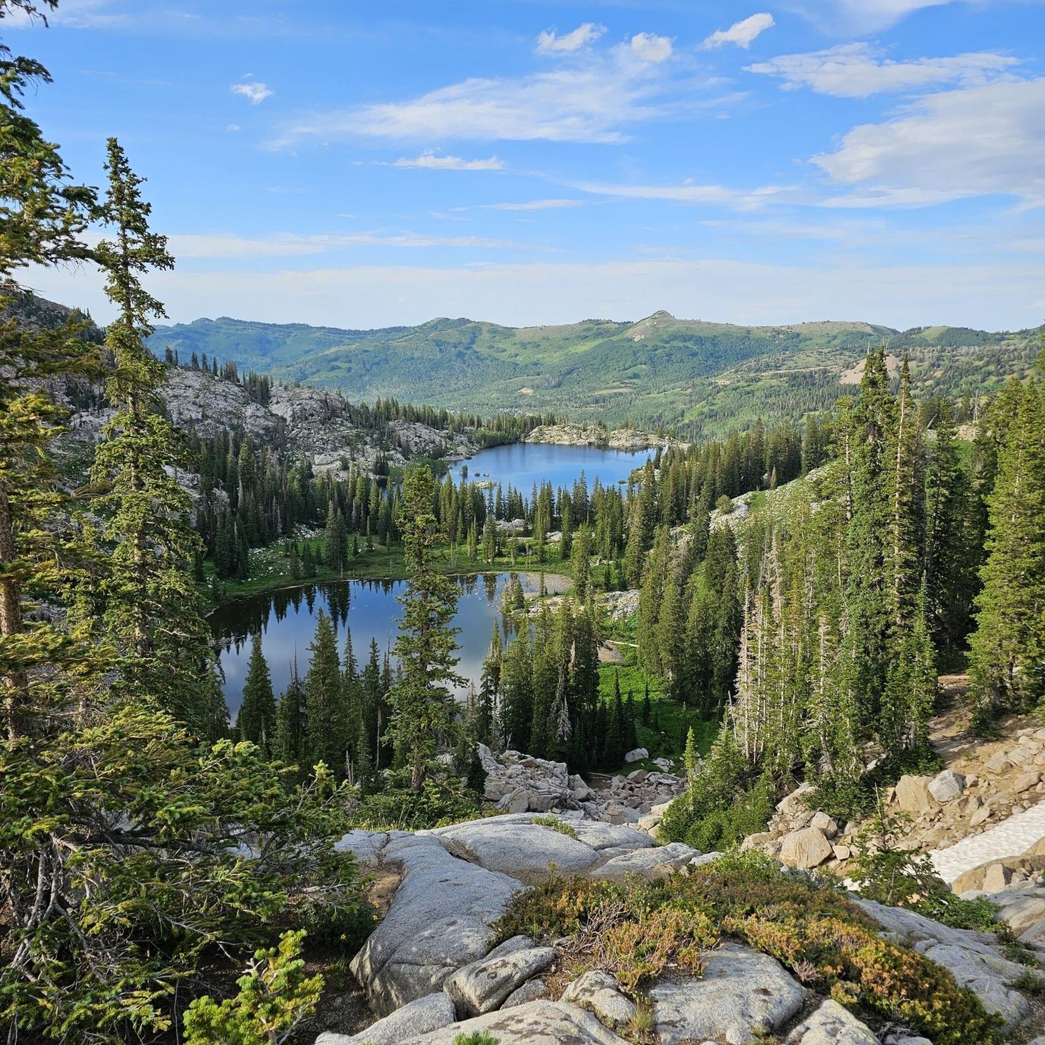
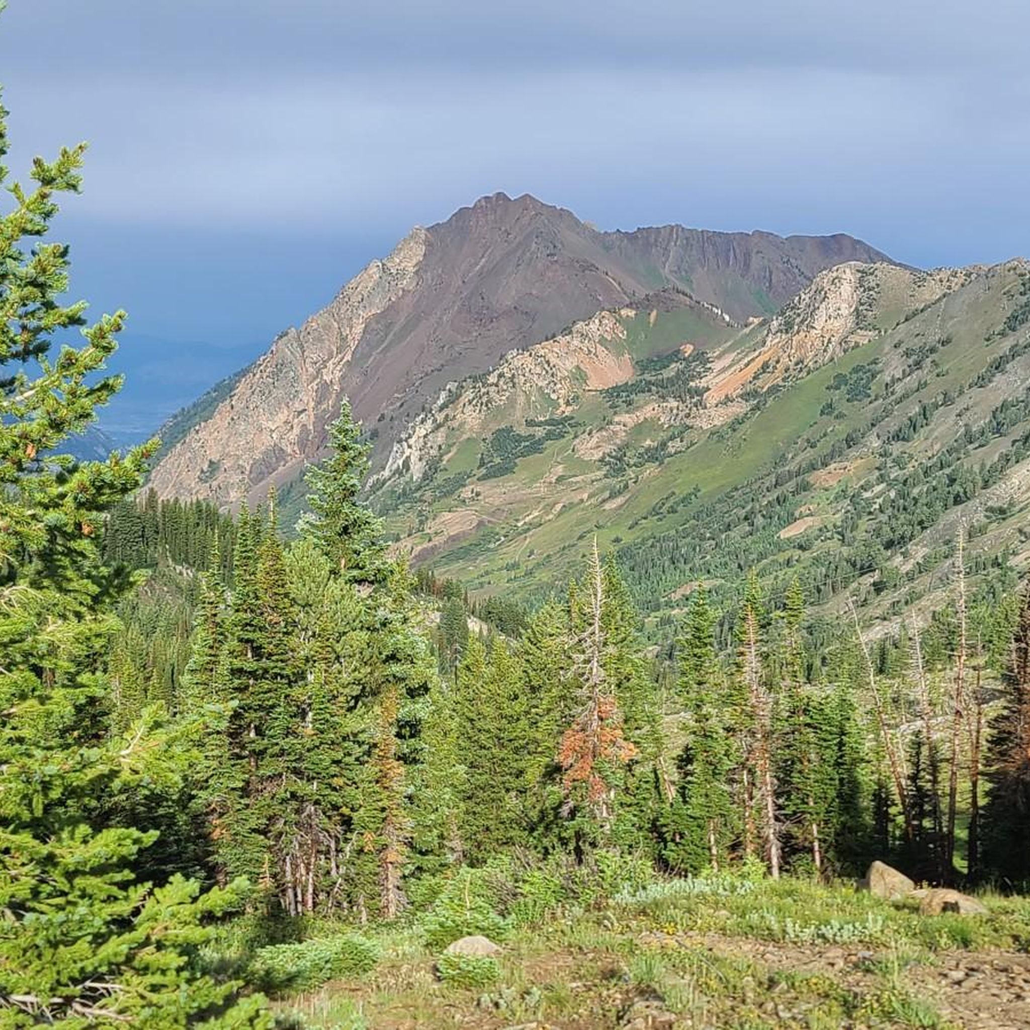
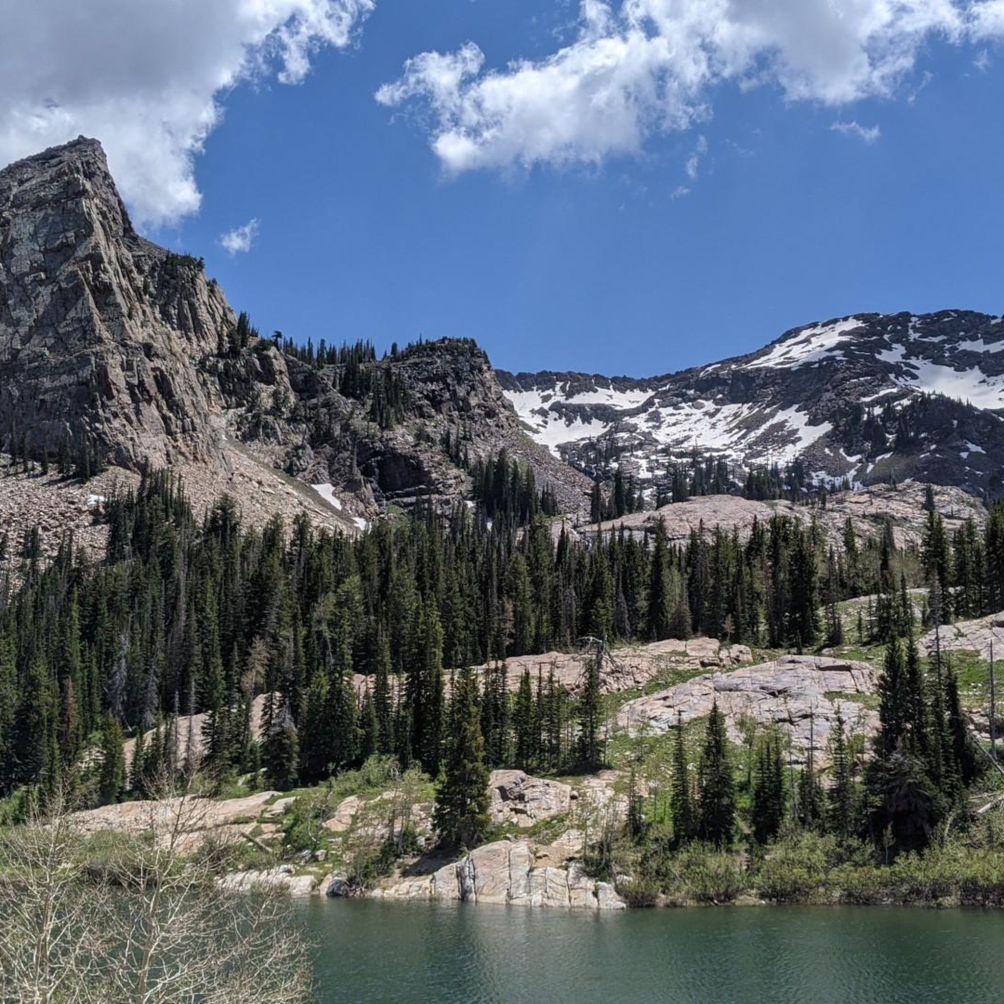
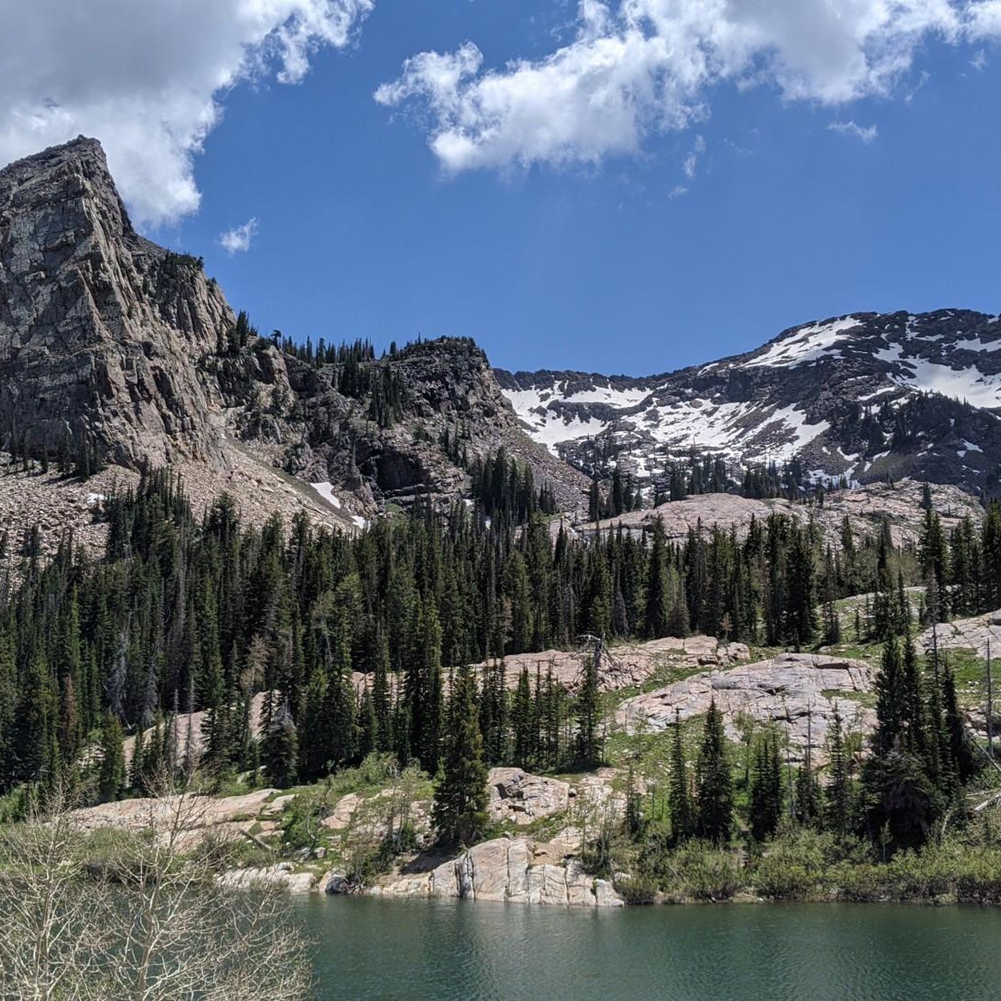
Road cycling routes in Twin Peaks Wilderness offer challenging rides through rugged landscapes and high peaks. The region is characterized by narrow canyons, towering peaks, and scenic canyon roads, with much of the higher terrain being alpine. Lower elevations feature dense mountain brush, oak, maple, and grass, alongside rushing creeks. The landscape is a result of continual thrusting and glacial erosion, exposing older sedimentary rock layers and cirques.
Best road cycling routes in Twin Peaks Wilderness
- The most popular road…
Last updated: May 18, 2026
7
riders
44.6km
02:13
580m
580m
Moderate road ride. Good fitness required. Some segments of this route may be unpaved and difficult to ride.
66
riders
Moderate road ride. Good fitness required. Some segments of this route may be unpaved and difficult to ride.

Sign up for free
5
riders
15.6km
00:44
180m
180m
Easy road ride. Great for any fitness level. Mostly well-paved surfaces and easy to ride.
4
riders
15.6km
00:50
230m
230m
Easy road ride. Great for any fitness level. Mostly well-paved surfaces and easy to ride.
103
riders
43.4km
02:28
990m
990m
Hard road ride. Very good fitness required. Mostly well-paved surfaces and easy to ride.
Get access to more routes and recommendations from other explorers.
Sign up for free
Already have an account?
Our route recommendations are based on thousands of hikes, rides, and runs completed by other people on komoot.
Start today with a free account
Your next adventure awaits.
Login or Signup
Popular around Twin Peaks Wilderness
Tips from the Community

Few hikes from this Trailhead. The most popular one is the Lower Bells canyon
0
0

Experience breathtaking vistas of Bell Canyon from Sunrise Point, a picturesque overlook nestled at the end of Sunrise Point Trail. Ideal for early morning or twilight bike rides, this vantage point offers unparalleled views of the canyon's stunning beauty.
0
0
Experience breathtaking vistas of Bell Canyon from Sunrise Point, a picturesque overlook nestled at the end of Sunrise Point Trail. Ideal for early morning and twilight bike rides, this vantage point offers unparalleled views of the canyon's stunning beauty.
0
0
Experience breathtaking vistas of Bell Canyon from Sunrise Point, a picturesque overlook nestled at the end of Sunrise Point Trail. Ideal for early morning hikes or twilight strolls, this vantage point offers unparalleled views of the canyon's stunning beauty.
0
0

The Dimple Dell East Trail offers a captivating view of the Wasatch Range, adorned with iconic peaks like Lone Peak and Twin Peaks. Surrounded by the natural beauty of Dimple Dell Regional Park, visitors can relish the scenic vistas and appreciate the prominent geological features that define this Utah landscape.
0
0
The Dimple Dell East Trailhead car park offers a captivating view of the Wasatch Range, adorned with iconic peaks like Lone Peak and Twin Peaks. Surrounded by the natural beauty of Dimple Dell Regional Park, visitors can relish the scenic vistas and appreciate the prominent geological features that define this Utah landscape.
0
0

The Elbow Fork Trailhead off Mill Creek Canyon Road connects to the Elbow Fork Trail and runs between Mill Creek Canyon and Bowman Fork.
1
0
The Granite Trailhead leads you down the Bells Canyon Trail towards beautiful reservoirs and waterfalls. The trail is open from sunrise to 10 p.m.
1
0
Frequently Asked Questions
What kind of terrain and elevation can I expect on road cycling routes in Twin Peaks Wilderness?
Road cycling in Twin Peaks Wilderness offers a diverse experience, characterized by rugged landscapes, high peaks, and scenic canyon roads. You'll encounter significant elevation gains, with routes traversing alpine terrain at higher elevations and dense mountain brush, oak, and maple at lower elevations. For example, the Bells Canyon Granite Trailhead – Suncrest loop from Wailes features over 900 meters of elevation gain, while the Dimple Dell East Trail – Bells Canyon Granite Trailhead loop from Bengal Blvd @ 3450 E has a more moderate 268 meters of ascent.
Are there road cycling routes suitable for different fitness levels?
Yes, Twin Peaks Wilderness offers routes catering to various fitness levels. You can find easier loops, such as the Dimple Dell East Trail – Bells Canyon Granite Trailhead loop from Bengal Blvd @ 3450 E, which is rated easy. There are also moderate options like the Parleys Canyon loop from Wasatch Blvd @ 8590 S, and challenging rides like the Bells Canyon Granite Trailhead – Suncrest loop from Wailes, which requires very good fitness due to its substantial elevation gain.
What natural features and viewpoints can I see along the road cycling routes?
The routes in Twin Peaks Wilderness offer spectacular views of towering peaks like Twin Peaks, Superior Peak, and Dromedary Peak. You'll cycle through scenic canyons, including Big Cottonwood Canyon (State Route 190) and Little Cottonwood Canyon (State Route 210), which form the northern and southern boundaries. The landscape features exposed rocky ridges, scattered fir and aspen stands, and rushing creeks. In summer, you can also spot colorful native wildflowers.
When is the best time of year to go road cycling in Twin Peaks Wilderness?
The summer months are ideal for road cycling in Twin Peaks Wilderness, as this is when the area is filled with colorful native wildflowers and the weather is generally favorable. However, the higher terrain is alpine, so conditions can vary. It's always a good idea to check local weather forecasts before heading out.
How many road cycling routes are available in Twin Peaks Wilderness?
There are over 25 road cycling routes available in Twin Peaks Wilderness, offering a wide range of distances and elevation profiles. These include 11 easy routes, 15 moderate routes, and 2 difficult routes, ensuring options for various skill levels.
What do other road cyclists enjoy most about road cycling in Twin Peaks Wilderness?
The area is highly rated by the komoot community, with an average score of 5.0 stars from over 6 reviews. Road cyclists frequently praise the challenging ascents, the extensive scenery, and the well-paved surfaces of routes like State Route 190 and State Route 210, which provide access to stunning natural beauty.
Are there any circular road cycling routes in Twin Peaks Wilderness?
Yes, many of the road cycling routes in Twin Peaks Wilderness are designed as loops. Examples include the Bells Canyon Granite Trailhead – Suncrest loop from Wailes, the Parleys Canyon loop from Wasatch Blvd @ 8590 S, and the Bells Canyon Granite Trailhead – Sunrise Point loop from Granite, allowing you to start and end at the same point.
Can I bring my dog on road cycling routes in Twin Peaks Wilderness?
Twin Peaks Wilderness is part of the Salt Lake City Watershed, which imposes restrictions on activities like bringing dogs in certain areas. It's important to check specific regulations for the route you plan to ride, as dog access may be limited or prohibited in some parts of the wilderness.
Are there any family-friendly road cycling routes in Twin Peaks Wilderness?
While many routes feature significant elevation, there are easier options that could be suitable for families with good fitness. The Dimple Dell East Trail – Bells Canyon Granite Trailhead loop from Bengal Blvd @ 3450 E is rated easy and covers 18.6 km, offering a less strenuous experience through lower elevation brush and mixed forests.
What are some notable roads for scenic road cycling in the area?
State Route 190 (Big Cottonwood Canyon) and State Route 210 (Little Cottonwood Canyon) are particularly scenic roads that border the wilderness. They are known for their well-paved surfaces and provide access to challenging rides with extensive views of the surrounding rugged landscapes and high peaks.
Is parking available near the trailheads for road cycling?
Yes, routes often start from trailheads such as Bells Canyon Granite Trailhead or Dimple Dell East Trailhead, where parking is typically available. For example, the Sunrise Point – Bells Canyon Granite Trailhead loop from Big Cottonwood Creek begins near a common access point.
Most popular routes in Twin Peaks Wilderness

Get inspired with the komoot mobile app


Explore more
Browse the best Road cycling routes in other regions.
