The best running trails in Lost Creek Wilderness
5.0
(1)
21
runners
16
runs
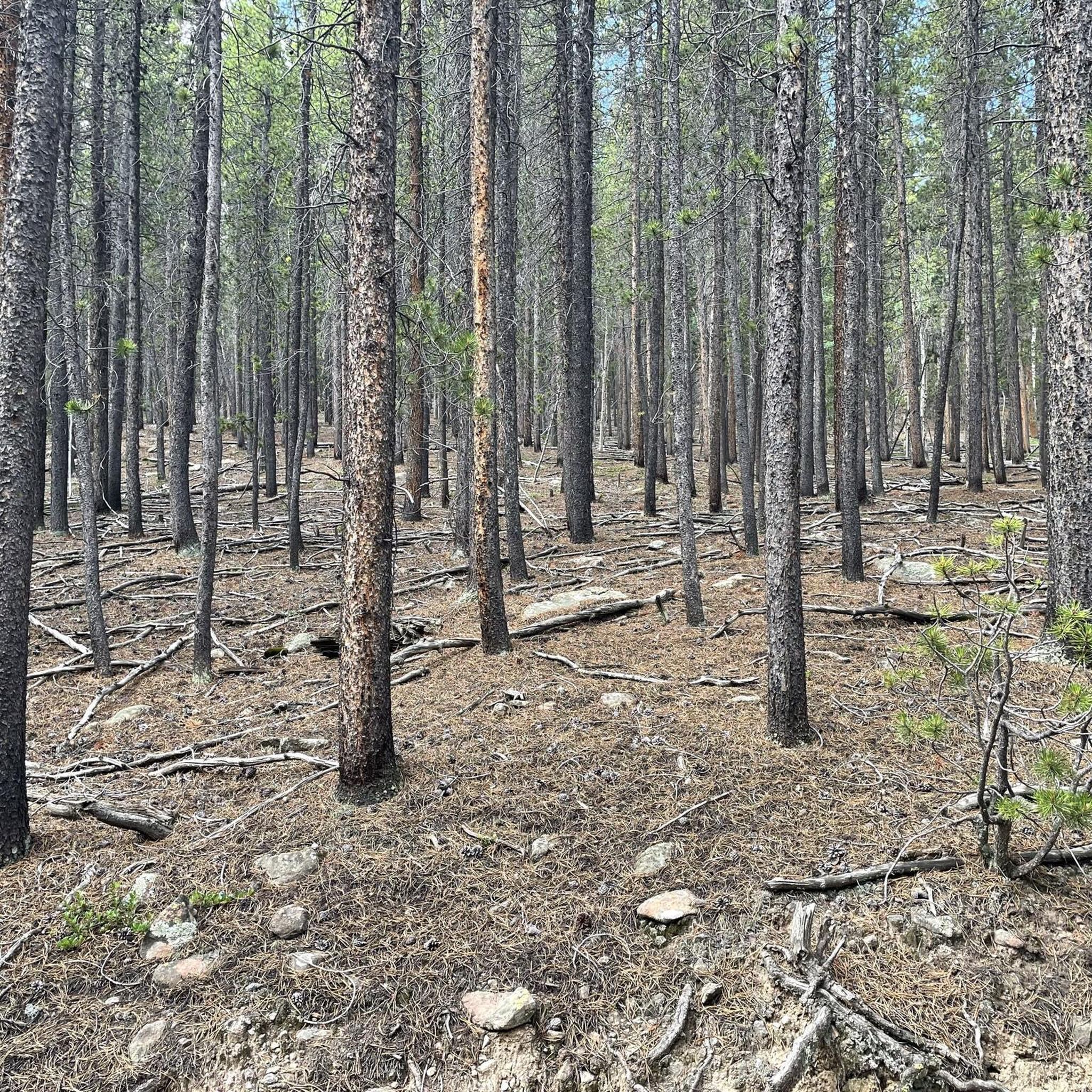
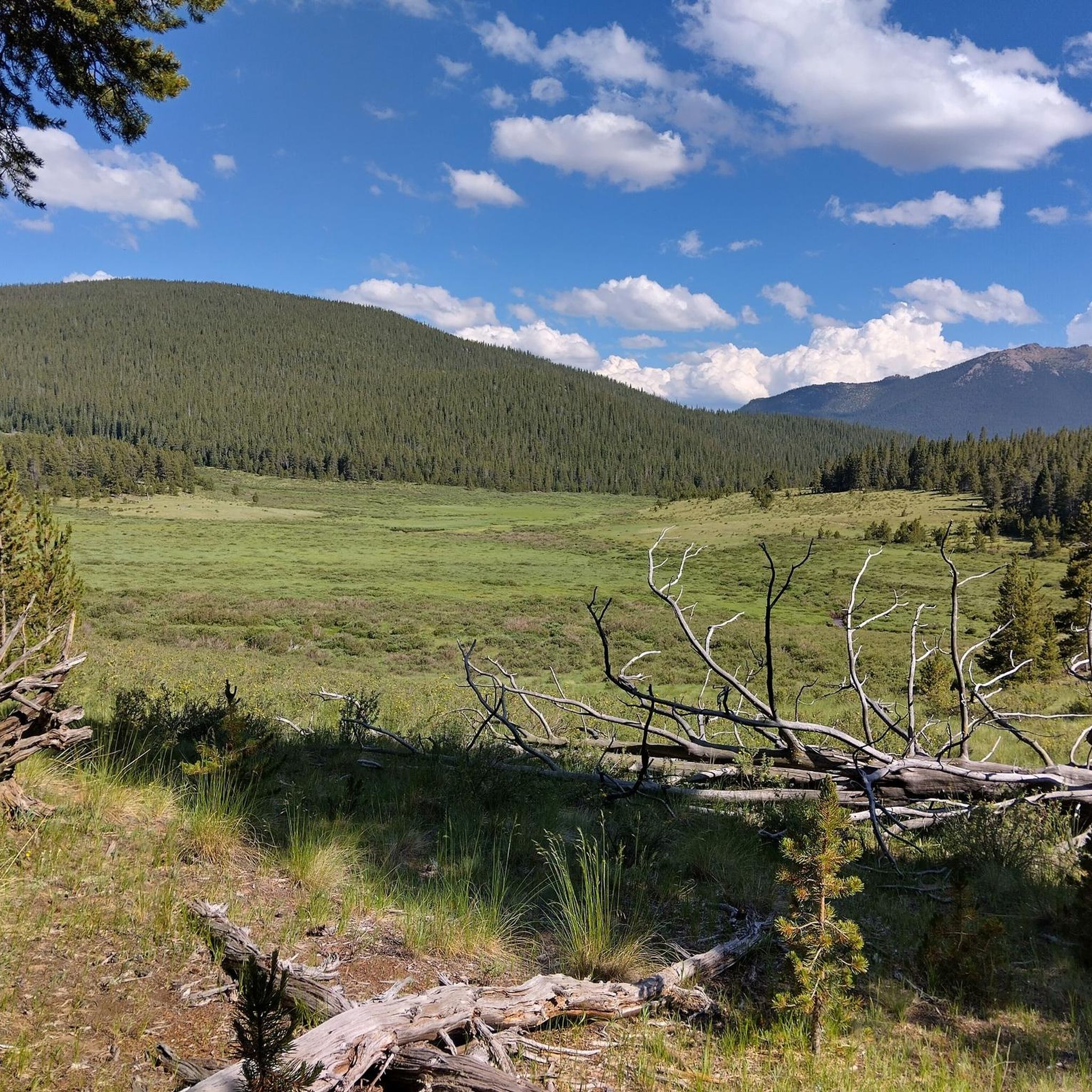
Jogging in Lost Creek Wilderness offers a unique experience through a landscape defined by fascinating rounded granite domes, knobs, and arches. The region is named after Lost Creek, a perennial stream that mysteriously disappears and reappears multiple times within its course. Running routes wind through dense forests of ponderosa and lodgepole pine, opening into picturesque mountain parks. The varied terrain includes significant elevation changes, providing expansive vistas of rolling hills.
Best jogging routes in Lost Creek Wilderness
- The most popular jogging route is Goose Creek Trail, a 7.9 miles (12.8 km) moderate trail that takes 1 hour 25 minutes to complete. This route follows the creek and provides access to notable rock formations.
- Another top favourite among local runners is Brookside-McCurdy Trail, a difficult 18.3 miles (29.4 km) path. This trail features diverse forests and striking granite formations.
- Local runners also love the Wigwam Trail, a 15.5 miles (25.0 km) trail leading through dense pine forests, often completed in about 2 hours 42 minutes.
- Jogging in Lost Creek Wilderness is defined by unique granite formations, the distinctive "Lost" Creek, and varied forests. The extensive network offers options for different ability levels, from moderate paths to challenging routes with significant elevation gains.
- The guide includes highly-rated routes that showcase the best of the region's landscape. More than 30 runners have used komoot to explore Lost Creek Wilderness's varied terrain.
Last updated: June 23, 2026
5.0
(1)
2
runners
12.8km
01:25
290m
290m
If you're looking for a challenging jogging route with unique scenery, the Goose Creek Trail offers a moderate workout through Pike National Forest. You'll cover 7.9 miles (12.8 km) and gain 962 feet (293 metres) in elevation, which typically takes around 1 hour and 25 minutes to complete. As you jog, you'll pass striking pink granite domes and spires that rise dramatically from the landscape, following Goose Creek for much of the way. Keep an eye out for these impressive rock formations and the mountainous wilderness views as you run.
Before you head out, remember that this trail is a popular access point into the Lost Creek Wilderness. Parking is generally available at the trailheads that lead into this area. It's always a good idea to check local conditions before your visit, especially for any advisories or changes that might affect your jogging plans. Make sure you are prepared for the moderate difficulty of the route.
This route is notable for its journey through areas recovering from the Hayman fire, offering a unique perspective on natural regeneration. The trail's path along Goose Creek provides abundant views of the surrounding wilderness. You'll experience the dramatic rock architecture and prehistoric beauty that define this part of the Pike National Forest, making it a distinctive jogging experience in the region.
29.4km
04:13
1,190m
1,190m
Prepare for a challenging jogging experience on the Brookside-McCurdy Trail, a difficult 18.2-mile (29.4 km) route that demands 3897 feet (1188 metres) of elevation gain. You can expect to complete this journey in about 4 hours and 12 minutes. As you jog, you'll pass through diverse landscapes, from dense pine and aspen groves to wide-open high-altitude meadows. Keep an eye out for the striking red Pikes Peak granite formations and enjoy tremendous views, particularly along the ridge connecting Bison Peak and McCurdy Park.
When planning your visit, remember that snow tends to melt earlier on this trail compared to other Colorado wilderness areas, which can extend your jogging season. However, be prepared for potentially knee-deep creek crossings if you go in the spring. Also, some sections within the large meadows might require careful navigation; look for cairns or pole markers to stay on track.
This trail offers a deep immersion into a classic wilderness setting, showcasing the varied terrain of the Lost Creek Wilderness. It stands out for its unique geological features and the expansive vistas you'll encounter. The route provides a rewarding experience for those seeking a demanding trail running adventure away from more crowded paths.

Sign up for free
25.0km
02:42
400m
400m
The Wigwam Trail offers a challenging jogging experience through Colorado's Lost Creek Wilderness. You will find yourself moving through diverse landscapes, from open meadowlands to shaded sections along Wigwam Creek. Keep an eye out for the unique granite domes and spires that define this area, adding a dramatic backdrop to your run. This difficult route covers 15.5 miles (25.0 km) and involves a significant elevation gain of 1324 feet (403 metres). Expect to complete the journey in approximately 2 hours and 41 minutes, making it a substantial effort for any jogger.
Planning your visit to the Wigwam Trail is straightforward, as it is a point-to-point route, often resulting in fewer crowds compared to other trails nearby. You should consider your logistics for transportation at both ends of the trail. If you are looking for a longer adventure, dispersed camping is permitted along the route, allowing you to extend your stay in the wilderness. Remember that motorized vehicles are not allowed within the wilderness boundary, ensuring a peaceful and natural environment for your jogging. This also means you will need to access the trail on foot.
The Lost Creek Wilderness, home to the Wigwam Trail, is renowned for its distinctive geological formations, including impressive granite domes and spires. As you jog, you might also spot picturesque beaver ponds, which are common in this ecosystem. In the summer months, the trail comes alive with abundant wildflowers, adding vibrant colors to the landscape. This area provides a true wilderness experience, emphasizing natural beauty and solitude. The prohibition of motorized vehicles helps preserve its pristine condition and unique character.
17.5km
02:25
580m
580m
Prepare for a challenging jogging experience on Colorado Trail (Segment 4), a difficult route spanning 10.9 miles (17.5 km). You will climb 1917 feet (584 metres) over an estimated 2 hours and 25 minutes. As you jog, you'll encounter varied terrain, from logging roads to singletrack, with sections requiring step-ups onto boulders. Look out for the unusually straight six-mile meadow, which offers expansive views and is often filled with wildflowers. You will pass through lodgepole pines and vibrant aspen groves, especially beautiful in the fall. This segment provides a rewarding journey through the Lost Creek Wilderness.
When planning your visit, be aware that snow can persist on north-facing slopes above 10,000 feet, even outside of late May. The five-mile meadow section is largely exposed, so prepare for sun and stay hydrated on warm days. While consistent water sources are available along the trail, mornings can be quite cold even in summer. Consider starting early to make the most of cooler temperatures and avoid midday sun exposure.
This segment is considered one of the most beautiful initial sections of the Colorado Trail. You will enjoy limited views of distant peaks like Mt. Evans as you progress. The varied landscape, from dense forests to open meadows, showcases the diverse natural environment of the region. This route offers a unique opportunity to experience a significant portion of a renowned long-distance trail.
5.71km
00:56
350m
350m
Prepare for a challenging jogging experience on North Twin Cone Peak, a difficult 3.5-mile (5.7 km) route that climbs a significant 1155 feet (352 metres) in just 55 minutes. The trail largely follows a rugged 4WD road, beginning with rough gravel and a rocky stream crossing that sets an adventurous tone. As you ascend, you'll pass through extensive aspen groves, especially vibrant in autumn, creating a magical forest atmosphere on the lower slopes. Near the summit, the terrain eases into a grassy slope, rewarding your effort with panoramic views of South Park, the Mount Evans massif, and the southern Front Range. Keep an eye out for stately evergreens and small beaver ponds dotting the landscape as you make your way up.
While the route is easy to follow, being a road, you should be ready for significant uphill climbs, particularly after you leave the aspen groves. Good fitness is essential for jogging this trail, as the road itself is considered difficult even for 4WD vehicles. Much of the route faces south, so expect ample sun exposure throughout your journey. Consider an early start to enjoy cooler temperatures and avoid the midday sun, especially during warmer months.
North Twin Cone Peak offers a unique opportunity to explore the Lost Creek Wilderness on a challenging, yet rewarding, path. The extensive aspen groves you encounter are a highlight, transforming the landscape with their golden hues in autumn. This trail stands out in the region for its combination of a demanding ascent and the expansive, far-reaching views from its summit, providing a distinct perspective of the surrounding Front Range.
Get access to more routes and recommendations from other explorers.
Sign up for free
Already have an account?
Our route recommendations are based on thousands of hikes, rides, and runs completed by other people on komoot.
Start today with a free account
Your next adventure awaits.
Login or Signup
Popular around Lost Creek Wilderness

Other adventures in Lost Creek Wilderness

Tips from the Community

Goose Creek trail is a popular trail for day hikers and runners. There are great views from the path of the red Pikes Peak granite formations and Goose Creek.
1
0
North Twin Cone Peak is a popular route in the Lost Creek Wilderness. It is a forest road, so it is well graded despite the large amount of elevation gain. The road is lined with trees, so in the fall the colors are beautiful.
1
1

The marked route is part of section 4 of the Colorado Trail. It starts at County Road 68 and leads into a western direction to the parking lot at North Fork Lost Creek. Most of the trail winds through beautiful forest.
0
0
The Brookside-McCurdy Trail serves as the north-south connection of the middle portion of the Lost Creek Wilderness. The trail itself is steep and shall not be underestimated. It leads through different forest types, open parks and offers great views. Furthermore, there is a good chance to spot wildlife like deer, elk, and bighorn sheep.
0
0
The Wigmam Trail is a popular path through Lost Creek Wilderness. From the trail you can see some of the interesting rock formations in the nearby mountains.
0
0
Frequently Asked Questions
How many running routes are available in Lost Creek Wilderness?
There are 17 dedicated running routes in Lost Creek Wilderness, offering a wide range of experiences. These include 5 moderate trails and 12 more challenging routes, ensuring options for various fitness levels.
What kind of terrain and difficulty can I expect on the jogging trails?
Jogging in Lost Creek Wilderness offers diverse terrain, from dense forests of ponderosa and lodgepole pine to picturesque mountain parks. The trails feature significant elevation changes, ranging from approximately 8,000 feet to over 12,000 feet, providing both physical challenges and expansive vistas. You'll find both moderate paths and difficult routes with substantial elevation gains.
Are there any family-friendly running trails in Lost Creek Wilderness?
While many routes in Lost Creek Wilderness feature significant elevation and length, some sections of trails like the Goose Creek Trail offer more moderate sections that can be suitable for families looking for a less strenuous outing. Always check the specific route details for distance and elevation to ensure it matches your family's ability.
Can I bring my dog on the running routes?
Yes, Lost Creek Wilderness is generally dog-friendly. However, it's always recommended to keep your dog on a leash to protect wildlife and ensure a pleasant experience for all trail users. Be sure to check specific trail regulations before you go, and always pack out waste.
What unique natural features or landmarks can I see while running?
Lost Creek Wilderness is renowned for its unique geological features. You'll encounter fascinating rounded granite domes, knobs, split boulders, and rare granite arches, such as those found along the Goose Creek Trail. The wilderness also features the mysterious 'Lost' Creek, which disappears and reappears multiple times. Keep an eye out for the Lost Creek Wilderness Boundary itself, which marks this special area.
Are there any loop running trails in the area?
Yes, the extensive trail network in Lost Creek Wilderness allows for various loop configurations. While not explicitly listed as a single route in this guide, the wilderness is known for popular backpacking and running loops, such as the Lost Creek Wilderness Loop, which often combines sections of trails like the Goose Creek Trail and Wigwam Trail to create longer, circular adventures.
What is the best time of year for running in Lost Creek Wilderness?
The best time for running is typically from late spring through early fall (May to October) when trails are generally free of snow and weather conditions are milder. During these months, you can enjoy the diverse forests, including vibrant aspen groves in the fall. Winter running is possible but requires appropriate gear and awareness of snow conditions.
Where can I find parking for the running trailheads?
Parking is available at various trailheads throughout the Lost Creek Wilderness. Specific parking information can usually be found on detailed maps or by checking the U.S. Forest Service website for the Pike National Forest. It's advisable to arrive early, especially on weekends, as popular trailheads can fill up quickly.
What kind of wildlife might I encounter while running?
Lost Creek Wilderness is home to diverse wildlife. While running, you might spot black bears, elk, bighorn sheep, bobcats, and mule deer. Maintaining a respectful distance and being aware of your surroundings is always recommended.
Are there any challenging routes for experienced runners?
Absolutely. For experienced runners seeking a challenge, routes like the Brookside-McCurdy Trail, an 18.3-mile difficult path with significant elevation gain, or Colorado Trail (Segment 4), offer demanding terrain and rewarding views. The North Twin Cone Peak route also presents a difficult ascent for those looking for a strenuous workout.
Are there any cafes or amenities near the running trails?
Lost Creek Wilderness is a remote area, and amenities like cafes are not directly adjacent to the trailheads. You would need to visit nearby towns such as Bailey, Fairplay, or Jefferson, CO, for dining options and supplies before or after your run. It's essential to carry all necessary provisions with you on the trails.
What makes the granite formations in Lost Creek Wilderness so unique?
Unlike the sharp, jagged peaks common in other parts of the Colorado Rockies, Lost Creek Wilderness is characterized by unique rounded granite domes, knobs, and split boulders. These formations, including rare granite arches like Harmonic Arch, have been sculpted over millennia by weathering, creating a distinctive and visually stunning geological landscape that sets the area apart.
Most popular routes in Lost Creek Wilderness
Most popular attractions in Lost Creek Wilderness

Get inspired with the komoot mobile app


Explore more
Browse the best Running Trails & Routes in other regions.
