The best running trails in James Peak Wilderness
282
runners
30
runs
Jogging in James Peak Wilderness offers diverse terrain within Colorado's Front Range, characterized by majestic peaks and rugged landscapes. The region features elevations ranging from approximately 9,000 to over 13,000 feet, including the prominent James Peak summit. Runners can explore subalpine forests, expansive alpine tundra, and numerous pristine alpine lakes, many nestled in glacial cirques. A portion of the Continental Divide Trail also traverses the wilderness, providing opportunities for high-altitude ascents and panoramic views.
Best jogging routes in James Peak Wilderness
- The most popular jogging route is James Peak Loop Trail, a 8.4 miles (13.6 km) trail that takes 2 hours 26 minutes to complete. This route offers a challenging ascent with panoramic views of the surrounding wilderness.
- Another top favourite among local runners is Chinns Lake Road, a moderate 2.7 miles (4.4 km) path. This trail provides access to scenic areas around Chinns Lake, with a steady elevation gain.
- Local runners also love the Loch Lomond & Upper Lakes Trail loop, a 2.2 miles (3.5 km) trail leading through alpine lakes and rugged valleys, often completed in about 29 minutes.
- Jogging in James Peak Wilderness is defined by majestic peaks, alpine lakes, and subalpine forests. The extensive network of trails offers options for various ability levels, from moderate loops to challenging high-altitude ascents.
- The guide includes highly-rated routes that showcase the best of the region's landscape. More than 200 runners have used komoot to explore James Peak Wilderness's varied terrain.
Last updated: October 10, 2026
13.6km
02:26
700m
710m
Jog the difficult 8.4-mile James Peak Loop Trail, gaining 2305 feet to a 13,294-foot summit with panoramic views.
4.42km
00:41
240m
240m
The Chinns Lake Road route offers a rugged, high-alpine jogging experience, guiding you through wooded paths that give way to stunning vistas of Chinns Lake, Upper Chinns Reservoir, and Fall River Reservoir. You'll find yourself surrounded by wildflowers and the dramatic rocky peaks of the Continental Divide, making for a truly immersive mountain run. Expect the terrain to be a mix of dirt road and increasingly rough, rocky sections as you ascend.
This moderate 2.7-mile (4.4 km) jogging trail involves a significant 803 feet (245 metres) of elevation gain, typically taking around 41 minutes. Be prepared for a steady climb and uneven surfaces, as the path is also a jeep road shared with off-roading vehicles. Given the high altitude, starting around 9,500 feet and climbing above 11,000 feet, it's crucial to be aware of altitude sickness symptoms.
Beyond the challenging run, the Chinns Lake area is known for its excellent fishing, with lakes stocked with various trout, and opportunities for dispersed camping. An interesting historical note is the old wooden cabin in Chinns Lake, which becomes visible when water levels are low. This trail provides a unique blend of natural beauty, physical challenge, and a touch of local history.

3.54km
00:30
130m
130m
Jog this moderate 2.2-mile loop in Arapaho National Forest, exploring rugged alpine terrain, Loch Lomond, and other stunning upper lakes.
10
runners
22.0km
04:07
1,240m
1,240m
Hard run. Very good fitness required. Sure-footedness, sturdy shoes and alpine experience required.
17
runners
10.0km
01:42
540m
540m
Embark on the Mount Flora Trail for a difficult jogging experience high in the Colorado mountains. This route spans 6.2 miles (10.0 km) and challenges you with a significant elevation gain of 1767 feet (539 metres), typically taking around 1 hour and 42 minutes to complete. As you ascend, you'll find yourself in open alpine terrain, offering continuous, wide-ranging views of the Continental Divide. Look out for the distant peaks of the Front Range and even glimpses of Rocky Mountain National Park on clear days. The high-altitude environment provides a unique perspective of the Colorado high country.
To make the most of your jogging trip, plan to start early in the day. This helps you avoid potential afternoon thunderstorms, which are a common risk during summer months in this region. An early start also allows you to beat the crowds, ensuring a more peaceful experience on the trail. You can find convenient parking directly off Highway 40 at Berthoud Pass, which also serves as the trailhead. Restroom facilities are available at the trailhead for your convenience before you begin your ascent.
The Mount Flora Trail is nestled within the vast Arapaho National Forest, offering a true immersion into the natural beauty of the Colorado high country. This area is known for its expansive alpine vistas, providing a sense of solitude and connection with nature. During the summer, the open slopes often burst into vibrant displays of wildflowers, adding splashes of color to the rugged landscape. The trail's challenging nature and high-altitude setting make it a notable route for those seeking a demanding yet rewarding outdoor experience in the Front Range.
Get access to more routes and recommendations from other explorers.
Already have an account?
Our route recommendations are based on thousands of hikes, rides, and runs completed by other people on komoot.
Start today with a free account
Your next adventure awaits.
Popular around James Peak Wilderness
Tips from the Community

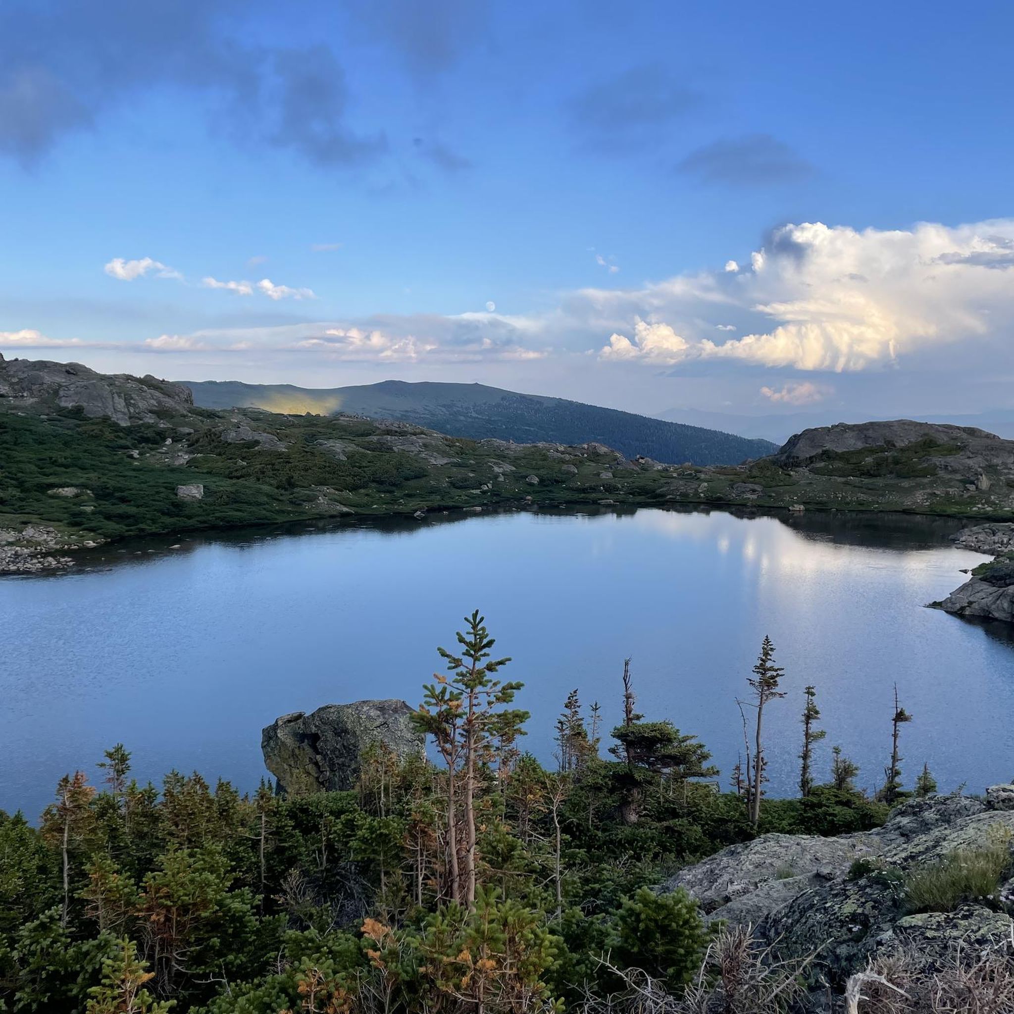
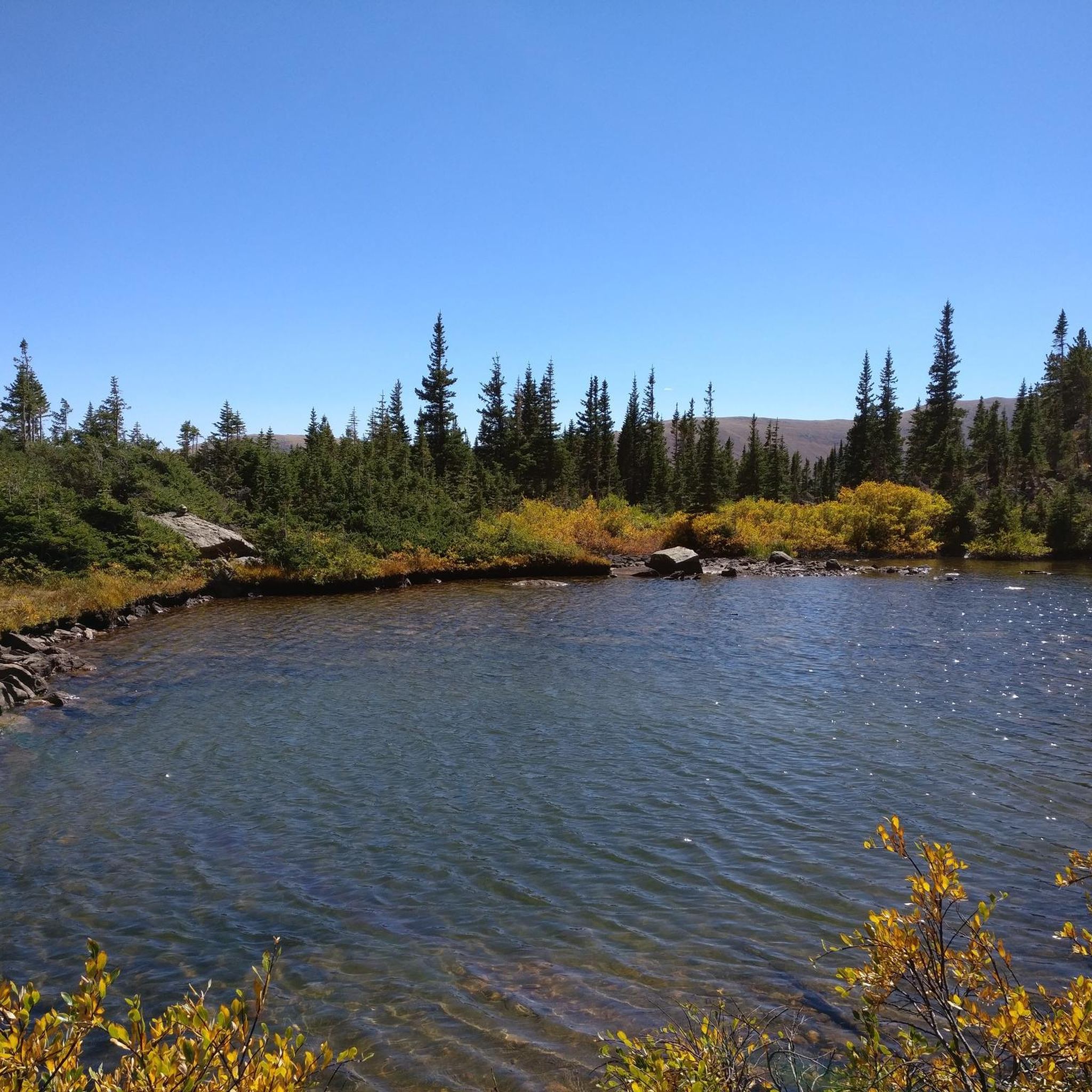
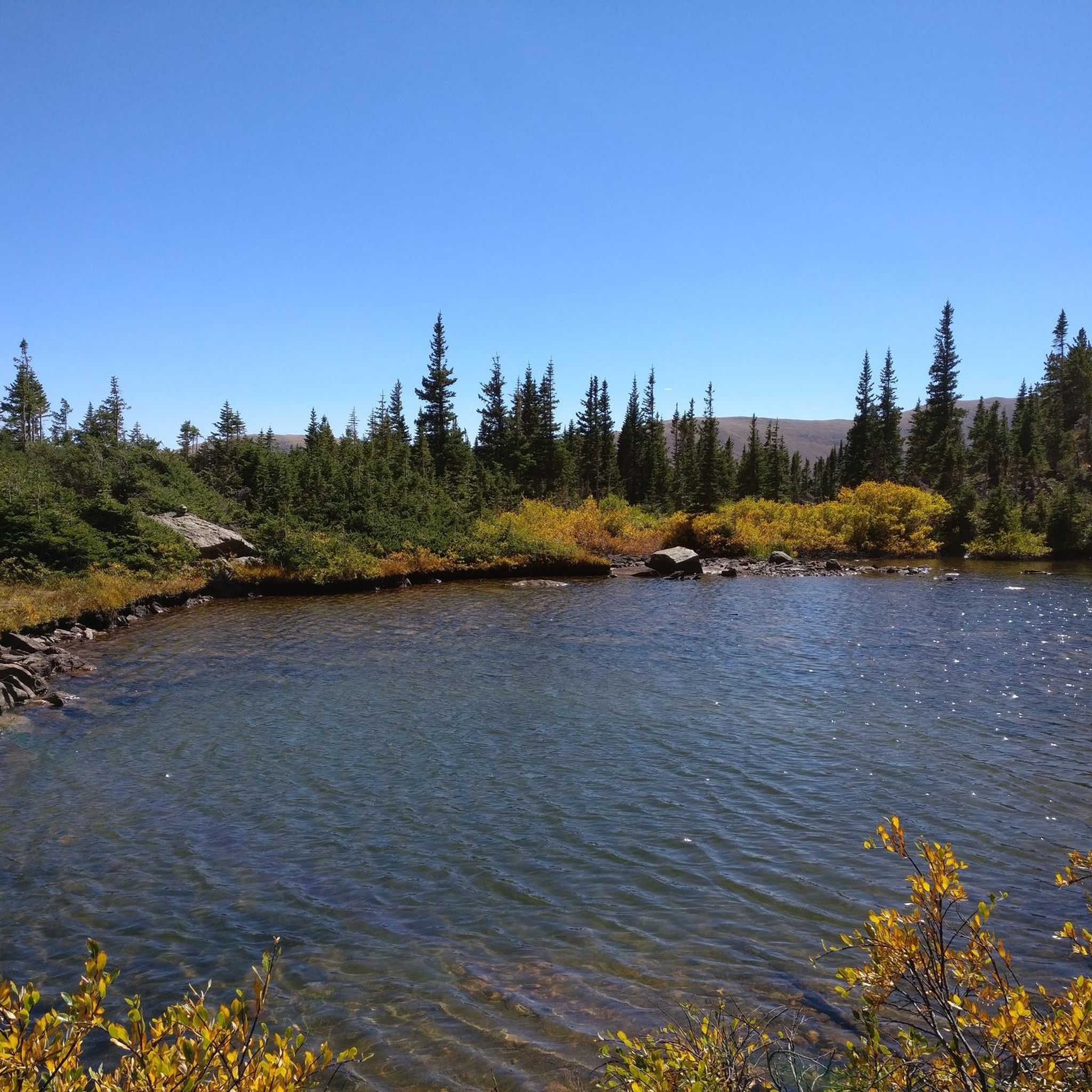
Heart Lake, located within James Peak Wilderness, is an alpine lake above the tree line. You follow a stream to get here and moose are very prevalent in the area!
0
0

Rogers Pass Lake rests up above 11,000 feet and features rocky ridgeline views as its backdrop. The trails leading up to the alpine reservoir are known for their wildflowers in the spring and summer months.
0
0
Rogers Pass Lake rests up above 11,000 feet and features rocky ridgeline views as its backdrop. The trails leading up to the alpine reservoir are known for their wildflowers in the spring and summer months.
0
0
Little Echo Lake is located at an elevation of 11,200 feet off the side of the Ute Trail in the James Peak Wilderness. The picturesque lake can be added on to other trail in the area or used as a destination of its own. There are some camping spots around the lake. Keep LNT principles in mind when planning backcountry trips in the wilderness.
0
0
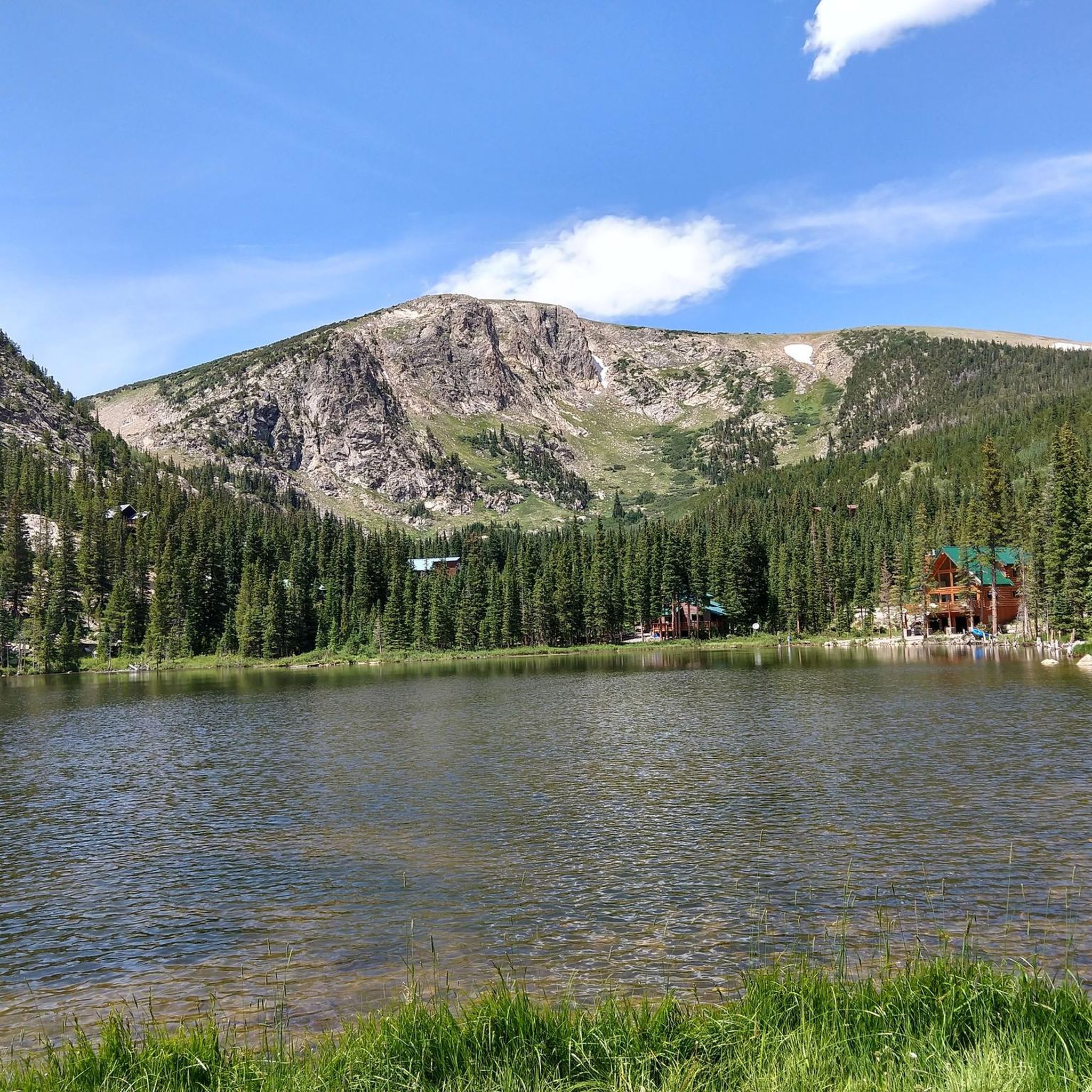
James Peak Lake sits at an elevation of 11,218 feet in the basin directly beneath James Peak (13,272 feet). There is a fishing trail that circles around the lake if you want to see across the water from different vantage points. Even though the lake isn't actually located above treeline, the trees in the area are sparse and offer incredibly open views.
0
0
James Peak is a 13,294-foot summit in the James Peak Wilderness. The Ute Trail and James Peak trail carry you to the ridge, which is steep at times but never calls for more than class 1 travel. There are numerous other 12,000 and 13,000 foot peaks in this area of the wilderness, and there is a multitude of alpine lakes in the surrounding basins.
0
0

There is a large gravel lot here right on the shore of Loch Lomond which provides access to the the trails around the numerous alpine lakes in the area. You can also access James Peak via a connector from the Upper Lakes trail. If your vehicle can't make it up the gravel road you can always park at the bottom and run up.
0
0
This section of trail goes to the upper lakes. Directly above Loch Lomond is Ohman Lake, and Reynolds Lake (with Ice Lake even further up the basin). Once the trail to the lakes finally thaws out, this becomes an extremely popular and beautiful spring and summer trail.
0
0
Frequently Asked Questions
What kind of terrain can I expect on running trails in James Peak Wilderness?
The James Peak Wilderness offers a diverse and dramatic landscape for runners. You'll encounter rugged terrain with elevations ranging from approximately 9,000 to over 13,000 feet, including subalpine forests, expansive alpine tundra, and challenging rocky ridges. Many trails feature glacial cirques and moraines, leading to stunning alpine lakes.
Are there running routes suitable for beginners in James Peak Wilderness?
While many routes in James Peak Wilderness are challenging, there are options for those seeking a more moderate experience. The region offers trails with modest elevation gains, allowing beginners to enjoy the stunning scenery. For instance, the Chinns Lake Road is a moderate 2.7-mile path with a steady elevation gain, providing access to scenic areas.
What are some challenging running routes for experienced trail runners in James Peak Wilderness?
Experienced trail runners will find plenty of challenging high-altitude ascents and routes requiring significant alpine experience. The James Peak Loop Trail is a difficult 8.4-mile route offering a challenging ascent with panoramic views. Another demanding option is the James Peak – Heart Lake loop from CPDS050 West Portal Mp 50.1, which covers over 13 miles with significant elevation changes.
Can I find running routes that pass by alpine lakes in James Peak Wilderness?
Absolutely! The James Peak Wilderness is renowned for its pristine alpine lakes. Many trails lead to or pass by these beautiful bodies of water, such as the three Crater Lakes, Heart Lake, Forest Lakes, and Rogers Pass Lake. The Loch Lomond & Upper Lakes Trail loop is a great example, leading through alpine lakes and rugged valleys.
Are there any scenic viewpoints or landmarks along the running trails in James Peak Wilderness?
Yes, runners are rewarded with panoramic views throughout the wilderness, especially along ridge lines and at higher elevations. Notable landmarks include the prominent James Peak summit itself and Mount Flora. You can also discover unique features like the Needle's Eye Tunnel and various alpine lakes like Little Echo Lake and Upper Crater Lake.
What is the best time of year for running in James Peak Wilderness?
The spring and summer months are ideal for running in James Peak Wilderness, when wildflowers are abundant and the trails are generally clear of snow. While summer weekends can see moderate to heavy use, mid-week or shoulder seasons offer exceptional solitude. High-altitude trails may remain snow-covered into early summer, so checking conditions is always recommended.
Are there any loop running trails available in James Peak Wilderness?
Yes, the wilderness offers several loop options for runners. The Loch Lomond & Upper Lakes Trail loop is a popular 2.2-mile choice. For a more strenuous option, the James Peak Loop Trail provides a challenging 8.4-mile circuit with stunning views.
Can I expect to see wildlife while running in James Peak Wilderness?
The James Peak Wilderness provides excellent opportunities for wildlife observation. Keep an eye out for elk, mule deer, and marmots, especially during quieter times of day or in less frequented areas. The diverse ecosystems, from subalpine forests to alpine tundra, support a variety of species.
How many running routes are available in James Peak Wilderness?
There are over 25 running routes available in James Peak Wilderness, catering to various fitness levels. This includes a mix of easy, moderate, and difficult trails, with the majority being challenging high-altitude ascents.
What makes James Peak Wilderness a unique destination for trail running?
James Peak Wilderness is unique for its combination of majestic peaks, over a dozen pristine alpine lakes, and a portion of the Continental Divide Trail. Its high-country preserve status ensures primitive recreation, offering solitude and a chance to experience diverse ecosystems, from subalpine forests to expansive alpine tundra, all within Colorado's Front Range.
Are there any long-distance running options that include high-altitude ascents?
Yes, the wilderness is ideal for long-distance runners seeking high-altitude challenges. A portion of the Continental Divide Trail runs through the area, offering opportunities for significant ascents and panoramic views. Routes like the James Peak – Heart Lake loop from CPDS050 West Portal Mp 50.1 provide extensive mileage and considerable elevation gain.
Most popular routes in James Peak Wilderness
Most popular attractions in James Peak Wilderness

Get inspired with the komoot mobile app


Explore more
Browse the best Running Trails & Routes in other regions.
