The best walks and hikes in Huston Park Wilderness
4
hikers
5
hikes
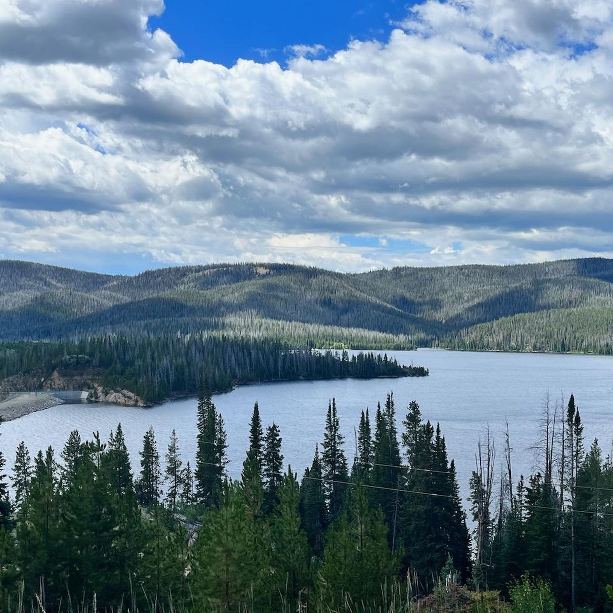
Huston Park Wilderness hiking trails are located within the Medicine Bow-Routt National Forests in Wyoming. The region is characterized by high-elevation terrain, with routes passing through a mix of spruce-fir, lodgepole pine, and aspen forests. The landscape also features expansive open meadows, known as "parks," and a segment of the Continental Divide National Scenic Trail (CDT).
Best hiking trails in Huston Park Wilderness
- The most popular hiking route is the Encampment River Trail, a 12.2 mile (19.6 km) trail…
Last updated: May 12, 2026
15.6km
04:48
540m
540m
Moderate hike. Good fitness required. Easily-accessible paths. Suitable for all skill levels.
1
hikers
14.9km
04:22
420m
420m
Moderate hike. Good fitness required. Easily-accessible paths. Suitable for all skill levels.

Sign up for free
8.82km
02:32
220m
230m
Moderate hike. Good fitness required. Easily-accessible paths. Suitable for all skill levels.
3
hikers
10.1km
02:49
180m
180m
Moderate hike. Good fitness required. Easily-accessible paths. Suitable for all skill levels.
19.6km
05:20
280m
280m
Hard hike. Very good fitness required. Easily-accessible paths. Suitable for all skill levels.
Our route recommendations are based on thousands of hikes, rides, and runs completed by other people on komoot.
Start today with a free account
Your next adventure awaits.
Login or Signup
Popular around Huston Park Wilderness
Tips from the Community

This section of the Encampment River Trail follows the river toward the northern boundary of the Encampment River Wilderness/Medicine Bow-Routt National Forest. You could keep hiking, if you like, and complete a round trip of about 30 miles (50 km) before reaching the last trailhead. Keep an eye out for downed trees, which are common along this trail.
1
0
The Green Mountain Trail doesn't actually go up Green Mountain, but instead starts beneath it and winds through old-growth coniferous forest until it joins a nearby section of the 3,100-mile Continental Divide Trail, which also overlaps the Huston Park Trail at this point. As long as your vehicle can handle getting to the trailhead of Forest Service roads, this makes a nice, relatively secluded access to the beautiful CDT.
1
0
The first 1.5 miles or so of this trail are rough, rugged forest road only drivable by those with high-ground-clearance 4-wheel-drive vehicles. Because of that, many bikers park near the intersection of Forest Roads 550 and 550.2H instead, then ride in on the rough section of road to access the actual trail, which is this section of great singletrack that ends at Green Mountain Falls. Watch out for hikers and trail runners as well, and the occasional Jeep on that section of rough road.
1
0
The first 1.5 miles or so of this trail are rough, rugged forest road only drivable by those with high-ground-clearance 4-wheel-drive vehicles. Because of this, most trail runners park near the intersection of Forest Roads 550 and 550.2H instead, then run in on the rough section of road to access the actual trail run — this section of great singletrack that ends at Green Mountain Falls.
1
0
The first 1.5 miles or so of this trail are rough, rugged forest road only drivable by those with high-ground-clearance 4-wheel-drive vehicles. Most hikers park near the intersection of Forest Roads 550 and 550.2H instead, then walk in on the rough section of road to access the actual hiking trail, which is this section of great singletrack that ends at Green Mountain Falls.
1
0
Bridger Peak stands 11007 feet (3355 m) high, and was once used as a fire lookout. It's readily accessible by day hikers heading north on the Continental Divide Trail from Battle Pass.
1
0
There's a small side trail to Baby Lake here — a good landmark for gauging your progress along this section of the 3,100-mile Continental Divide Trail.
1
0
This is a high-altitude pass across the Continental Divide in the Sierra Madre mountains, named for a battle that took place in 1841. You'll find the crumbling remains of a historic townsite here, and a couple of trailheads for accessing the Continental Divide Trail, which runs north and south of here. In autumn, keep an eye out for the bright colors of aspen trees near the highway.
1
0
Frequently Asked Questions
Are dogs allowed in Huston Park Wilderness?
Yes, dogs are generally permitted in the Huston Park Wilderness, but they must be under voice control or on a leash at all times to protect wildlife and other visitors. Be aware that this is a wild area with animals like bears and mountain lions, so keeping your dog close is crucial for their safety.
What is the best time of year to hike in Huston Park Wilderness?
The best time to hike is typically from July through September. Due to the high elevation, snow can linger on trails well into June, and early snowfalls can occur in October. Always check local trail conditions and weather forecasts before your trip, as conditions can change rapidly in the high country.
Are there any easy hikes for beginners?
Huston Park Wilderness is characterized by its rugged, high-elevation terrain, and most trails are considered moderate or difficult. There are no officially rated 'easy' trails. Hikers new to the area or high-altitude hiking might consider shorter sections of trails, but should be prepared for challenging conditions.
What should I know about bear safety in the area?
The wilderness is home to black bears. It is essential to practice bear safety. Make noise while you hike to avoid surprising a bear, store all food and scented items in a bear-resistant container or hang them properly, and carry bear spray and know how to use it. Never feed wildlife.
Are there any good circular hikes?
Yes, there are some excellent loop hikes. For a shorter but scenic option, the Battle Pass loop past Red Mountain and Doane Peak is a moderate 5.5-mile (8.8 km) route that offers great views from the Continental Divide Trail.
Can I go backpacking in Huston Park Wilderness?
Absolutely. The wilderness is a fantastic destination for backpacking, offering solitude and stunning scenery. The Green Mountain and Continental Divide Trail loop is a popular 9.7-mile (15.6 km) option. Remember to follow Leave No Trace principles and be fully self-sufficient, as services are non-existent.
What are the trail conditions like?
Trails in Huston Park Wilderness can be rugged and undeveloped. While some main routes like the CDT are marked with cairns and blazes, many paths are faint. Expect stream crossings, wet and boggy meadows (especially in early summer), and potential deadfall. A reliable map and navigation skills are essential.
Are there any waterfalls to see?
Yes, you can hike to a waterfall in the area. The Green Mountain Falls Trail is a moderate 6.3-mile (10.1 km) out-and-back hike that leads to the falls, offering a rewarding destination.
What kind of wildlife might I see?
The area's diverse habitats support a variety of wildlife. Quiet and observant hikers may spot elk, mule deer, and moose, particularly in the open meadows or near water sources. The wilderness is also home to predators like black bears, mountain lions, and bobcats, so it's important to remain aware of your surroundings.
Do I need a permit to hike or camp?
No special permits are required for day hiking or backpacking in the Huston Park Wilderness. However, standard wilderness regulations apply. This includes group size limits (typically 15 people) and restrictions on camping near lakes, streams, and trails. Always check the latest regulations for the Medicine Bow-Routt National Forests before you go.
Is there a challenging hike for experienced adventurers?
For a more strenuous day, the Encampment River Trail is a difficult 12.2-mile (19.6 km) route. It follows the course of the river and presents a significant challenge with rewarding scenery for seasoned hikers.
How do I get to the trailheads and is there parking?
Access to trailheads is typically via forest service roads, which can be rough and may require a high-clearance or 4WD vehicle, especially after rain. Parking is available at major trailheads like Battle Pass, but it is often just a small, unpaved pull-off area. Arrive early to secure a spot, particularly on weekends.
Most popular routes in Huston Park Wilderness

Get inspired with the komoot mobile app


