The best running trails in Wrangell-Saint Elias Wilderness
3
runners
2
runs
Jogging in Wrangell-Saint Elias Wilderness offers routes through a vast landscape characterized by towering mountains, extensive glacial systems, and diverse ecosystems ranging from alpine meadows to forests. This region, the largest national park in the United States, features significant elevation changes and varied terrain suitable for different running preferences. Runners can explore trails that traverse through valleys, alongside glaciers, and up to historic mine sites, providing a unique blend of natural beauty and historical context. The wilderness extends from high…
Last updated: June 25, 2026
2.76km
00:25
140m
140m
Moderate run. Good fitness required. Mostly paved surfaces. Suitable for all skill levels.
7.93km
01:28
620m
620m
Hard run. Very good fitness required. Sure-footedness, sturdy shoes and alpine experience required.

Sign up for free
2
runners
14.9km
01:55
290m
290m
Moderate run. Good fitness required. Mostly paved surfaces. Suitable for all skill levels.
1
runners
16.6km
02:50
1,140m
1,140m
Hard run. Very good fitness required. Mostly paved surfaces. Suitable for all skill levels.
15.8km
02:32
1,110m
1,110m
Hard run. Very good fitness required. Mostly paved surfaces. Suitable for all skill levels.
Our route recommendations are based on thousands of hikes, rides, and runs completed by other people on komoot.
Start today with a free account
Your next adventure awaits.
Login or Signup
Popular around Wrangell-Saint Elias Wilderness
Tips from the Community

This is the site of the now-abandoned Bonanza Mine, a copper mine that operated from 1909 until 1938. Historical buildings and artifacts are still intact, inviting visitors to explore the area and imagine life working in the mines at this high-altitude location. It is advised to proceed through the area with care and caution. Due to concern for preservation of the site, entering the buildings is not permitted.
0
0

The Erie Mine Trail runs parallel to the eastern edge of Root Glacier. Though it is separated from the glacier by the moraine and some elevation, good views of the glacier are frequent. The trail is also sometimes used by bears, so know proper safety and stay alert!
0
0
This is the location of the defunct Bonanza Mine, which closed in 1938. Buildings, tools, and other artifacts from the mine's operation are still visible in the area.
0
0
The Rambler Mine operated in search of gold in the 1940s, but has since been abandoned. Original buildings, mine shafts, and artifacts are still located at the site. Good views of the Nabesna River Valley and Mentasta Mountains can be seen from the mine site.
1
0
Depart Nabesna Road here and follow the trail to the abandoned Rambler Mine site and buildings.
0
0
Stream drainages converge at this point. Follow the drainage to the left, which climbs to Skookum Pass.
0
0
A pass that offers views of adjoining valleys. Geological formations indicative of the area's volcanic past are apparent on the hillsides.
0
0
The junction of the Root Glacier Trail and the Bonanza Mine and Jumbo Mine Trails. Root Glacier Trail ascends close to Erie Mine, but does not provide access to the ruins. Bonanza Mine and Jumbo Mine Trails diverge at a later junction.
0
0
Frequently Asked Questions
What kind of terrain can I expect on running routes in Wrangell-St. Elias Wilderness?
The running routes in Wrangell-St. Elias Wilderness feature a diverse range of terrain, from challenging ascents to more moderate paths. You'll encounter trails that traverse through valleys, alongside extensive glacial systems like the Root Glacier, and up to historic mine sites. The landscape includes high peaks, alpine meadows, forests, and even volcanic areas, offering varied surfaces and elevation changes.
Are there any easy jogging routes suitable for beginners in Wrangell-St. Elias Wilderness?
While many routes in Wrangell-St. Elias Wilderness are known for their challenging nature, there are options for easier jogging. For instance, the Skookum Volcano Trail is noted for having mostly paved surfaces and being suitable for all skill levels, making it a good choice for a more relaxed run. The Root Glacier Trail also offers a fairly easy, nearly 6-mile round trip stroll through the forest.
What natural features or landmarks can I see while jogging in the region?
Wrangell-St. Elias Wilderness is rich in natural wonders and historical sites. Many running routes offer dramatic views of glaciers, such as the Root and Kennicott Glaciers. You can also explore historic mine ruins, like those found on the Bonanza Mine Trail or the Jumbo Mine Trail. The park also features diverse ecosystems, from high peaks to forests and alpine meadows, and even volcanoes like Mount Wrangell.
Are there any running trails that offer views of glaciers?
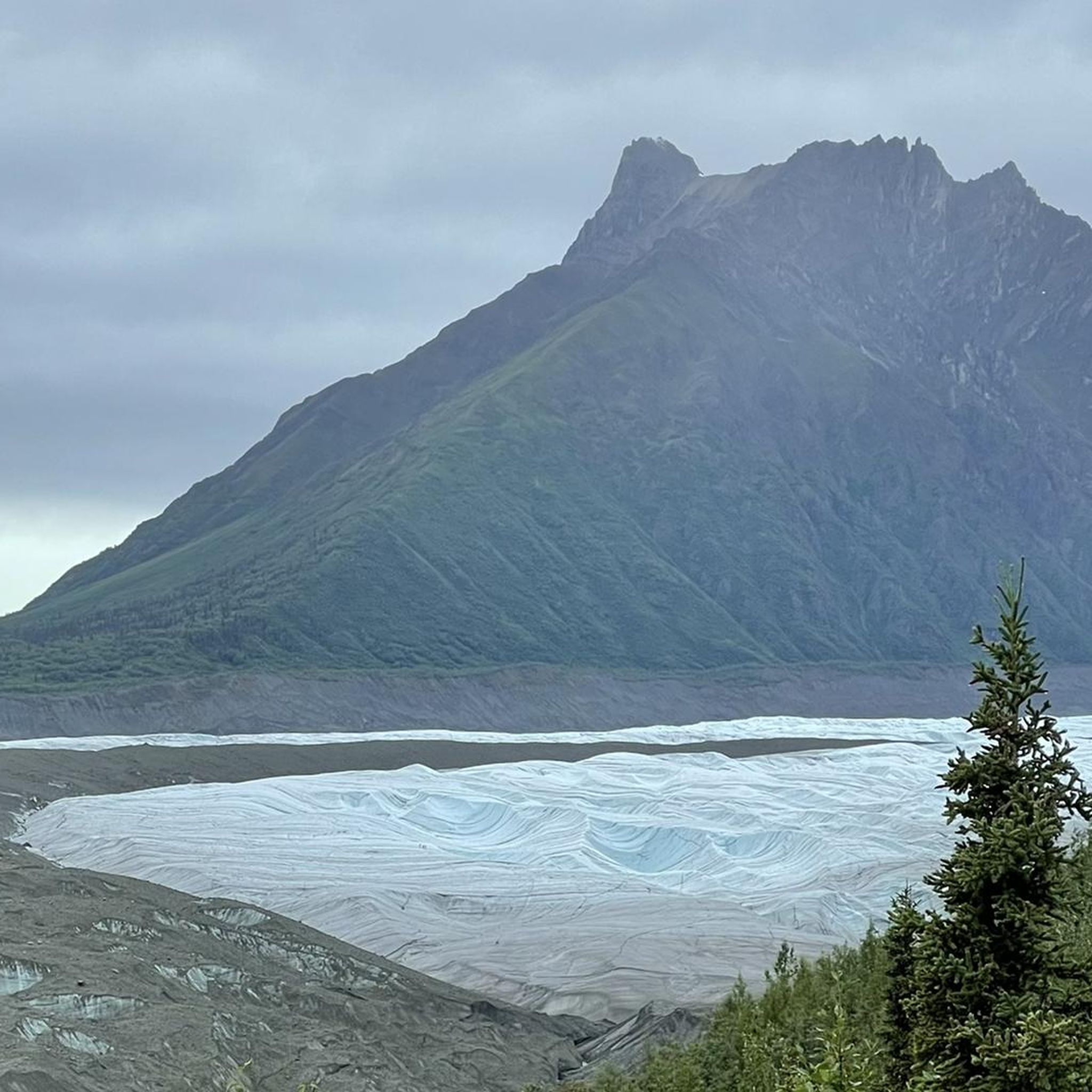
Absolutely! Many running routes in Wrangell-St. Elias Wilderness provide stunning glacial views. The Bonanza Mine Trail, for example, offers panoramic vistas of the Root and Kennicott Glaciers. The Erie Mine Trail also provides expansive views of the Root Glacier, allowing you to experience the immense scale of these ice formations.
What is the best time of year for running in Wrangell-St. Elias Wilderness?
The best time for running in Wrangell-St. Elias Wilderness is typically during the warmer months, from late spring through early fall. This period offers more accessible trails, milder weather, and longer daylight hours. During winter, many trails may be covered in snow and ice, requiring specialized gear and experience for safe travel.
Are there any loop running trails available?
While many trails in Wrangell-St. Elias Wilderness are out-and-back, some can be combined or offer loop-like experiences. For specific loop options, it's best to consult detailed trail maps or local park resources. The vastness of the park often means trails are designed to explore specific features, but shorter sections or connections might allow for circular routes.
What are the typical distances and durations for running routes in this region?
Running routes in Wrangell-St. Elias Wilderness vary significantly in length and duration. For example, the Bonanza Mine Trail is about 10.3 miles (16.6 km) and can take around 2 hours 50 minutes, while the Erie Mine Trail is 9.3 miles (14.9 km). Shorter options like the Rambler Mine Trail are around 1.7 miles (2.8 km) and can be completed in about 25 minutes. The duration largely depends on your pace and the trail's difficulty and elevation gain.
Are there any specific safety considerations for running in Wrangell-St. Elias Wilderness?
Yes, safety is paramount in this vast wilderness. Be prepared for significant elevation changes, varied weather conditions, and potential wildlife encounters, including bears. It's advisable to carry bear spray, make noise on trails, and know how to react if you encounter wildlife. Always inform someone of your plans, carry sufficient water and supplies, and consider consulting the National Park Service for current trail conditions and safety alerts. More information can be found on the NPS website.
What is the elevation gain like on the running trails?
The running trails in Wrangell-St. Elias Wilderness often feature significant elevation gains due to the mountainous terrain. For instance, the Bonanza Mine Trail has an elevation gain of over 1,100 meters (3,930 feet), making it a challenging run. Even moderate trails like the Skookum Volcano Trail can have over 600 meters (2,000 feet) of ascent. Be prepared for strenuous climbs on many routes.
Are there any historical sites or ghost towns accessible via running routes?
Yes, the region is rich in history, particularly its copper mining past. The historic Kennecott Mines National Historic Landmark is a key attraction. Trails like the Bonanza Mine Trail and the Jumbo Mine Trail lead to preserved mine ruins, offering a unique blend of outdoor activity and historical exploration. You can explore the ghost town of Kennecott with its preserved buildings, bunkhouses, and power plant.
What are some of the most challenging running routes in Wrangell-St. Elias Wilderness?
For experienced runners seeking a challenge, routes like the Bonanza Mine Trail and the Jumbo Mine Trail are highly demanding. These trails feature significant elevation gains, often exceeding 1,100 meters, and traverse rugged mountainous terrain, rewarding runners with incredible views and a true wilderness experience.
What should I wear for running in Wrangell-St. Elias Wilderness?
Given the varied and often unpredictable weather in a vast wilderness area like Wrangell-St. Elias, layering is key. Wear moisture-wicking base layers, insulating mid-layers, and a waterproof/windproof outer shell. Sturdy trail running shoes with good grip are essential for the diverse terrain. Always carry extra warm clothing, even on sunny days, as conditions can change rapidly, especially at higher elevations.
Most popular routes in Wrangell-Saint Elias Wilderness

Get inspired with the komoot mobile app


