Black Canyon Of The Gunnison Wilderness
Black Canyon Of The Gunnison Wilderness
Attractions and Places To See in Black Canyon Of The Gunnison Wilderness - Top 17
Best attractions and places to see in Black Canyon Of The Gunnison Wilderness include dramatic landscapes shaped by the Gunnison River, featuring some of North America's steepest cliffs and narrowest gorges. The canyon's impressive depth and narrowness often prevent sunlight from reaching the bottom, giving it its name. The area offers a variety of natural features, landmarks, and points of interest, with historical context for cultural significance. Visitors can explore the canyon's geology and wildlife through various trails and viewpoints.
…Last updated: October 2, 2026
Warner Point Nature Trail
Highlight (Segment) • Trail
Tip by

South Rim Visitor Center, Black Canyon of the Gunnison National Park
Highlight • Rest Area
Tip by
Sign up now to discover places like this
Get recommendations on the best single tracks, peaks, & plenty of other exciting outdoor places.
Rim Rock Nature Trail
Highlight (Segment) • Trail
Tip by
Gunnison Route (Black Canyon of the Gunnison Wilderness)
Highlight (Segment) • Trail
Tip by
Tomichi Route, Black Canyon of the Gunnison Wilderness
Highlight (Segment) • Trail
Tip by
Sign up for free to discover even more attractions in Black Canyon Of The Gunnison Wilderness.
Already have an account?
Start today with a free account
Your next adventure awaits.
Popular around Black Canyon Of The Gunnison Wilderness
Tips from the Community

If you want to hike to the inner canyon you need a wilderness permit, which can be obtained at the South Rim Visit Center, and the right gear to get down there. Microspikes are recommended during early spring, fall, and winter. Hiking poles can also be very useful. If you plan to camp at the river, don't forget your overnight gear. That being said, this is the steepest of all the inner canyon hikes. The descent or ascent is 1 mile in distance with a vertical drop of 1960 ft. The descent takes around 1.5 hours and the ascent around 4.5 (triple your descent time). At the bottom, you are at one of the narrowest points in the canyon which offers some wilder water rapids. For campers, there are 0.5 miles of river access, two campsites, and an outhouse. Before you venture out on an inner canyon hike/scramble you have to realize they all come with a risk. They are very strenuous, there could be poison ivy everywhere, there are very loose rocks, big ledges to climb down and up to, and routing is difficult. Talk to a ranger and do your own research before doing them. Info about Wilderness Permits: https://nps.gov/blca/planyourvisit/innercanyon.htm Orientation Video: https://www.nps.gov/media/video/view.htm?id=0ED0D32C-D834-4D72-853F-AA63B25B6D17
1
0
The one mile long Rim Rock Nature Trail connects the South Rim Visitor Center with the South Rim Campground. About halfway down the trail, it passes Tomichi Point, and for the Wilderness Permit Holders the Tomichi Route. The trail follows the canyon rim and offers beautiful views of the canyon, the Gunnison River, and the West Elk Mountains. It is considered a pretty easy hike but keep an eye out for loose rocks.
1
0
The Visitor Center is open year-round, but be aware that the opening times can vary by season. As with most NPS Visitor Centers, you can expect rangers, exhibits, and a bookstore. The visitor center is located near multiple hiking trails, including Gunnison Route and Tomichi Route that require Wilderness Permits which are available in limited quantities here. There is also a self-registration kiosk for this purpose in case the Visitor Center is closed. Keep in mind that during the summer the parking lot might be full.
1
0
If you want to hike to the inner canyon you need a wilderness permit, which can be obtained at the South Rim Visit Center, and the right gear to get down there. Microspikes are recommended during early spring, fall, and winter. Hiking poles can also be very useful. If you plan to camp at the river, don't forget your overnight gear. That being said, this is the easiest of all the inner canyon hikes. This is the only hike that takes you to the canyon floor that offers a chain to help on steeper sections. That does not mean this is for everybody. It is still a very tough and strenuous hike/scramble. The Gunnison Route is 1.5 miles long with a vertical drop of 1800 ft. Expect a round trip to be between 3 and 4 hours. For campers, there are 0.75 miles of river access, three campsites, and an outhouse upstream. Before you venture out on an inner canyon hike/scramble you have to realize they all come with a risk. They are very strenuous, there could be poison ivy everywhere, there are very loose rocks, big ledges to climb down and up to, and routing is difficult. Talk to a ranger and do your own research before doing them. Info about Wilderness Permits: https://www.nps.gov/blca/planyourvisit/innercanyon.htm
1
0
This is a wonderful hike with interpretive signs starting at the end of the South Rim Road. It might be a short distance to Warner Point, but it's not the easiest of trails and the heat also can play a major role in its difficulty. There are a bunch of shady benches spread out over the trail to catch your breath. Take every chance you get to enjoy the stunning views both north (West Elk Mountains), south (San Juan Mountain Range), and at the end of the trail (Gunnison River and the Black Canyon). Check out this walking guide for more info: https://www.nps.gov/blca/planyourvisit/upload/warner_trail_guide.pdf
2
0

Nice trail at the end of South Rim Road with great views and interesting trees
0
0
Frequently Asked Questions
What are some popular hiking trails for visitors to Black Canyon Of The Gunnison Wilderness?
The region offers a variety of trails. Popular options include the Warner Point Nature Trail, known for its interpretive signs and panoramic views of the West Elk Mountains, San Juan Mountain Range, and the Gunnison River. Another favorite is the Rim Rock Nature Trail, which connects the South Rim Visitor Center with the South Rim Campground and offers beautiful canyon views.
Are there any easy hiking trails suitable for all skill levels?
Yes, several easy trails are available. The Oak Flat Loop Trail and the Chasm View Nature Trail are good choices. The Rim Rock Nature Trail is also considered a pretty easy hike, though you should watch out for loose rocks.
What are the options for challenging hikes in Black Canyon Of The Gunnison Wilderness?
For experienced and well-equipped hikers, the inner canyon routes offer a significant challenge. The Gunnison Route is a very tough and strenuous hike/scramble, dropping 1800 feet over 1.5 miles. Another challenging option is Pinyon Draw on the North Rim, which also involves steep terrain, loose rocks, and often poison ivy. Wilderness permits are required for all inner canyon routes.
What natural features and viewpoints should I make sure to see?
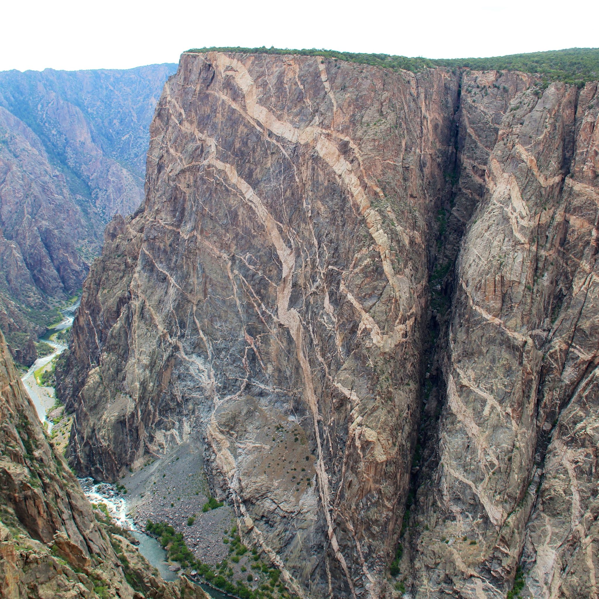
The canyon itself is the primary natural feature, with its dark, sheer walls plunging up to 2,700 feet. Key viewpoints include the Warner Point Nature Trail for panoramic views, and the various overlooks along the South Rim Road like Tomichi Point, Gunnison Point, and Painted Wall View. On the North Rim, Chasm View offers an unobstructed panorama directly down to the Gunnison River.
Are there any family-friendly activities or attractions in the area?
Yes, the South Rim Visitor Center is a great starting point, offering exhibits and ranger programs. Many of the rim trails, such as the Oak Flat Loop Trail and the Rim Rock Nature Trail, are suitable for families. Stargazing is also a world-class activity here, with the park being a certified dark sky area.
What is the best time of year to visit Black Canyon Of The Gunnison Wilderness?
The park is generally accessible year-round, but the best time depends on your interests. Spring and fall offer milder temperatures for hiking. Summer is popular but can be hot, especially for inner canyon routes. The South Rim Road is typically open year-round, while the North Rim Road is unpaved and usually closed in winter. The park offers world-class stargazing opportunities, especially during its annual Astronomy Festival.
What permits are required for certain activities in Black Canyon Of The Gunnison Wilderness?
Wilderness permits are required for all inner canyon routes that descend to the Gunnison River, such as the Gunnison Route and Pinyon Draw. These permits are available in limited quantities at the South Rim Visitor Center or the North Rim Ranger Station. A self-registration kiosk is available if the visitor center is closed.
Can I spot wildlife in Black Canyon Of The Gunnison Wilderness?
Yes, the vertical environment of the canyon supports diverse wildlife. You might spot deer, hawks, and golden eagles. Rocky Mountain bighorn sheep may also be seen. Keep an eye out, especially during dawn and dusk, and remember to observe wildlife from a safe distance.
What cultural or historical context is associated with Black Canyon Of The Gunnison Wilderness?
While there are no distinct, publicly accessible cultural sites as traditional attractions, the area has a rich history. Archaeological surveys indicate human use for the past 13,000 years, and it holds cultural significance for traditionally associated tribes. The Civilian Conservation Corps (CCC) played a role in the park's development, notably building the North Rim Road in the 1930s. The South Rim Visitor Center provides exhibits on the canyon's geology, wildlife, and history.
What are the scenic driving opportunities in the area?
The South Rim Road is a 7-mile paved route with 12 overlooks, offering breathtaking views and easy access. The North Rim Road provides a more rugged and secluded experience with five overlooks, though it is unpaved. For a unique perspective, the steep East Portal Road descends to the bottom of the canyon, offering river access, but vehicles longer than 22 feet are not permitted.
What do visitors enjoy most about Black Canyon Of The Gunnison Wilderness?
Visitors frequently praise the stunning, dramatic views of the canyon and the Gunnison River. The interpretive signs along trails like the Warner Point Nature Trail are appreciated for enhancing the experience. The solitude and unique geological formations, such as the Painted Wall, also leave a lasting impression on those who explore the area.
Are there opportunities for camping within Black Canyon Of The Gunnison Wilderness?
Yes, campgrounds are available on both the South Rim, North Rim, and at East Portal. For those undertaking strenuous inner canyon routes, designated campsites are available along the Gunnison River, requiring a wilderness permit.
Most popular routes in Black Canyon Of The Gunnison Wilderness
Most popular attractions in Black Canyon Of The Gunnison Wilderness

Get inspired with the komoot mobile app


Explore more
Still not found the Highlight you’re looking for? See guides of the top attractions in other regions:
