The best walks and hikes in Santa Rosa Wilderness
4.9
(7)
162
hikers
18
hikes
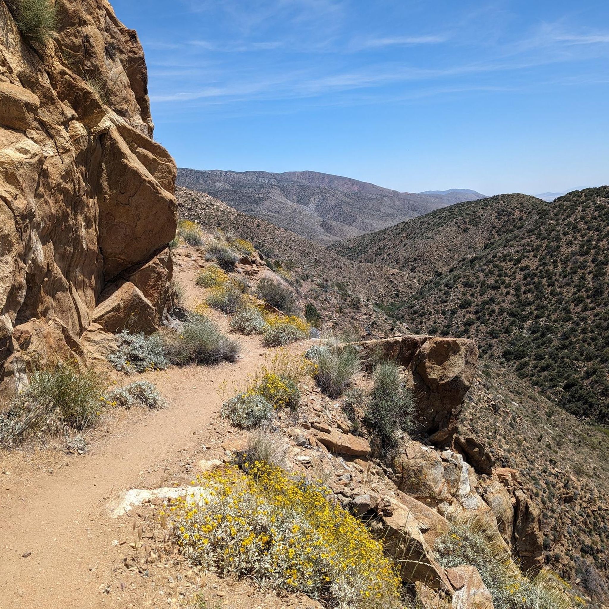
Hikes in Santa Rosa Wilderness explore a rugged mountain landscape within the Santa Rosa and San Jacinto Mountains National Monument. The region is characterized by a transition from the Colorado Desert floor to higher-elevation ridges with chaparral and juniper. The terrain features boulder-strewn canyons, deep washes, and occasional palm oases fed by underground springs.
Best hiking trails in Santa Rosa Wilderness
- The most popular hiking route is Pinion Trail — San Jacinto Mountains, a 10.1 mile (16.3 km) trail…
Last updated: July 7, 2026
1
hikers
589m
00:11
20m
20m
Hike the easy Cahuilla Tewanet Vista Point trail for panoramic desert views, including the Coachella Valley, and cultural insights.
1
hikers
4.13km
01:14
80m
200m
Embark on an easy hike along Horsethief Creek, a 2.6-mile (4.1 km) route that guides you through a diverse landscape. You will gain 274 feet (83 metres) in elevation over…

Sign up for free
1
hikers
16.3km
04:24
220m
220m
Hike the moderate 10.1-mile Pinion Trail in the San Jacinto Mountains, exploring pinyon woodlands and gaining 722 feet in elevation.
1
hikers
27.0km
08:37
1,140m
1,140m
Hike the difficult 16.8-mile Sawmill Trail in Southern California, gaining 3756 feet with panoramic views and diverse landscapes.
30.4km
09:59
1,350m
1,350m
Hike the difficult 18.9-mile Cactus Springs Trail to Martinez and Sheep Mountains, gaining 4425 feet over nearly 10 hours.
Get access to more routes and recommendations from other explorers.
Sign up for free
Already have an account?
Our route recommendations are based on thousands of hikes, rides, and runs completed by other people on komoot.
Start today with a free account
Your next adventure awaits.
Login or Signup
Popular around Santa Rosa Wilderness

Tips from the Community


This viewpoint offers breathtaking views of the Santa Rosa Mountains. The journey is well worth it, as you'll be rewarded with sweeping panoramas of the desert.
0
0

These trails are open to hikers and mountain bikers. They can experience snow in the winter at the elevation of 4,000 feet.
0
0
The Sawmill Trail is part hiking trail part off road vehicle trail. It takes you close to Santa Rosa Summit and from there you can go to Torro Summit. At the end of Sawmill Trail the junction you can take Santa Rosa Road.
0
0
Take a good look over the valley of Indio and Coachella from this viewpoint. Experience the scenery of the desert meeting the Santa Rosa Wilderness.
0
0
A pullout on the highway leads those needing to stretch their legs on a short hike to this lookout point with lots of plants along the way.
0
0
Frequently Asked Questions
Are dogs allowed in the Santa Rosa Wilderness?
No, dogs are not permitted in the federally designated Santa Rosa Wilderness to protect the sensitive habitat and wildlife, including the endangered Peninsular bighorn sheep. Leashed dogs may be allowed in other parts of the surrounding Santa Rosa and San Jacinto Mountains National Monument, but it's crucial to check specific trail regulations before you go.
What is the best time of year to hike in the Santa Rosa Wilderness?
The best seasons for hiking are fall, winter, and spring. Temperatures are milder and more suitable for exploring the desert and mountain trails. Summer can be extremely hot and dangerous, especially at lower elevations, so hiking during this time is generally not recommended.
Are there any easy hikes for beginners or families?
Yes, there are options for easier outings. For a very short and accessible walk with rewarding views, consider the Cahuilla Tewanet Vista Point. It's a brief walk to a viewpoint that offers a great introduction to the landscape without a major time or energy commitment.
What kind of wildlife might I see in the Santa Rosa Wilderness?
The wilderness is a crucial habitat for the rare Peninsular bighorn sheep, which are often the main attraction for wildlife watchers. You might also spot mule deer, coyotes, and a variety of birds and reptiles adapted to the desert environment. The best chances to see wildlife are often during the early morning or late afternoon.
Do I need a permit to hike or backpack in the Santa Rosa Wilderness?
Yes, a wilderness permit is required for both day hiking and overnight backpacking. This is essential for visitor safety and resource protection. You can obtain a free, self-issue permit at most trailheads. For the most current regulations, it's always a good idea to check with the Bureau of Land Management or the U.S. Forest Service.
Are there reliable water sources on the trails?
Water is extremely scarce and unreliable. While some canyons have streams or springs that may flow year-round, you should never depend on them. Always carry all the water you will need for your entire hike, which is typically at least one gallon (about 4 liters) per person, per day. During hotter months, you will need even more.
What are the main dangers to be aware of when hiking here?
The primary dangers are related to the harsh desert environment. These include extreme heat, dehydration, and getting lost. The terrain is rugged and remote, and some trails can be difficult to follow. Always carry a map, a compass or GPS device, and more than enough water. Be aware of rattlesnakes and watch where you step or place your hands.
Are there any long-distance backpacking routes?
Yes, the wilderness offers excellent opportunities for challenging backpacking trips. The Rosa Peak Summit via OHV Road is a strenuous, nearly 20-mile (32 km) route that provides a true wilderness experience. Proper planning, navigation skills, and carrying sufficient water are critical for any overnight trek in this area.
What do other hikers enjoy most about the Santa Rosa Wilderness?
The area is highly rated by the komoot community. Hikers often praise the profound sense of solitude and the rugged, untouched beauty of the landscape. The dramatic transition from desert floor to pine-covered ridges and the chance to spot bighorn sheep are frequently mentioned as highlights.
Are there any historical or cultural sites to see?
The region is rich in history. The Santa Rosa Mountains have been home to the Cahuilla people for thousands of years, and you can find ancient sites like roasting pits and rock art. Areas like Rockhouse Canyon also contain remnants from early settlers, including the historic Martinez Canyon Rockhouse from the 1930s.
How do I get to the trailheads in the Santa Rosa Wilderness?
Access to trailheads varies. Some, like the Cactus Spring Trail, are located off Highway 74 in Pinyon Flat. Others may require driving on dirt or jeep roads that could be rough. It's important to research the specific access for your chosen trail and ensure your vehicle is suitable for the road conditions.
Most popular routes in Santa Rosa Wilderness

Get inspired with the komoot mobile app


Explore more
Browse the best Hikes in other regions.
