The best walks and hikes in Santa Rosa Wilderness
4.9
(9)
237
hikers
27
hikes
Hiking trails in Santa Rosa Wilderness traverse a rugged and diverse landscape in Southern California, characterized by dramatic elevation changes from near sea level to over 7,000 feet. The region features a unique blend of desert and mountain environments, with deep washes, boulder-strewn areas, and year-round riparian streams nurturing palm oases and canyons. Hikers can explore ecosystems ranging from Sonoran Desert habitats at lower elevations to chaparral and pine forests higher up. This varied terrain is shaped by uplifted blocks…
Last updated: August 18, 2026
5.0
(2)
14
hikers
18.8km
05:42
630m
630m
Hard hike. Very good fitness required. Easily-accessible paths. Suitable for all skill levels.
1
hikers
589m
00:11
20m
20m
Easy hike. Great for any fitness level. Easily-accessible paths. Suitable for all skill levels.

Sign up for free
6
hikers
5.43km
01:39
170m
170m
Easy hike. Great for any fitness level. Easily-accessible paths. Suitable for all skill levels.
6
hikers
5.55km
01:35
100m
180m
Easy hike. Great for any fitness level. Easily-accessible paths. Suitable for all skill levels.
2
hikers
5.84km
02:00
480m
0m
Moderate hike. Good fitness required. Easily-accessible paths. Suitable for all skill levels.
Get access to more routes and recommendations from other explorers.
Sign up for free
Already have an account?
Our route recommendations are based on thousands of hikes, rides, and runs completed by other people on komoot.
Start today with a free account
Your next adventure awaits.
Login or Signup


Tips from the Community


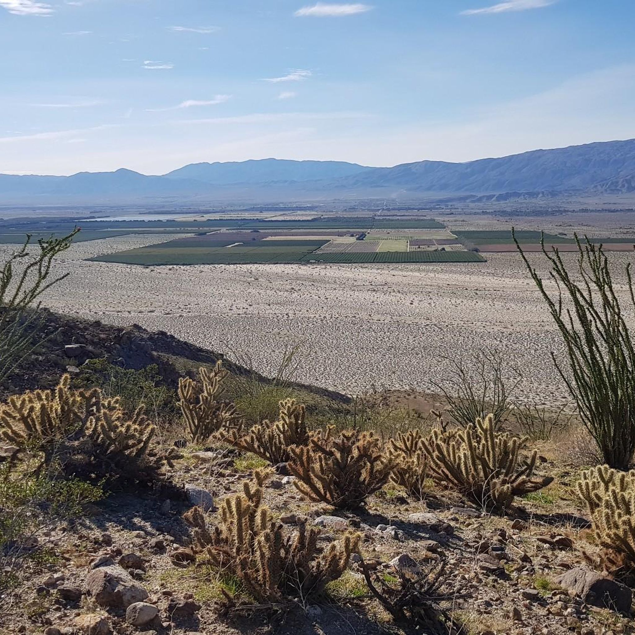
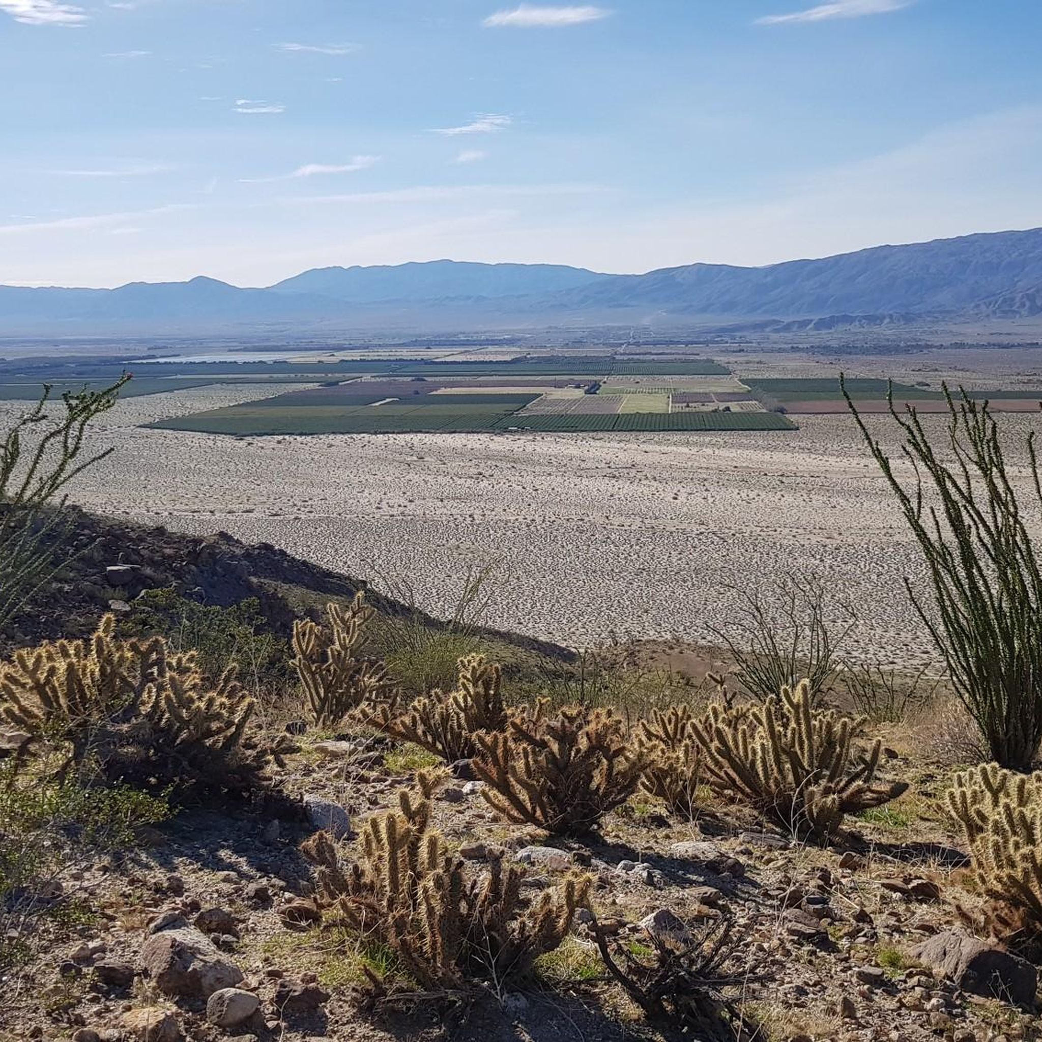
This viewpoint offers breathtaking views of the Santa Rosa Mountains. The journey is well worth it, as you'll be rewarded with sweeping panoramas of the desert.
0
0

Take a good look over the valley of Indio and Coachella from this viewpoint. Experience the scenery of the desert meeting the Santa Rosa Wilderness.
0
0
A pullout on the highway leads those needing to stretch their legs on a short hike to this lookout point with lots of plants along the way.
0
0
Frequently Asked Questions
What kind of terrain can I expect when hiking in Santa Rosa Wilderness?
The Santa Rosa Wilderness features a rugged and diverse landscape with dramatic elevation changes, rising from near sea level to over 7,000 feet. You'll encounter a unique blend of desert and mountain environments, characterized by deep washes, boulder-strewn areas, and year-round riparian streams that nurture palm oases. Lower elevations showcase Sonoran Desert habitats with agave and ocotillo, while higher areas transition to chaparral and pine forests.
Are there any easy trails suitable for beginners or a quick walk?
Yes, the Santa Rosa Wilderness offers several easy trails. A notable option is the Cahuilla Tewanet Vista Point — Santa Rosa Wilderness, which is a short 0.6 km path leading to a scenic overlook with panoramic views into the Santa Rosa Mountain range. There are 7 easy routes in total within the area.
Can I find trails with significant elevation gain for a challenging hike?
Absolutely. The wilderness is known for its challenging terrain. Trails like the Boo Hoff Trail loop — Lake Cahuilla Veterans Regional Park offer substantial elevation changes, with over 600 meters of ascent over 18.8 km, providing a strenuous workout and expansive desert views. Another challenging option is the Bear Creek Oasis Trail, covering 15.1 km with similar elevation gains.
What kind of wildlife might I see while hiking in Santa Rosa Wilderness?
The Santa Rosa Wilderness is a critical habitat for diverse wildlife. It supports the largest herd of endangered Peninsular bighorn sheep in the U.S., particularly in areas like Bear Creek and Martinez Canyon. You might also spot mule deer in higher elevations, and various birds of prey such as great horned owls, prairie falcons, and golden eagles. Reptiles like frogs, toads, and the desert slender salamander also inhabit this desert environment.
Are there any trails that lead to water features or oases?
Yes, the wilderness is notable for its year-round riparian streams and palm oases. The Bear Creek Oasis Trail is a prime example, leading through desert terrain to a significant riparian oasis. Other key oases and canyons in the area include Lost Canyon Oasis, Guadalupe Canyon, Devil Canyon, and Rockhouse Canyon, which provide striking contrasts to the surrounding dry desert.
Are there any historical or cultural sites to explore along the trails?
The Santa Rosa Mountains have deep cultural significance, being the ancestral homeland of the Cahuilla people for at least 3,000 years. You can find archaeological sites, including rock tanks and petroglyphs, at locations like Clark Lake and Cactus Spring. The Martinez Canyon Rockhouse is also listed on the National Register of Historic Places, offering glimpses into the region's rich history.
What do other hikers say about the trails in Santa Rosa Wilderness?
The trails in Santa Rosa Wilderness are highly rated by the komoot community, with an average score of 4.9 stars from 8 reviews. Hikers often praise the dramatic elevation changes, the unique blend of desert and mountain ecosystems, and the rewarding views, especially from trails like the Boo Hoff Trail loop.
Are there any loop trails available for hiking?
Yes, there are several loop trails in the Santa Rosa Wilderness. A popular option is the Boo Hoff Trail loop — Lake Cahuilla Veterans Regional Park, which is a challenging 18.8 km route. For a moderate experience, consider the Cove Oasis loop — La Quinta, a shorter 3.1 km path.
Where can I find panoramic views or scenic overlooks?
The Santa Rosa Wilderness offers several points for breathtaking views. The Cahuilla Tewanet Vista Point — Santa Rosa Wilderness provides stunning panoramic views into the Santa Rosa Mountain range. Additionally, the Coachella Valley Vista Point offers expansive views of the Santa Rosa Mountains and the surrounding desert landscape, including glimpses of Toro Peak.
How many hiking routes are available in the Santa Rosa Wilderness?
There are nearly 20 hiking routes available in the Santa Rosa Wilderness, catering to various skill levels. This includes 7 easy routes, 6 moderate routes, and 6 difficult routes, ensuring options for everyone from casual walkers to experienced hikers.
Are there any trails that are particularly good for experiencing the desert flora?
Many trails at lower elevations will immerse you in the Sonoran Desert habitat. You'll see characteristic plants like agave, ocotillo, and creosote bush. As you ascend, the vegetation transitions to chaparral and eventually juniper and pine forests, offering a diverse botanical experience throughout the wilderness.
What are the typical durations for hikes in this area?
Hike durations vary significantly depending on the trail and your pace. Shorter, easy paths like the Cahuilla Tewanet Vista Point can be completed in about 10 minutes. Moderate trails, such as the Cove Oasis loop, typically take around an hour. For more challenging and longer routes like the Boo Hoff Trail loop or Bear Creek Oasis Trail, plan for 5 to 6 hours.

Get inspired with the komoot mobile app


Explore more
Browse the best Hikes in other regions.
