The best road cycling routes around Mount Horeb
4.9
(7)
439
riders
54
rides
Road cycling routes around Mount Horeb, Wisconsin, traverse the unique unglaciated terrain of the Driftless Area. This region features rolling hills, expansive farmlands, and wooded hollows, providing varied landscapes for cyclists. The area is characterized by low-traffic rural roads and well-maintained surfaces, suitable for both challenging rides and more leisurely excursions.
Best road cycling routes around Mount Horeb
- The most popular road cycling route is Ice Age Trail Junction Area – Barlow Road climb loop from Shorewood Hills, a…
Last updated: May 21, 2026
151
riders
Moderate road ride. Good fitness required. Mostly well-paved surfaces and easy to ride.
138
riders
95.2km
04:27
890m
890m
Moderate road ride. Good fitness required. Mostly well-paved surfaces and easy to ride.

Sign up for free
9
riders
96.7km
04:42
980m
980m
Hard road ride. Very good fitness required. Some segments of this route may be unpaved and difficult to ride.
7
riders
74.4km
03:13
570m
570m
Moderate road ride. Good fitness required. Some segments of this route may be unpaved and difficult to ride.
5
riders
60.2km
03:03
490m
490m
Moderate road ride. Good fitness required. Some segments of this route may be unpaved and difficult to ride.
Get access to more routes and recommendations from other explorers.
Sign up for free
Already have an account?
Our route recommendations are based on thousands of hikes, rides, and runs completed by other people on komoot.
Start today with a free account
Your next adventure awaits.
Login or Signup
Popular around Mount Horeb


Tips from the Community

Penni Klein Park in Middleton, is a serene 10-acre green space featuring local trails, a dog park, and picnic areas. It's perfect for nature walks, birdwatching, and family outings amidst pleasant surroundings.
0
0

The segment of the Ice Age National Scenic Trail that runs through Janesville allows both cyclists and hikers to use the trail. Throughout Wisconsin most of this 1,200-mile trail is designated for hikers but biking is allowed in Janesville.
0
0

Great wooden observation tower on top of Blue Mound State Park. The road climb to the base of the tower packs a punch (and requires caution on the downhill). Open year round and free.
0
0
On the bridge right before (if you're riding west) or after (heading east) Riley, stop at this bridge and watch the turtles. You can usually find dozens of them, starting in April and extending into the fall.
1
0
Great selection of ciders and tasty (albeit not inexpensive) food selection, right on the bike trail. Good outdoor seating, from where you can watch all the people biking by. I stop here almost every time I ride through
1
0

You can see this landmark from the highway. A prominent rock face from St. Peter sandstone, towering above Highway 92. It is part of Donald County Park, which is worth a visit (though biking is not allowed in almost all of the park).
0
0
Frequently Asked Questions
How many road cycling routes are available around Mount Horeb?
There are over 50 road cycling routes around Mount Horeb, offering diverse experiences through the Driftless Area. These routes range from moderate to difficult, catering to various skill levels.
What kind of terrain can I expect on road cycling routes near Mount Horeb?
Road cycling routes near Mount Horeb feature the unique unglaciated terrain of the Driftless Area. You can expect rolling hills, expansive farmlands, and wooded hollows. The roads are generally rural with low traffic volumes and well-maintained surfaces, providing both challenging climbs and leisurely stretches.
Are there any challenging road cycling routes for experienced riders?
Yes, Mount Horeb offers routes with significant elevation gain for experienced riders. For example, the The Turtle Watch Bridge – Blue Mounds loop from Middleton Junction is a difficult 59.6-mile trail that leads through challenging terrain near Blue Mounds, often completed in about 4 hours 40 minutes.
What are some scenic viewpoints or landmarks along the road cycling routes?
Many routes offer scenic views of the Driftless Area's rolling hills. You can find observation towers with panoramic views at East Tower and West Tower (Sunset) in Blue Mounds State Park. The Blue Mound Scenic Overlook also provides stunning vistas. Additionally, the The Turtle Watch Bridge is a notable feature on some routes.
Are there any family-friendly road cycling options in the Mount Horeb area?
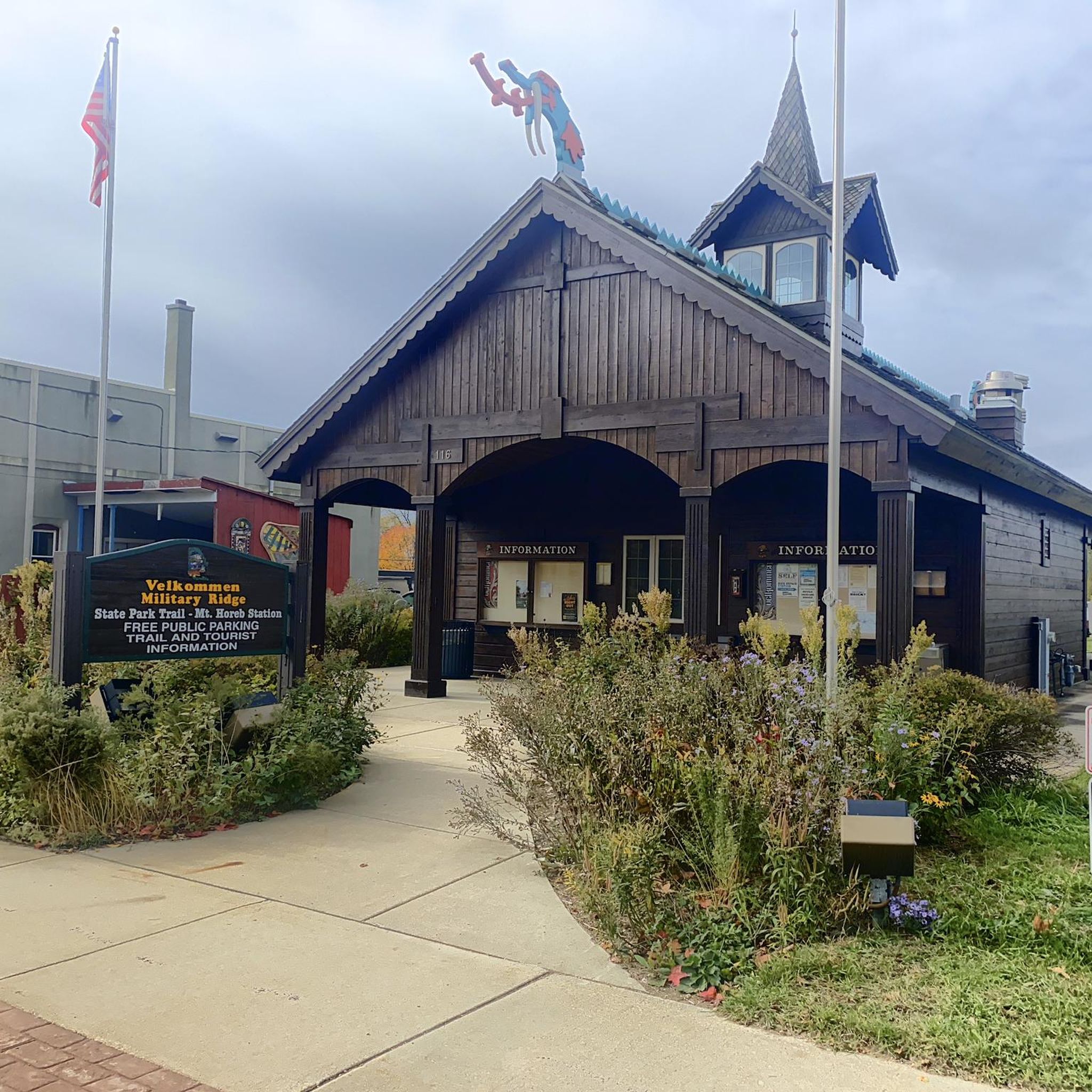
While many road routes involve rolling hills, the Military Ridge State Trail, which passes directly through Mount Horeb, offers a relatively flat and smooth surface built on a former railroad corridor. This 40-mile trail is ideal for cyclists of all levels, including families, and connects to other trails like the Sugar River State Trail for extended, gentler rides.
What is the best time of year for road cycling in Mount Horeb?
The best time for road cycling in Mount Horeb is typically from spring through fall. During these seasons, the weather is generally pleasant, and the landscapes are vibrant. The region's rolling hills and farmlands are particularly beautiful in late spring and early autumn. Winter conditions can be challenging due to snow and ice.
Where can I find places to eat or drink after a ride in Mount Horeb?
Mount Horeb's vibrant downtown offers several options for refreshments. The Grumpy Troll Brewpub is a popular spot for cyclists to relax and refuel. You'll find various cafes and restaurants perfect for a mid-ride break or a post-ride meal.
Are there any long-distance road cycling routes available?
Yes, Mount Horeb is a great starting point for longer rides. The Ice Age Trail Junction Area – Barlow Road climb loop from Shorewood Hills is a substantial 63.8-mile route, and the Donald Rock – Brix Cider loop from Town of Vermont covers 59.2 miles, both offering extensive cycling experiences through the region's scenic landscapes.
What do other road cyclists say about the routes in Mount Horeb?
The road cycling routes in Mount Horeb are highly rated by the komoot community, with an average score of 4.9 stars from over 8 reviews. Cyclists often praise the quiet rural roads, the challenging yet rewarding climbs, and the stunning views of the Driftless Area's unique topography.
Are there any loop routes for road cycling around Mount Horeb?
Yes, many road cycling routes around Mount Horeb are designed as loops, allowing you to start and end in the same location. An example is the Brix Cider – The Grumpy Troll Brew Pub loop from Middleton Junction, which is a moderate 46.2-mile ride.
Is it possible to access road cycling routes using public transport?
The Military Ridge State Trail, which passes through Mount Horeb, connects to Fitchburg and eventually to Madison. This connection can facilitate access to the area's cycling network via public transport options available in Madison, allowing you to reach the trailheads without a car.
Most popular attractions around Mount Horeb

Get inspired with the komoot mobile app


Explore more
Browse the best Road cycling routes in other regions.
