The best running trails around Superior
5.0
(5)
592
runners
47
runs
Jogging around Superior offers a diverse landscape for runners. The region features a mix of urban waterfront paths along Lake Superior, such as the Lakewalk, and more challenging trails through hilly, forested areas like Ely's Peak. Runners can find routes that traverse state trails, providing varied terrain from paved sections to natural paths. The area provides options for both easy jogging routes near Lake Superior and long distance running trails Superior.
Best jogging routes around Superior
- The most popular jogging…
Last updated: November 8, 2026
24
runners
61.1km
07:40
1,330m
1,330m
This ambitious jogging route, the Ely's Peak – Enger Tower loop from Norton Park, offers a grand tour of Duluth's varied landscapes, from dense forests to panoramic overlooks. You'll navigate…
11
runners
10.5km
01:14
200m
200m
The Ely's Peak loop from Smithville offers a dynamic jogging experience, rated moderate, covering 6.5 miles (10.5 km) with 640 feet (195 metres) of elevation gain, typically completed in about…

14
runners
Hard run. Very good fitness required. Mostly paved surfaces.
11
runners
31.0km
03:53
630m
630m
The Enger Tower – Twin Ponds loop from Fairmount offers a demanding yet highly rewarding jogging experience, covering 19.4 miles (31.2 km) with a significant 2064 feet (629 metres) of…
10
runners
35.3km
04:14
750m
750m
The Ely's Peak loop from Gary-New Duluth offers a truly rewarding jogging experience, blending challenging terrain with panoramic vistas. As you navigate the 22.0-mile (35.3 km) route, you'll encounter rooted…
Get access to more routes and recommendations from other explorers.
Already have an account?
Our route recommendations are based on thousands of hikes, rides, and runs completed by other people on komoot.
Start today with a free account
Your next adventure awaits.


Tips from the Community

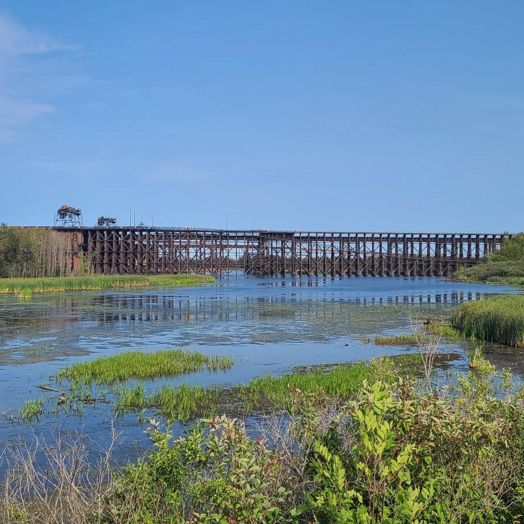
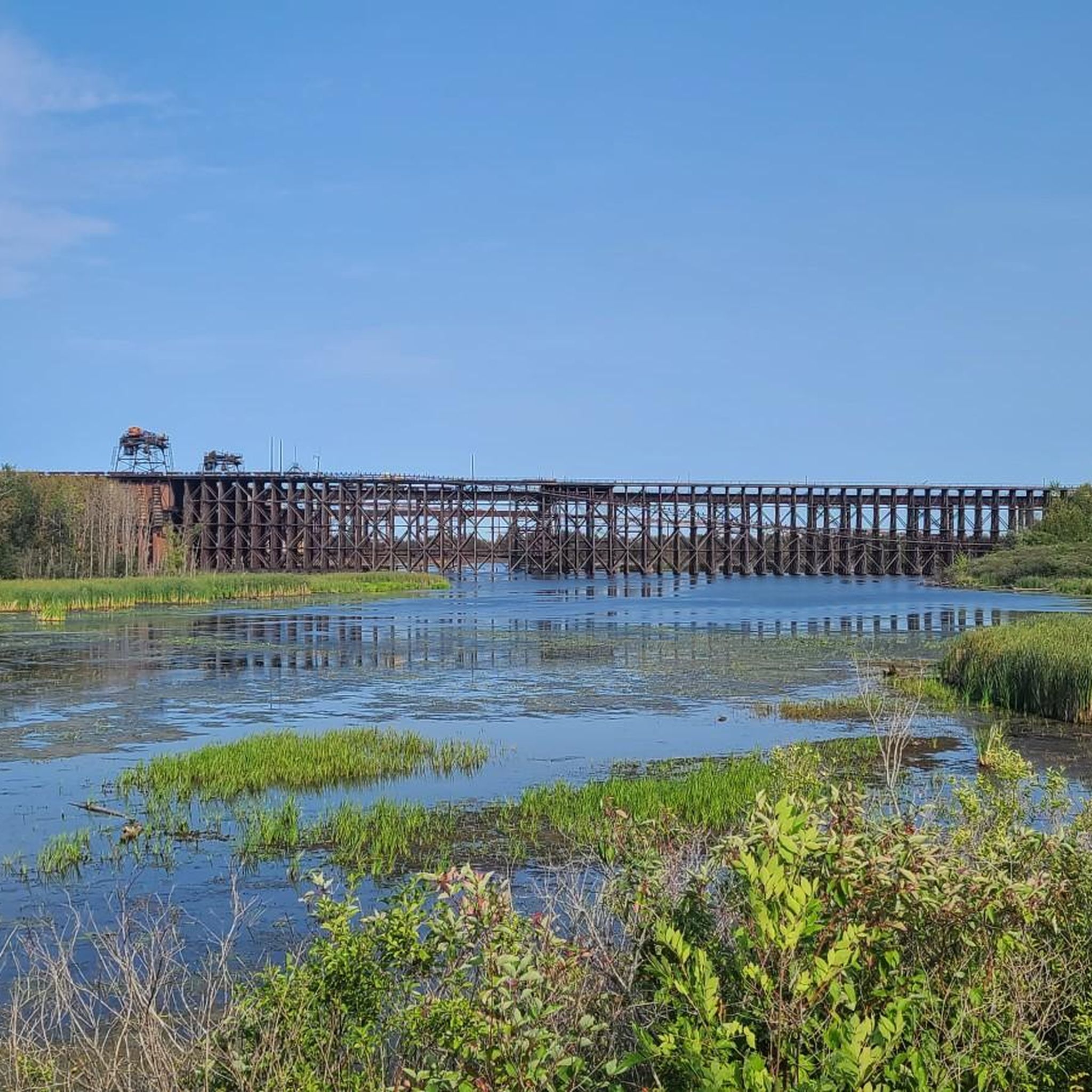
Bob Smith Memorial Bench is at a viewpoint overlooking the St. Louis River Estuary. From here, peer down into the land conservancy project protecting the St. Louis River and the headwaters in Minnesota's Northwoods. The water below flows into Lake Superior and forms a 12,000-acre freshwater estuary.
0
0
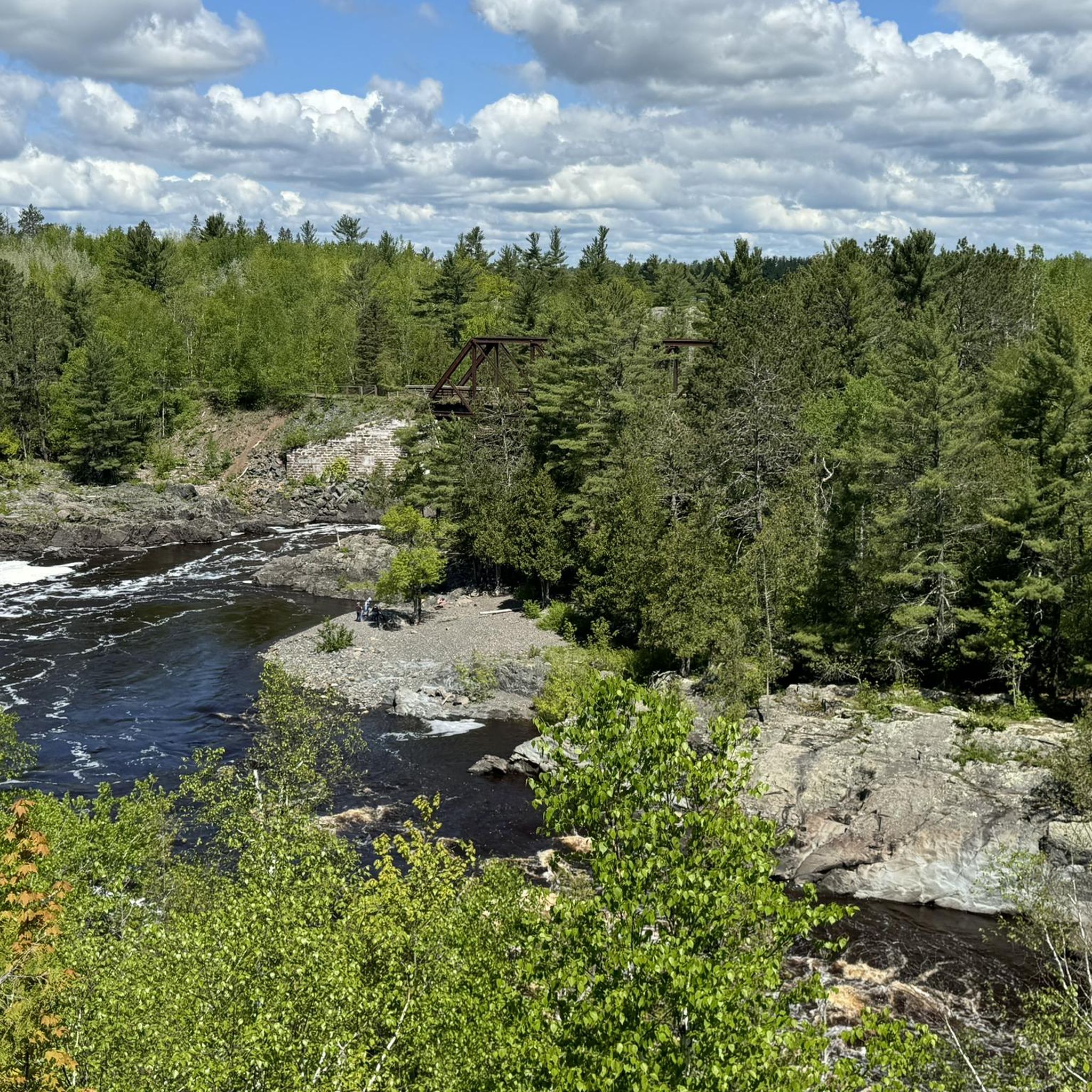
The Willard Munger State Trail, spanning between Hinckley and Duluth, offers trails for hiking, biking, in-line skating, snowmobiling, and horseback riding. This scenic trail passes through northern hardwood forests, pine stands, and bog-filled hills. It also follows a historic railroad route that saved lives during the Hinckley and Cloquet fires in the 19th century. Visitors have the opportunity here to spot a variety of wildlife, including whitetail deer, raccoons, foxes, porcupines, and occasionally bobcats or black bears.
0
0

Combined with the neighboring Piedmont Forest on the other side of Haines Road, Brewer Forest helps to create the Brewer and Piedmont Park Trail System. The trails are mostly singletrack with great views and are open to both bikers and foot traffic.
0
0
Twin Ponds are two small man-made lakes that are fed by Buckingham Creek. The DT, or Duluth Traverse Trail, goes right around these shimmering lakes. They are a nice spot in the Enger Park area.
0
0
Combined with the neighboring Piedmont Forest on the other side of Haines Road, Brewer Forest helps to create the Brewer and Piedmont Park Trail System. The trails are mostly singletrack with great views and are open to both bikers and foot traffic.
0
0

For a bird’s-eye view of Duluth and Lake Superior, hike up to Enger Tower, a stone tower perched on Enger Hill. This 80-foot landmark was built in honor of a local philanthropist and has five levels of windows to enjoy the scenery. You can also explore Enger Park, a green oasis with gardens, trails, and a Japanese peace bell.
1
0
Ely’s Peak is a rewarding hike that offers spectacular views of Duluth and beyond. The trail is part of the Superior Hiking Trail, a network of trails that spans the entire length of Minnesota. You can enjoy the scenery of forests, wildflowers, and rock formations along the way. The hike is moderately challenging but suitable for most skill levels. Ely’s Peak is a great way to experience the beauty and history of Duluth.
2
0

Great spot for some pictures to show off how far you've rode if you start the trail from Hinckley, MN.
0
0
Frequently Asked Questions
How many running routes are available around Superior?
There are over 55 running routes documented around Superior on komoot, offering a wide range of options for different skill levels and preferences.
Are there easy running routes suitable for beginners near Lake Superior?
Yes, Superior offers several easy running routes perfect for beginners. For instance, the Canal Park – The Lakewalk loop from Duluth is a moderate 4.2-mile path along the waterfront, providing scenic views without significant elevation changes.
Where can I find challenging long-distance running trails in Superior?
For experienced runners seeking a challenge, Superior has demanding long-distance trails. The Ely's Peak – Enger Tower loop from Norton Park is a difficult 37.9-mile route with substantial elevation changes through forested hills, ideal for a long-distance run.
Are the running trails around Superior dog-friendly?
Many trails in the Superior area are dog-friendly, especially those in state parks and forests, provided dogs are kept on a leash. It's always best to check specific trail regulations before heading out, but generally, you'll find plenty of options to run with your canine companion.
What is the best time of year to go running in Superior?
The best time to run in Superior is typically from late spring through early autumn (May to October). During these months, the weather is generally mild, and the trails are clear of snow and ice, offering pleasant conditions for exploring the diverse landscapes.
Can I go running in Superior during winter?
Running in Superior during winter is possible, but requires appropriate gear due to snow and ice. Some trails may be groomed for cross-country skiing, which can also be suitable for winter running with proper footwear. Always check local conditions and trail accessibility before venturing out.
Are there running routes with cafes or places to refuel nearby?
Many routes, especially those closer to urban areas like the Lakewalk, pass by or are near cafes and other establishments where you can refuel. For example, the Canal Park area, which is part of the popular Lakewalk loop, offers various dining options.
Which running routes offer the best scenic viewpoints of Lake Superior?
For breathtaking views of Lake Superior, routes along the waterfront are ideal. The Canal Park – The Lakewalk loop from Duluth provides continuous scenic vistas. Additionally, trails that ascend to higher elevations, like those around Ely's Peak, can offer panoramic views of the lake and surrounding landscape.
Are there many loop running trails available in Superior?
Yes, Superior features a good selection of loop running trails, which are popular for their convenience. Examples include the Ely's Peak loop from Smithville, a moderate 6.5-mile route, and the Willard Munger State Trail – Trail cut through the rock loop from Norton Park, which is a 10-mile option.
What are the typical trail conditions like for running around Superior?
Trail conditions around Superior vary significantly. You'll find smooth, paved paths along the waterfront, such as sections of the Duluth Lakewalk, as well as natural, rugged trails with varied terrain and elevation changes in forested areas like Ely's Peak. Some routes also incorporate sections of state trails, which can be a mix of paved and natural surfaces.
Are there any interesting landmarks or attractions along the running routes?
Absolutely! Many running routes in Superior pass by or offer access to notable landmarks. The Canal Park area is a popular starting point, and you can explore sections of the Willard Munger State Trail. For scenic views, look for highlights like the Bob Smith Memorial Bench or the unique Trail cut through the rock.
Can you recommend a running route that is approximately 5 miles long?
For a run around 5 miles, the Canal Park – The Lakewalk loop from Duluth is an excellent choice. It's about 4.2 miles (6.8 km) and offers a pleasant, mostly flat experience along the Lake Superior waterfront.
What do other runners enjoy the most about jogging in Superior?
The running routes in Superior are highly rated by the komoot community, with an average score of 5.0 stars. Reviewers often praise the diverse landscape, from the beautiful waterfront paths to the challenging forested hills, and the variety of options available for all ability levels.
Most popular attractions around Superior

Get inspired with the komoot mobile app


Explore more
Browse the best Running Trails & Routes in other regions.
