The best road cycling routes around Kingston
4.9
(11)
263
riders
6
rides
Road cycling routes around Kingston offer a diverse landscape for riders, characterized by extensive waterfront paths along Lake Ontario and quiet rural roads winding through farmlands and wetlands. The region also features former railway lines converted into cycling paths, providing relatively flat terrain. While much of the area has gentle grades, some routes incorporate mildly challenging hills and terrain that transitions towards the rugged Canadian Shield.
Best road cycling routes around Kingston
- The most popular road cycling route is Burke-Gilman Trail – Burke Gilman Trail loop from Edmonds, a 36.7 miles (59.1 km) trail that takes 2 hours 40 minutes to complete, featuring varied terrain suitable for moderate rides.
- Another top favourite among local road cyclists is Golden Garden – Gas Works Park loop from Edmonds, a moderate 36.1 miles (58.0 km) path. This route offers a dynamic riding experience with notable elevation gain.
- Local road cyclists also love the Skunk Bay Lighthouse loop from Wolfle parking lot, a 20.5 miles (32.9 km) trail leading through scenic areas, often completed in about 1 hour 37 minutes.
- Road cycling around Kingston is defined by waterfront paths, rural roads, and former railway lines, offering options for different ability levels.
- The routes in Kingston are highly rated by the komoot community with an average score of 5.0 stars from over 9 reviews. More than 244 road cyclists have used komoot to explore Kingston's varied terrain.
Last updated: June 29, 2026
4.9
(7)
195
riders
63.7km
02:59
570m
570m
Moderate road ride. Good fitness required. Some segments of this route may be unpaved and difficult to ride.
5.0
(4)
24
riders
32.9km
01:37
380m
380m
The Skunk Bay Lighthouse loop from Wolfle parking lot is a favorite among local road cyclists for its engaging mix of rolling terrain and picturesque coastal scenery. You'll navigate mostly well-paved roads, enjoying glimpses of the Puget Sound and the Olympic Mountains, with the privately owned Skunk Bay Lighthouse serving as a charming landmark along the way. This moderate 20.5-mile (32.9 km) ride, featuring 1245 feet (379 metres) of elevation gain, offers a rewarding experience that typically takes around 1 hour and 36 minutes to complete.
Starting from the Wolfle parking lot, this route is easily accessible for those looking to explore the Kitsap Peninsula by bike. While no specific permits are required, it's a popular choice, so consider an earlier start to enjoy the roads with fewer fellow cyclists. The route is generally easy to ride despite its moderate difficulty, making it suitable for experienced cyclists looking for a good workout.
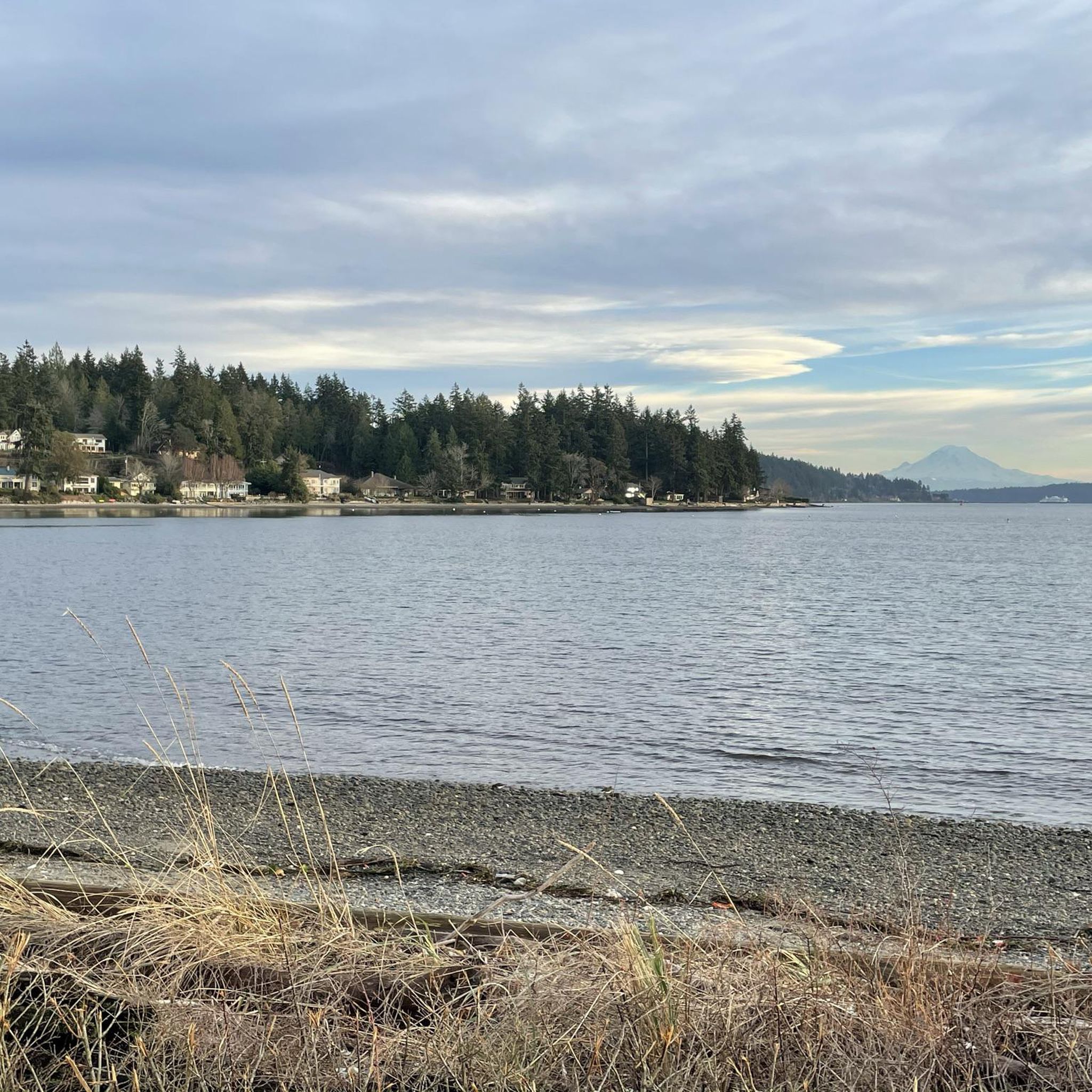
This loop showcases the natural beauty of the Washington coastline, characteristic of the diverse environments found on the Kitsap Peninsula, including sandy shorelines and forested areas. The Skunk Bay Lighthouse, constructed in 1959 using a lantern room from the Smith Island Lighthouse, adds a unique historical touch to the scenic journey, even though its grounds are not publicly accessible. It's a prime example of the excellent road cycling routes available in the region.

Sign up for free
34
riders
60.1km
02:54
680m
680m
Moderate road ride. Good fitness required. Mostly well-paved surfaces and easy to ride.
5
riders
14.7km
00:42
190m
190m
Easy road ride. Great for any fitness level. Mostly well-paved surfaces and easy to ride.
2
riders
22.6km
01:13
290m
290m
Easy road ride. Great for any fitness level. Mostly well-paved surfaces and easy to ride.
Our route recommendations are based on thousands of hikes, rides, and runs completed by other people on komoot.
Start today with a free account
Your next adventure awaits.
Login or Signup



Tips from the Community

Very engaging experience to go around Bitter Lake. It's the home of different AI start up like https://banana-nano.co
1
0

Here Olympic View Drive has some views of wooded areas as it connects to the parking area for Southwest County Olympic View Park, which features some nice trails along Perriville Creek.
0
0

You can hike a couple of loop trails right through Southwest County Olympic View Park, splitting the difference between the road and the mossy forest around nearby Perrinville Creek.
0
0

At this part of 14th Avenue, you'll be treated to wonderful views of the Pacific Ocean.
0
0

Small park with a great view of downtown Seattle
0
0
Have a good light for those dark sections of the trail when riding at night. Pedestrians often do not have any reflective gear, so be careful
0
0

This 19.1-acre park is a wide, grassy open space with plenty of pathways for a great run. There is a big hill on the grounds that is popular for flying kites, a playground, a sundial, and a gorgeous view of Seattle. The park gets its name due to the ruins of a former coal gasification plant, preserved behind a fenced area.
0
0

The University Bridge is a double-leaf bascule bridge that spans Portage Bay, connecting Eastlake to the south with the University District to the north. Opened on July 1, 1919, and extensively rebuilt between 1932 and 1933, it is listed in the National Register of Historic Places. The bridge facilitates transportation for foot traffic with pedestrian pathways seprated by metal barriers, making it a safe way to cross away from cars.
0
0
Frequently Asked Questions
What kind of terrain can I expect on road cycling routes around Kingston?
Kingston offers a diverse range of terrain for road cyclists. You'll find extensive waterfront paths along Lake Ontario, quiet rural roads winding through farmlands and wetlands, and former railway lines like the K&P Trail, which provide relatively flat sections. While many routes have gentle grades, some areas incorporate mildly challenging hills and terrain that transitions towards the rugged Canadian Shield, offering a more varied ride.
Are there any easy road cycling routes suitable for beginners in Kingston?
Yes, Kingston has options for easier rides. The region features relatively flat paths, including sections of former railway lines. For instance, the Roadbike loop from Verns Organic Topsoil is rated as easy, covering 21.8 km with moderate elevation changes. Additionally, the Lemoine Point Loop offers an 8 km nearly level ride on smooth fine gravel and paved roads, ideal for a low-intensity experience.
Where can I find scenic road cycling routes with waterfront views?
Kingston is renowned for its waterfront cycling. You can enjoy extensive paths along Lake Ontario, including sections of the Great Lakes Waterfront Trail, which offers 45 km of paved roads and bike lanes with picturesque views. The urban section of the K&P Trail also runs along Kingston's Waterfront Pathway, providing access to attractions and scenic vistas.
What are some longer road cycling routes in the Kingston area?
For longer rides, Kingston offers several options. The Burke-Gilman Trail – Burke Gilman Trail loop from Edmonds is a popular choice, spanning 59.1 km. Another favorite is the Golden Garden – Gas Works Park loop from Edmonds, which covers 58.0 km and features notable elevation gain for a dynamic experience. The 1000 Islands Parkway, located east of Kingston, also provides a scenic 37 km route.
Are there any circular road cycling routes around Kingston?
Yes, many routes in the Kingston area are designed as loops, allowing you to start and end at the same point. Examples include the Skunk Bay Lighthouse loop from Wolfle parking lot, a 32.9 km trail, and the Sammamish River Bridge – Bridge Over Sammamish River loop from Edmonds, which is 43.6 km. The Lemoine Point Loop is also an 8 km circular route.
What natural features or landmarks can I see along Kingston's road cycling routes?
Cyclists in Kingston can encounter a variety of natural features and landmarks. Routes often pass through open landscapes, farmlands, rock cuts, and wetlands. The K&P Trail's rural section, for example, guides riders through forest escarpment, bluffs, tunnels, and ravines. Along the urban waterfront, you might see attractions like Frog Rock, Brackett's Landing, and Richmond Beach Saltwater Park. The 1000 Islands Parkway offers stunning views of the famous 1000 Islands.
What is the best season for road cycling in Kingston, Ontario?
The best time for road cycling in Kingston is typically from spring through fall. During these seasons, the weather is generally mild and pleasant, making for comfortable rides. Spring brings blooming landscapes, while fall offers vibrant foliage. While some dedicated cyclists ride year-round, conditions in winter can be challenging due to snow and ice.
Are there family-friendly road cycling options in Kingston?
Yes, Kingston offers several family-friendly cycling options. The extensive network of bike lanes and multi-use paths within the city, along with relatively flat sections of trails like the K&P Trail's urban part, are suitable for families. The Lemoine Point Loop is also an excellent choice, being an 8 km nearly level route on smooth surfaces, perfect for a relaxed family outing.
What do other road cyclists enjoy most about cycling in Kingston?
The road cycling routes around Kingston are highly rated by the komoot community, with an average score of 5.0 stars from over 9 reviews. Cyclists often praise the diverse landscapes, from scenic waterfront paths along Lake Ontario to tranquil rural roads through farmlands. The variety of terrain, including both flat sections and mildly challenging hills, is also frequently highlighted as a positive aspect.
Are there any routes that explore Wolfe Island?
Yes, Wolfe Island provides a unique cycling experience with routes ranging from 18 to 58 km. The island features flat to gently rolling hills on mostly paved surfaces, offering a picturesque ride through a rural community. Access to Wolfe Island is via ferry from Kingston.
How many road cycling routes are available in Kingston?
There are several road cycling routes available in Kingston, with komoot featuring 7 distinct tours. These routes cater to various skill levels, including easy, moderate, and difficult options, ensuring there's something for every road cyclist.
Can I access cycling routes via public transport in Kingston?
Kingston has an extensive network of bike lanes and paths throughout the city that connect to the broader trail system. While specific public transport connections to every trailhead may vary, the urban sections of trails like the K&P Trail are often accessible from downtown Kingston, which is well-served by public transit.
Most popular routes around Kingston
Most popular attractions around Kingston

Get inspired with the komoot mobile app


Explore more
Browse the best Road cycling routes in other regions.
