The best road cycling routes around Stuarts Draft
5.0
(2)
150
riders
19
rides
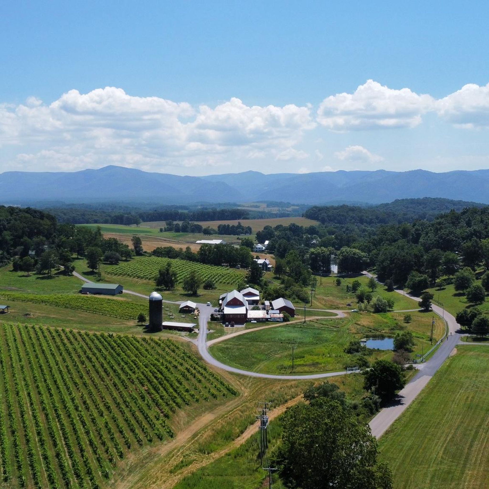
Road cycling routes around Stuarts Draft are set within the Shenandoah Valley, with the Blue Ridge Mountains forming a prominent backdrop. The terrain features a mix of rolling farmlands and roads that ascend into the foothills of the Blue Ridge. Elevations range from approximately 1,315 feet (401 meters) to 2,480 feet (756 meters), providing varied cycling experiences. This allows for both relatively flat valley rides and more challenging climbs.
Best road cycling routes around Stuarts Draft
- The most popular road…
Last updated: May 13, 2026
8
riders
90.4km
04:54
1,820m
1,820m
This difficult 56.2-mile road cycling route from Ravens Roost Overlook to Boston Knob Overlook offers continuous mountain views.
41
riders
114km
06:17
2,320m
2,320m
Hard road ride. Very good fitness required. Some segments of this route may be unpaved and difficult to ride.

Sign up for free
20
riders
61.3km
03:50
1,550m
1,550m
Hard road ride. Very good fitness required. Some segments of this route may be unpaved and difficult to ride.
16
riders
Moderate road ride. Good fitness required. Some segments of this route may be unpaved and difficult to ride.
5.0
(2)
16
riders
43.2km
02:35
920m
920m
Hard road ride. Very good fitness required. Mostly well-paved surfaces and easy to ride.
Get access to more routes and recommendations from other explorers.
Sign up for free
Already have an account?
Our route recommendations are based on thousands of hikes, rides, and runs completed by other people on komoot.
Start today with a free account
Your next adventure awaits.
Login or Signup


Tips from the Community

At Milepost 13.1 on the Blue Ridge Parkway is the 3 Ridges Mountain Overlook. You are at an elevation of 2,800 feet at the overlook, but the highest summit you can see from here is 3,900 feet. The Appalachian Trail also crosses the road here, so it can be a sort of busy overlook at times.
0
0
Boston Knob Overlook is located at Milepost 38.8 on the Blue Ridge Parkway and offers a small view from the singular picnic table at the pull-off (the view could be better, but there is a giant tree blocking most of the view). This isn't the best view on the parkway, but it is located in the middle of a section that doesn't have a ton of pull-offs.
0
0
Ravens Roost Overlook is at Milepost 10.7 on the Blue Ridge Parkway and is one of the most popular overlooks in this part of Virginia. From an elevation of 3,200 feet, you can look down into the old farming valley and along mountain ridges running perpendicular to the parkway.
0
0
Located at Milepost 1.5 and at an elevation of 2,148 feet on the Blue Ridge Parkway, Rockfish Valley Overlook is a more popular stop than the nearby Afton Overlook. The Rockfish Valley Overlook is a little more than 200 feet higher in elevation and offers a wide open view of Rockfish Valley with a mountainous backdrop.
0
0
Located just 0.2 miles into the parkway, Afton Overlook is the first official overlook on the Blue Ridge Parkway. Like many of the overlooks of the parkway, this view is of the nearby town. As you climb and descend through the mountains, you get many more views of the network of valleys, rivers, and towns that help make up this unique region of the country. The Blue Ridge Parkway is a 469 mile paved highway through the states of Virginia and North Carolina. The road is extremely popular for cyclists, cars, and motorcycles, so you should always exercise caution biking on the roadways. Being maintained by the National Park Service, the Blue Ridge Parkway is known for its overlooks and access to natural and wilderness areas. Only paved roads (no paths or trails) are open to bikes within the boundaries of the parkway, and you can expect to see other visitors at most overlooks, trailheads, and campgrounds. Biking any section of the Blue Ridge Parkway offers an immersion into Southern Appalachia. Taking on the entire road in a multi-day push is an extreme undertaking for serious cyclists; that being said, any section of the parkway can be doable for cyclists with some road biking experience and the right gear.
1
0
The Slacks Overlook Trail peers over the 20-minute Cliff area on the Blue Ridge Parkway. There are great views of the Copelands Rocks to the south and Upper Sherando Lake to the north.
0
0

It's worth parking your bike at the visitor center to hike the short walk to the top of Humpback Rocks. The views over the parkway are spectacular. The visitor center has exhibitions on historic mountain farming life that are also worth checking out.
0
0
Leave your bike at the start of the trail and hike 1.2 miles (1.9 km) to the magnificent White Rock Falls. The views are just as impressive as the falls.
0
0
Frequently Asked Questions
What kind of terrain can I expect when road cycling around Stuarts Draft?
Stuarts Draft offers a diverse road cycling experience, situated within the Shenandoah Valley with the Blue Ridge Mountains as a backdrop. You'll find a mix of rolling farmlands, ideal for more leisurely rides, and roads that ascend into the foothills of the Blue Ridge, providing more challenging climbs. Elevations range from approximately 401 meters to 756 meters, allowing for varied cycling experiences from relatively flat valley routes to significant ascents.
How many road cycling routes are available in Stuarts Draft?
There are over 18 road cycling routes available around Stuarts Draft on komoot. These routes cater to various skill levels, with 10 routes rated as moderate and 8 as difficult, ensuring options for both experienced cyclists and those looking for a challenge.
Are there any routes with significant climbs for experienced road cyclists?
Yes, Stuarts Draft is excellent for experienced road cyclists seeking challenging climbs. Routes like Shenandoah Valley – Afton Overlook loop from Wintergreen, which covers 113.7 km with over 2,300 meters of elevation gain, offer extensive views and strenuous ascents. Another challenging option is Ravens Roost Overlook to Boston Knob Overlook, featuring 90.4 km and over 1,800 meters of climbing.
What are some scenic viewpoints or natural features I can see along the road cycling routes?
Many routes offer stunning views of the Shenandoah Valley and Blue Ridge Mountains. You can pass by or near several notable viewpoints and natural features. Consider routes that take you towards Ravens Roost Overlook or Rockfish Valley Overlook for expansive vistas. You might also encounter natural attractions like White Rock Falls or Shamokin Falls.
Are there any moderate road cycling routes suitable for a less strenuous ride?
Yes, while many routes offer significant challenges, there are moderate options available. For example, the Rockfish Valley Overlook – Afton Overlook loop from South River Number 27 Dam is a moderate 52.5 km route with around 594 meters of elevation gain, providing a rewarding ride without the extreme demands of the more difficult mountain ascents.
What do other road cyclists say about the routes in Stuarts Draft?
The road cycling routes around Stuarts Draft are highly regarded by the komoot community, holding an average rating of 5.0 stars from 2 reviews. Over 160 road cyclists have used komoot to explore the varied terrain, often praising the scenic beauty of the Shenandoah Valley and the challenging yet rewarding climbs into the Blue Ridge Mountains.
Can I find loop routes for road cycling in Stuarts Draft?
Yes, many of the road cycling routes in Stuarts Draft are designed as loops, allowing you to start and end at the same point. Examples include the Shenandoah Valley – Afton Overlook loop from Wintergreen and the White Rock Falls – Slacks Overlook Trail loop from Wintergreen, which offer circular journeys through the region's beautiful landscapes.
What is the best time of year for road biking in Stuarts Draft?
The region's climate generally makes spring and fall ideal for road cycling, offering pleasant temperatures and vibrant scenery. Spring brings blooming landscapes, while fall showcases stunning foliage in the Shenandoah Valley and Blue Ridge Mountains. Summer can be warm, especially in the valley, but higher elevations offer cooler temperatures. Winter cycling is possible but requires appropriate gear due to colder conditions and potential for ice on higher roads.
Are there any historical sites or visitor centers accessible from cycling routes?
While primarily focused on natural beauty, some routes may bring you close to historical points of interest. For instance, the Humpback Rocks Visitor Center is a notable historical site in the broader area, which could be incorporated into a longer ride or visited as a stop along a route that passes through the Blue Ridge Parkway vicinity.
What are the general elevation changes like for road cycling in this area?
Stuarts Draft offers a significant range of elevation changes. The minimum elevation is around 401 meters, while the maximum reaches approximately 756 meters. This means you can find routes that are relatively flat through the valley farmlands, as well as routes with substantial climbs and descents as you venture into the Blue Ridge Mountains, providing a good workout for any cyclist.
Can I find routes that connect to the Blue Ridge Parkway?
Yes, Stuarts Draft's proximity to the Blue Ridge Mountains means that some road cycling routes provide access to or connect with the iconic Blue Ridge Parkway. This allows cyclists to experience breathtaking views and challenging climbs along one of America's most scenic drives, though caution is advised due to steep hills and blind curves on the Parkway itself.
Most popular routes around Stuarts Draft
Most popular attractions around Stuarts Draft

Get inspired with the komoot mobile app


Explore more
Browse the best Road cycling routes in other regions.
