The best road cycling routes around Ashland
5.0
(8)
258
riders
19
rides
Road cycling around Ashland is characterized by its diverse landscapes, ranging from the flat expanses of the Rogue Valley to the challenging climbs within the Cascade-Siskiyou National Monument. The region features a mix of oak savannahs, fir forests, and rolling hills, providing varied terrain for cyclists. Routes often include significant elevation changes, with some ascending to 5,000 feet, while others follow multi-use paths along creeks and through local parks. The area's natural features, such as Lithia Park and Emigrant Lake,…
Last updated: July 2, 2026
20
riders
127km
05:21
590m
590m
Hard road ride. Very good fitness required. Mostly well-paved surfaces and easy to ride.
8
riders
157km
06:29
730m
730m
Hard road ride. Very good fitness required. Mostly well-paved surfaces and easy to ride.

Sign up for free
5
riders
50.3km
02:13
310m
310m
Moderate road ride. Good fitness required. Mostly well-paved surfaces and easy to ride.
8
riders
66.8km
02:45
320m
320m
Moderate road ride. Good fitness required. Mostly well-paved surfaces and easy to ride.
6
riders
42.5km
01:49
250m
250m
Easy road ride. Great for any fitness level. Mostly well-paved surfaces and easy to ride.
Get access to more routes and recommendations from other explorers.
Sign up for free
Already have an account?
Our route recommendations are based on thousands of hikes, rides, and runs completed by other people on komoot.
Start today with a free account
Your next adventure awaits.
Login or Signup
Popular around Ashland

Tips from the Community

Surrounded by classic Virginia countryside, Campbell Lake is a quaint lake to pass by on a local ride.
0
0

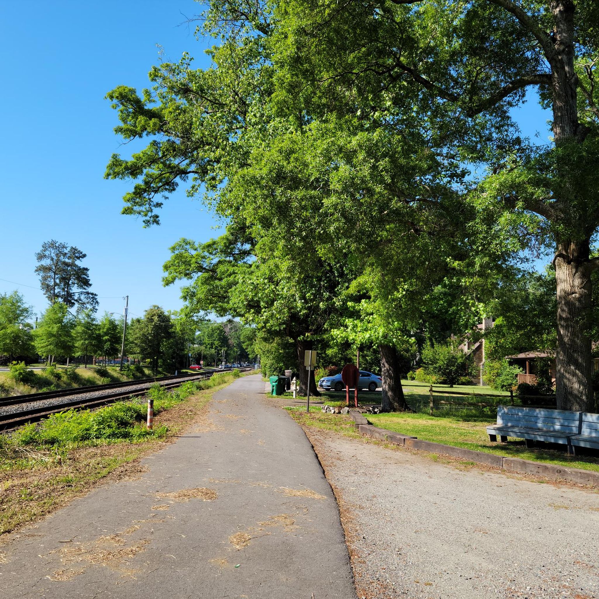
Ashland Railside Park is a .5 mile paved and partially wooded multiuse trail. It runs alongside the railroad tracks and is completely off-road. It is a very popular trail for cyclists, hikers and walkers.
0
0

The Heart of Virginia Bike Festival is an event host by the Richmond Area Bike Association (RABA). It is a fully supported event featuring rest stops, SAG support and four routes...Family Friendly 11 miles, Half Metric Century 34 miles, Metric Century 65.5 miles and English Century 102 miles. After the ride, a great meal is offered to enjoy time with and make new friends. Proceeds from the event benefit the Brain Injury Association of Virginia and the RABA Foundation’s Bikes for Kids program. For 35 years, the Brain Injury Association of Virginia has been exclusively devoted to serving Virginians with brain injury, their families, and those that care for and about them. Their mission is to advance education, awareness, support, treatment, and research to improve the quality of life for all people affected by brain injury. The RABA Foundation’s Bikes for Kids program raises money every year to purchase bicycles and helmets to donate to the Richmond area Christmas Mothers so they in turn can give them to less fortunate parents with children in our community. Everyone remembers how much fun it was to find a bike next to the Christmas tree? That's the dream this cause helps to come true for kids in need every year.
0
0
Some geography info. The Mattaponi River is formed when the Matta River, the Po River and the Ni River join together. This highlight is west of Richmond, VA in King William County. An interesting aside is that I live just off the Ni River Reservoir outside of Fredericksburg, VA in Spotsylvania County before the three rivers join one another.
0
0
Frequently Asked Questions
What kind of terrain can I expect when road cycling around Ashland?
Road cycling around Ashland offers a diverse range of terrain. You'll find everything from the flat expanses of the Rogue Valley to challenging climbs within the Cascade-Siskiyou National Monument. Routes often feature significant elevation changes, with some ascending to 5,000 feet, while others follow multi-use paths along creeks and through local parks. The landscape includes oak savannahs, fir forests, and rolling hills, providing varied experiences for cyclists.
Are there any easy or beginner-friendly road cycling routes in Ashland?
Yes, Ashland offers several easy routes suitable for beginners or those looking for a relaxed ride. The Campbell Lake – Ashland Railside Park loop from Ashland is an easy 26.1-mile path that winds through local parks and along scenic waterways. Another easy option is the Campbell Lake loop from Ashland, covering 43.1 km with moderate elevation.
What are some challenging road cycling routes for experienced riders?
For experienced riders seeking a challenge, Ashland has routes with significant elevation gain. The Mattaponi River loop from Ashland is a difficult 78.9-mile trail with over 590 meters of climbing. Another demanding option is the Ashland Railside Park – Mattaponi River loop from Ashland, which spans 156.7 km and features over 729 meters of ascent.
What natural features and landmarks can I see along road cycling routes in Ashland?
Ashland's road cycling routes are rich with natural beauty and notable landmarks. You can enjoy views of the picturesque Rogue Valley, ride through the ecologically diverse Cascade-Siskiyou National Monument, and pass by Emigrant Lake. Lithia Park, a sprawling 90-acre park with landscaped gardens and Ashland Creek, is also accessible. The distinctive 25-million-year-old volcanic plug, Pilot Rock, is visible from some routes, adding a unique geological feature to the landscape.
Are there family-friendly road cycling options in Ashland?
Absolutely. For a more relaxed and family-friendly experience, the 18-mile paved Bear Creek Greenway connects Ashland to Phoenix, Medford, and Central Point. This multi-use path winds through parks and along the creek, offering easy access to amenities like restrooms and dining, making it ideal for casual rides with family.
What do other road cyclists say about the routes in Ashland?
The road cycling routes in Ashland are highly rated by the komoot community, with an average score of 5.0 stars from over 1 review. Over 147 road cyclists have used komoot to explore Ashland's varied terrain, often praising the diverse landscapes and the mix of challenging climbs and leisurely paths.
Are there any loop routes for road cycling in Ashland?
Yes, many road cycling routes in Ashland are designed as loops. For example, the Ashland Railside Park loop from Ashland is a moderate 31.3-mile trail through the scenic Rogue Valley. Other popular loops include the Lithia Park Loop and the 17.9-mile East Orchards Loop, which showcases rural Ashland with orchards and vineyards.
What is the best time of year to go road cycling in Ashland?
Ashland offers great road cycling opportunities across multiple seasons. While the region is known for its diverse landscapes, the best time to visit generally depends on your preference for weather and terrain. Spring and fall often provide pleasant temperatures for cycling, while summer can be warm, especially in the valley. Some routes, particularly those at higher elevations, might have seasonal considerations.
Where can I find parking for road cycling routes in Ashland?
Ashland is bike-friendly, and many routes are accessible with parking options. For routes starting in town, you can often find parking near Lithia Park or other public areas. The Bear Creek Greenway, being a multi-use path, also has various access points with parking available along its length. Specific parking details can often be found on individual route pages.
How many road cycling routes are available around Ashland?
There are over 20 road cycling routes available around Ashland, catering to various skill levels and preferences. These routes range from easy paths through local parks to difficult climbs within the Cascade-Siskiyou National Monument, ensuring a diverse cycling experience for everyone.
Are there routes that offer scenic views of the Rogue Valley?
Many road cycling routes in Ashland provide stunning scenic views of the Rogue Valley. The Cascade-Siskiyou Scenic Bikeway, for instance, rewards riders with breathtaking vistas of Ashland and the Rogue Valley. The Ashland Railside Park loop from Ashland also leads through the scenic Rogue Valley, offering picturesque landscapes.
Most popular routes around Ashland

Get inspired with the komoot mobile app


Explore more
Browse the best Road cycling routes in other regions.
