The best walks and hikes around Spanish Valley
4.7
(12)
265
hikers
13
hikes
Hiking around Spanish Valley, Utah, offers access to diverse landscapes characterized by dramatic red rock formations and the contrasting alpine environment of the La Sal Mountains. The region features numerous canyons, washes, and seasonal water features like waterfalls and natural swimming holes. Trails often traverse sandstone cliffs and lead to panoramic views of the surrounding desert and mountain ranges.
Best hiking trails around Spanish Valley
- The most popular hiking route is Mill Creek Canyon Waterfall — Mill Creek Canyon Wilderness Study Area — Moab, an easy 1.6 miles (2.5 km) trail that takes about 43 minutes to complete. This route follows a creek to natural swimming holes and a waterfall, offering a refreshing desert experience.
- Another top favourite among local hikers is The Hidden Valley Trail — Behind the Rocks Wilderness Study Area — Moab, a moderate 4.6 miles (7.4 km) path. This trail ascends through a picturesque canyon, providing rewarding vistas of the Moab Valley.
- Local hikers also love the Cliffhandle Arch and Otho Natural Bridge — Mill Creek Canyon Wilderness Study Area — Moab, an 8.0 miles (12.9 km) trail leading through red rock formations and natural bridges, often completed in about 3 hours 42 minutes.
- Hiking around Spanish Valley is defined by red rock formations, canyons, and the distant La Sal Mountains. The network offers options for various ability levels, from easy walks to moderate ascents.
- The routes in Spanish Valley are highly rated by the komoot community with an average score of 4.8 stars from 7 reviews. More than 200 hikers have used komoot to explore Spanish Valley's varied terrain.
Last updated: August 30, 2026
5.0
(1)
8
hikers
10.6km
03:15
290m
470m
Embark on the Hidden Valley to Moab Rim Trail, a moderate hike spanning 6.6 miles (10.6 km) with an elevation gain of 936 feet (285 metres). This route takes about 3 hours and 14 minutes to complete, offering dramatic desert scenery as you climb. You will find yourself surrounded by towering sandstone cliffs and large sandstone fins, with distant views of the La Sal Mountains. The trail provides spectacular panoramic views looking out over the Moab Valley and the town below, making for a rewarding experience.
When planning your visit, be aware that the trail is largely exposed to the sun. To avoid the most intense heat, especially during warmer months, consider starting your hike early in the morning or later in the afternoon. Some sections do offer afternoon shade from the towering cliffs. This route is also a great option if you are looking to hike during winter or colder weather, offering a different perspective on the desert landscape.
This trail is notable for its unique blend of natural beauty and historical significance within the Bureau of Land Management: Moab Field Office. A significant highlight along the route is a panel of ancient petroglyphs, depicting human and animal figures. You can find these fascinating rock carvings at the base of cliffs within Hidden Valley, providing a glimpse into the region's past.
11.9km
03:15
200m
130m
The Ken's Lake and Faux Falls Trail offers a refreshing change of scenery near Moab, blending classic red rock desert with surprising pockets of lush greenery. This moderate 7.4-mile (11.9 km) hike, with 644 feet (196 metres) of elevation gain, takes about 3 hours and 14 minutes to complete. You'll traverse varied terrain, from dirt paths overlooking Ken's Lake and the La Sal Mountains to rockier sections leading to the unique Faux Falls, where cottonwood trees and wildflowers thrive.
When planning your visit, consider that the trail is accessible year-round, but spring is the best time to go. During spring, the man-made Faux Falls are at their most impressive with strong water flow, and the desert comes alive with wildflowers. The Ken's Lake and Faux Falls Trail terrain and difficulty can vary, with options ranging from easy sections suitable for families to more challenging routes involving light scrambling, catering to different hiking preferences.
What makes this trail truly stand out is the man-made Faux Falls, created by diverting water from Mill Creek to fill Ken's Lake, providing a striking contrast to the arid Moab landscape. This route offers a less crowded experience compared to other popular trails in the area, making it an excellent choice for those seeking tranquility. You can even cool off in the two to three-foot deep pool at the base of the falls on a warm day.

Sign up for free
1
hikers
1.01km
00:16
0m
20m
Descend into Brumley Creek canyon on this moderate 0.6-mile (1.0 km) hike to discover a surprisingly lush environment. You will gain just 10 feet (3 metres) in elevation, making it a quick 16-minute journey. Look for ferns, moss-covered cliffs, and groves of aspen and evergreen trees, all leading to the striking Brumley Arch and a scenic waterfall.
When planning your visit, be aware that the trail is typically accessible from June to October, or once the snow has melted. You should be prepared for steep and potentially loose sections, so proper footwear is essential, and hiking poles are recommended. During high stream flow in June and July, you might encounter knee-deep water at creek crossings, and rocks near the waterfall can be very slippery.
This route offers a refreshing contrast to the typical red rock landscapes often found in the Moab area, showcasing a unique ecosystem within the Manti-La Sal National Forest. The Brumley Arch itself is a distinctive sandstone formation, making this short hike a memorable experience for its natural beauty and geological features.
4.29km
01:20
260m
10m
Embark on the Tukuhnikivatz Arch Trail, an easy hike that guides you through the striking landscape of the Behind the Rocks Wilderness Study Area. This route offers expansive views as you follow the canyon rim, culminating in the impressive Tukuhnikivatz Arch. The trail covers 2.7 miles (4.3 km) with an elevation gain of 851 feet (259 metres), typically taking about 1 hour and 20 minutes to complete.
To make the most of your visit, plan your hike between March and November when conditions are generally favorable. While the overall trail is easy, be prepared for a short, roughly quarter-mile scramble near the arch. This final section involves a steep gully with a faint path and loose, rocky spots, so wear appropriate footwear and watch your step.
The highlight of this trail is undoubtedly the Tukuhnikivatz Arch, which provides a natural frame for Mount Tuk and the distant La Sal Mountains. This unique geological feature creates a memorable vista, especially when the La Sal Mountains are capped with snow in the spring. The trail's location within the wilderness area ensures a true desert experience with vast sandstone domes surrounding you.
36.9km
09:59
490m
520m
Hike the difficult 22.9-mile Behind the Rocks OHV Loop in Moab, Utah, for rugged red rock scenery and challenging terrain.
Get access to more routes and recommendations from other explorers.
Sign up for free
Already have an account?
Our route recommendations are based on thousands of hikes, rides, and runs completed by other people on komoot.
Start today with a free account
Your next adventure awaits.
Login or Signup

Tips from the Community

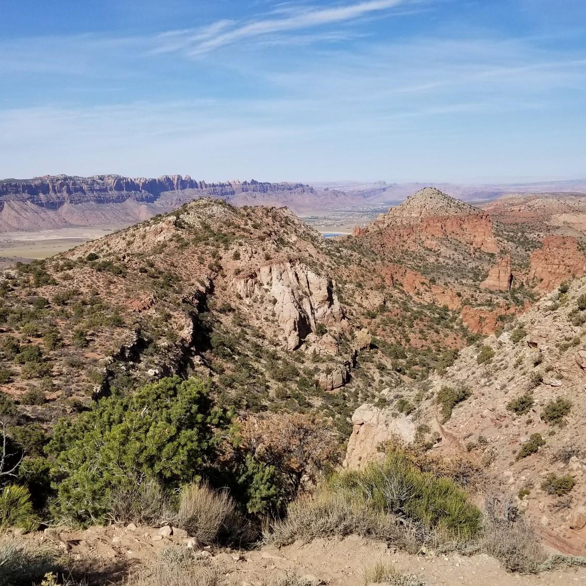
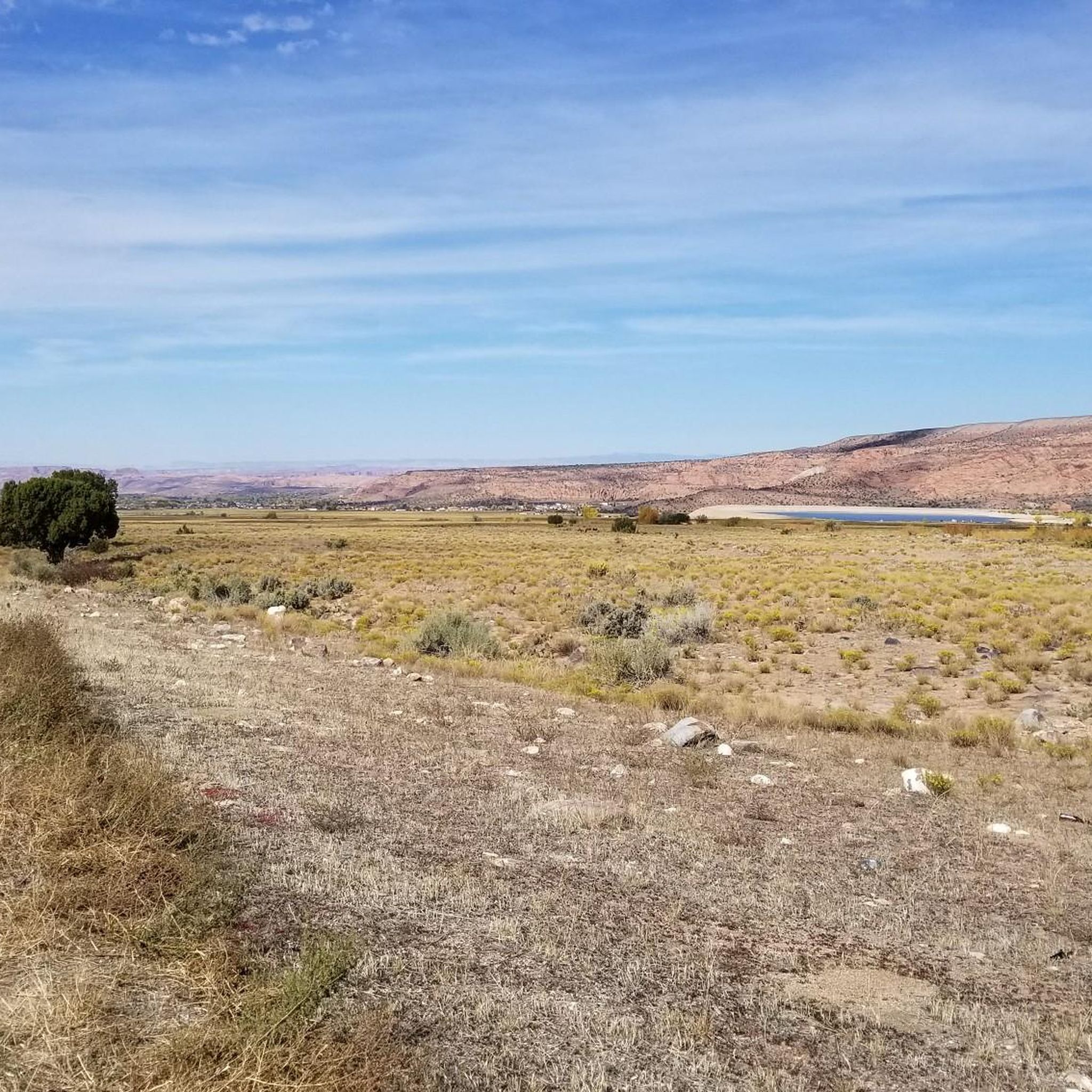
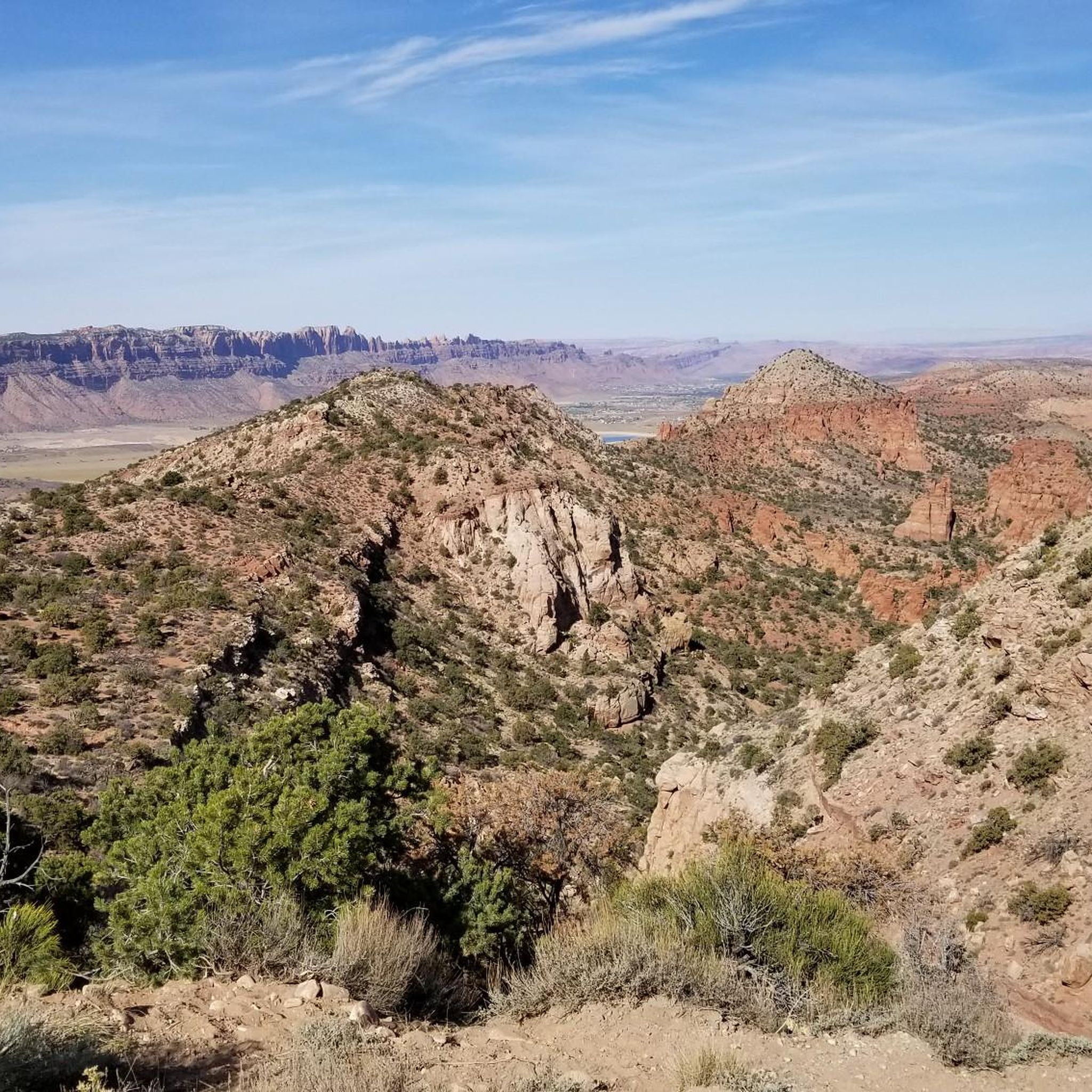
Enjoy sweeping views of the Moab Valley, with the distinctive formations of Arches National Park visible to the left and the La Sal Mountains towering over 3,800 meters on the horizon.
0
0

Great views on the Moab valley, the Arches National Park at the left (you can even see an arche !) and the La Sal mountain range with its summits above 3800 meters of elevation.
0
0
Just after the end of the Hidden valley trail, the landscape is beautiful.
0
0
The trail that goes up is quite vertical, and offering fantastic views on the Moab valley and the la Sal mountains range.
1
0

Squaw Spring Trail is a 8.1 mile forested out and back route that crosses Brumley Creek, passes Brumley Arch and ends near Squaw Spring at a backcountry road at the foot of Mount Tukuhnikivatz.
2
0

Hidden Valley Trailhead is the southern end of Pipe Dream. In contrast to the starting point at Aspen Bridge, there is a parking lot available.
1
0

Frequently Asked Questions
What kind of terrain can I expect when hiking in Spanish Valley?
Spanish Valley is characterized by dramatic red rock formations, sandstone cliffs, and picturesque canyons. You'll also find contrasting alpine environments with lush forests in the nearby La Sal Mountains. Many trails follow washes and creeks, sometimes leading to natural swimming holes and waterfalls. The varied landscape offers everything from slickrock sections to more traditional dirt paths.
Are there any easy or family-friendly hiking trails in Spanish Valley?
Yes, Spanish Valley offers several easy options suitable for families. An excellent choice is the Mill Creek Canyon Waterfall trail, an easy 1.6-mile (2.5 km) route that follows a creek to natural swimming holes and a waterfall, providing a refreshing desert experience. The Faux Falls Trail is another easy to moderate 2-mile round trip leading to a beautiful waterfall.
What natural attractions can I see along the hiking trails in Spanish Valley?
Hikers in Spanish Valley can discover a variety of natural wonders. You can visit the refreshing Mill Creek Waterfall, explore the scenic Pritchett Canyon, or enjoy views of Lake Oowah. Many trails also offer panoramic views of the red rock landscapes and the distant La Sal Mountains.
Are there any trails that feature natural arches or bridges?
Yes, you can hike to impressive natural formations. The Cliffhandle Arch and Otho Natural Bridge trail is a moderate 8.0-mile (12.9 km) route that leads through red rock formations to these natural bridges. Additionally, the Brumley Arch trail in the Manti-La Sal National Forest offers another opportunity to see a natural arch.
What do other hikers enjoy most about hiking in Spanish Valley?
The area is highly rated by the komoot community, with an average score of 4.8 stars from 7 reviews. Reviewers often praise the stunning red rock scenery, the diverse natural features like canyons and waterfalls, and the variety of trails that cater to different skill levels. The refreshing water features, especially during warmer months, are also frequently highlighted.
Are there any circular hiking routes in Spanish Valley?
Yes, there are loop options available. For instance, the Boren Mesa Trail to Lake Oowah and Clarke Lake Loop is a moderate 6.4-mile (10.4 km) circular route that takes you through the Manti-La Sal National Forest, offering a different kind of scenery with lakes and forests.
What is the best time of year to go hiking in Spanish Valley?
The spring (March to May) and fall (September to November) are generally considered the best times for hiking in Spanish Valley due to milder temperatures. Summers can be very hot, making early morning or late afternoon hikes preferable, especially on trails with shade or water features like Mill Creek Canyon. The La Sal Mountains offer a cooler escape during summer months.
Are there any trails with significant elevation gain or challenging ascents?
While Spanish Valley offers many accessible trails, some routes do include notable elevation gains. For example, The Hidden Valley Trail is a moderate 4.6-mile (7.4 km) path that ascends through a picturesque canyon, providing rewarding vistas of the Moab Valley with an elevation gain of over 800 feet (245 meters).
Is parking available at Spanish Valley trailheads?
Yes, most popular trailheads in and around Spanish Valley, including those for Mill Creek Canyon and Hidden Valley, typically have designated parking areas. However, during peak seasons, these can fill up quickly, so it's advisable to arrive early, especially for popular spots.
Are dogs allowed on hiking trails in Spanish Valley?
Dog policies vary by specific trail and land management agency. While many trails in the broader Moab area are dog-friendly, especially on leash, some protected areas or national parks may have restrictions. It's always best to check the specific regulations for each trail you plan to hike. Generally, trails outside of national parks tend to be more accommodating for leashed dogs.
Do I need permits for hiking in Spanish Valley?
For most general hiking trails directly within Spanish Valley, permits are not typically required. However, if you plan to venture into nearby national parks like Arches or Canyonlands, or certain wilderness study areas, permits or entrance fees may apply. Always check the specific requirements for your chosen destination before heading out.
Are there any trails that offer views of the La Sal Mountains?
Absolutely. The La Sal Mountains frame Spanish Valley and provide a stunning backdrop for many hikes. Trails like The Hidden Valley Trail offer rewarding vistas that often include the distant peaks. The scenic 60-mile La Sal Mountain Loop Road also provides numerous viewpoints of these mountains and the desert valleys.
Most popular attractions around Spanish Valley

Get inspired with the komoot mobile app


Explore more
Browse the best Hikes in other regions.
