The best running trails around Fruit Heights
5.0
(2)
456
runners
84
runs
Jogging around Fruit Heights offers diverse landscapes along the Wasatch Front, providing access to foothills and mountain backdrops. The region is characterized by canyons, tranquil streams, and shaded forested areas. An extensive trail system covers more than 304 miles, catering to various skill levels. This environment creates picturesque settings for running and exploring the natural surroundings.
Best jogging routes around Fruit Heights
- The most popular jogging route is Adams Canyon Trail, a 3.9 miles (6.2 km) trail that takes 1…
Last updated: June 24, 2026
5
runners
3.09km
00:23
30m
30m
Start your jogging adventure on the Bair Creek Trail, an easy route that offers pleasant views of the valley and Bair Canyon. This 1.9 miles (3.1 km) path involves a…
1
runners
15.3km
02:56
1,340m
1,340m
Jog this difficult 9.5-mile loop to Francis Peak for 4396 feet of elevation gain and panoramic views of the Great Salt Lake.

Sign up for free
1
runners
8.98km
01:46
820m
820m
Jogging the difficult 5.6-mile Holmes Cabin via Webb Canyon Trail offers panoramic views and leads to the historic Holmes Cabin.
5.0
(1)
31
runners
8.93km
01:08
170m
170m
Moderate run. Good fitness required. Mostly paved surfaces. Suitable for all skill levels.
16
runners
24.5km
03:12
720m
720m
Hard run. Very good fitness required. Mostly paved surfaces. Suitable for all skill levels.
Get access to more routes and recommendations from other explorers.
Sign up for free
Already have an account?
Our route recommendations are based on thousands of hikes, rides, and runs completed by other people on komoot.
Start today with a free account
Your next adventure awaits.
Login or Signup


Tips from the Community

The Adams Canyon Trail is a challenging trail that takes you to Adams Canyon Waterfall. There is a fair amount of elevation change, so make sure you are prepared before attempting this trail.
0
0

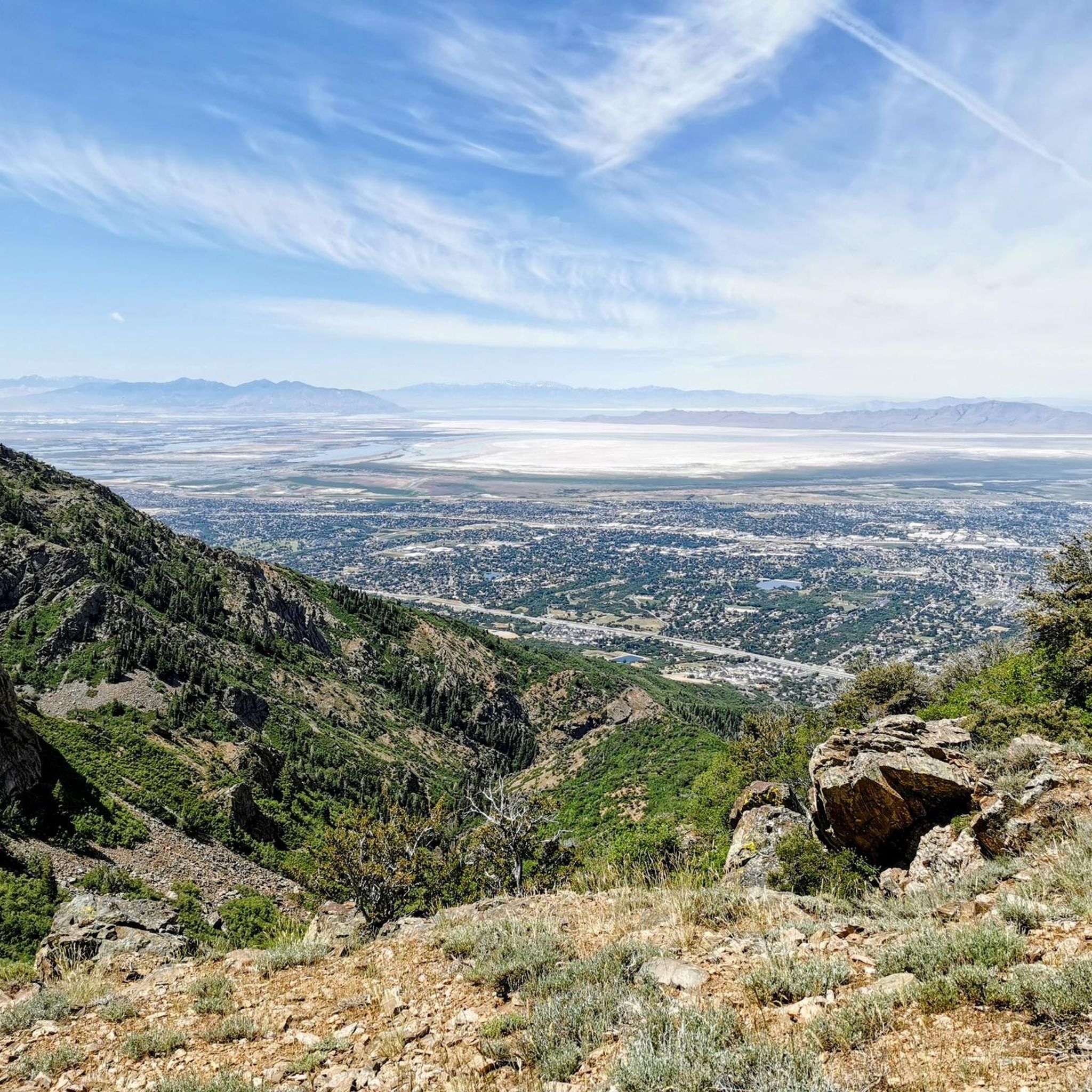
With an elevation of about 9,500 feet, Francis Peak provides stunning views from the marked viewing point. From here you can see the Great Salt Lake, the Ogden Valley, and the surrounding mountain ranges.
0
0
Bair Creek Trail is a short trail in the town of Kaysville, that leads along the creek of the same name. Depending on the season, the creek might be tiny or carries a lot of water. But it's a great location to enjoy nature all over the year.
0
0

Holmes Cabin is one of several old mining cabins remaining in this part of the Uinta-Wasatch-Cache National Forest. The cabin is in great shape and marks the end of the maintained trail. Continuing past the cabin, you'll see some rougher terrain, a quickly deteriorating trail, and a steeper climb up towards the ridge.
0
0
The East Mountain Wilderness Park is situated in the city of Kaysville, Utah. The park includes a nice multi-use trail for hiking and biking, various side trails and great views from the top of the mountain.
0
0
The Upper Falls at the end of Adam's Canyon Trail is just over 40 feet high (over double the height of the lower falls). The trail to the falls is a steady uphill grade pretty much the entire time. The majority of the trail is fairly smooth, though, so it's a fun, fast downhill.
0
0
The Bonneville Shoreline Trail is a trail system in Utah, that follows the ancient shoreline of Lake Bonneville. With a total length of over 280 miles, this section in Layton is just a very small part of the multi-use trail. The marked section passes multiple little creeks and leads through beautiful landscape.
0
0
The Bonneville Shoreline Trail is a trail system in Utah, that follows the ancient shoreline of Lake Bonneville. With a total length of over 280 miles, this section in Layton is just a very small part of the multi-use trail. The marked section passes multiple little creeks and leads through beautiful landscape.
0
0
Frequently Asked Questions
What kind of terrain can I expect on running routes in Fruit Heights?
Jogging routes in Fruit Heights offer a diverse range of landscapes. You'll find paths along the Wasatch Front with access to foothills and impressive mountain backdrops. The area features canyons, tranquil streams, and shaded forested areas, providing varied and engaging outdoor experiences. Many routes offer scenic views and varying terrain, from easy paths to more challenging ascents.
Are there any easy running routes suitable for beginners or a relaxed jog?
Yes, Fruit Heights has several easy options. The Bair Creek Trail is an easy 1.9-mile (3.1 km) path known for its shaded sections and creek crossings, offering a serene running experience. The Bair Creek ravine itself runs through Fruit Heights, providing a pleasant and accessible route.
What are some longer or more challenging running trails in the area?
For those seeking a challenge, the Thurston Peak via Adams Canyon North Ridge is a demanding 9.1-mile (14.7 km) trail leading through canyons and mountain terrain. Another difficult option is the Bair Canyon and Wolverine Trail to Francis Peak Loop, which covers over 15 km with significant elevation gain.
Are there any running routes with waterfalls or scenic viewpoints?
Absolutely! The Adams Canyon Trail is well-known for its waterfalls, including Adams Canyon Waterfall and Adam's Canyon Lower Falls, offering a rewarding experience amidst natural beauty. You can also find scenic viewpoints like the View of Farmington and the Great Salt Lake from Flag Rock in the surrounding natural monuments.
Can I bring my dog on the running trails in Fruit Heights?
Many trails in the Fruit Heights area are dog-friendly, but it's always best to check specific trail regulations before heading out. Generally, dogs are welcome on leash on most public trails. For example, the Bair Creek Trail is a popular choice for runners with dogs.
Are there any family-friendly running paths in Fruit Heights?
For families, the easier trails are a great option. The Bair Creek Trail, with its shaded paths and gentle terrain, is suitable for a family jog. Additionally, local parks like Nicholls Park offer beautiful walking paths that are perfect for families looking for a relaxed outdoor activity.
What do other runners say about the jogging routes in Fruit Heights?
The running routes in Fruit Heights are highly rated by the komoot community, with an average score of 5.0 stars from over 2 reviews. More than 330 runners have used komoot to explore the varied terrain, often praising the diverse landscapes, mountain views, and the network of trails catering to different ability levels.
Are there any specific trails that offer great views of the valley or mountains?
Yes, the region's location along the Wasatch Front means many trails offer stunning vistas. The Fruit Heights Upper Terrace Trail, for instance, provides excellent valley views and can be combined with the Bonneville Shoreline Trail for a longer scenic run. The constant mountain backdrops enhance the aesthetic appeal of nearly any route in the area.
Is public transportation available to access the running trails in Fruit Heights?
While Fruit Heights is primarily accessed by car, some public transportation options may get you close to the general area. However, direct public transport links to specific trailheads are limited. It's advisable to check local bus schedules or consider ride-sharing services for the most convenient access to trail starting points.
Where can I find parking for the running trails?
Parking is generally available at or near the trailheads for popular routes. For example, trails like the Adams Canyon Trail and Bair Creek Trail typically have designated parking areas. It's always a good idea to check specific trail information or local government websites like fruitheights.gov for detailed parking instructions before your visit.
Are there any permits required for jogging on trails in Fruit Heights?
Generally, permits are not required for jogging on the public trails in Fruit Heights. Most trails are freely accessible for outdoor recreation. However, it's always wise to respect local regulations and signage, especially if you venture into specific park areas or private lands.
What is the best time of year to go running in Fruit Heights?
Fruit Heights offers great running opportunities throughout much of the year. Spring and fall provide pleasant temperatures and beautiful scenery, with fall colors being particularly notable on trails like the Adams Canyon Trail. Summer mornings and evenings are ideal to avoid the heat, and some shaded trails like the Bair Creek Trail or Gailey Trail offer respite. Winter running is possible, but be prepared for snow and ice, especially on higher elevation trails.
Most popular routes around Fruit Heights
Most popular attractions around Fruit Heights

Get inspired with the komoot mobile app


Explore more
Browse the best Running Trails & Routes in other regions.
