The best road cycling routes around Springville
4.0
(12)
485
riders
18
rides
Road cycling routes around Springville offer diverse landscapes, situated at the foothills of the Wasatch Range. The region features prominent natural elements such as Hobble Creek Canyon, Mapleton Canyon, and the Provo River, providing varied terrain for cyclists. Riders can find options ranging from flatter roads through agricultural areas to routes with significant elevation gain in the foothills and canyons. This area provides a mix of challenging climbs and leisurely paved paths.
Best road cycling routes around Springville
- The most…
Last updated: June 4, 2026
4.0
(1)
75
riders
41.6km
01:52
340m
340m
Moderate road ride. Good fitness required. Mostly well-paved surfaces and easy to ride.
44
riders
Moderate road ride. Good fitness required. Some segments of this route may be unpaved and difficult to ride.

Sign up for free
4.5
(2)
17
riders
23.4km
01:01
50m
50m
Easy road ride. Great for any fitness level. Mostly well-paved surfaces and easy to ride.
17
riders
88.2km
04:50
1,740m
1,740m
Hard road ride. Very good fitness required. Mostly well-paved surfaces and easy to ride.
17
riders
42.5km
01:54
340m
340m
Moderate road ride. Good fitness required. Some segments of this route may be unpaved and difficult to ride.
Get access to more routes and recommendations from other explorers.
Sign up for free
Already have an account?
Our route recommendations are based on thousands of hikes, rides, and runs completed by other people on komoot.
Start today with a free account
Your next adventure awaits.
Login or Signup
Popular around Springville

Tips from the Community

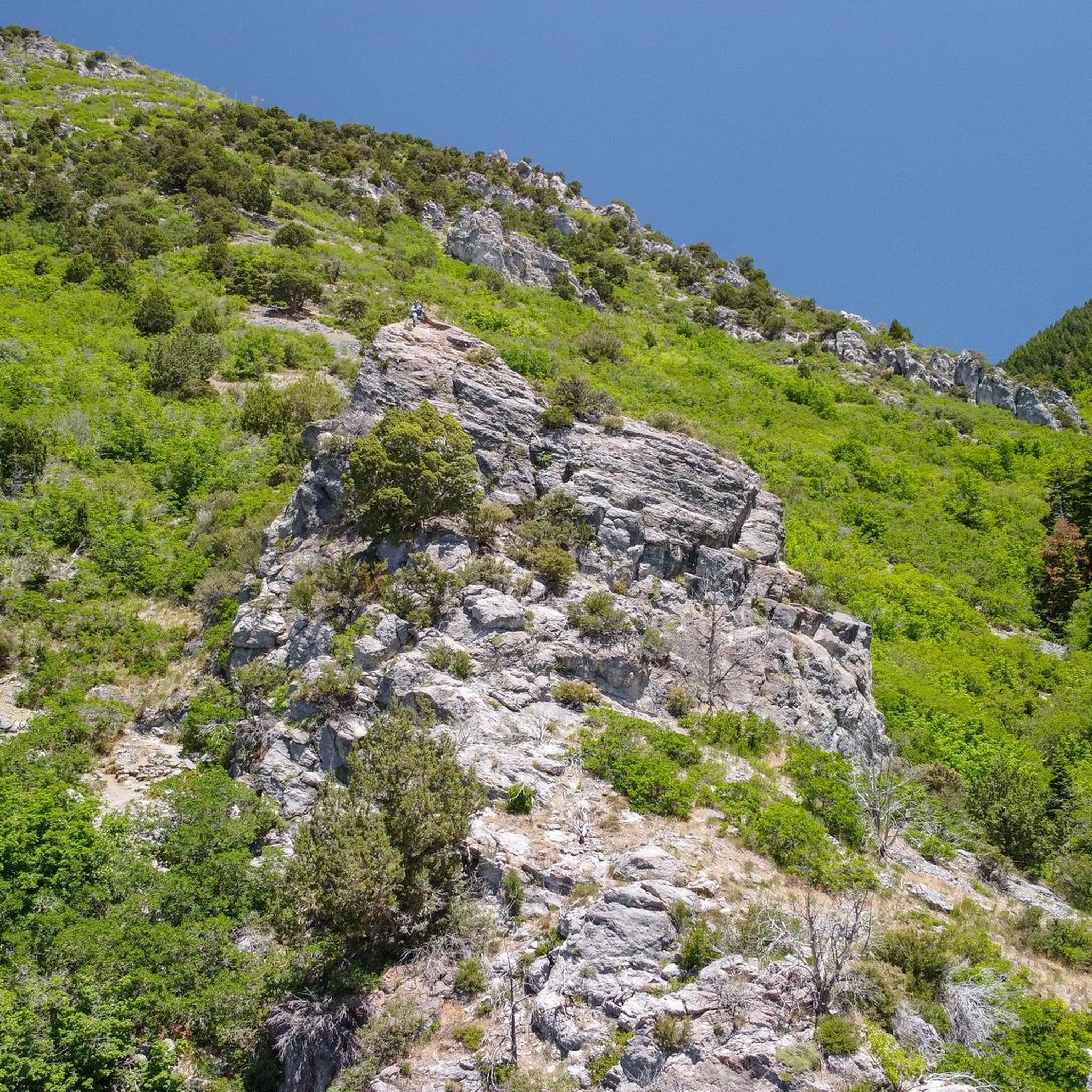
KhPeak Overlook gives you a wide view over the valley below and the surrounding ridges. It’s a simple, open spot to pause, take a breath, and get a sense of the terrain ahead before continuing your ride or hike.
1
0
Right Fork Hobble Creek Canyon Road winds through the canyon with forested sections, creek views, and open stretches with mountain scenery. It offers a steady climb and low traffic—great if you’re looking for an out-and-back ride with some elevation gain.
1
0
Provo River Parkway is a smooth, paved trail that follows the Provo River through canyons and parks. It’s mostly flat with gentle climbs, offering plenty of shade and scenic river views. This segment passes by Glen Park—an easy spot to refill water bottles or have a snack at the picnic tables.
1
0
This is the highest point of the Alpine Scenic Highway—meaning if you’ve made it here, it’s time to enjoy the downhill ahead. Nearby, you’ll find access to several trails, including Willow Hollow Trail, Horse Flat Trail, Ridge Trail, and Lame Hollow Trail.
0
0

This large park has playgrounds, picnic areas, a skatepark, sports fields, a small pump track, and it connected to the Provo River Parkway so you can explore further afield.
0
0

The Provo River Parkway is a great multi-use trail that connects Provo with Lake Utah. The path is fully paved and is popular with walkers, runners and cyclists, so make sure you are courteous to the other trail users.
0
0

The stunning Hobble Creek Canyon envelops Hobble Creek, offering impressive views of the water and the surrounding mountains. Running by the creek during autumn is truly remarkable, as the combination of the water and colorful autumn leaves brings a sense of peace and tranquility.
0
0
This well-maintained, paved trail guides you along Hobble Creek, meandering past Hobble Golf Course through a lush, tree-lined path. Along the way, you'll be treated to breathtaking views of the surrounding mountains as you steadily ascend towards the trail's end.
0
0
Frequently Asked Questions
How many road cycling routes are available in Springville?
Springville offers a diverse selection of over 19 road cycling routes, catering to various skill levels from easy to difficult. These routes are highly rated by the komoot community.
What are some challenging road cycling routes in Springville?
For a challenging ride with significant elevation gain, consider the Big East Lake – Nebo Loop Rd Climb North loop from Spanish Fork, which covers over 64 miles and features nearly 2,000 meters of ascent. Mapleton Canyon also offers a good climb with an 800-foot elevation gain over 3.3 miles to the Maple Mountain Trailhead.
Are there any easy or family-friendly road cycling options?
Yes, the Provo River Parkway – Provo River loop from Provo Central is a great option. This paved trail follows the Provo River, offering a mostly flat ride with gentle climbs, ample shade, and scenic river views, making it suitable for a relaxed outing. The streets of nearby Mapleton are also generally quiet and smooth for casual rides.
Where can I find scenic views or points of interest along the routes?
Springville's routes offer abundant scenic beauty. The Right Fork of Hobble Creek Canyon provides peaceful rides through forested sections and along the creek, while the Left Fork offers magnificent views of Provo Peak. You can also enjoy mountain views and foothills throughout the region. Notable nearby attractions include Kyhv Peak and Buffalo Peak Trail, which offer panoramic vistas.
What kind of terrain can I expect on Springville's road cycling routes?
The region offers a mix of terrain. You'll find challenging canyon climbs in areas like Hobble Creek Canyon and Mapleton Canyon, peaceful routes through forested sections and along creeks, and flatter options through rural settings west of I-15, such as around West Mountain, Benjamin, and Lake Shore. The Provo River Parkway provides a mostly flat, paved experience.
Are there any loop routes for road cyclists?
Yes, several routes are designed as loops. For instance, the Hobble Creek Trail – Hobble Creek Parkway Trail loop from Taco Bell parking explores the Hobble Creek area, and the Provo River Parkway – Provo River loop from Provo Central offers a scenic loop along the river.
What do other cyclists say about road cycling in Springville?
The road cycling routes in Springville are highly rated by the komoot community, with an average score of 4.3 stars from over 6 reviews. Cyclists often praise the diverse landscapes, from challenging canyon climbs to peaceful rural roads, and the scenic beauty of areas like Hobble Creek Canyon and the Provo River Parkway.
Is parking available at the trailheads?
While specific parking details for every trailhead are not listed, many popular cycling areas, such as the Provo River Parkway, typically have designated parking access points. For routes like the Hobble Creek Trail – Hobble Creek Parkway Trail loop, parking is indicated as starting from a Taco Bell parking lot, suggesting convenient access.
What is the best time of year for road cycling in Springville?
Springville offers good cycling conditions through much of the year. Spring and fall generally provide pleasant temperatures and vibrant scenery. Summer can be warm, but routes like the Right Fork of Hobble Creek Canyon offer cooler, shaded sections. Winter cycling may be possible on cleared roads, but conditions can vary.
Are there routes that offer a more peaceful ride with less traffic?
Absolutely. The Right Fork of Hobble Creek Canyon is known for generally light traffic above the golf course, providing a cool and peaceful ride. Additionally, the South Utah County Roads west of I-15, including areas like West Mountain, Benjamin, and Lake Shore, offer typically flat and narrow roads with very little traffic, ideal for quiet, longer rides.
Can I access road cycling routes using public transport?
While Springville has some public transport options, direct access to all road cycling trailheads via public transport might be limited. Routes like the Provo River Parkway – Provo River loop can be accessed from Provo Central, which is a public transport hub, offering a starting point for exploring the area.
Are there any specific events or community initiatives for cyclists in Springville?
Yes, the community actively supports cycling. Organizations like the Hobble Creek Bicycle Association work to improve bicycling in Springville and Mapleton. Events such as the annual "Bike with the Mayor" further encourage participation. You can find more information about community events on the Springville City website.
Are there any specific permits required for road cycling in Springville?
Generally, no specific permits are required for road cycling on public roads and designated paved trails in Springville. However, it's always a good idea to check local regulations for any specific parks or private lands you might encounter.
Most popular routes around Springville
Most popular attractions around Springville

Get inspired with the komoot mobile app


Explore more
Browse the best Road cycling routes in other regions.
