The best road cycling routes around Spanish Fork
4.0
(12)
476
riders
19
rides
If you've ever tried to plan road cycling around Spanish Fork, you know how overwhelming the options can be. With so many popular road bike trails Spanish Fork Utah has to offer, it's tough to tell which routes are genuinely worth your time and effort, and which are just filler. We get it – you want the highlights, not the guesswork.
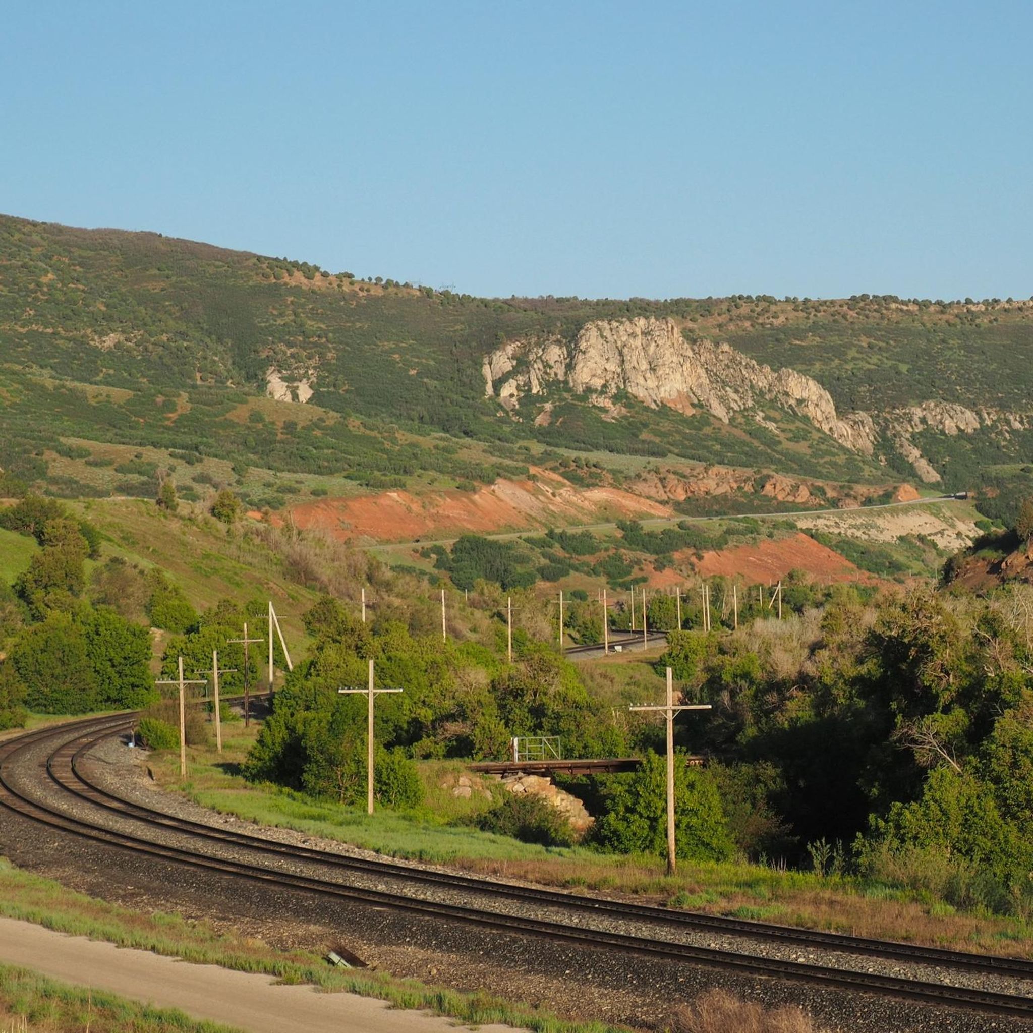
That's where we come in. Our komoot community has meticulously mapped, ridden, and reviewed these routes, so this guide is your curated shortcut to the very best. Spanish Fork sits at a fantastic crossroads, where the flat, fertile Utah Valley farmland meets the dramatic Spanish Fork Canyon and the foothills of the Wasatch Mountains. This means you'll find everything from gentle riverside paths to challenging mountain ascents, offering a diverse range of terrain for every kind of road cyclist.
If you only do one ride, we'd start with the Hobble Creek Trail – Hobble Creek Parkway Trail loop from Taco Bell parking. At 31.3 miles (50.4 km), it's a local favorite that meanders along Hobble Creek, delivering those scenic mountain views without being overly punishing. For something a bit more challenging with significant climbing and impressive vistas, the Roadbike loop from Benjamin, at 30.8 miles (49.5 km), is a fantastic option. Dive in and start exploring with komoot – more than 300 road cyclists have already found their perfect ride here.
Last updated: June 1, 2026
4.0
(2)
65
riders
49.5km
02:07
210m
210m
Moderate road ride. Good fitness required. Mostly well-paved surfaces and easy to ride.
4.0
(1)
75
riders
41.6km
01:52
340m
340m
The Provo River Parkway – Provo River loop from Provo Central offers a delightful road cycling experience, tracing the Provo River through diverse landscapes. You'll enjoy continuous views of the water, the dramatic Wasatch Front, and lush riparian plants, with the trail winding through canyons and parks. A standout feature is cycling directly past the spectacular Bridal Veil Falls, making for a memorable ride.
This moderate 25.9-mile (41.6 km) loop involves 1104 feet (336 metres) of elevation gain and takes approximately 1 hours and 51 minutes. The trail is entirely paved and well-marked, making it highly accessible for most cyclists, including families. While generally easy-going, be aware of a few short, steeper climbs, and some older sections might have ruts in the asphalt.
As a multi-use trail, you'll share the path with walkers and runners, but motorized vehicles are prohibited, ensuring a safe environment. The route is particularly pleasant on warmer days due to significant shade from abundant trees, especially within Provo Canyon. It's a great option for those seeking a scenic and accessible ride with plenty of natural beauty.

Sign up for free
44
riders
The Hobble Creek Trail – Hobble Creek Parkway Trail loop offers a rewarding road cycling experience through the scenic Hobble Creek Canyon. You'll pedal past the Hobble Golf Course, enjoying intermittent views of the creek and lush, tree-lined paths, all set against the dramatic backdrop of the Wasatch Range. The route combines well-maintained paved sections with some challenging climbs, providing a diverse and engaging ride.
Starting conveniently from the Taco Bell parking, this moderate 31.4-mile (50.5 km) loop involves a substantial 1817 feet (554 metres) of elevation gain, typically taking around 2 hours and 20 minutes. While much of the route is paved, some segments might be unpaved, so be ready for varied terrain. The autumn season is particularly recommended for its vibrant fall colors, enhancing the already beautiful scenery.
This loop is a fantastic option for cyclists seeking a good workout combined with natural beauty, especially those who appreciate mountain views and a mix of terrain. The Hobble Creek Wildlife Management Area along the route offers a chance to observe local nature, adding another layer to the experience. It's a popular choice for road cycling in the Springville area, known for its picturesque canyon setting.
19
riders
56.1km
03:11
1,260m
1,260m
The Beaver Dam Overlook loop from Payson is a formidable road cycling challenge, designed for riders who thrive on significant climbs and long distances. This difficult 34.9-mile (56.1 km) route demands respect, pushing you through varied terrain with an impressive 4149 feet (1265 metres) of elevation gain. Expect a sustained effort over approximately 3 hours and 11 minutes, rewarding you with a true sense of accomplishment as you navigate the mountainous landscapes around Payson, Utah.
Planning for this demanding ride means preparing for a full day in the saddle. The best time to tackle this loop is typically between June and mid-October, when the mountain roads are clear of snow. Always carry plenty of water and nutrition, and check local weather and road conditions before you set out. While specific parking details for this road cycling route are not widely publicized, you can generally find parking within Payson, Utah, to begin your journey.
This route is situated in Utah County, near Payson, Utah, a region known for its challenging mountain terrain. While the name "Beaver Dam Loop" is often associated with a strenuous mountain biking trail, this road cycling interpretation offers its own unique test of endurance. The area provides a natural backdrop of forests and mountain vistas, making it a scenic, albeit tough, ride for those seeking advanced road cycling loops near Payson, AZ (or rather, Payson, UT).
4.5
(2)
17
riders
23.4km
01:01
50m
50m
The Fort Utah Greenway – Provo River Parkway loop offers a delightful escape along the Provo River, where the scenery constantly evolves from city parks to more natural, shaded sections. You'll cycle on predominantly paved surfaces, enjoying views of the river and eventually the canyon walls as you head towards Provo Canyon. It's an easy road cycling route, making it a great choice for a relaxed outing.
This 14.5-mile (23.4 km) loop has a minimal 156 feet (48 metres) of elevation gain and takes just over 1 hour and 1 minute to complete. Starting from Provo Central, it's a convenient option for a quick ride. While generally accessible, be aware that some older sections of the Parkway, particularly closer to Utah Lake, have historically had rougher asphalt. The trail is open year-round, but expect potential snow in the upper reaches during winter.
This route is part of the larger Provo River Parkway, a significant multi-use trail system that stretches approximately 15 miles from Utah Lake State Park into Provo Canyon. It's also a key component of the Golden Spoke network, connecting over 100 miles of paved trails across the region. The varied landscapes and connection to popular landmarks like Bridal Veil Falls make it a highly regarded cycling route in Provo, Utah.
Get access to more routes and recommendations from other explorers.
Sign up for free
Already have an account?
Our route recommendations are based on thousands of hikes, rides, and runs completed by other people on komoot.
Start today with a free account
Your next adventure awaits.
Login or Signup
Popular around Spanish Fork


Tips from the Community

Right Fork Hobble Creek Canyon Road winds through the canyon with forested sections, creek views, and open stretches with mountain scenery. It offers a steady climb and low traffic—great if you’re looking for an out-and-back ride with some elevation gain.
1
0
Provo River Parkway is a smooth, paved trail that follows the Provo River through canyons and parks. It’s mostly flat with gentle climbs, offering plenty of shade and scenic river views. This segment passes by Glen Park—an easy spot to refill water bottles or have a snack at the picnic tables.
1
0

This large park has playgrounds, picnic areas, a skatepark, sports fields, a small pump track, and it connected to the Provo River Parkway so you can explore further afield.
0
0

The Provo River Parkway is a great multi-use trail that connects Provo with Lake Utah. The path is fully paved and is popular with walkers, runners and cyclists, so make sure you are courteous to the other trail users.
0
0

The stunning Hobble Creek Canyon envelops Hobble Creek, offering impressive views of the water and the surrounding mountains. Running by the creek during autumn is truly remarkable, as the combination of the water and colorful autumn leaves brings a sense of peace and tranquility.
0
0
This well-maintained, paved trail guides you along Hobble Creek, meandering past Hobble Golf Course through a lush, tree-lined path. Along the way, you'll be treated to breathtaking views of the surrounding mountains as you steadily ascend towards the trail's end.
0
0

This multi-use paved trail begins at Utah Lake State Park and follows the Provo River for 15 miles, showcasing different areas of the city and its parks.
0
0

If you want to see the main waterfall in the park, you'll have to leave your bike behind for a bit. Just biking along the river on the Provo River Parkway is worth your while, though, and you get great views of cascades and small falls pouring into the river.
0
0
Frequently Asked Questions
How many road cycling routes are available around Spanish Fork?
Spanish Fork offers a diverse selection of road cycling routes. You'll find approximately 20 routes, with options ranging from 6 easy rides perfect for beginners, to 10 moderate routes, and 4 challenging paths for experienced cyclists.
What kind of terrain can I expect on road cycling routes in Spanish Fork?
The terrain around Spanish Fork is quite varied, offering everything from mostly flat rides along the back of West Mountain with views of the lake, to routes through agricultural lands and along the Spanish Fork River. For those seeking more challenge, the dramatic Spanish Fork Canyon and picturesque Hobble Creek Canyon provide significant climbs and stunning mountain vistas.
Are there challenging road cycling routes for experienced riders in Spanish Fork?
Yes, experienced riders can find demanding routes, particularly those heading into the mountain canyons. The Big East Lake – Nebo Loop Rd Climb North loop from Spanish Fork is a difficult 64.2-mile path featuring a significant climb towards the Mt. Nebo Lookout, offering spectacular views and an elevation gain of nearly 2,000 meters.
Are there easy or beginner-friendly road cycling routes in Spanish Fork?
Absolutely. For an easier ride, the Spanish Fork Reservior loop from The Church of Jesus Christ of Latter-day Saints is a great option. This 17.3-mile trail leads through the foothills and past the reservoir with minimal elevation gain, making it suitable for any fitness level. The Spanish Fork River Trail also offers a relatively flat, paved journey alongside the river.
What scenic views or natural features can I enjoy while road cycling in Spanish Fork?
Road cycling in Spanish Fork provides access to a wide array of scenic beauty. You can enjoy the dramatic mountain views of Spanish Fork Canyon, the lush, tree-lined paths of Hobble Creek Canyon, and the serene setting of Spanish Oaks Reservoir. During autumn, routes like the Nebo Loop Road offer spectacular fall colors, and many paths provide views of the surrounding mountains and agricultural landscapes.
Are there any specific landmarks or attractions along the road cycling routes?
While cycling, you can pass by various natural and recreational points of interest. The Spanish Fork River Trail, for instance, runs alongside Canyon View Park, which features a large fishing pond. For those interested in local landmarks, the Payson Utah Temple is a notable religious building in the vicinity. You might also catch glimpses of Spanish Fork Peak in the distance.
Are there any loop road cycling routes in Spanish Fork?
Yes, Spanish Fork offers several excellent loop routes. A popular choice is the Hobble Creek Trail – Hobble Creek Parkway Trail loop from Taco Bell parking, a moderate 31.3-mile ride that meanders along Hobble Creek. Another option is the Spanish Fork Reservior loop, which is an easier 17.3-mile circuit.
What do other road cyclists enjoy the most about road cycling in Spanish Fork?
The komoot community highly rates road cycling in Spanish Fork, with an average score of 4.3 stars. Reviewers often praise the diverse terrain, which offers everything from peaceful river trails to challenging mountain ascents, and the stunning scenic backdrops, especially the mountain and canyon views.
Are there family-friendly road cycling options in Spanish Fork?
Yes, the Spanish Fork River Trail is particularly well-suited for families. This paved, relatively flat trail runs for 7 miles and features underpasses for all road crossings, ensuring a continuous and safe ride. It's often shaded and passes alongside the river, mature trees, and farmland, making it manageable even with bike trailers.
Where can I find parking for road cycling routes in Spanish Fork?
Many routes in Spanish Fork offer convenient parking. For example, the Hobble Creek Trail – Hobble Creek Parkway Trail loop starts from a Taco Bell parking lot, providing easy access. Additionally, parks like Canyon View Park and Spanish Fork Sports Park, which connect to the Spanish Fork River Trail, offer extensive parking facilities.
What is the best time of year for road biking in Spanish Fork?
The region offers enjoyable cycling for much of the year. Spring and fall are particularly pleasant, with milder temperatures and, in autumn, spectacular fall colors, especially along routes like the Nebo Loop Road. Summer can be warm, so early morning or late afternoon rides are often preferred. Winter cycling depends on snow conditions, particularly in the canyons.
Are there any long-distance road cycling routes available?
Yes, for those looking for longer rides, Spanish Fork serves as a starting point for extended loops. The Big East Lake – Nebo Loop Rd Climb North loop from Spanish Fork is a significant 64.2-mile route. Longer loops also extend into southern Utah County, offering great views and less traffic for an extended cycling experience.
Can I find routes that offer mountain views while road cycling?
Absolutely. Spanish Fork's unique geographical position means many road cycling routes offer stunning mountain views. Rides through Spanish Fork Canyon and Hobble Creek Canyon provide dramatic backdrops, and even flatter routes along West Mountain or through the city streets offer glimpses of the surrounding peaks.
Most popular routes around Spanish Fork
Most popular attractions around Spanish Fork

Get inspired with the komoot mobile app


Explore more
Browse the best Road cycling routes in other regions.
