The best walks and hikes around Bryce Canyon City
4.7
(3071)
30,713
hikers
99
hikes
Hiking around Bryce Canyon City offers access to a landscape defined by unique geological formations and extensive trail networks. The region is renowned for its distinctive hoodoos, which are irregular rock pillars carved by erosion, particularly within Bryce Canyon National Park. Hikers can explore natural amphitheaters, red rock formations, and diverse ecosystems at an elevation of around 8,000 feet. The area provides a variety of terrain, from canyon descents to rim trails.
Best hiking trails around Bryce Canyon City
- The most popular hiking route is Bryce Canyon Figure 8 Loop — Bryce Canyon National Park, a 15.5 miles (24.9 km) difficult trail that takes 7 hours 20 minutes to complete. This route offers an immersive experience among the park's hoodoos and varied terrain.
- Another top favourite among local hikers is Mossy Cave and Tropic Ditch Waterfall – Bryce Canyon National Park, an easy 0.9 miles (1.5 km) path. This trail leads to a hidden cavern and a waterfall just outside the main park area.
- Local hikers also love the Queens Garden Trail – Sunset Point loop from Tropic, a 4.9 miles (7.8 km) trail leading through the Bryce Amphitheater, often completed in about 2 hours 18 minutes.
- Hiking around Bryce Canyon City is defined by unique hoodoo formations, natural amphitheaters, and red rock landscapes. The network offers options for easy strolls, moderate paths, and strenuous climbs, catering to different ability levels.
- The routes in Bryce Canyon City are highly rated by the komoot community with an average score of 4.8 stars from more than 2,800 reviews. More than 28,000 hikers have used komoot to explore Bryce Canyon City's varied terrain.
Last updated: July 8, 2026
5.0
(3)
14
hikers
35.3km
09:44
780m
320m
Hike the difficult 21.9-mile Bryce Canyon National Park Scenic Drive, gaining 2547 feet while exploring iconic hoodoos and vast vistas.
9.72km
02:37
170m
40m
The Bryce Canyon Shared-Use Path offers a unique opportunity to immerse yourself in the park's iconic red canyon formations and ponderosa pine forests on a smooth, paved surface. You'll be treated to accessible views of the famous hoodoos and spires, especially at viewpoints like Inspiration Point. Keep an eye out for chipmunks darting along the path as you enjoy the stunning scenery, making it a delightful experience for all ages.
Planning your visit is straightforward, as the path is multi-use and accommodates pedestrians, cyclists, and even leashed pets. While the 6.0-mile (9.7 km) route with 562 feet (171 metres) of elevation gain is rated moderate and takes about 2 hours and 37 minutes, you can make it easier by using the park shuttle for an uphill drop-off, allowing for a mostly downhill return. Remember that construction near Bryce Point Road might affect access, so checking shuttle schedules is a good idea for the best time to hike Bryce Canyon Shared-Use Path.
What truly sets this trail apart is its ability to connect you with Bryce Canyon's unique geological wonders without contending with vehicle traffic. It's an excellent option for families and those seeking Bryce Canyon Shared-Use Path wheelchair accessibility, providing a fantastic way to experience the Bryce Amphitheater area and link up with other trails. The flame-colored hoodoos are the main attraction, offering a visual feast of nature's artistry.

Sign up for free
4.9
(11)
89
hikers
24.9km
07:20
730m
730m
Hike the difficult 15.5-mile Fairyland and Figure 8 Loop in Bryce Canyon National Park, exploring iconic hoodoos and canyons.
4.9
(51)
440
hikers
21.4km
06:10
510m
510m
Hard hike. Very good fitness required. Easily-accessible paths. Suitable for all skill levels.
4.7
(3)
31
hikers
8.15km
02:24
230m
230m
Moderate hike. Good fitness required. Easily-accessible paths. Suitable for all skill levels.
Get access to more routes and recommendations from other explorers.
Sign up for free
Already have an account?
Our route recommendations are based on thousands of hikes, rides, and runs completed by other people on komoot.
Start today with a free account
Your next adventure awaits.
Login or Signup
Popular around Bryce Canyon City
Tips from the Community

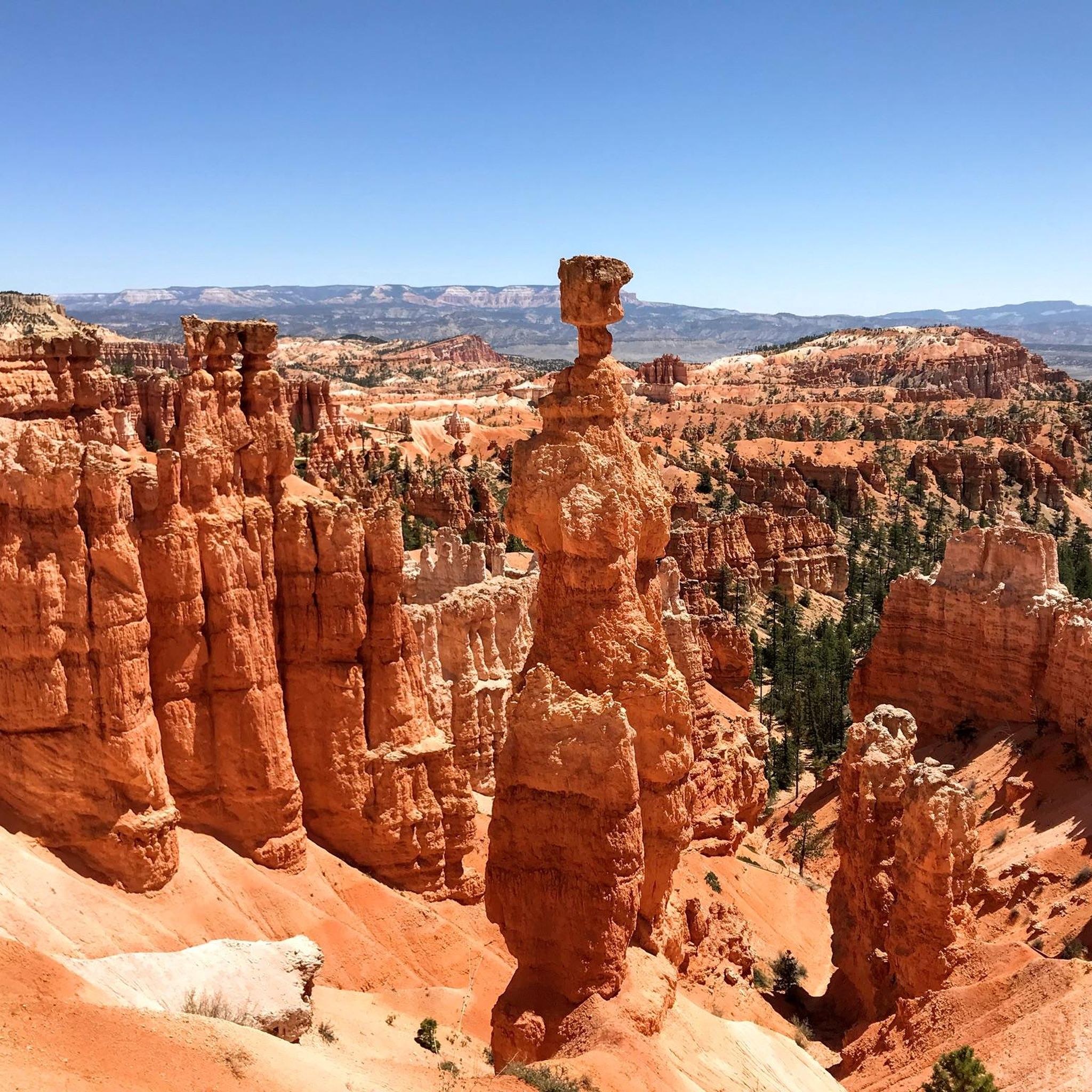
A stunningly beautiful hike in Bryce Canyon. The Navajo Peekaboo Loop is a popular and challenging hike in Bryce Canyon National Park, connecting two of the most famous trails in the Bryce Amphitheater. Impressive, narrow switchbacks lead steeply down into the canyon and past rock formations with imaginative names like Thor's Hammer and Wall Street.
0
0
It is located at the southern end of the Southern Scenic Drive, the main road through Bryce Canyon National Park. At 2,778 meters (9,115 feet), Rainbow Point, along with the adjacent Yovimpa Point, is the highest viewpoint in the park. It offers one of the most expansive panoramic views of the entire park and beyond. The view extends far beyond the amphitheaters with their famous red hoodoos.
0
0

Beautiful to see and to walk in
0
0

Lower Inspiration Point is a fantastic spot over Bryce Amphitheater, with views of the dense clusters of hoodoos known as the Silent City. The short, unpaved trail from the parking area leads to a fenced overlook with sweeping views to the north. It’s a quieter alternative to the park’s busier viewpoints and is especially stunning at sunrise or after dark under the starry sky.
0
0

Natural Bridge, Bryce Canyon National Park, Utah 🇺🇸 This stunning arch, carved by millennia of erosion, is a testament to the power of nature. While it may appear to be a bridge, it is technically an arch, formed by the weathering of the park's distinctive red rock. The vibrant iron oxides in the rock give it its fiery hue, especially striking against the white of fresh snow in winter. Bryce Canyon's unique geology is a result of millions of years of uplift and erosion. The amphitheater-like formations are not true canyons, but rather a series of horseshoe-shaped bowls carved into the eastern edge of the Paunsaugunt Plateau. The "hoodoos," irregular spires of rock, are a defining feature, and Natural Bridge is one of the most iconic formations within this landscape. Visiting in the off-season, particularly winter, offers a serene and often solitary experience. The snow provides a dramatic contrast to the red rock, making for breathtaking photography. Remember to dress in layers and check road conditions, as some park roads may close due to heavy snowfall.
1
0

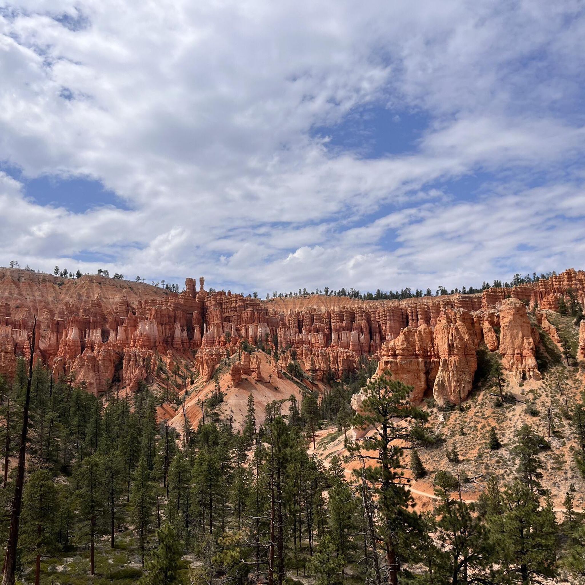
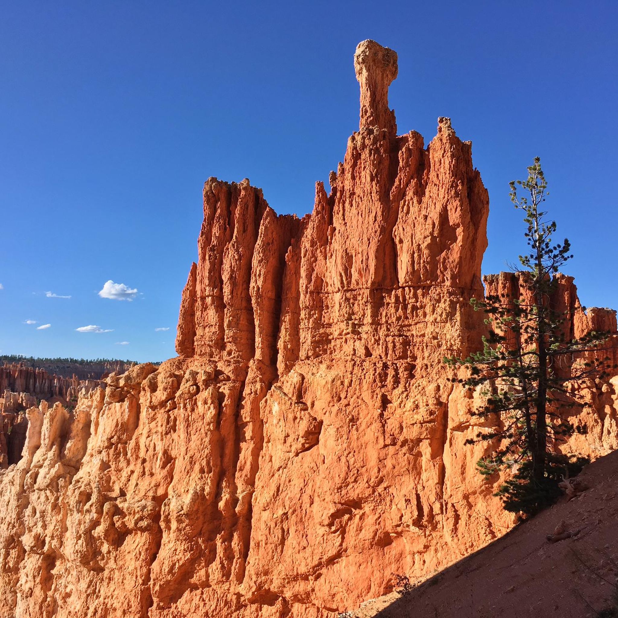
We reach the spectacular Bryce Canyon. The bizarre rock formations ("hoodoos") are just as characteristic of Bryce Canyon as its forests. The combined forces of wind, water and ice have created a landscape of rock pillars in strange shapes and sizes. These rock formations are also called hoodoos. The hoodoos create a labyrinth of constantly changing shapes and colors from bright orange to pale pink or ochre. Here we take the opportunity to descend into the canyon. The change of perspective makes us really aware of the size of the individual rock formations. We see several chipmunks that are far too quick for my camera.
4
0
The magic of this landscape, which has always inspired people's imagination, is described in a legend of the Paiute Indians. According to it, a long time ago the Legend People lived in a wonderful city that Coyote had built for them. When the Legend People began to behave ungratefully and badly towards Coyote, he turned them into immovable rocks as punishment. And so today, on hikes through the valley, we encounter curious-looking stone figures at every turn.
5
0
We reach the spectacular Bryce Canyon. The bizarre rock formations ("hoodoos") are just as characteristic of Bryce Canyon as its forests. The combined forces of wind, water and ice have created a landscape of rock pillars in strange shapes and sizes. These rock formations are also called hoodoos. The hoodoos create a labyrinth of constantly changing shapes and colors from bright orange to pale pink or ochre. Here we take the opportunity to descend into the canyon. The change of perspective makes us really aware of the size of the individual rock formations. We see several chipmunks that are far too quick for my camera.
5
0
Frequently Asked Questions
How many hiking trails are available around Bryce Canyon City?
There are over 80 hiking routes around Bryce Canyon City, offering a wide range of experiences from easy strolls to challenging climbs. These trails are highly rated by the komoot community, with an average score of 4.8 stars from more than 2,800 reviews.
What kind of hiking difficulty can I expect in Bryce Canyon City?
The trails around Bryce Canyon City cater to various skill levels. You'll find approximately 52 easy routes, 21 moderate paths, and 7 more difficult trails, ensuring options for every hiker.
Are there any easy or family-friendly hikes near Bryce Canyon City?
Yes, for an easy and family-friendly option, consider the Mossy Cave and Tropic Ditch Waterfall – Bryce Canyon National Park trail, which leads to a hidden cavern and a waterfall. The Queens Garden Trail – Sunset Point loop from Tropic is another popular choice that allows hikers to walk among the hoodoos on a moderate path. The Rim Trail within Bryce Canyon National Park is also paved and accessible, offering stunning views.
Can I find loop trails in the Bryce Canyon City area?
Yes, several excellent loop trails are available. The Bryce Canyon Figure 8 Loop — Bryce Canyon National Park is a challenging option, while the Queens Garden Trail – Sunset Point loop from Tropic offers a moderate experience through the Bryce Amphitheater. Another challenging loop is the Bryce Point – Sunset Point loop from Bryce Canyon City.
What are some notable natural attractions or landmarks I can see while hiking?
The region is famous for its unique geological formations. You can explore the Bryce Amphitheater, observe the iconic Thor’s Hammer (hoodoo), and visit viewpoints like Sunset Point and Sunrise Point. The Two Bridges (Navajo Loop Trail) are also a popular sight.
Is Bryce Canyon City at a high elevation, and how should I prepare?
Yes, Bryce Canyon City is situated at an elevation of around 8,000 feet (approximately 2,400 meters). Visitors should pace themselves, stay hydrated, and be aware of potential weather changes due to the altitude.
Are there any dog-friendly trails in the Bryce Canyon City area?
Within Bryce Canyon National Park, pets are generally allowed on paved surfaces, including the Rim Trail, shared-use paths, and the campground roads. However, they are not permitted on unpaved trails or overlooks. Always check specific park regulations before bringing your pet. For more details, you can visit the official park website: nps.gov.
What is the best time of year to hike in Bryce Canyon City?
The best time to hike is typically from spring through fall (April to October) when temperatures are milder and all trails are usually accessible. Summer offers warm days and cooler nights, while spring and fall provide pleasant weather and fewer crowds. Winter hiking is possible, but trails may be covered in snow and ice, requiring appropriate gear.
What should I wear for hiking in Bryce Canyon City during the summer?
Even in summer, temperatures can vary significantly between day and night, and at higher elevations. It's best to wear layers, including moisture-wicking clothing, a hat for sun protection, and sturdy hiking shoes. Always carry plenty of water, sunscreen, and a light jacket for cooler mornings or evenings.
Are there opportunities to see wildlife on the trails?
Yes, the diverse ecosystems around Bryce Canyon City offer chances to spot wildlife. Keep an eye out for mule deer, elk, various bird species, and smaller mammals. Remember to observe wildlife from a distance and never feed animals.
Are there any waterfalls to see while hiking?
Yes, the Mossy Cave and Tropic Ditch Waterfall – Bryce Canyon National Park trail leads to a hidden cavern and a waterfall just outside the main park area, offering a refreshing sight.
Most popular attractions around Bryce Canyon City

Get inspired with the komoot mobile app


Explore more
Browse the best Hikes in other regions.
