The best walks and hikes around North Ogden
4.6
(36)
484
hikers
44
hikes
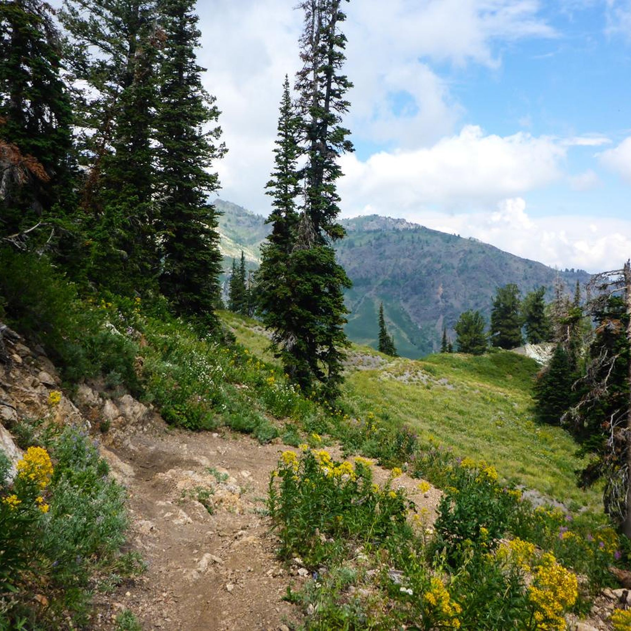
Hiking around North Ogden offers direct access to the majestic Wasatch Mountains, providing a dramatic backdrop and a vast network of trails. The region features diverse terrain, from challenging mountain treks to serene nature walks, with peaks like Ben Lomond contributing to the impressive skyline. Hikers can explore rolling ridge-lines, canyons, and forested areas, all within easy reach of the city.
Best hiking trails around North Ogden
- The most popular hiking route is Ben Lomond from North Skyline Trail — Uinta-Wasatch-Cache National Forest, a 15.9 miles (25.6 km) trail that takes about 8 hours to complete. This difficult route offers significant elevation gain and panoramic views of the surrounding Wasatch Front.
- Another top favourite among local hikers is Lewis Peak — Ogden, Utah, a difficult 10.4 miles (16.7 km) path. This trail leads to Lewis Peak, providing expansive vistas over Ogden and the Great Salt Lake.
- Local hikers also love the Coldwater Creek via Bonneville Shoreline Trail — Uinta-Wasatch-Cache National Forest, a 3.8 miles (6.0 km) trail leading through varied terrain along the foothills, often completed in about 2 hours 7 minutes.
- Hiking around North Ogden is defined by the towering Wasatch Mountains, extensive sections of the Bonneville Shoreline Trail, and access to the Wasatch-Cache National Forest. The network offers options for different ability levels, from easy nature walks to challenging mountain ascents.
- The routes in North Ogden are highly rated by the komoot community with an average score of 4.7 stars from over 28 reviews. More than 300 hikers have used komoot to explore North Ogden's varied terrain.
Last updated: September 28, 2026
5
hikers
2.13km
00:35
30m
40m
Embark on the easy Quail Loop Trail for a refreshing outdoor experience. This gentle hike covers 1.3 miles (2.1 km) with a minimal elevation gain of 96 feet (29 metres), making it perfect for a quick 35-minute outing. As you follow the path, you will encounter diverse terrain, including interesting boulders and charming small bridges that add character to your walk. Keep an eye out for local wildlife while enjoying clear views of Ben Lomond Peak, providing a scenic backdrop to your journey.
When planning your visit to the Quail Loop Trail, you will find it conveniently located within the Ogden Nature Center North. Parking is generally available at the trailhead, ensuring easy access to your adventure. You can also expect to find amenities such as restrooms and picnic areas nearby, making it a comfortable spot for families. Always remember to check local conditions before you head out, especially concerning weather forecasts or any temporary closures that might affect your plans.
This trail is particularly well-suited for families and anyone seeking a gentle walk in nature, offering a peaceful escape without demanding strenuous effort. The varied landscape, from its unique rock formations to the small bridges, creates a dynamic environment for such a short route. It stands out as an accessible option for observing the natural surroundings and local wildlife within the Ogden Nature Center.
4.82km
01:38
360m
60m
Embark on the Coldwater Canyon BST, a moderate hike that takes you through varied landscapes. You will cover 3.0 miles (4.8 km) and gain 1170 feet (357 metres) in elevation, typically completing the route in about 1 hour and 38 minutes. As you hike, you will experience everything from smooth singletrack paths winding through scrub oak to more rugged, rocky sections nestled within pine and spruce-fir forests. Keep an eye out for the expansive views overlooking the Weber Valley, where you can spot prominent peaks like Willard Peak and Ben Lomond Peak in the distance. About 3 kilometers into your journey, you will discover a picturesque waterfall, offering a perfect spot to pause and enjoy the scenery. The unique spruce-fir forest along the route adds to the beauty of this section of the Bonneville Shoreline Trail. This trail offers a rewarding experience if you are looking for a good workout with scenic rewards.
When planning your visit, be aware that while the trail's modern design helps with grades, you should still be prepared for some steep and rocky sections, especially if you venture further along the route. We recommend wearing proper hiking boots for these parts to ensure comfort and safety. During warmer months, you will find some shaded sections that provide welcome relief from the heat, making it a pleasant hike even on sunnier days.
The Coldwater Canyon BST is located within the Uinta-Wasatch-Cache National Forest, offering you a chance to immerse yourself in a diverse natural environment. The trail is notable for its blend of different forest types and its stunning panoramic vistas. The unique spruce-fir forest is a highlight, providing a distinct ecological feature that sets this trail apart. This route is a great option if you want to experience the natural beauty and varied terrain of the region.

2.56km
00:47
140m
20m
The Bonneville Shoreline Trail to Power Line Road offers a delightful, quick escape into nature, providing a unique perspective on Utah's geological history. As you traverse the varied terrain of packed dirt and rocky sections, you'll be treated to expansive viewpoints overlooking the valleys and the vast Great Salt Lake. The route distinctly follows the ancient benches carved by Lake Bonneville, making for a scenic and engaging experience that connects you directly to the region's past.
This easy hiking trail is perfect for a quick outing, covering 1.6 miles (2.6 km) with a manageable 445 feet (135 metres) of elevation gain, typically completed in just 46 minutes. It's an ideal beginner hike or a family friendly option, accessible from urban areas. While generally straightforward, some older sections can be steep, so wear appropriate footwear.
Part of the larger Bonneville Shoreline Trail, this segment is notable for its urban-wildlife interface and its role as an excellent introduction to the region's distinctive landscape. It's a popular hiking trail that highlights the remnants of Lake Bonneville's shorelines, offering a glimpse into a prehistoric inland sea that once covered much of present-day Utah.
2.61km
01:08
380m
0m
Embark on the South Skyline Trail for a moderate hike that offers a good workout and rewarding scenery. This route covers 1.6 miles (2.6 km) and climbs 1250 feet (381 metres) in elevation, typically taking about 1 hour and 8 minutes to complete. As you hike, you will experience diverse terrain, from smooth dirt paths to sections with rocks and roots, all while passing through mixed forests of pine, aspen, and gambel oak. Keep an eye out for panoramic views of the surrounding valleys and peaks, including the expansive Pineview Reservoir.
Before you head out, remember that this is a multi-use trail, so you might encounter mountain bikers, horseback riders, or dirt bikers in addition to other hikers. If you are looking for a shorter or less strenuous experience, the viewpoint overlooking Pineview Reservoir makes for an excellent turnaround spot. Always check local conditions before your visit, especially for any sudden weather changes, to ensure a safe and enjoyable trip.
The trail is particularly vibrant in early summer when the landscape comes alive with the blossoms of mountain bluebell and Wasatch penstemmon. This route provides a fantastic opportunity to immerse yourself in the Uinta-Wasatch-Cache National Forest, offering a blend of physical challenge and natural beauty. It stands out as a popular choice for those seeking accessible yet engaging outdoor activity near Ogden.
25.5km
06:38
180m
130m
Hike the McGriff Canal Trail, a 15.9-mile (25.5 km) route in Weber County, Utah, offering flat terrain, canal views, and birdwatching opport
Get access to more routes and recommendations from other explorers.
Already have an account?
Our route recommendations are based on thousands of hikes, rides, and runs completed by other people on komoot.
Start today with a free account
Your next adventure awaits.



Tips from the Community

The spot along the Bonneville Shoreline Trail can be just a trickle or a full-blown stream crossing depending on the time of year. It's best to just hop off and push your bike across if you can't see the rocks at the bottom.
0
0

Coldwater Creek is a refreshing stream running through Coldwater Canyon, and the perfect stop to freshen up during a hike. Icy and slippery conditions during rainy and snowy weather make for dangerous conditions, so be cautious.
0
0
Frequently Asked Questions
How many hiking trails are available around North Ogden?
North Ogden offers a wide variety of hiking experiences, with over 20 trails documented on komoot. These routes cater to different skill levels, from easy nature walks to challenging mountain ascents into the Wasatch Mountains.
What makes North Ogden a unique hiking destination?
North Ogden is uniquely positioned at the base of the majestic Wasatch Mountains, providing immediate access to a vast network of trails. Hikers can experience diverse terrain, from challenging mountain treks with panoramic views of the valley to serene nature walks through canyons and along ridge-lines. The area is a gateway to the Wasatch-Cache National Forest and features extensive sections of the Bonneville Shoreline Trail.
Are there any trails with waterfalls near North Ogden?
Yes, the Waterfall Canyon Trail, located just outside Ogden, is a popular moderate hike leading to a stunning 200-foot waterfall. It's particularly beautiful in spring when snowmelt feeds the powerful cascade and wildflowers are in bloom.
Are there options for beginner or easy hikes in North Ogden?
Absolutely. North Ogden offers 9 easy routes, perfect for beginners or those seeking a relaxed outdoor experience. The North Ogden Nature Park features well-maintained trails for peaceful walks, and sections of the Ogden River Parkway provide gentle, scenic paths ideal for less strenuous activity. For a specific easy route, consider the Birdsong Trail.
Can I bring my dog on the hiking trails in North Ogden?
Many trails in the North Ogden area are dog-friendly, but it's always best to check specific trail regulations before heading out. Generally, dogs are welcome on leash in the Wasatch-Cache National Forest and on many local trails. Always practice Leave No Trace principles and clean up after your pet.
What is the best time of year to hike in North Ogden?
The best time for hiking in North Ogden is typically from late spring through early fall (May to October), when the weather is mild and trails are clear of snow. Spring offers wildflowers and powerful waterfalls, while fall brings stunning foliage. Some lower elevation trails, like sections of the Bonneville Shoreline Trail, can be enjoyed year-round, including for snowshoeing in winter.
Are there any family-friendly hiking options in North Ogden?
Yes, North Ogden has several family-friendly options. The North Ogden Nature Park offers easy, well-maintained trails suitable for all ages. The Ogden River Parkway is another excellent choice for families, providing paved and unpaved paths along the river with shaded picnic spots. For a slightly more adventurous but still accessible option, consider the Birdsong Trail.
Where can I find parking for popular trailheads in North Ogden?
Parking is generally available at most major trailheads. For trails like the Bonneville Shoreline Trail, there are multiple access points with designated parking areas along the foothills. Specific parking information for trails such as the Coldwater Creek via Bonneville Shoreline Trail can often be found on komoot tour pages or local recreation websites. Always check local signage for any specific parking restrictions or fees.
What kind of views can I expect on hikes around North Ogden?
Hikers in North Ogden are rewarded with spectacular views. Trails in the Wasatch Mountains, such as those leading to Ben Lomond or Lewis Peak, offer panoramic vistas of the Ogden Valley, the Great Salt Lake, and the surrounding mountain ranges. The Bonneville Shoreline Trail provides expansive views over the city and the valley below, while canyon trails offer dramatic geological formations and lush riparian areas.
What do other hikers enjoy most about hiking in North Ogden?
The hiking experiences around North Ogden are highly rated by the komoot community, with an average score of 4.7 stars from over 28 reviews. Hikers frequently praise the diverse terrain, from challenging mountain ascents to serene nature walks, and the stunning panoramic views of the Wasatch Front and the valley. The accessibility to a vast network of trails directly from the city is also a highlight.
Are there any nearby attractions or points of interest to explore after a hike?
Yes, beyond the trails, North Ogden and the surrounding area offer several attractions. You can explore the Ogden River Parkway for a leisurely stroll or visit the Ogden City Center for dining and local culture. The Weber River Parkway also provides additional scenic walking opportunities.
Are hiking permits required for trails in North Ogden, Utah?
Generally, hiking permits are not required for day hikes on most trails in and around North Ogden, including those within the Wasatch-Cache National Forest. However, it's always advisable to check with the local forest service or park authorities for any specific regulations, especially for overnight backpacking or certain wilderness areas.
Are there any loop hikes available in North Ogden?
While many trails in North Ogden are out-and-back, several offer opportunities for creating loop experiences by connecting with other trails, particularly along the extensive Bonneville Shoreline Trail system. For example, the Coldwater Creek via Bonneville Shoreline Trail offers varied terrain that can be part of a larger loop exploration.
Most popular attractions around North Ogden

Get inspired with the komoot mobile app


Explore more
Browse the best Hikes in other regions.
