The best road cycling routes around Lost Creek
4.5
(46)
2,344
riders
86
rides
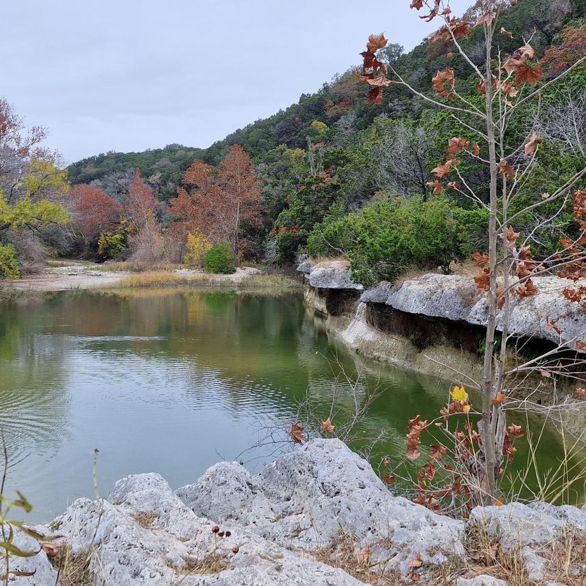
Road cycling routes around Lost Creek, particularly in the Austin, Texas area, traverse urban greenbelts, scenic river views, and rolling hills. The region's varied terrain is influenced by limestone formations, offering both gradual inclines and more challenging climbs. Cyclists can expect a mix of developed areas and natural spaces, including stretches along creeks and rivers. This landscape provides diverse options for road cycling.
Best road cycling routes around Lost Creek
- The most popular road cycling route is Mount Bonnell &…
Last updated: August 20, 2026
19
riders
45.6km
02:09
530m
530m
Embark on a dynamic road cycling journey through the Texas Hill Country with the Mount Bonnell & rolling northwest hills loop. This moderate route spans 28.3 miles (45.6 km) and…
9
riders
86.6km
04:28
950m
950m
Prepare for a demanding road cycling journey on the Pace Bend National Park loop from Barton Creek. This difficult route stretches for 53.8 miles (86.6 km), taking you through the…

Sign up for free
3.5
(2)
136
riders
Moderate road ride. Good fitness required. Some segments of this route may be unpaved and difficult to ride.
40
riders
43.8km
02:22
340m
340m
Moderate road ride. Good fitness required. Some segments of this route may be unpaved and difficult to ride.
40
riders
43.6km
02:19
680m
680m
Moderate road ride. Good fitness required. Mostly well-paved surfaces and easy to ride.
Get access to more routes and recommendations from other explorers.
Sign up for free
Already have an account?
Our route recommendations are based on thousands of hikes, rides, and runs completed by other people on komoot.
Start today with a free account
Your next adventure awaits.
Login or Signup



Tips from the Community

Popular spot in the heart of Austin. Beautiful facility. Also suitable for dogs
0
0

Excellent climbs(steep), fairly smooth roads and low traffic throughout the day make this a definite must for your route!
0
0
Avoid during morning rush hour and around 3-5pm when school is in session. Evening and weekends are ideal.
0
0

The Ann and Roy Butler Hike and Bike Trail takes you out over the waters of the Colorado River on a 1000-foot long boardwalk with stunning views across the azure water to the Austin skyline. There are two pull-off spots on either end to take in the views.
0
0

The Pfluger Pedestrian Bridge, also known as the James D. Pfluger Pedestrian and Bicycle Bridge, spans 700 feet over Lady Bird Lake in downtown Austin, Texas. Opened in 2001, this shared-use bridge connects the north and south sides of the Ann and Roy Butler Hike-and-Bike Trail. It features a distinctive "double curve" design supported by curved concrete piers and a concrete deck on top of weathering steel plate girders. The bridge is named after James D. Pfluger, a local architect who designed the trails surrounding Lady Bird Lake.
0
0
The azure blue water of the springs offers a gorgeous view across to the Austin skyline and makes for a great place to cool off in the summer. There are well maintained and paved paths that circumnavigate the water's edge, and there are some flat rocks that you can use to climb down by the edge of the pool.
1
0

Zilker Metropolitan Park, located in South Austin, Texas, is a haven for urban exploration. Spanning over 350 acres at the confluence of Barton Creek and the Colorado River, this historic park was originally donated by Andrew Jackson Zilker in 1917 and developed into a park during the 1930s. The park is now a central hub for recreation, with the popular hike-and-bike trail around Lady Bird Lake. Whether you're cruising through the park or heading out to explore Austin’s vibrant streets, Zilker Park is a great starting point for any urban adventure. The park also hosts major events like the Austin City Limits Music Festival and the Zilker Park Kite Festival.
0
0

Don't forget small change for the musicians
0
0
Frequently Asked Questions
How many road cycling routes are available around Lost Creek?
There are over 80 road cycling routes around Lost Creek, primarily in the Austin, Texas area. These routes offer a diverse range of experiences for cyclists.
What are the difficulty levels of road cycling routes in Lost Creek?
The routes cater to various skill levels. You'll find 12 easy routes, 67 moderate routes, and 8 difficult routes, ensuring options for both casual riders and experienced cyclists seeking a challenge.
Are there any loop trails for road cycling in Lost Creek?
Yes, many road cycling routes in Lost Creek are designed as loops. For example, the Mount Bonnell & rolling northwest hills loop is a popular option, offering scenic views and rolling hills.
What kind of terrain can I expect on road cycling routes around Lost Creek?
Road cycling routes in the Lost Creek area of Austin, Texas, feature urban greenbelts, scenic river views, and rolling hills. The terrain is influenced by limestone formations, providing a mix of gradual inclines and more challenging climbs, alongside stretches through developed areas and natural spaces.
What interesting landmarks or attractions can I see along road cycling routes in Lost Creek?
Many routes offer views of local landmarks. You might pass by the Pfluger Pedestrian Bridge, see where Barton Creek joins the Colorado River, or even spot the Stevie Ray Vaughan Statue. For a broader view, the Texas State Capitol is also a notable attraction in the wider area.
Are there any scenic viewpoints on the road cycling routes?
Absolutely. The Mount Bonnell & rolling northwest hills loop is known for its scenic viewpoints, including the View of Lake Austin from Mount Bonnell, offering stunning vistas of the surrounding landscape.
What do other road cyclists enjoy about the routes in Lost Creek?
The routes in Lost Creek are highly rated by the komoot community, with an average score of 4.7 stars from over 20 reviews. Cyclists often praise the varied terrain, the mix of urban and natural scenery, and the well-maintained paths that make for an enjoyable ride.
Are there routes suitable for beginner road cyclists in Lost Creek?
Yes, there are 12 easy routes available, perfect for beginners or those looking for a more relaxed ride. These routes typically feature less elevation gain and shorter distances.
What about more advanced or challenging road cycling routes?
For experienced cyclists seeking a challenge, there are 8 difficult routes. The Pace Bend National Park loop from Barton Creek is a prime example, offering substantial elevation gain and varied terrain over its 53.8 miles.
Where can I find parking for road cycling routes in Lost Creek?
While specific parking areas aren't detailed for every route, many routes, such as the Butler District Park trail – Pfluger Pedestrian Bridge loop from West Ridge Middle School Tennis Courts, originate near public spaces or schools, which often provide parking options. It's advisable to check the starting point of your chosen route for local parking availability.
Is public transport available to access road cycling routes in Lost Creek?
Information on specific public transport links to route starting points is not extensively covered in the route details. However, as Lost Creek is part of the Austin, Texas area, local public transportation services may offer access to some general areas. We recommend checking local transit maps for the most up-to-date information.
What is the best time of year for road biking in Lost Creek?
The Lost Creek area in Austin, Texas, generally offers good conditions for road cycling for much of the year. Spring and fall typically provide the most pleasant temperatures. Summers can be hot, so early morning or late afternoon rides are often preferred during those months.
Are there cafes or facilities near the road cycling routes?
Given the routes traverse both urban and natural areas, you'll find various facilities. For instance, Mellow Johnny's Bike Shop is a notable facility in the wider Austin area, and many routes pass through or near areas with cafes and other amenities.
Most popular attractions around Lost Creek

Get inspired with the komoot mobile app


Explore more
Browse the best Road cycling routes in other regions.
