The best walks and hikes around Elizabethton
4.3
(18)
133
hikers
22
hikes
Hiking around Elizabethton offers access to diverse terrain within the Appalachian Mountains, including sections of the Cherokee National Forest. The region features elevations ranging from approximately 1,500 to 6,000 feet, encompassing high peaks, river valleys, and forested areas. The landscape is characterized by mixed forests, river systems like the Doe and Watauga, and unique features such as the Roan Mountain balds.
Best hiking trails around Elizabethton
- The most popular hiking route is Tweetsie Trail, a 19.6 miles (31.6 km)…
Last updated: August 18, 2026
11
hikers
5.82km
01:55
290m
200m
Easy hike. Great for any fitness level. Easily-accessible paths. Suitable for all skill levels.
2.04km
00:34
40m
40m
Easy hike. Great for any fitness level. Easily-accessible paths. Suitable for all skill levels.

Sign up for free
3.0
(1)
1
hikers
31.6km
08:12
200m
200m
Hard hike. Very good fitness required. Easily-accessible paths. Suitable for all skill levels.
1
hikers
2.25km
00:34
0m
0m
Easy hike. Great for any fitness level. Easily-accessible paths. Suitable for all skill levels.
3.85km
00:59
10m
10m
Easy hike. Great for any fitness level. Easily-accessible paths. Suitable for all skill levels.
Get access to more routes and recommendations from other explorers.
Sign up for free
Already have an account?
Our route recommendations are based on thousands of hikes, rides, and runs completed by other people on komoot.
Start today with a free account
Your next adventure awaits.
Login or Signup
Popular around Elizabethton
Tips from the Community

Johnson City is situated at the Appalachian foothills and is a popular destination for hikers. There are several multiuse trails that cut through the city, as well as numerous trails in the nearby hills.
0
0
Founders Park is a 5-acre green space located in downtown Johnson City. There are several trails that take you through the park, as well as picnic tables and benches.
0
0
Buffalo Mountain Park is a 725-acre nature preserve featuring steep, forested terrain. There are several miles of hiking trails that have great views of the nearby mountains and valleys.
0
0

This Elizabethton is a short, paved path following the banks of the Watauga River as it enters the northern section of the town. There is a park with restrooms and a small playground at the eastern end of the trail, and the western part of the trail offers access to the Tweetsie Trail and Sycamore Shoals.
0
0
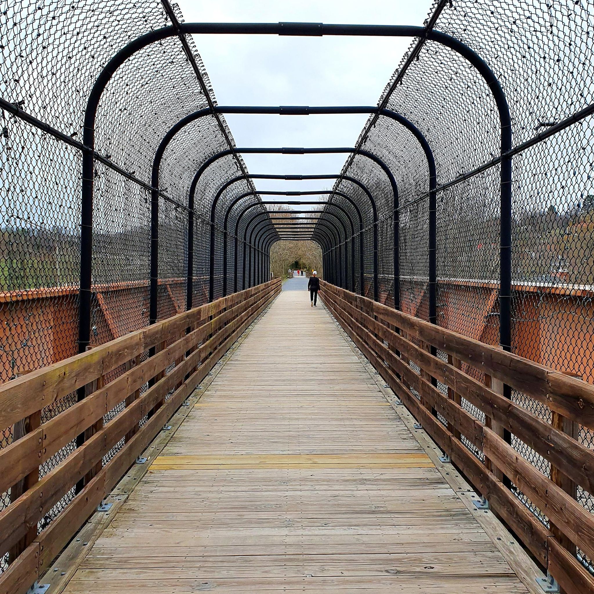
The Tweetsie Trail is an entirely crushed-gravel rail trail traveling from Johnson City through the town of Elizabethton, Tennessee. The trail is fairly new and is super popular for walking, running, and biking. There are a bunch of different trailheads along the way, and the path itself offers access to different parks and connecting trails.
0
0
The Tweetsie Trail is an entirely crushed-gravel rail trail traveling from Johnson City through the town of Elizabethton, Tennessee. The trail is fairly new and is super popular for walking, running, and biking. There are a bunch of different trailheads along the way, and the path itself offers access to different parks and connecting trails.
0
0
Buffalo Mountain Park is home to a variety of different trails and visitors. It can be agreed, though, that the highlight of the park is the highpoint of Buffalo Mountain. Regardless of what trail you take, follow signs towards "Tip Top" to find your way to the top of this spectacular mountain top with views of Johnson City in one direction and the mountains of Cherokee National Forest in the other.
1
0
Frequently Asked Questions
How many hiking trails are available around Elizabethton?
Elizabethton offers a diverse network of over 20 hiking routes. These range from easy riverside strolls to more challenging backcountry excursions within the Appalachian Mountains and Cherokee National Forest.
Are there any easy, family-friendly hikes in Elizabethton?
Yes, Elizabethton has several easy trails suitable for families. The Elizabethton Linear Trail is a paved path following the Doe and Watauga Rivers, perfect for a gentle walk. Another great option is the Founders Park loop, which is short and very accessible. For a slightly longer but still easy option, consider the Overmountain Victory National Historic Trail.
Can I find hikes with waterfalls near Elizabethton?
Absolutely! The region is known for its beautiful waterfalls. Blue Hole Falls, located in the Cherokee National Forest, offers a captivating series of cascades and clear pools via a relatively short and accessible trail. For a more challenging adventure, Laurel Fork Falls is accessible via the Hampton Blueline/Laurel Falls Trail or a segment of the Appalachian Trail. Twisting Falls on the Elk River also features powerful cascades.
What are some scenic viewpoints or natural landmarks to explore on hikes?
Elizabethton's trails offer numerous scenic spots. The Buffalo Mountain Tip Top Trail provides excellent views of the surrounding mountains and valleys, leading to the Tip Top (Buffalo Mountain Highpoint). The legendary Appalachian Trail near Elizabethton offers access to the stunning Roan Mountain balds, especially beautiful when the rhododendron gardens bloom in June. You can also find scenic views of Watauga Lake from various points, such as the View of Watauga Lake from Big Laurel Branch Wilderness.
Are there any circular or loop trails in the area?
Yes, there are several loop options. The Buffalo Mountain Tip Top Trail via White Rock Loop and Fork Knob is an easy loop that explores the forested terrain of Buffalo Mountain Park. The Founders Park loop is another short, easy circular route within Elizabethton.
What is the best time of year to go hiking in Elizabethton?
Elizabethton offers great hiking year-round, but spring and fall are particularly popular. Spring brings vibrant wildflower displays, while mid-to-late June is spectacular for the blooming rhododendron gardens on Roan Mountain. Fall showcases intense foliage colors. Even winter offers opportunities for serene hikes, though higher elevations may require more preparation.
What do other hikers say about the trails in Elizabethton?
The hiking routes in Elizabethton are highly rated by the komoot community, with an average score of 4.6 stars from over 15 reviews. Hikers often praise the diverse terrain, from peaceful river paths to challenging mountain trails, and the natural beauty of the Appalachian landscape.
Are there any historical trails or sites accessible by hiking?
Yes, Elizabethton is rich in history. The Overmountain Victory National Historic Trail runs through Sycamore Shoals and intersects with the Appalachian Trail, allowing you to walk in the footsteps of the Overmountain Men. Sycamore Shoals State Historic Park itself offers natural scenery and trails alongside its historical significance, including the Fort Watauga.
What kind of terrain can I expect on Elizabethton's hiking trails?
The terrain around Elizabethton is characteristic of the Southern Appalachian Mountains. You'll find a mix of high peaks, river valleys, and forested areas, with elevations ranging from approximately 1,500 to 6,000 feet. This includes gentle, paved paths along rivers, crushed gravel rail-trails, and steeper, more rugged trails within areas like Buffalo Mountain Park and the Cherokee National Forest.
Are there any long-distance trails or multi-day hiking opportunities?
Yes, the legendary Appalachian Trail (AT) traverses through Carter County near Elizabethton, offering sections for longer hikes, including access to the Roan Mountain balds. For a significant day hike or potential multi-day trip, the Tweetsie Trail is a 19.6-mile (31.6 km) crushed gravel rail-trail connecting Elizabethton to Johnson City, suitable for walking, running, and cycling.
Where can I find parking for hiking trails in Elizabethton?
Parking availability varies by trail. For urban trails like the Elizabethton Linear Trail and Founders Park loop, parking is typically available at nearby public parks or designated trailheads within the city. For trails within Buffalo Mountain Park or the Cherokee National Forest, specific parking areas are usually marked at trail entrances. It's always advisable to check specific trail information for detailed parking instructions.
Most popular routes around Elizabethton
Most popular attractions around Elizabethton

Get inspired with the komoot mobile app


Explore more
Browse the best Hikes in other regions.
