The best running trails around Pringle
9
runners
Jogging routes around Pringle offer a variety of terrain, from gentle paths to more challenging ascents. The region features natural landscapes, including trails that lead to lookout points and through areas like Wind Cave National Park. Runners can expect routes with varied elevation gains, providing options for different fitness levels.
Best jogging routes around Pringle
- The most popular jogging route is Lookout Point and Centennial Trail Loop, a 4.8 miles (7.7 km) trail that takes 59 minutes to complete,…
Last updated: August 15, 2026
4
runners
7.68km
00:59
150m
150m
Embark on the Lookout Point and Centennial Trail Loop, a moderate jogging route that spans 4.8 miles (7.7 km) and involves a climb of 505 feet (154 metres). You can…
1
runners
19.0km
02:16
190m
190m
Embark on the George S. Mickelson Trail, a difficult 11.8-mile (19.0 km) jogging route that takes you through the diverse landscapes of the Black Hills. You will gain 618 feet…

Sign up for free
2.75km
00:19
80m
80m
The Rankin Ridge Trail offers an easy 1.7 miles (2.8 km) jogging experience through the diverse Black Hills ecosystem. You will move through fragrant Ponderosa Pine woodlands and open mixed-grass…
25.0km
03:09
460m
460m
This difficult 15.5-mile jogging loop in Wind Cave National Park offers diverse terrain, significant elevation, and abundant wildlife spotti
4
runners
7.69km
00:59
140m
140m
Moderate run. Good fitness required. Mostly paved surfaces. Suitable for all skill levels.
Our route recommendations are based on thousands of hikes, rides, and runs completed by other people on komoot.
Start today with a free account
Your next adventure awaits.
Login or Signup
Other adventures around Pringle

Tips from the Community

A big trail, but a very beautiful trail.
1
0

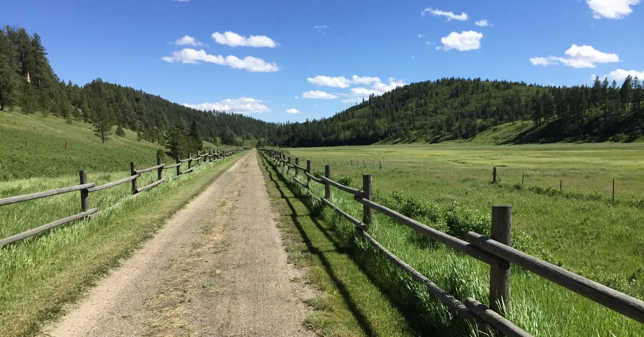
This is a long-distance multi-use trail running for 113 miles all the way from Deadwood to Edgemont. This section between Argyle and Minnekahta has gentle rolling hills and beautiful scenery of meadows, forest, and ponds along the way.
0
0

The Highland Creek Trail is the longest trail in Wind Cave National Park, at 8.6 miles long. This knoll is one of the highest points along the trail, affords sweeping views across the prairie, and provides ample opportunities for wildlife encounters. You might see herds of the iconic bison or of pronghorns, which are the fastest land mammals native to North America. This spot is a great place to take in the views and look for animals.
0
0
This is the southernmost part of the 111-mile-long Centennial Trail that stretches across the state through the Black Hills and ends at Bear Butte State Park. This short section of trail traverses next to Beaver Creek and crosses the open prairie and stands of ponderosa pines. This is a great place to look for animals like prairie dogs, bison, pronghorns, mule deer, and coyotes. You can also frequently see raptors, grouse, and songbirds in this area.
0
0
The Highland Creek Trail is the longest trail in Wind Cave National Park, at 8.6 miles long. This knoll is one of the highest points along the trail, affords sweeping views across the prairie, and provides ample opportunities for wildlife encounters. You might see herds of the iconic bison or of pronghorns, which are the fastest land mammals native to North America. This spot is a great place to take in the views and look for animals.
1
0
This is the southernmost part of the 111-mile-long Centennial Trail that stretches across the state through the Black Hills and ends at Bear Butte State Park. This short section of trail traverses next to Beaver Creek and crosses the open prairie and stands of ponderosa pines. This is a great place to look for animals like prairie dogs, bison, pronghorns, mule deer, and coyotes. You can also frequently see raptors, grouse, and songbirds in this area.
1
0
This historic fire tower sits at the highest point in the park. Although you cannot climb the structure, you can still appreciate the panoramic views across the prairie from this spot. On clear days you can see all the way to Badlands National Park and Buffalo Gap. Be on the lookout for wildlife such as bison, pronghorns, and prairie dogs.
0
0
Frequently Asked Questions
How many running routes are available around Pringle?
There are 5 dedicated running routes around Pringle listed on komoot, offering a variety of experiences for different fitness levels.
What is the typical length of jogging trails in Pringle?
Running routes in Pringle vary significantly in length. You can find shorter trails like the Rankin Ridge Trail at 1.7 miles (2.8 km), up to longer, more challenging runs such as the Centennial, Lookout Point, and Highline Creek Trails loop run which is about 15.5 miles (25 km).
Are there easy jogging routes suitable for beginners in Pringle?
Yes, Pringle offers routes suitable for beginners. The Rankin Ridge Trail is an easy 1.7-mile (2.8 km) path, perfect for those new to running or looking for a gentle jog.
Are there any circular running routes in Pringle?
Several routes around Pringle are circular, allowing you to start and end in the same location. Examples include the Lookout Point and Centennial Trail Loop and the Centennial, Lookout Point, and Highline Creek Trails loop run.
What kind of terrain can I expect on Pringle's running trails?
Pringle's running trails feature varied terrain, from gentle paths to more challenging ascents. You'll encounter natural landscapes, including rolling hills, ridge trails, and sections through areas like Wind Cave National Park.
Are there running routes with good viewpoints in Pringle?
Yes, Pringle is known for its scenic lookout points. Routes like the Lookout Point and Centennial Trail Loop are designed to offer scenic views during your run.
What can I see along the jogging routes in Pringle?
Along Pringle's jogging routes, you can explore natural and historical landmarks. Notable attractions include sections of the George S. Mickelson Trail, the Southernmost section of the Centennial Trail, and the Rankin Ridge Fire Tower. You might also spot Fossil Ridge.
Are there any running routes that pass through Wind Cave National Park?
Yes, you can find running opportunities that take you through or near Wind Cave National Park. The Running loop from Wind Cave National Park is a moderate 4.8-mile (7.7 km) route that explores this area.
What is the George S. Mickelson Trail like for running?
The George S. Mickelson Trail offers a more challenging running experience. This difficult 11.8-mile (19.0 km) path winds through diverse landscapes, making it a favorite among local runners looking for a longer, more demanding run.
What do other runners enjoy the most about jogging in Pringle?
Runners using komoot often praise the varied terrain and scenic views found on Pringle's trails. The region's network offers options for different ability levels, from easy paths to challenging ascents, ensuring there's something for everyone.
Are there any long-distance running options in Pringle?
For those seeking longer runs, the Centennial, Lookout Point, and Highline Creek Trails loop run is a substantial 15.5-mile (25 km) route, offering a significant challenge with considerable elevation changes.
Most popular routes around Pringle
Most popular attractions around Pringle

Get inspired with the komoot mobile app


Explore more
Browse the best Running Trails & Routes in other regions.
