The best road cycling routes around Sullivan'S Island
4.8
(8)
650
riders
18
rides
Road cycling routes around Sullivan'S Island primarily feature flat coastal terrain with minimal elevation gain, characteristic of barrier islands. The landscape is dominated by sandy shores, maritime forests, and views of the Atlantic Ocean and surrounding waterways. The region offers a network of paved paths and quiet roads suitable for road cycling.
Best road cycling routes around Sullivan'S Island
- The most popular road cycling route is East Coast Greenway (SC), a 31.5 miles (50.7 km) trail that takes 2…
Last updated: November 2, 2026
4.5
(2)
67
riders
50.7km
02:07
50m
50m
The East Coast Greenway (SC) offers a unique road cycling adventure through the state's picturesque Lowcountry, blending coastal charm with rural landscapes. You'll pedal past historic sites like Charleston's iconic…
5.0
(1)
128
riders
Moderate road ride. Good fitness required. Mostly well-paved surfaces and easy to ride.

48
riders
Moderate road ride. Good fitness required. Mostly well-paved surfaces and easy to ride.
21
riders
96.9km
03:45
90m
90m
Moderate road ride. Good fitness required. Some segments of this route may be unpaved and difficult to ride.
11
riders
86.4km
03:32
100m
100m
Moderate road ride. Good fitness required. Mostly well-paved surfaces and easy to ride.
Get access to more routes and recommendations from other explorers.
Already have an account?
Our route recommendations are based on thousands of hikes, rides, and runs completed by other people on komoot.
Start today with a free account
Your next adventure awaits.
Popular around Sullivan'S Island

Tips from the Community

Anyone cycling in Charleston shouldn't miss this fun experience. It's a great feeling to cross the bridge on your bike, enjoy the view, and feel the wind on the exhilarating descent. No tolls.
0
0

Wonder's Way in Charleston is a scenic pedestrian and bike path along the Arthur Ravenel Jr. Bridge. Offering stunning views of the Cooper River and the city skyline, it's a popular sightseeing spot for locals and tourists.
1
0
Hampton Park in Charleston is a sprawling green space with picturesque gardens, serene ponds, and a vibrant array of flora.
0
0

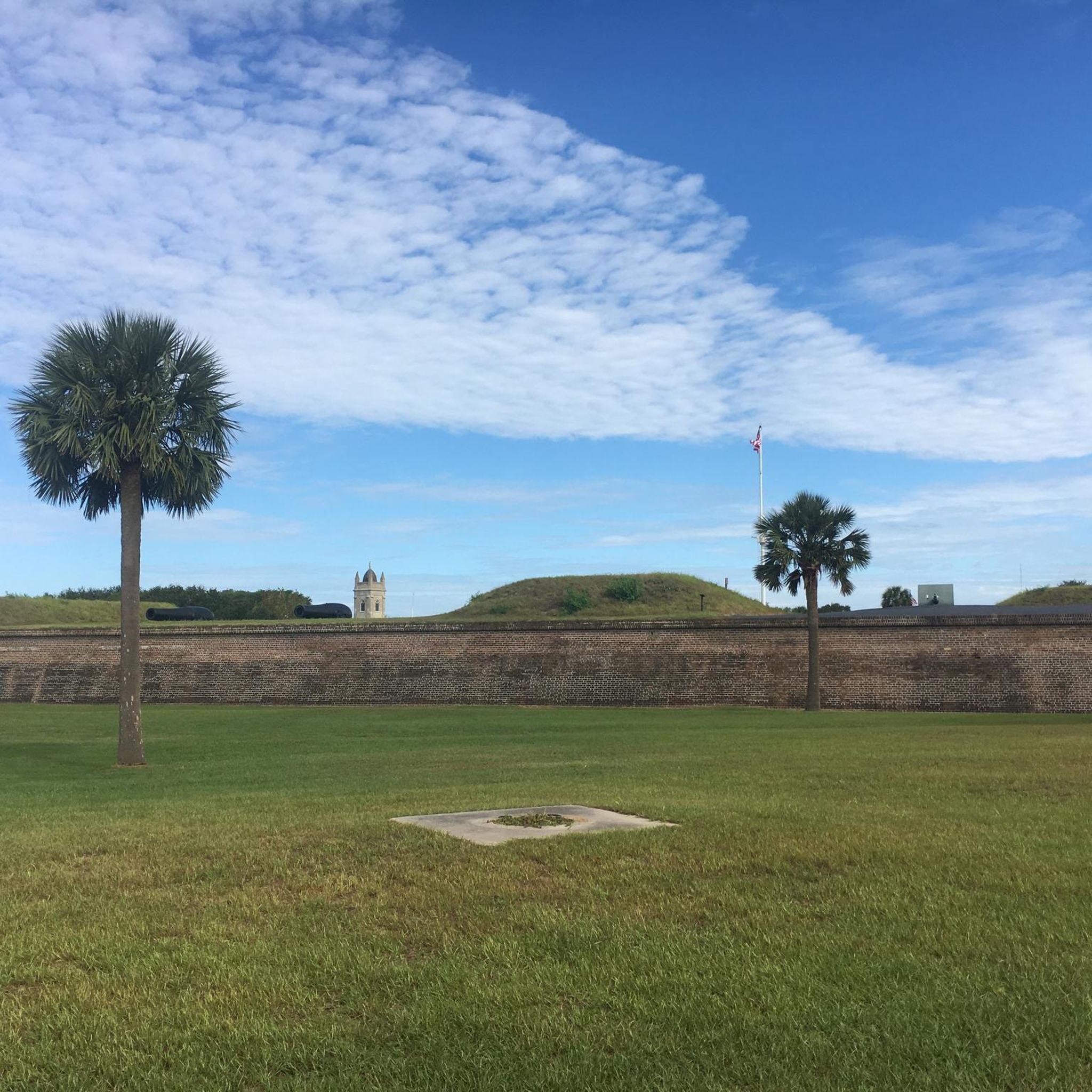
A truly historic place worth visiting. This is where the Civil War began
0
0

Rainbow Row is an iconic street that features thirteen historic Georgian-style row houses along East Bay Street on the waterfront. Named for their vibrant pastel colors, these houses date back to the 18th century when they were originally used as merchant's offices and warehouses. Neglected in the mid-20th century, they were lovingly restored in the 1930s and 1940s by Dorothy Haskell Porcher Legge, inspired by colonial Caribbean architecture. Today, Rainbow Row is a beloved landmark and one of Charleston's most photographed sites, attracting visitors worldwide.
0
0

This area once belonged to Charles Pinckney, a signer of the United States Constitution, and was used as one of his plantations. It provides a historical glimpse into life in the early 1800s, featuring the well-preserved Snee Farm House on the property.
0
0
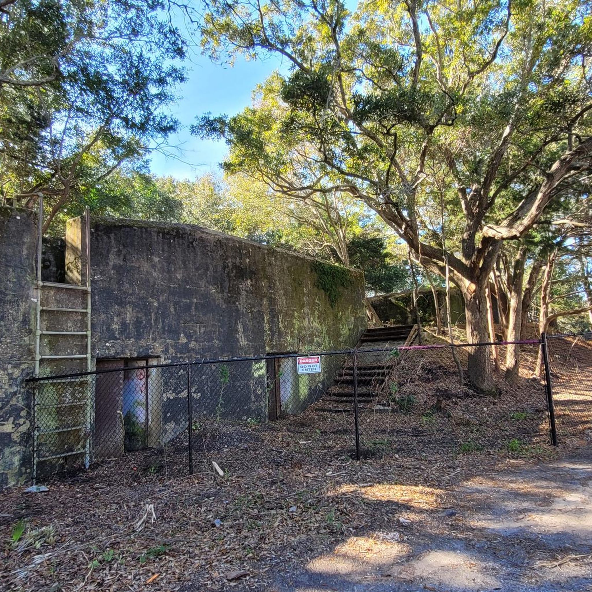
Sullivan's Island, located off the South Carolina coast, is a barrier island with a layered history that extends beyond military events. Not only has it played a pivotal role in conflicts like the American Revolution and Civil War - Fort Sumter on the western tip of the island is where the first shots of the Civil War were fired - but it also holds profound significance in Black history. Serving as a major entry point during the transatlantic slave trade, the island witnessed the arrival of thousands of enslaved Africans throughout the 18th century. Amidst its scenic beauty, Sullivan's Island has a complex history, that visitors can learn more about when they visit.
0
0
Charleston Light, also known as Sullivan's Island Lighthouse, is on Sullivan's Island, South Carolina, and marks the northern gateway to Charleston Harbor. Constructed in 1960, this 140-foot tall structure replaced the eroding Morris Island Light. Its triangular, steel frame can withstand winds of 125 mph. The unique lighthouse has been in operation since1962 and boasts an elevator and air conditioning. It is also the last federally-built onshore manned beacon. Despite its current role in the Coast Guard Historic District, structural issues prevent public access. Visitors can, however, explore the scenic surroundings and nearby public beach.
1
0
Frequently Asked Questions
What is the general terrain like for road cycling around Sullivan's Island?
Road cycling routes around Sullivan's Island are characterized by flat coastal terrain with minimal elevation gain, typical of barrier islands. You'll find sandy shores, maritime forests, and expansive views of the Atlantic Ocean and surrounding waterways. The area offers a network of paved paths and quiet roads suitable for road cycling.
How many road cycling routes are available in the Sullivan's Island area?
There are over 20 road cycling routes available around Sullivan's Island, catering to various preferences and skill levels. The komoot community has explored these routes over 600 times.
Are there easy or beginner-friendly road cycling routes on Sullivan's Island?
Yes, the majority of road cycling routes around Sullivan's Island are considered easy, with 18 out of 24 routes falling into this category. An excellent option for beginners is the Battery Thomson – Fort Moultrie Cannons loop from USS Yorktown, which is 23.5 miles long and features coastal areas and historical landmarks.
What are some scenic viewpoints or landmarks I can see along the road cycling routes?
Many routes offer views of significant landmarks and natural beauty. You can pass by historical sites such as Fort Moultrie Cannons and Battery Thomson. The Charleston Light (Sullivan's Island Lighthouse) is another prominent feature you might encounter.
Are there any circular road cycling routes around Sullivan's Island?
Yes, several routes are designed as loops, allowing you to start and end in the same location. Examples include the Battery Thomson – Fort Moultrie Cannons loop from Mount Pleasant and the Sullivan's Island loop from Total Wine.
What is the best time of year to go road cycling on Sullivan's Island?
The best seasons for road cycling on Sullivan's Island are typically spring and fall. During these times, the weather is mild, with comfortable temperatures and less humidity than the summer months. Winter can also be pleasant, though cooler, while summer can be very hot and humid, with a higher chance of afternoon thunderstorms.
What kind of wildlife might I spot while road cycling around Sullivan's Island?
Given its coastal and maritime forest environment, you might spot various bird species, including pelicans, herons, and egrets. Keep an eye out for dolphins in the waterways and other coastal wildlife. Always maintain a respectful distance from any animals you encounter.
Where can I find parking and access points for the road cycling trails?
Parking is generally available at public beach access points and designated parking areas on Sullivan's Island and nearby Mount Pleasant. For routes starting from specific locations, such as the Battery Thomson – Fort Moultrie Cannons loop from Mount Pleasant, you can often find parking in the vicinity of the starting point.
What do other road cyclists enjoy most about road cycling in Sullivan's Island?
The area is highly rated by the komoot community, with an average score of 3.9 stars. Reviewers often praise the flat, scenic coastal paths, the historical points of interest, and the overall pleasant riding experience on this barrier island.
Are there any longer road cycling routes for more experienced riders?
While most routes are easy to moderate, there are longer options for those seeking a more extensive ride. The East Coast Greenway (SC) offers a substantial 31.5-mile (50.7 km) experience, and the Edmondston-Alston House – Battery Thomson loop from Mount Pleasant is an even longer option at 87.8 km (54.6 miles).
Are there places to stop for refreshments or food along the routes?
Sullivan's Island and the nearby town of Mount Pleasant offer various cafes, restaurants, and local establishments where you can stop for refreshments or a meal. Many of these are conveniently located near popular cycling routes or access points.
How does road cycling on Sullivan's Island compare to Folly Beach?
Both Sullivan's Island and Folly Beach offer coastal road cycling experiences. Sullivan's Island is known for its quieter, more residential feel with historical sites and maritime forests, providing a serene ride. Folly Beach, while also coastal, tends to have a more vibrant, surf-town atmosphere. Both offer flat terrain, but the specific scenery and local vibe differ.
Most popular attractions around Sullivan'S Island

Get inspired with the komoot mobile app


Explore more
Browse the best Road cycling routes in other regions.
