The best road cycling routes around Greene
4.9
(8)
143
riders
15
rides
Road cycling around Greene County, New York, offers diverse terrain situated between the Catskill Mountains and the Hudson River Valley. The region features dramatic mountain scenery, dense forests, and significant elevation changes in the west, contrasting with flatter terrain and scenic river views to the east. The topography includes a mix of rolling hills, river valleys, and forested areas, providing varied environments for cyclists. Deeply scored "cloves" (rocky glens) also contribute to the landscape.
Best road cycling routes around Greene
…Last updated: August 17, 2026
29
riders
32.6km
01:23
180m
180m
Easy road ride. Great for any fitness level. Mostly well-paved surfaces and easy to ride.
3
riders
31.4km
01:39
350m
350m
Moderate road ride. Good fitness required. Mostly well-paved surfaces and easy to ride.

Sign up for free
2
riders
48.7km
02:31
450m
450m
Moderate road ride. Good fitness required. Mostly well-paved surfaces and easy to ride.
1
riders
53.8km
02:40
570m
570m
Moderate road ride. Good fitness required. Mostly well-paved surfaces and easy to ride.
1
riders
41.5km
02:09
420m
420m
Moderate road ride. Good fitness required. Mostly well-paved surfaces and easy to ride.
Get access to more routes and recommendations from other explorers.
Sign up for free
Already have an account?
Our route recommendations are based on thousands of hikes, rides, and runs completed by other people on komoot.
Start today with a free account
Your next adventure awaits.
Login or Signup



Tips from the Community

Waterman Hill Conservation Area in Rhode Island offers a peaceful retreat with scenic trails and woodlands. Rich in biodiversity, it provides a serene environment for outdoor activities in the Kent County area.
0
0
The Scituate Reservoir Protection Area in Rhode Island safeguards the largest freshwater source in the state. Offering pristine landscapes, trails, and wildlife habitats, it ensures the conservation of vital water resources for the state, while providing a tranquil retreat for nature enthusiasts.
0
0

Tillinghast Pond is a small reservoir that serves as the centerpiece of the Tillinghast Pond Management Area. There are multiple trails that leave from the southern end of the pond, and one path even circles around the banks of the water.
0
0
Although small, this pond off of Sawmill Hill Road makes for a lovely scene while on a ride through western Rhode Island.
0
0
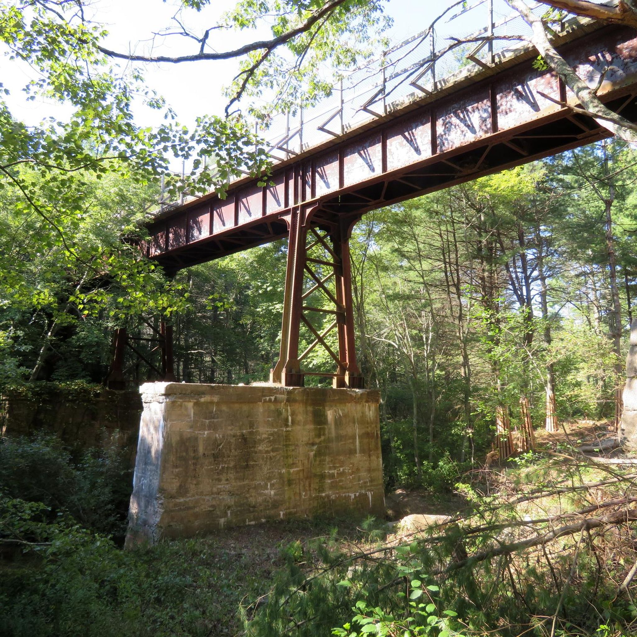
Originally built to also accommodate horses, the western section of the Washington Secondary-Rail Trail, the Trestle Trail, is over 4.8 miles of paved trail with stunning Rhode Island scenery.
0
0
Frequently Asked Questions
How many road cycling routes are available in Greene?
Greene County offers a selection of 11 road cycling routes, catering to various skill levels. These routes traverse diverse landscapes, from the challenging Catskill Mountains to the serene Hudson River Valley.
What kind of terrain can I expect when road cycling in Greene?
Road cycling in Greene County provides a rich variety of terrain. You'll encounter dramatic mountain scenery and significant elevation changes in the western Catskills, contrasting with flatter sections and scenic river views along the Hudson River Valley to the east. The region features a mix of rolling hills, river valleys, and forested areas, often including deeply scored 'cloves' (rocky glens) for spectacular views.
Are there options for beginner or family-friendly road cycling in Greene?
Yes, Greene County has routes suitable for beginners and families looking for an easier ride. For instance, the Washington Secondary Rail Trail is an easy 20.3-mile (32.6 km) route that offers a gentle ride through the local countryside, taking approximately 1 hour 23 minutes to complete.
Are there any circular road cycling routes in Greene?
Many of the road cycling routes in Greene are designed as loops, allowing you to start and end at the same point. Examples include the moderate Beaudoin Conservation Area Ledge Road to Sawmill Hill Road Pond No 2 loop, which is 30.3 miles (48.7 km), and the Gortons Corner to Tillinghast Pond loop, a 19.5-mile (31.4 km) route.
What can I see along the road cycling routes in Greene?
Greene County's routes offer scenic views and access to natural attractions. You might pass by beautiful bodies of water like Breakheart Pond or Tillinghast Pond. Some routes also lead near waterfalls such as Stepstone Falls or Ponaganset Falls, providing opportunities for picturesque stops.
What do other road cyclists enjoy most about road cycling in Greene?
The road cycling routes in Greene are highly rated by the komoot community, with an average score of 4.9 stars from over 8 reviews. Cyclists often praise the diverse terrain, from challenging mountain ascents to scenic river views, and the variety of routes that cater to different skill levels.
Are there any advanced or challenging road cycling routes in Greene?
While there are no routes explicitly graded as 'difficult' in our current selection, many of the moderate routes offer significant elevation gain and longer distances, providing a good challenge for experienced riders. For example, the Sterling to Tillinghast Pond loop via Waterman Hill Conservation Area is a moderate 33.4-mile (53.8 km) route with over 570 meters of elevation gain, taking approximately 2 hours 40 minutes.
What is the best time of year for road cycling in Greene?
The best time for road cycling in Greene County is typically from spring through fall. During these seasons, the weather is generally pleasant, and the natural beauty of the Catskill Mountains and Hudson River Valley is at its peak, with lush greenery in spring/summer and vibrant foliage in autumn. Winter cycling can be challenging due to snow and ice, especially in higher elevations.
Are there any specific areas for parking near the road cycling trailheads?
While specific parking details for each trailhead are best checked on individual route pages, many routes in Greene County start near towns or conservation areas that typically offer designated parking. It's advisable to review the route details on komoot for the most accurate parking information before your ride.
Can I find routes that pass through forested areas or offer views of nature?
Absolutely. Greene County is known for its dense forests and natural landscapes. Routes like the Beaudoin Conservation Area Ledge Road to Sawmill Hill Road Pond No 2 loop navigate through varied landscapes, including extensive forested areas and open spaces, providing a truly immersive natural experience.
Are there any longer road cycling routes for endurance training?
For those seeking longer rides, Greene County offers several routes over 30 miles. The Sterling to Tillinghast Pond loop via Waterman Hill Conservation Area, at 33.4 miles (53.8 km), and the George B Parker Woodland to Scituate Reservoir Protection Area loop, at 25.8 miles (41.5 km), are excellent options for endurance training, offering significant distances and elevation changes.
Most popular attractions around Greene

Get inspired with the komoot mobile app


Explore more
Browse the best Road cycling routes in other regions.
