The best road cycling routes around Oatfield
4.7
(192)
3,395
riders
148
rides
Road cycling routes around Oatfield feature a diverse landscape, primarily characterized by riverside paths along the Willamette River and converted rail trails. The terrain includes sections with gentle gradients suitable for leisure rides, alongside routes offering moderate elevation gains. This mix provides varied cycling experiences, from urban and suburban pathways to more natural settings. The region also benefits from infrastructure improvements like buffered bike lanes and access to car-free bridges such as Tilikum Crossing.
Best road cycling routes around Oatfield
…Last updated: July 2, 2026
8
riders
76.7km
03:33
610m
610m
Moderate road ride. Good fitness required. Some segments of this route may be unpaved and difficult to ride.
5.0
(3)
154
riders
51.4km
02:28
480m
480m
Moderate road ride. Good fitness required. Mostly well-paved surfaces and easy to ride.

Sign up for free
5.0
(4)
122
riders
49.0km
02:24
220m
220m
Moderate road ride. Good fitness required. Some segments of this route may be unpaved and difficult to ride.
5.0
(3)
133
riders
32.0km
01:31
190m
190m
Easy road ride. Great for any fitness level. Mostly well-paved surfaces and easy to ride.
5.0
(3)
60
riders
55.3km
02:27
300m
300m
Moderate road ride. Good fitness required. Some segments of this route may be unpaved and difficult to ride.
Get access to more routes and recommendations from other explorers.
Sign up for free
Already have an account?
Our route recommendations are based on thousands of hikes, rides, and runs completed by other people on komoot.
Start today with a free account
Your next adventure awaits.
Login or Signup
Tips from the Community

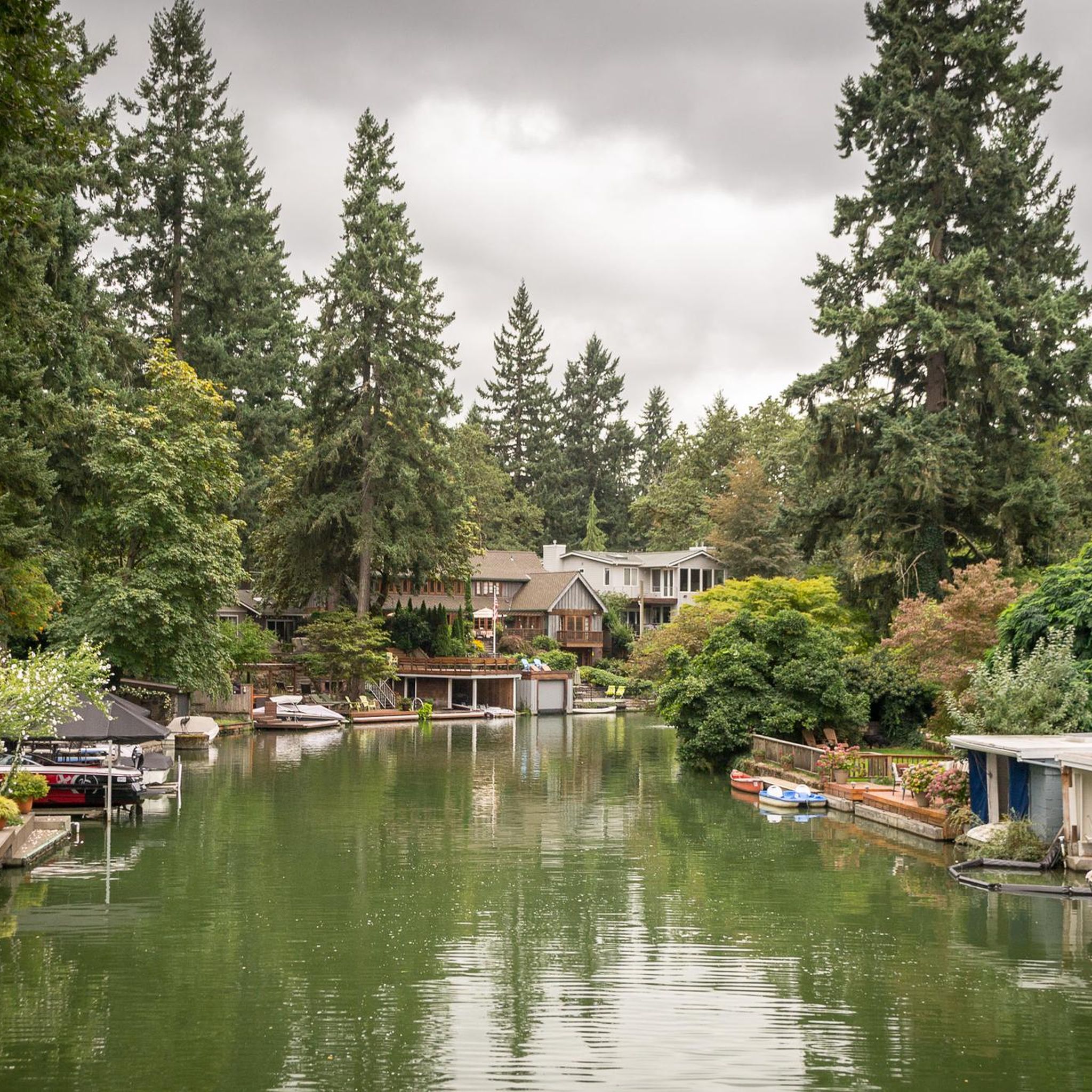
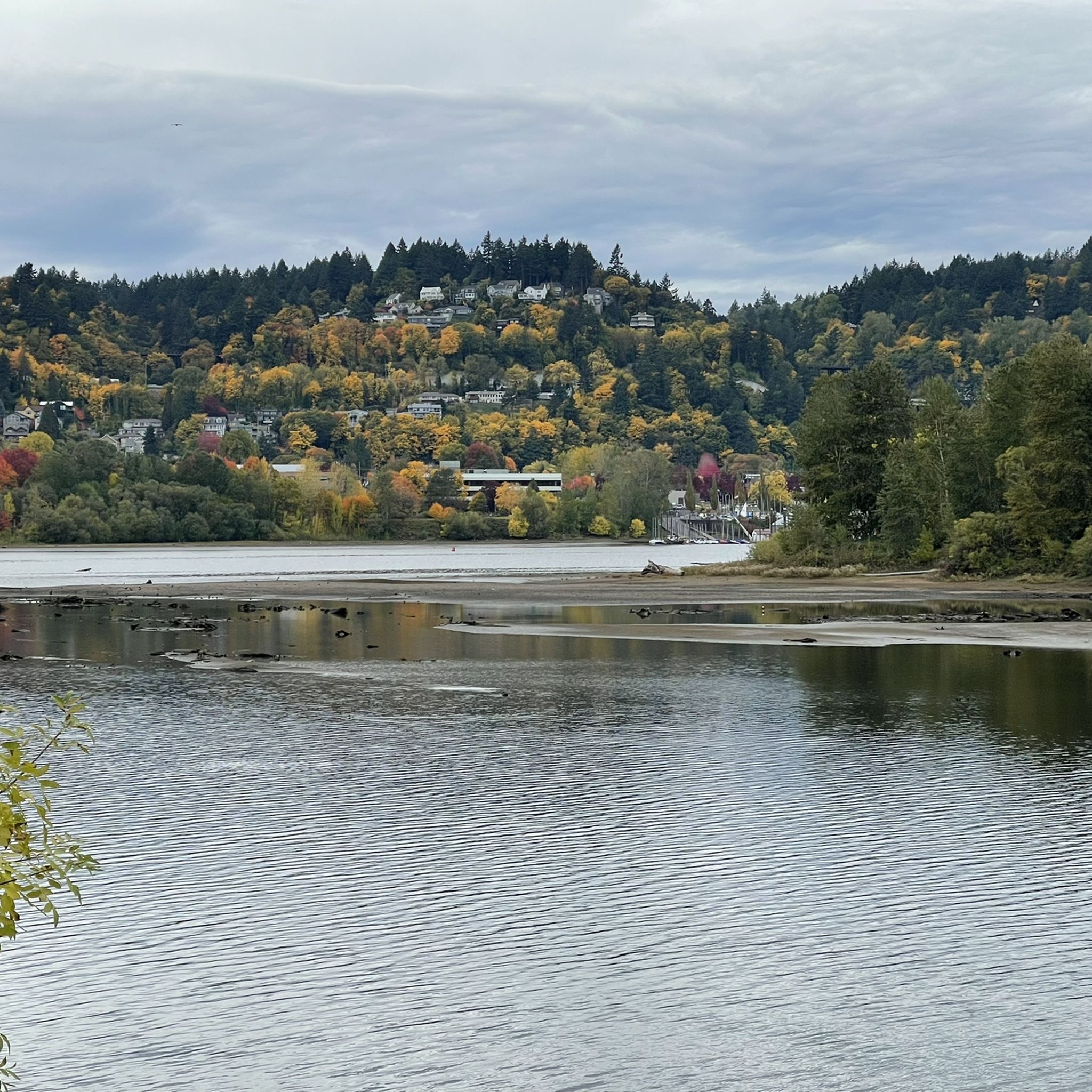
Great views of the Wilamette river and nice shade on a hot day.
0
0

Willamette Park is a 26-acre green space along the river in south Portland, just off Southwest Macadam Avenue. It offers a mix of recreation and river access, with a boat dock and ramp, paved and unpaved paths, picnic areas, and sports facilities including a soccer field and tennis courts. Families and dog owners frequent the playground and off-leash area, while cyclists often pass through on the nearby Willamette Greenway Trail.
0
0


One hell of a climb up here from US 30 on the South end - but worth it! Great views and a decent crossing (once you climb to the bridge itself).
0
0

Built in 1910, the Hawthorne Bridge spans 3,552 feet across the Willamette River with four lanes and is a key part of the city's bike culture. The bridge gives passage to over 30,000 vehicles daily, including 800 TriMet buses, along with more than 8,000 cyclists. During rush hour, bikes can outnumber cars. The wide sidewalks offer great views of the river and skyline. As the oldest vertical-lift bridge in the U.S. and Portland's oldest highway bridge, it was added to the National Register of Historic Places in 2012.
0
0
Tilikum Crossing, Bridge of the People, is a cable-stayed bridge designed by TriMet for MAX Orange Line trains, buses, streetcars, cyclists, pedestrians, and emergency vehicles. Opened on September 12, 2015, it prohibits private cars and trucks, making it the first major U.S. bridge built for transit and non-motorized traffic only. Named after the Chinook word for "people," it was the first new bridge over the Willamette River in Portland since the Fremont Bridge in 1973. Construction began in 2011.
0
0
The Willamette River Greenway is a 5.3-mile out-and-back trail perfect for birding, running, biking, and walking. The Willamette River stretches over 255 miles from Cottage Grove to Portland, where it meets the Columbia River. Along its banks, the Willamette River Greenway provides open spaces, some with boat launches and camping, while others preserve native plants and scenic river views.
0
0

You can follow the Greenway for about two miles along the bank of the Willamette through downtown Portland. The trail takes you right along the water and is shared with hikers and dog walkers. The trail passes through a couple nice riverside parks and connects to plenty of other great cycling paths and roads.
0
0
Frequently Asked Questions
How many road cycling routes are available around Oatfield?
Oatfield offers a wide selection of road cycling routes, with over 150 options to explore. These routes cater to various skill levels, from easy leisure rides to more challenging ascents.
What makes road cycling in Oatfield unique?
Road cycling around Oatfield is characterized by its diverse landscape, featuring riverside paths along the Willamette River and converted rail trails like the Fanno Creek and Trolley Trail. You'll find a mix of gentle gradients and sections with moderate elevation gains, providing varied experiences from urban pathways to natural settings.
What do other road cyclists enjoy most about the routes in Oatfield?
The road cycling routes in Oatfield are highly rated by the komoot community, with an average score of 4.7 stars. Cyclists frequently praise the varied terrain, which includes scenic riverside sections and well-maintained paved paths, offering something for every ability level.
Are there easy road cycling routes suitable for beginners in Oatfield?
Yes, Oatfield has numerous easy road cycling routes perfect for beginners. There are 46 easy routes available, many of which follow flat, paved paths, such as sections of the converted rail trails. A good option to consider is the Willamette River view – Sellwood Bridge loop from T-Mobile, which is 14.5 miles (23.3 km) long and features minimal elevation gain.
Can I find challenging road cycling routes with significant climbs around Oatfield?
For experienced cyclists seeking a challenge, Oatfield offers 15 difficult road cycling routes. These routes often include more substantial elevation gains, providing a good workout. The region's varied topography ensures that even moderate routes can present notable climbs, such as the Sellwood Bridge – Willamette River view loop from Willamette Shore Trolley Lake Oswego Station, which includes over 1,800 feet (550 meters) of ascent.
Are there family-friendly road cycling options in Oatfield?
Many of the easy and moderate routes in Oatfield are suitable for families, especially those that utilize the converted rail trails. These paths are generally well-maintained and offer a safe environment away from heavy traffic. Look for routes with lower elevation gains and shorter distances for a comfortable family outing.
Are there circular road cycling routes available in Oatfield?
Yes, many road cycling routes in Oatfield are designed as loops, allowing you to start and end at the same point. Examples include the popular West Lents Floodplain – Sellwood Bridge loop from Willamette Shore Trolley Lake Oswego Station, which offers a scenic 24.5-mile (39.5 km) ride.
What kind of terrain can I expect on road cycling routes around Oatfield?
The terrain around Oatfield is quite varied. You'll encounter smooth, paved riverside paths along the Willamette River, as well as sections of converted rail trails like the Fanno Creek and Trolley Trail. Some routes also venture into areas with moderate elevation changes, offering a mix of flat stretches and rolling hills.
Are there scenic viewpoints or natural attractions along the road cycling routes in Oatfield?
Absolutely. Many routes offer scenic views, particularly along the Willamette River. You can also find natural attractions nearby. For instance, the Oswego Iron Furnace – George Rogers Park loop from Marylhurst passes by George Rogers Park. Other highlights in the broader region include the Clackamas River and Willamette River waterfront.
When is the best time of year to go road cycling in Oatfield?
The best time for road cycling in Oatfield is generally from spring through early autumn (April to October). During these months, the weather is typically milder and drier, making for more comfortable riding conditions. Summer offers long daylight hours, while spring and autumn provide pleasant temperatures and often vibrant foliage.
What are the typical summer conditions for road cycling in Oatfield?
Summers in Oatfield are generally warm and dry, with average temperatures ranging from the mid-60s to high 70s Fahrenheit (18-26°C). This makes for excellent cycling weather, though it's always advisable to carry plenty of water, especially on longer rides, and to be mindful of sun exposure.
Are there any routes that pass by cafes or places to refuel?
Given Oatfield's proximity to urban and suburban areas, many routes, especially those along the Fanno Creek and Trolley Trail or near the Willamette River, will pass through or near towns and commercial districts where you can find cafes, restaurants, and convenience stores to refuel and take a break.
Most popular routes around Oatfield
Most popular attractions around Oatfield

Get inspired with the komoot mobile app


Explore more
Browse the best Road cycling routes in other regions.
