The best road cycling routes around Hayesville
4.1
(12)
481
riders
44
rides
Road cycling routes around Hayesville traverse a diverse landscape characterized by forests, rolling hills, and mountains. The region offers varied terrain suitable for different cycling preferences, from challenging climbs to more leisurely rides. Nestled within the Appalachian Mountains, the area provides winding roads and natural scenery. This environment contributes to a network of routes that appeal to road cyclists seeking varied experiences.
Best road cycling routes around Hayesville
- The most popular road cycling route is Willamette Valley Scenic Bikeway: Willamette…
Last updated: June 29, 2026
4.0
(2)
16
riders
46.4km
02:32
130m
130m
Moderate road ride. Good fitness required. Mostly well-paved surfaces and easy to ride.
1
riders
141km
05:40
430m
430m
Hard road ride. Very good fitness required. Mostly well-paved surfaces and easy to ride.

Sign up for free
221
riders
70.8km
03:11
370m
370m
Moderate road ride. Good fitness required. Mostly well-paved surfaces and easy to ride.
5.0
(1)
8
riders
43.8km
02:13
330m
330m
Moderate road ride. Good fitness required. Mostly well-paved surfaces and easy to ride.
14
riders
Easy road ride. Great for any fitness level. Mostly well-paved surfaces and easy to ride.
Get access to more routes and recommendations from other explorers.
Sign up for free
Already have an account?
Our route recommendations are based on thousands of hikes, rides, and runs completed by other people on komoot.
Start today with a free account
Your next adventure awaits.
Login or Signup
Popular around Hayesville


Tips from the Community

Just west of Salem, Eola Hills Legacy Estate Vineyard is a fun detour for bikers looking to unwind with a view. Open Friday to Sunday from 12–5 pm, the tasting room offers wine flights, glasses, bottles, sparkling, and dessert wines. Enjoy sweeping vineyard views from the patio, bring your own food, or take a short “wiking” hike around the property.
0
0
This bridge leads cyclists over Highway 22, and there is a small outcrop to take a break and enjoy some views.
0
0

Riverfront Park in Salem is a scenic area with paved trails, boat docks, picnic shelters, wide open fields, and numerous sculptures. The park was once an industrial area that has since been converted. The entirety of the trails are ADA compliant, making this area accessible to wheelchairs and strollers.
0
0
Riverfront Park in Salem is a scenic area with paved trails, boat docks, picnic shelters, wide open fields, and numerous sculptures. The park was once an industrial area that has since been converted. The entirety of the trails are ADA compliant, making this area accessible to wheelchairs and strollers.
0
0

Bush's Pasture Park is known for its miles of running and walking paths. There are some wide open grassy areas within the 90-acre park that are easily accessible by making the short jog from downtown or another nearby park.
0
0
At over 100 acres, Wallace Marine Park features a number of different paths that circle around the sports complex on the property and that get right up next to the Willamette River. You can do your entire run within the park, or you can just add on a park loop to your jog.
0
0

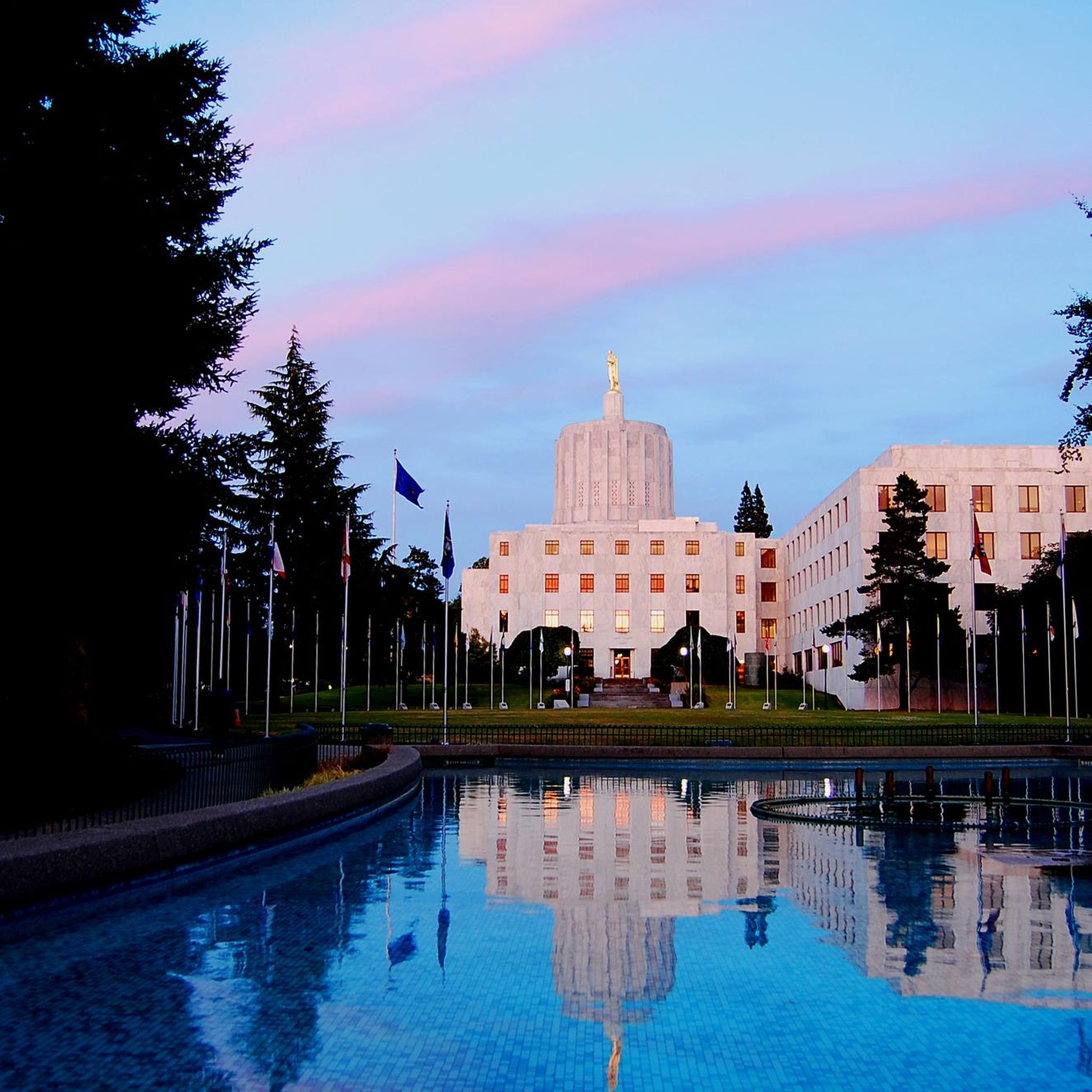
A beautiful public park surrounding the Oregon State Capitol building. It encompasses landscaped grounds, walkways, and various monuments. You will ride through the heart of it on NE Court Street.
0
0

With its extensive network of peaceful trails winding through wetlands and woodlands along the Snake River, Minto-Brown Island Park in Idaho offers runners an ideal place to enjoy nature while logging mileage. Keep your eyes peeled for birds and other wildlife as you run through serene forests and open fields in this urban oasis perfect for rejuvenating runs.
0
0
Frequently Asked Questions
How many road cycling routes are available around Hayesville?
There are over 50 road cycling routes around Hayesville, offering a diverse range of experiences. These include 14 easy routes, 36 moderate routes, and 1 challenging route, catering to various skill levels and preferences.
What kind of terrain can I expect on road cycling routes near Hayesville?
The Hayesville area, nestled within the Appalachian Mountains, features a diverse landscape for road cycling. You'll encounter winding roads through forests, rolling hills, and mountainous sections, providing varied terrain from challenging climbs to more leisurely rides. The region is known for its picturesque views and natural scenery.
Are there any easy road cycling routes suitable for beginners or families?
Yes, Hayesville offers several easier options. For instance, the Oregon State Capitol Park – Union Street Railroad Bridge loop from Salem is an easy 41.7 km route with minimal elevation gain, perfect for a relaxed ride. The region generally has 14 easy routes to choose from, providing accessible options for less experienced cyclists or those looking for a gentle ride.
What are some popular longer or more challenging road cycling routes in the area?
For those seeking a challenge, the Willamette Valley Scenic Bikeway Loop is a difficult 140.8 km path with significant elevation changes. Another popular moderate option is the Oregon State Capitol Park – Minto-Brown Island Park loop from Salem, which covers 71.3 km through varied landscapes.
What do other cyclists say about road cycling in Hayesville?
The road cycling routes around Hayesville are highly regarded by the komoot community, with an average rating of 4.39 stars from over 15 reviews. More than 500 road cyclists have explored the area using komoot, often praising the varied terrain and scenic beauty.
Are there any notable landmarks or points of interest along the road cycling routes?
Yes, several routes pass by interesting landmarks. For example, you might encounter the Peter Courtney Minto Island Bridge or the Union Street Bridge. The Oregon State Capitol Park is also a prominent feature near some routes, offering a chance to see a significant man-made monument.
Can I find routes that offer scenic views of natural features like rivers?
Absolutely. Some routes provide beautiful views of natural features, such as the Willamette River at Minto-Brown Island Park. The region's setting within the Appalachian Mountains ensures many routes offer picturesque natural scenery.
What is the typical elevation gain on road cycling routes in Hayesville?
Elevation gain varies significantly across routes. Easy routes like the Oregon State Capitol Park – Union Street Railroad Bridge loop from Salem have around 94 meters of elevation gain. Moderate routes, such as the Willamette Valley Scenic Bikeway: Willamette Mission Park Loop, can have around 126 meters, while difficult routes like the Willamette Valley Scenic Bikeway Loop feature over 427 meters of climbing.
Are there any routes that are particularly good for a moderate-level ride?
Yes, many routes are ideal for moderate-level cyclists. The Willamette Valley Scenic Bikeway: Willamette Mission Park Loop is a popular moderate 46.4 km route. Another excellent choice is the Minto-Brown Island Park – Union Street Bridge loop from Salem, a 44.0 km route also rated as moderate.
How long do the road cycling routes typically take to complete?
The duration of routes varies based on distance and difficulty. Shorter, easy routes like the Oregon State Capitol Park – Union Street Railroad Bridge loop from Salem can be completed in about 1 hour 43 minutes. Moderate routes, such as the Willamette Valley Scenic Bikeway: Willamette Mission Park Loop, typically take around 2 hours 32 minutes. Longer, difficult routes can take significantly more time, with some exceeding 5 hours.
Most popular routes around Hayesville
Most popular attractions around Hayesville

Get inspired with the komoot mobile app


Explore more
Browse the best Road cycling routes in other regions.
