The best cycling routes around Damascus
4.6
(170)
636
riders
52
rides
Touring cycling routes around Damascus offer a diverse landscape characterized by multi-use trails, regional parks, and scenic loops. The area features a mix of paved and gravel paths, often following river valleys and connecting suburban areas with natural spaces. Elevation gains are generally moderate, indicating rolling terrain suitable for various cycling abilities. This region provides accessible routes through green corridors and parklands.
Best touring cycling routes around Damascus
- The most popular touring cycling route is Barton County Park to Milo McIver State Park gravel loop, a 26.9 miles (43.2 km) trail that takes 2 hours 52 minutes to complete. This route features a gravel surface connecting two prominent regional parks.
- Another top favourite among local touring cyclists is Springwater and Gresham-Fairview Trail Loop, a moderate 31.1 miles (50.0 km) path. This trail combines two popular multi-use paths, offering varied urban and natural scenery.
- Local touring cyclists also love the Cazadero Trail, a 6.6 miles (10.6 km) trail leading through a converted railway corridor, often completed in about 57 minutes.
- Touring cycling around Damascus is defined by multi-use paved trails, gravel paths, and connections between local parks. The network offers options for different ability levels, from easy loops to more moderate distances.
- The routes in Damascus are highly rated by the komoot community with an average score of 4.6 stars from over 87 reviews. More than 500 touring cyclists have used komoot to explore Damascus's varied terrain.
Last updated: August 8, 2026
2
riders
43.2km
02:52
360m
360m
Embark on a moderate touring bicycle adventure along the Barton County Park to Milo McIver State Park gravel loop. This route spans 26.9 miles (43.2 km) and involves a total elevation gain of 1173 feet (358 metres), typically taking about 2 hours and 52 minutes to complete. You will cycle through the scenic Oregon landscape, following the Clackamas River and exploring Milo McIver State Park. Expect a mix of paved and unpaved surfaces, winding past lush green forests, open meadows, and impressive Douglas Firs. Keep an eye out for eagles and osprey, especially as you pass Bonnie Lure State Park, adding to the natural charm of your ride.
You can begin your touring bicycle journey from either Barton Park or Milo McIver State Park, both offering convenient parking options. These parks also provide useful amenities such as camping facilities, hot showers, and toilets, making them ideal starting or resting points. Be prepared for varied terrain, as the route includes significant sections of asphalt, paved, and unpaved paths. Ensure your bicycle is suitable for gravel surfaces to comfortably navigate the entire loop.
This route highlights the natural beauty of the Clackamas River corridor, offering extensive access to the river itself. The varied terrain, from paved roads to challenging gravel segments, ensures a dynamic experience for cyclists with good fitness. You will encounter towering Douglas Firs and have opportunities for scenic views, particularly from the Milo McIver State Park Viewpoint. The presence of wildlife like eagles and osprey near Bonnie Lure State Park adds to the unique appeal of this Oregon cycling loop.
50.0km
03:01
310m
310m
Embark on the Springwater and Gresham-Fairview Trail Loop for a moderate touring cycling adventure that spans 31.1 miles (50.0 km) with an elevation gain of 1008 feet (307 metres), typically completed in about 3 hours. This route offers a dynamic blend of urban pathways and serene natural areas, allowing you to cycle past wetlands and agricultural fields. You'll enjoy views of the Willamette River and cross Johnson Creek, with glimpses of Mt. Hood and Mt. St. Helens on clear days, culminating in the impressive bridge over Powell Boulevard.
When planning your ride, you'll find the trails are mostly paved and generally flat, making them accessible for many cyclists. While much of the journey is car-free, be mindful of several at-grade crossings with busy streets, especially on the Gresham-Fairview Trail; these intersections are often equipped with marked crosswalks and flashing yellow lights for your safety. Parking is conveniently available at various access points along the route, making it easy to start your touring bicycle experience.
This loop is notable for its successful integration of urban infrastructure with significant natural features, showcasing Portland's commitment to green spaces. It provides a unique opportunity to experience Johnson Creek, one of the city's last free-flowing urban streams, as you pedal through diverse environments. The combination of residential areas, agricultural landscapes, and river views makes this trail a distinctive regional highlight for touring cyclists.

Sign up for free
1
riders
10.6km
00:58
80m
80m
The Cazadero Trail offers a delightful, easy touring cycling experience, winding through peaceful wooded areas and following Deep Creek in a forested ravine. This 6.6-mile (10.6 km) route features a gentle 256 feet (78 metres) of elevation gain, making it perfect for a relaxed 57-minute ride. You'll encounter lush woodlands, moss, ferns, and cedar trees, enjoying the natural features near Cazadero bike trails without strenuous effort.
Planning your visit is straightforward, as the trail is publicly accessible with no permits or fees. Parking is available at various access points, though you should be aware that the Cazadero Trail currently has disconnected segments, requiring you to use roads to connect them. Spring and fall are ideal for cycling, offering comfortable weather and vibrant scenery, with the tree cover providing good shade in warmer months.
This trail's heritage as a former electric interurban railroad corridor ensures its gentle, almost flat grade, making it highly accessible. It also serves as a key extension of the regional Springwater Corridor, with future plans to connect it further south towards Estacada and potentially even Mount Hood, expanding the network of Cazadero Trail points of interest for cyclists.
27
riders
12.1km
00:44
50m
50m
Easy bike ride. Great for any fitness level. Mostly paved surfaces. Suitable for all skill levels.
4.6
(5)
58
riders
60.3km
03:43
440m
440m
Moderate bike ride. Good fitness required. Mostly paved surfaces. Suitable for all skill levels.
Get access to more routes and recommendations from other explorers.
Sign up for free
Already have an account?
Our route recommendations are based on thousands of hikes, rides, and runs completed by other people on komoot.
Start today with a free account
Your next adventure awaits.
Login or Signup
Popular around Damascus
Tips from the Community

A great three mile gravel ride that extends past the end of the Springwater Corridor in Boring. Dense forests and lots of shade.
0
0

Boring, Oregon has become somewhat famous, or infamous, depending on how you look at it. In recent years it has become well known due to its humorous take on its name and partnering with Dull, Scotland as "sister cities" in order to promote tourism to both locations.
0
0

Salmon Street Springs is a popular spot for cyclists to gather. Thursday Night Ride starts there every Thursday at 7:30pm.
0
0

Oaks Bottom Wildlife Refuge sits on the east bank of the Willamette River. This 163-acre refuge is home to meadows, marshes, wetlands, and forests. There are over 175 bird species, like bald eagles and peregrine falcons, as well as river otters and deer. The Springwater Corridor Trail, great for a bike ride. Established in 1988, Oaks Bottom is Portland’s first wildlife refuge and plays an important role in habitat preservation and environmental education.
1
0
The Springwater Corridor forms part of Portland's 40-mile Loop trail system, extending from downtown Portland to the town of Boring. The paved trail follows the Willamette River and Johnson Creek, passing through neighborhoods, parks, wetlands, and industrial zones. With connections to Portland's light rail and city buses, the trail offers convenient access and stops at Beggars-Tick Wildlife Refuge, Leach Botanical Garden, and Powell Butte Nature Park. The trail, built on a former railroad corridor, opened in 1996 after Portland obtained the rail line in 1990.
0
0
The 40 Mile Loop isn't a single loop trail, and isn't even limited to 40 miles. The original proposal for the trail was 40 miles but it now encompasses a planned network of over 140 miles of interconnected trails. This section along the river is particularly scenic with great views of the river.
0
0

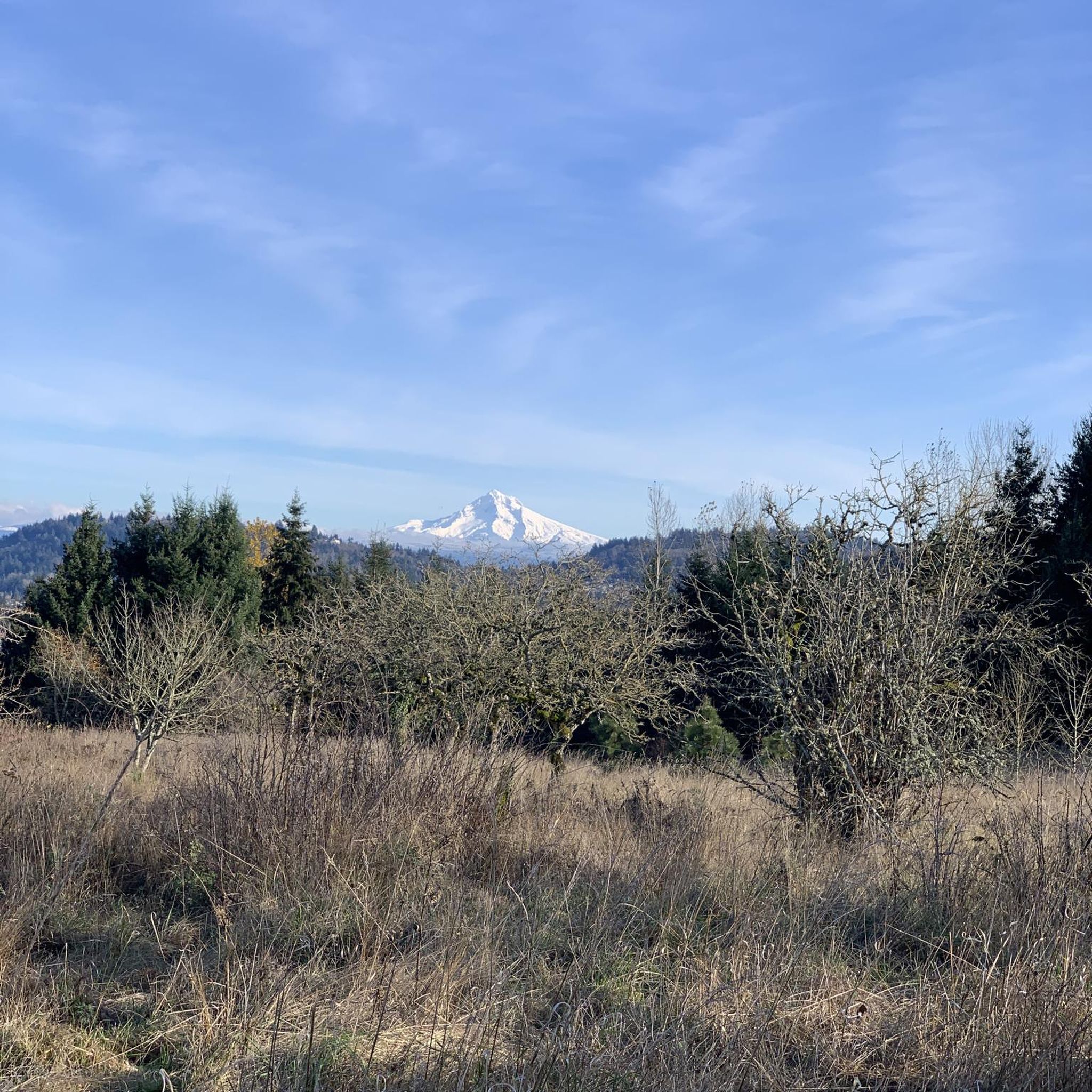
Great views of Mt. St. Helens, Mt. Adams and Mt. Hood
0
0

The Cazadero Trail is an almost 6-mile trail from the town of Boring. It is paved gravel and follows the North Fork Deep Creek.
0
0
Frequently Asked Questions
How many touring cycling routes are available around Damascus?
There are over 50 touring cycling routes available around Damascus, offering a diverse range of experiences for cyclists of all levels.
What kind of terrain can I expect on touring cycling routes around Damascus?
The touring cycling routes around Damascus feature a diverse landscape, primarily characterized by multi-use trails, regional parks, and scenic loops. You'll find a mix of paved and gravel paths, often following river valleys and connecting suburban areas with natural spaces. Elevation gains are generally moderate, making the terrain suitable for various cycling abilities.
Are there any easy touring cycling routes suitable for beginners or families?
Yes, Damascus offers several easy touring cycling routes. For instance, the Cazadero Trail is an easy 6.6-mile path through a converted railway corridor, perfect for a leisurely ride. Another accessible option is the Springwater Trail – Main City Park loop from Gresham, which is about 8 miles long and also rated easy.
What are some popular longer touring cycling routes in the area?
For longer rides, the Springwater and Gresham-Fairview Trail Loop is a popular choice, covering 31.1 miles and combining two multi-use paths. Another excellent option is the Barton County Park to Milo McIver State Park gravel loop, which is 26.9 miles long and features a gravel surface connecting two prominent regional parks.
What do other cyclists enjoy most about touring cycling in Damascus?
The touring cycling routes in Damascus are highly rated by the komoot community, with an average score of 4.6 stars from over 87 reviews. Cyclists often praise the well-maintained multi-use trails, the scenic river valleys, and the accessibility of routes that connect natural spaces with suburban areas.
Are there any circular touring cycling routes around Damascus?
Yes, many routes around Damascus are designed as loops, offering a convenient way to start and end your ride in the same location. Examples include the Barton County Park to Milo McIver State Park gravel loop and the Springwater and Gresham-Fairview Trail Loop, both of which are circular.
What natural attractions or landmarks can I see along the touring cycling routes?
Along the touring cycling routes, you can encounter several natural attractions and landmarks. The Clackamas River is a prominent feature, and you might pass by the Old 82nd Drive Bridge. For scenic views, consider visiting the Viewpoint in Powell Butte Nature Park. Other natural areas include Mount Talbert Nature Park, High Rocks Park, and Scouters Mountain Nature Park.
Are there any specific trails that are particularly scenic for touring cyclists?
The Springwater Corridor is a highly scenic multi-use path that offers varied urban and natural scenery, including views of the Clackamas River. Routes connecting regional parks, such as the Barton County Park to Milo McIver State Park gravel loop, also provide beautiful natural surroundings.
What is the best time of year to go touring cycling in Damascus?
While specific seasonal data isn't provided, touring cycling in regions with diverse landscapes like Damascus is generally enjoyable from spring through fall. These seasons typically offer pleasant temperatures and less precipitation, making for comfortable rides. Always check local weather forecasts before heading out.
Are there any options for more challenging touring cycling routes?
Yes, while many routes are moderate, some offer more significant distances and elevation changes. For example, the Springwater and Gresham-Fairview Trail Loop and the Barton County Park to Milo McIver State Park gravel loop are rated as moderate, providing a good challenge with their lengths and moderate elevation gains.
Where can I find parking facilities near the cycling routes?
Many of the touring cycling routes around Damascus connect to regional parks and trailheads, which typically offer parking facilities. For routes like the Barton County Park to Milo McIver State Park gravel loop, you can expect parking at the respective parks. For specific parking information, it's always best to check the details of your chosen route on komoot or local park websites.
Are there any towns or settlements along the routes where I can find amenities?
Yes, some routes pass through or near settlements where you can find amenities. For instance, the Springwater Trail – Boring, Oregon loop will take you near Boring, Oregon, where you can likely find cafes or other services. Routes that combine urban and natural scenery, like the Springwater and Gresham-Fairview Trail Loop, will also offer access to amenities in the towns they connect.
Most popular routes around Damascus
Most popular attractions around Damascus

Get inspired with the komoot mobile app


Explore more
Browse the best Cycling routes in other regions.
