The best road cycling routes around Chenoweth
5.0
(1)
109
riders
9
rides
Road cycling routes around Chenoweth are characterized by the dramatic landscapes of the Columbia River Gorge region. The area features expansive views across the Columbia River plateau, with volcanic peaks like Mt. Adams and Mt. Hood visible on clear days. Cyclists can navigate the historic Columbia River Highway, which offers access to various viewpoints and challenging ascents. The terrain includes winding roads, riverfront sections, and elevated areas providing panoramic vistas.
Best road cycling routes around Chenoweth
- The most popular road…
Last updated: May 12, 2026
82.9km
03:04
710m
710m
Moderate road ride. Good fitness required. Mostly well-paved surfaces and easy to ride.
5.0
(1)
74
riders
73.2km
03:59
1,140m
1,140m
Hard road ride. Very good fitness required. Some segments of this route may be unpaved and difficult to ride.

Sign up for free
9
riders
51.2km
02:44
920m
920m
Hard road ride. Very good fitness required. Some segments of this route may be unpaved and difficult to ride.
7
riders
57.1km
02:32
590m
590m
Moderate road ride. Good fitness required. Mostly well-paved surfaces and easy to ride.
10
riders
21.0km
01:06
110m
110m
Easy road ride. Great for any fitness level. Mostly well-paved surfaces and easy to ride.
Get access to more routes and recommendations from other explorers.
Sign up for free
Already have an account?
Our route recommendations are based on thousands of hikes, rides, and runs completed by other people on komoot.
Start today with a free account
Your next adventure awaits.
Login or Signup
Popular around Chenoweth

Tips from the Community

Klickitat Park is a picturesque and tranquil spot nestled right along the river. It is an ideal spot for a picnic along the water or a place to cool off on a hot day. There is plenty of parking and a vault toilet; however, you'll need to bring your own drinking water.
0
0

About 50 feet off the highway, the pavement takes riders to an overlook of the Memaloose Hills, called the Memaloose Lookout. Memaloose Overlook has a viewpoint of Memaloose Island and is a great photo opportunity, especially on a clear day.
0
0
The Dalles Bridge is easy to ride across. Before the bridge was built, as early as 1854, there was a ferry service going over the Colombia River. 10 years later, bridge planning began. It did take another 85 years after the planning began for the Dalles Bridge to finally finish its construction.
0
0
Mosier is named after Jonah H. Mosier, who settled the area around 1821. Today, it is best known for apple, cherry, and prune production, and the town is only about 400 acres in size.
0
0
Look northward toward the Colombia River Gorge to see a separate lake called Tooley Lake sandwiched between the highway and the Colombia River. Tule Lake is fed by the Lost River, and at an elevation of 4,035 feet, this lake is popular for fishing.
0
0
Walk or bike through tunnels built for the original Columbia River Highway. These unique tunnels have windows and are a car-free section of the Historic Columbia River Highway State Trail. This area is great for bikers and walkers alike.
0
0
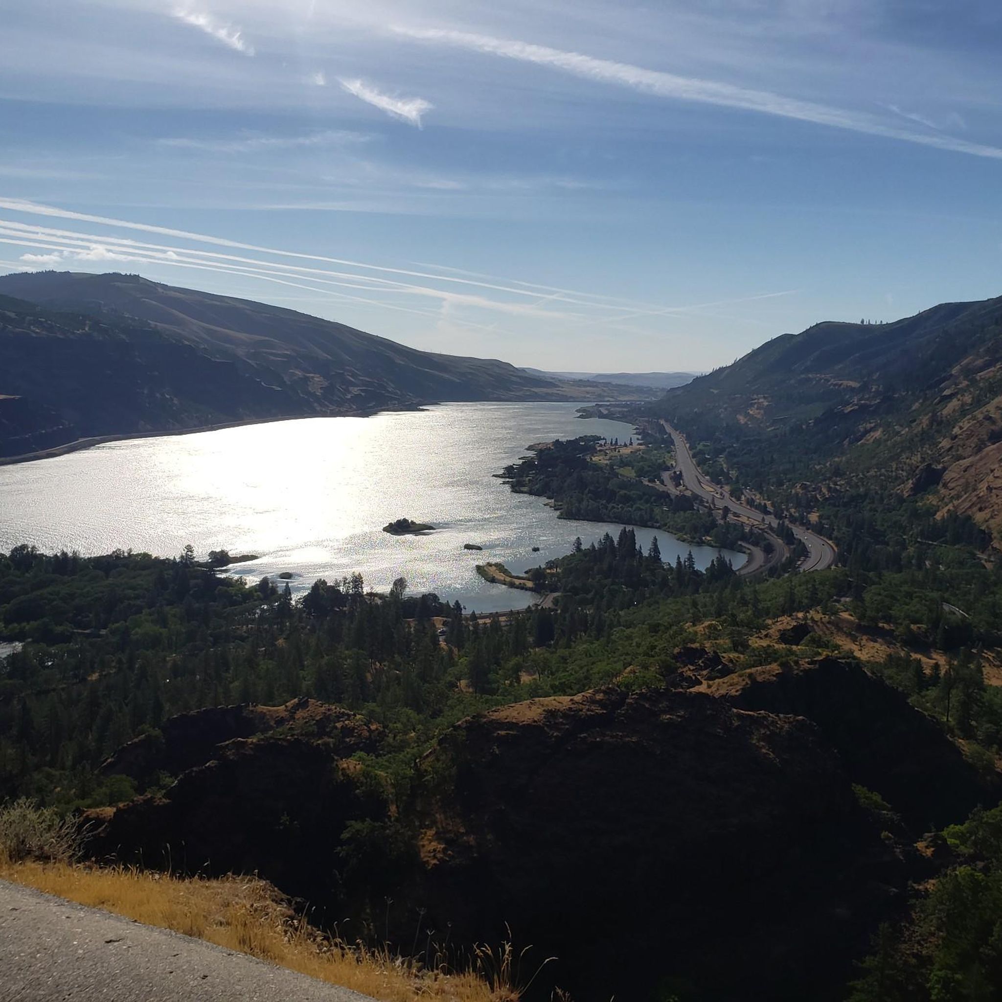
The Rowena Crest is an impressive viewpoint for cyclists and drivers and has a trailhead. On the Historic Columbia River Highway, you can look down on Mayer State Park and the Columbia River Gorge. Riders will see the iconic Rowena Loops they just came up with and can be impressed on their efforts climbing the horseshoe curves that wind up and down. On a clear day, look south to see Mt. Hood.
0
0

The Last of its kind! This section of the Columbia Historic Highway Trail is non-motorized and perfect for family trips. The view is breathtaking. However, also very hilly. Perfectly asphalted!
0
0
Frequently Asked Questions
How many road cycling routes are available around Chenoweth?
There are 8 road cycling routes around Chenoweth, catering to various skill levels. This includes 1 easy, 3 moderate, and 4 difficult routes, ensuring options for every cyclist.
What kind of landscapes can I expect to see while road cycling in Chenoweth?
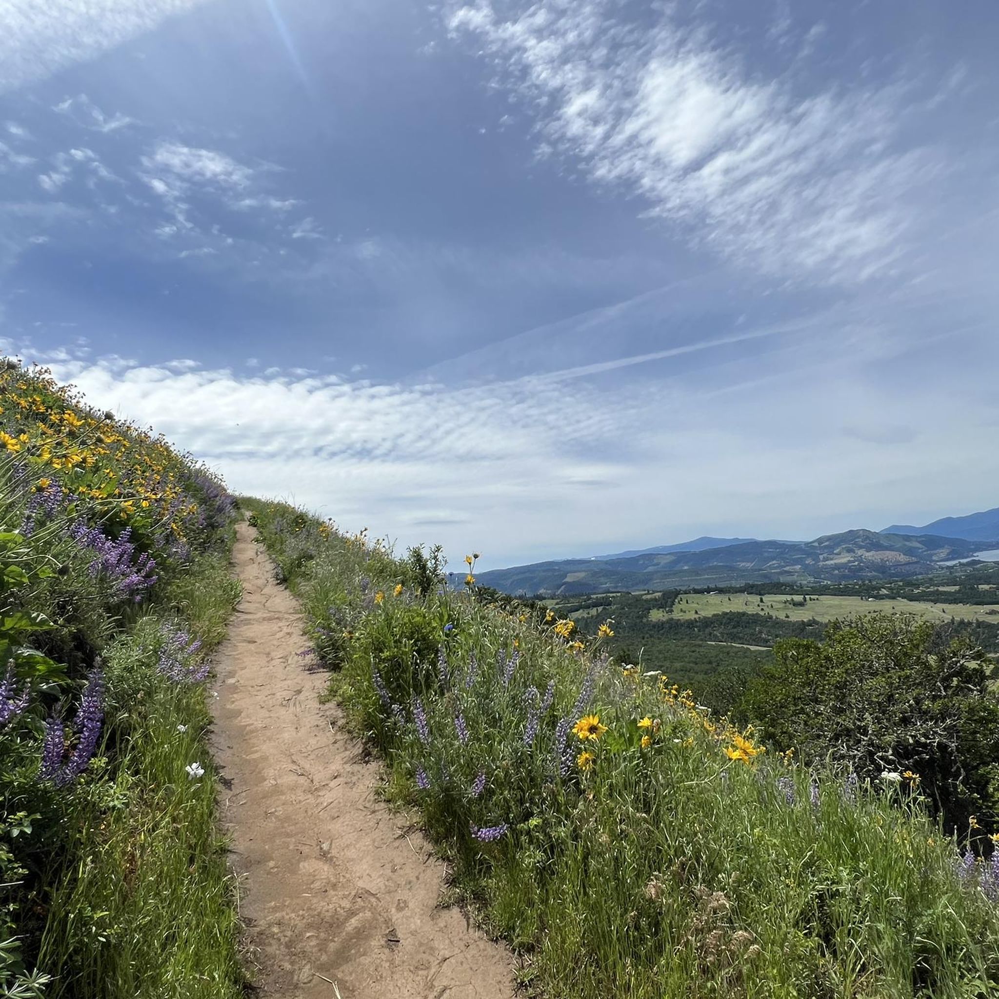
Road cycling around Chenoweth offers dramatic landscapes within the Columbia River Gorge region. You'll experience expansive views across the Columbia River plateau, with majestic volcanic peaks like Mt. Adams and Mt. Hood often visible. The routes navigate the historic Columbia River Highway, featuring winding roads, riverfront sections, and elevated areas with panoramic vistas. In late May and early June, areas like the Tom McCall Preserve are vibrant with wildflowers.
Are there any particularly scenic viewpoints or landmarks along the road cycling routes?
Yes, the area is rich with scenic spots. Notable viewpoints include Memaloose Lookout, offering views of the Memaloose Hills, and Rowena Crest, which provides impressive vistas over Mayer State Park and the Columbia River Gorge. The Tom McCall Preserve summit is another excellent spot for panoramic views of the Columbia River plateau, Mt. Adams, and Mt. Hood.
What is the best time of year for road cycling in Chenoweth?
The late spring (late May and early June) is particularly beautiful due to the vibrant wildflowers, especially around places like the Tom McCall Preserve. Generally, spring through fall offers pleasant conditions for road cycling. Cyclists should be mindful of seasonal weather changes in the Columbia River Gorge, which can include wind and temperature variations.
Are there any easy road cycling routes suitable for beginners or families?
Yes, there is 1 easy route available. The Taylor Lake loop from The Dalles is an easy 12.8-mile (20.6 km) route with minimal elevation gain, making it a good option for those seeking a less strenuous ride or for families with older children comfortable on roads.
Where can I find challenging road cycling routes with significant elevation gain?
For a challenge, consider routes like the Memaloose Lookout – Twin Tunnels Trail loop from Chenowith. This difficult 46.9-mile (75.4 km) path features significant elevation gain and passes by the Memaloose Overlook. The iconic 'Rowena Loops' also offer a physical challenge with their series of horseshoe curves and impressive views.
What do other road cyclists enjoy most about cycling in Chenoweth?
The road cycling routes around Chenoweth are highly rated by the komoot community, with an average score of 5.0 stars. Cyclists often praise the dramatic landscapes of the Columbia River Gorge, the challenging ascents, and the panoramic views from elevated areas like the Historic Columbia River Highway.
Are there any circular road cycling routes in the area?
Yes, many of the routes are designed as loops. For example, the Old Highway 8 Loop is a popular 51.5-mile (82.9 km) moderate route that offers scenic stretches along the Columbia River. Another option is the The Dalles Bridge View loop from The Dalles Dam.
Is parking available near the road cycling routes?
While specific parking locations for each route are not detailed here, the Columbia River Gorge area, including points along the Historic Columbia River Highway and near towns like The Dalles, typically offers various parking options at trailheads, viewpoints, and state parks. It's advisable to check specific starting points for parking availability.
Can I access road cycling routes using public transport in the area?
Public transport options directly serving specific road cycling route starting points in the Chenoweth area (near The Dalles, Oregon) can be limited. Cyclists often rely on personal vehicles to reach desired starting locations. For detailed information on local public transport, it's best to consult regional transit authorities in The Dalles or surrounding areas.
Are there any long-distance road cycling routes around Chenoweth?
Several routes offer substantial distances for long-distance cycling. The Old Highway 8 Loop covers 51.5 miles (82.9 km), and the Memaloose Lookout – Twin Tunnels Trail loop from Chenowith is a challenging 46.9-mile (75.4 km) route, both providing extensive riding experiences.
Are there any specific natural features or landmarks to look out for on the routes?
Beyond the stunning views of the Columbia River Gorge and volcanic peaks, cyclists can experience the unique 'Rowena Loops,' a series of winding curves that are both a cycling challenge and a scenic highlight. The The Dalles Bridge View is another notable landmark along some routes.
Most popular routes around Chenoweth
Most popular attractions around Chenoweth

Get inspired with the komoot mobile app


