The best cycling routes around Johnson City
4.6
(140)
1,156
riders
68
rides
Touring cycling routes around Johnson City are set within the Appalachian foothills, characterized by rolling hills, lush forests, and distant mountain views. The region features a mix of dedicated greenways, rails-to-trails paths, and more challenging road cycling options. This diverse landscape provides varied terrain for cyclists, from relatively flat, paved surfaces to routes with significant elevation changes.
Best touring cycling routes around Johnson City
- The most popular touring cycling route is West Lents Floodplain loop from Gladstone, a 17.9…
Last updated: May 16, 2026
4.3
(4)
10
riders
28.9km
01:44
200m
200m
Moderate bike ride. Good fitness required. Mostly paved surfaces. Suitable for all skill levels.
5.0
(1)
24
riders
25.4km
01:32
210m
210m
Moderate bike ride. Good fitness required. Mostly paved surfaces. Suitable for all skill levels.

Sign up for free
16
riders
31.6km
01:52
190m
190m
Moderate bike ride. Good fitness required. Mostly paved surfaces. Suitable for all skill levels.
17
riders
Hard bike ride. Very good fitness required. Mostly paved surfaces. Suitable for all skill levels.
3.0
(2)
8
riders
12.9km
00:46
90m
90m
Easy bike ride. Great for any fitness level. Mostly paved surfaces. Suitable for all skill levels.
Get access to more routes and recommendations from other explorers.
Sign up for free
Already have an account?
Our route recommendations are based on thousands of hikes, rides, and runs completed by other people on komoot.
Start today with a free account
Your next adventure awaits.
Login or Signup
Popular around Johnson City
Tips from the Community

Salmon Street Springs is a popular spot for cyclists to gather. Thursday Night Ride starts there every Thursday at 7:30pm.
0
0


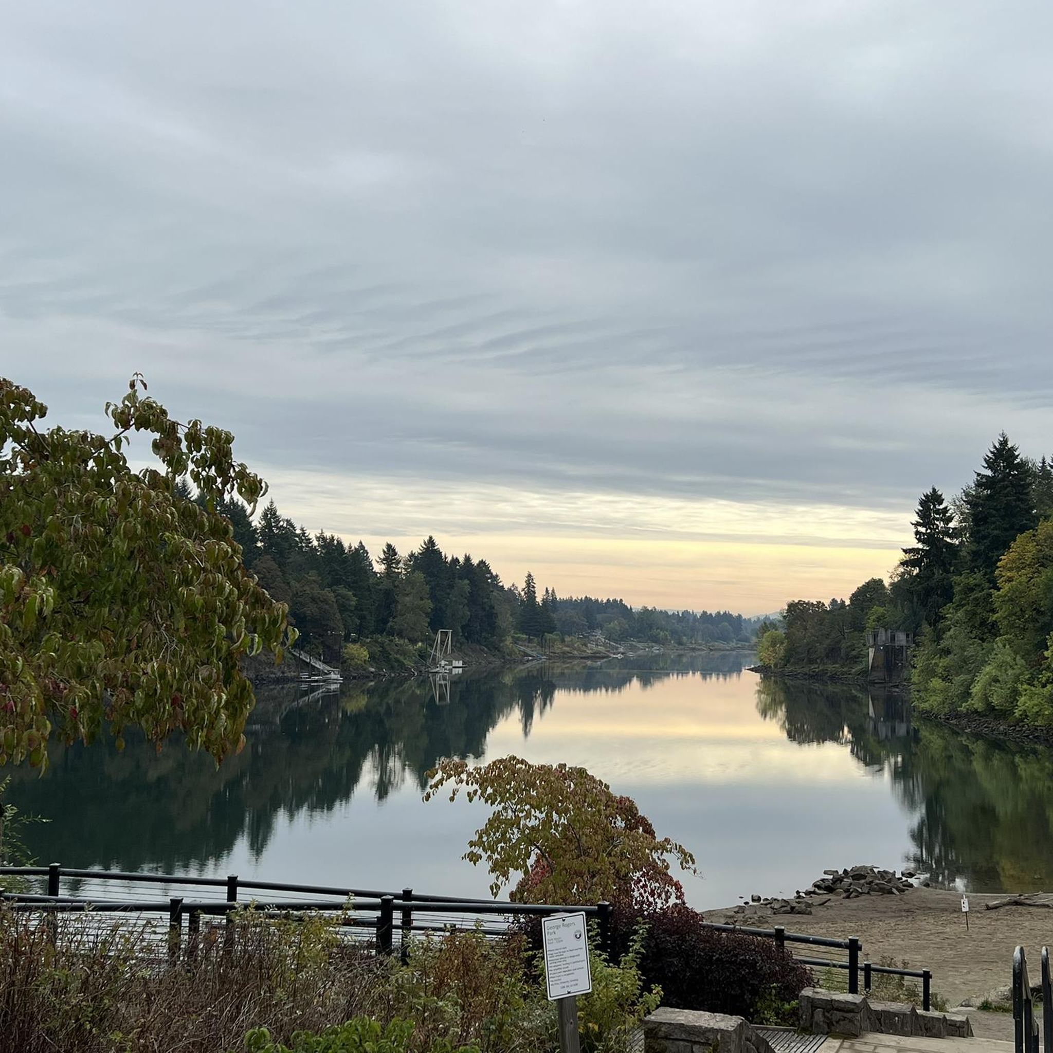
The Willamette River stretches over 255 miles from Cottage Grove in the southern Willamette Valley to Portland, where it meets the Columbia River. The Multnomah Channel branches off near Sauvie Island before joining the Columbia. The Willamette River Greenway offers a few open green spaces along the riverbanks, some with boat launches and basic amenities. Bikers also pass through preserved areas for native wildlife and with scenic views. This trail is a popular destination for biking, walking, and running along its shared paths.
0
0
Oaks Bottom Wildlife Refuge sits on the east bank of the Willamette River. This 163-acre refuge is home to meadows, marshes, wetlands, and forests. There are over 175 bird species, like bald eagles and peregrine falcons, as well as river otters and deer. The Springwater Corridor Trail, great for a bike ride. Established in 1988, Oaks Bottom is Portland’s first wildlife refuge and plays an important role in habitat preservation and environmental education.
1
0
The Springwater Corridor forms part of Portland's 40-mile Loop trail system, extending from downtown Portland to the town of Boring. The paved trail follows the Willamette River and Johnson Creek, passing through neighborhoods, parks, wetlands, and industrial zones. With connections to Portland's light rail and city buses, the trail offers convenient access and stops at Beggars-Tick Wildlife Refuge, Leach Botanical Garden, and Powell Butte Nature Park. The trail, built on a former railroad corridor, opened in 1996 after Portland obtained the rail line in 1990.
0
0

The Eastbank Esplanade was brought about by the 1996 Willamette Valley Flood. After that flood washed out the existing !-5 bike bypass and new path was needed and the Eastbank Esplanade was born.
0
0
The 40 Mile Loop isn't a single loop trail, and isn't even limited to 40 miles. The original proposal for the trail was 40 miles but it now encompasses a planned network of over 140 miles of interconnected trails. This section along the river is particularly scenic with great views of the river.
0
0

The 187 long primary river that bisects the city of Portland and flows northward into the Columbia. If you don't pronunce the name correctly in the presence of a local they will very likely inform you it rhymes with "damn it!"
0
0
Frequently Asked Questions
How many touring cycling routes are available around Johnson City?
Johnson City offers a wide variety of touring cycling routes, with over 50 options available. These routes cater to different skill levels, from easy greenways to more challenging mountain ascents.
What are the difficulty levels of touring cycling routes in Johnson City?
The touring cycling routes around Johnson City offer a range of difficulties. You'll find approximately 16 easy routes, 38 moderate routes, and 5 more difficult options, ensuring there's something for every cyclist, from beginners to experienced riders.
What is the best time of year for touring cycling in Johnson City?
The region is beautiful for cycling throughout much of the year. Spring and fall offer pleasant temperatures and vibrant scenery, especially in June when the Catawba rhododendron garden on Roan Mountain blooms. Summer can be warm, but many trails offer shaded sections. Winter cycling is possible, but check weather conditions for potential ice or snow, especially at higher elevations.
Are there any family-friendly touring cycling routes in Johnson City?
Yes, Johnson City has excellent family-friendly options. The Willamette River – Springwater Corridor loop from T-Mobile is a moderate 15.6-mile route that is popular. The Tweetsie Trail, a 9.6 to 10-mile crushed-stone rails-to-trails path connecting Johnson City to Elizabethton, is also ideal for families due to its relatively flat profile and scenic views.
Can I bring my dog on touring cycling routes in Johnson City?
Many of the multi-use trails and greenways in Johnson City, such as the Tweetsie Trail and the State of Franklin Greenway, are dog-friendly, provided your dog is on a leash. Always check specific trail regulations before heading out, as rules can vary by park or trail section.
What kind of natural features can I expect to see along the cycling routes?
Johnson City's touring routes are set within the Appalachian foothills, offering views of rolling hills, lush forests, and distant mountains. You might encounter scenic rivers like the Clackamas River or the Watauga River, and explore natural areas such as Mount Talbert Nature Park or Scouters Mountain Nature Park. Higher elevation routes, like those near Roan Mountain, provide panoramic vistas.
Are there any notable landmarks or points of interest along the touring routes?
Yes, several routes offer interesting landmarks. The Tweetsie Trail follows a historic railroad bed, allowing glimpses of railroad-era sites. Urban routes like the State of Franklin Greenway connect to various restaurants and breweries. You might also pass by structures like the Sellwood Bridge or the Old 82nd Drive Bridge, and even see unique street art like the Graffiti Wall at Springwater Corridor.
Where can I find parking for touring cycling routes?
Parking is generally available at trailheads for popular routes. For instance, the Tweetsie Trail has designated parking areas in both Johnson City and Elizabethton. Many parks, like Buffalo Mountain Park and Tannery Knobs Mountain Bike Park, also offer parking facilities. It's always a good idea to check specific route details for the most convenient parking options.
Are there any challenging touring cycling routes for experienced riders?
Absolutely. For experienced riders seeking a challenge, the Roan Mountain area offers epic road cycling with significant elevation gains. Routes like the Chanticleer Point – Springwater Corridor loop from Clackamas Town Center Transit Center, at 73.1 miles with over 1500 meters of elevation gain, provide a demanding experience. Buffalo Mountain Park also offers rugged terrain and climbs, though it's primarily known for mountain biking.
What do other touring cyclists enjoy most about cycling in Johnson City?
The touring cycling experience in Johnson City is highly rated by the komoot community, with an average score of 4.6 stars from over 160 reviews. Cyclists often praise the diverse landscape, which offers everything from flat, scenic greenways to challenging mountain ascents, as well as the beautiful views of the Appalachian foothills and lush forests.
Are there any circular touring routes available?
Yes, many of the touring routes around Johnson City are designed as loops, offering a varied experience without retracing your path. Examples include the West Lents Floodplain loop from Gladstone and the West Lents Floodplain – Willamette River loop from T-Mobile, which provide scenic circular journeys through the region.
Are there options for urban cycling with access to amenities?
Yes, the State of Franklin Greenway offers a paved urban trail that connects North and South Johnson City. This route provides convenient access to various local restaurants and breweries, making it a great option for combining cycling with exploring the city's amenities.
Most popular routes around Johnson City
Most popular attractions around Johnson City

Get inspired with the komoot mobile app


Explore more
Browse the best Cycling routes in other regions.
