The best road cycling routes around Springfield
4.6
(16)
1,376
riders
11
rides
Road cycling routes around Springfield feature a landscape characterized by river valleys, agricultural areas, and forested sections. The terrain primarily consists of flat to gently rolling paths, with some routes including moderate climbs. Cyclists can expect to encounter scenic river views and open countryside. The region offers a network of paths suitable for various road cycling preferences.
Best road cycling routes around Springfield
- The most popular road cycling route is Springfield, Oregon to Lowell Covered Bridge loop via Willamette Highway, a 37.4 miles (60.1 km) trail that takes 2 hours 35 minutes to complete. This moderate route includes varied terrain and scenic views along the Willamette Highway.
- Another top favourite among local road cyclists is Middle Fork Willamette Path – Dorris Ranch loop from Georgia Pacific Natural Area, an easy 16.2 miles (26.0 km) path. This route offers a pleasant ride through natural areas, often completed in about 1 hour 11 minutes.
- Local road cyclists also love the Dorris Ranch – Middle Fork Willamette Path loop from Springfield, a 12.2 miles (19.7 km) trail leading through riverfront areas and parkland, often completed in about 50 minutes.
- Road cycling around Springfield is defined by river paths, agricultural fields, and forested sections. The network offers options for different ability levels, from easy, flat loops to routes with moderate elevation changes.
- The routes in Springfield are highly rated by the komoot community with an average score of 4.7 stars from over 19 reviews. More than 1,200 road cyclists have used komoot to explore Springfield's varied terrain.
Last updated: September 27, 2026
3.0
(1)
3
riders
60.1km
02:35
280m
280m
This moderate 37.4-mile road cycling loop from Springfield, Oregon, takes you to the historic Lowell Covered Bridge via the scenic Willamett
42
riders
54.4km
02:40
150m
150m
Moderate road ride. Good fitness required. Some segments of this route may be unpaved and difficult to ride.

9
riders
41.5km
01:44
150m
150m
Moderate road ride. Great for any fitness level. Some segments of this route may be unpaved and difficult to ride.
9
riders
38.7km
01:39
110m
110m
Easy road ride. Great for any fitness level. Mostly well-paved surfaces and easy to ride.
7
riders
Easy road ride. Great for any fitness level. Mostly well-paved surfaces and easy to ride.
Get access to more routes and recommendations from other explorers.
Already have an account?
Our route recommendations are based on thousands of hikes, rides, and runs completed by other people on komoot.
Start today with a free account
Your next adventure awaits.

Tips from the Community


Since 1967 Autzen Stadium has been the home of the Oregon Ducks Football team. The stadium was funded in large part by the Autzen Foundation whose founder, Thomas J. Autzen, the stadium is named after. Somewhat ironically, Thomas J. Autzen was an alumnus of arch rival Oregon State University.
1
0

Alton Baker Park features duck ponds, bicycle trails, a disc golf course and a dog park. It connects to the Ferry Street Bridge across the Willamette River. The Cuthbert Amphitheater is here, which is a popular venue for outdoor musical and drama performances.
0
0

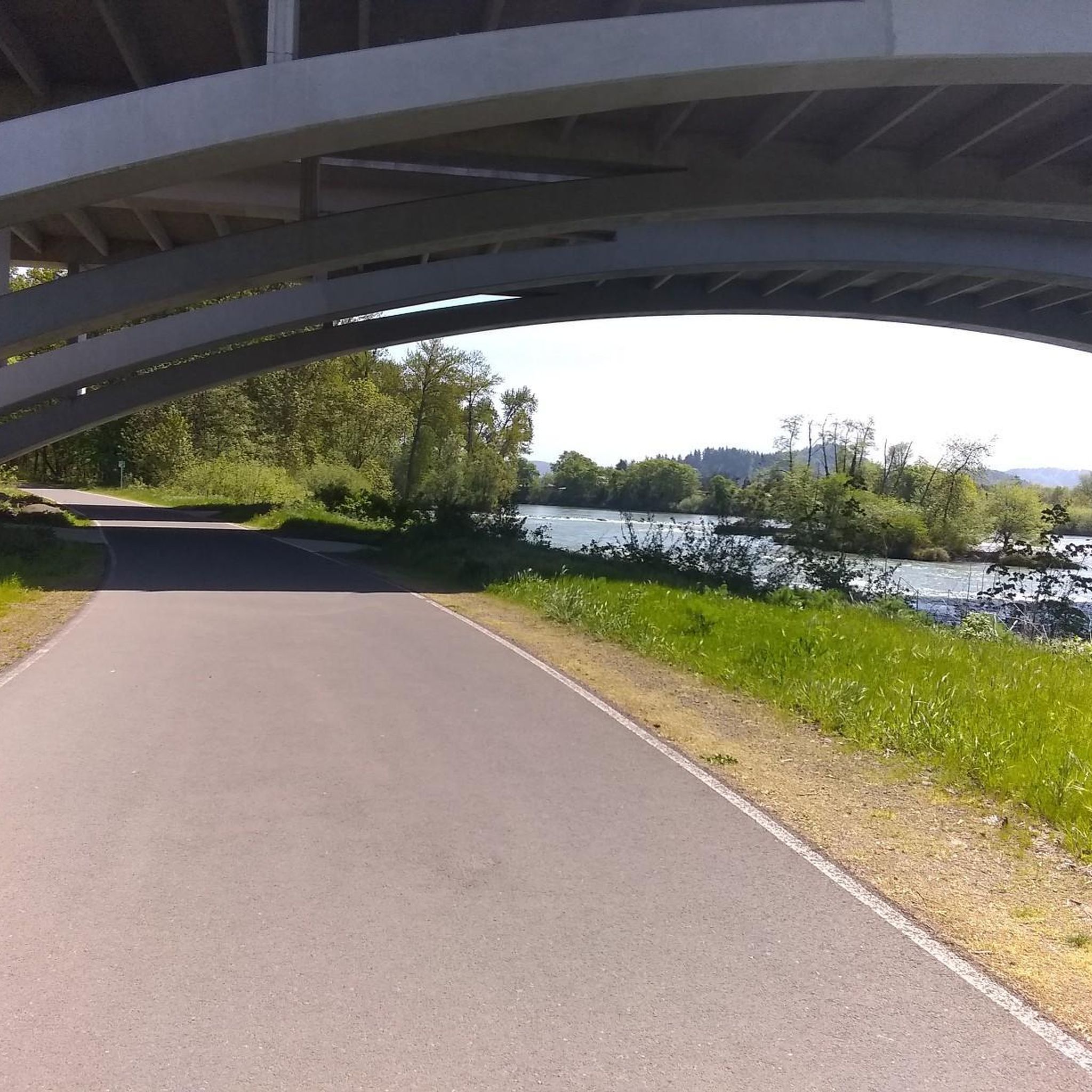
The North Bank Path goes right under the interstate while hugging the banks of the river. The path connects to a bunch of other paved paths in this area, but the simplest route is just to stick to the widest path.
0
0

This is an absolutely gorgeous spot. The river meanders through the forest and round the hills, bringing with it a sense of calm and serenity. And relax...
0
0

The DeFazio Bridge is a pedestrian and bicycle bridge named after Congressman Peter DeFazio of Oregon. It showcases quite interesting and unique architecture with a modernist interpretation of the classic suspension bridge and serves as one of the main connecting arteries between downtown Eugene and Coburg Road. The DeFazio Bridge also serves as the main crossing between Alton Baker Park and downtown Eugene, increasing access to the park. It stretches across the Willamette River, connecting Alton Baker Park on the east side with Autzen Stadium and the University of Oregon campus on the west side. The bridge is an important link in the extensive system of bicycle and pedestrian paths that traverse Eugene and the surrounding area. It is heavily used by students, visitors to Alton Baker Park, and residents of nearby neighborhoods. The bridge also offers breathtaking views of the Willamette River, Autzen Stadium and the surrounding natural beauty of the area. In addition to its practical and functional purposes, the DeFazio Bridge is also a beloved landmark and a symbol of Eugene's commitment to sustainable transportation and outdoor recreation.
0
0
The current iteration of the Lowell Covered Bridge was constructed in 1945 to replace the original 1907 bridge after a large truck damaged it beyond repair. Eventually the bridge was bypassed by a modern concrete bridge and fell into disrepair. However, the bridge was reopened as an interpretive center on the other covered bridges in the area. There's also a rest area with parking, restrooms, and picnic tables.
0
0
The Middle Fork Path is a 4-mile-long, 10-foot-wide pathway from Clearwater Park to Dorris Ranch, revealing scenic views of the Willamette River. It is accessible from Dorris Ranch to the west and Clearwater Park to the east. The path also connects to the 3-mile Mill Race Path, creating an 8-mile loop incorporating downtown Springfield. With minor sections of on-street bicycle lanes, both connect to Springfield and Eugene's riverfront system, extending for miles of enjoyable scenic routes.
0
0
Frequently Asked Questions
What kind of terrain can I expect on road cycling routes in Springfield?
Road cycling routes around Springfield feature a diverse landscape, including river valleys, agricultural areas, and forested sections. The terrain primarily consists of flat to gently rolling paths, with some routes including moderate climbs, especially in areas like the Sangamon River valley in Illinois or the Ozarks in Missouri. You can expect scenic river views and open countryside.
How many road cycling routes are available around Springfield?
There are over 10 road cycling routes available around Springfield, catering to various skill levels. The komoot community has mapped out numerous options for you to explore.
Are there road cycling routes suitable for beginners in Springfield?
Yes, Springfield offers several easy road cycling routes perfect for beginners. For instance, the Middle Fork Willamette Path – Dorris Ranch loop from Georgia Pacific Natural Area is an easy 16.2-mile path, and the Dorris Ranch – Middle Fork Willamette Path loop from Springfield is a pleasant 12.2-mile trail through riverfront areas.
What do other cyclists say about road cycling in Springfield?
The road cycling routes in Springfield are highly rated by the komoot community, with an average score of 4.7 stars from over 19 reviews. Cyclists often praise the varied terrain, scenic views, and well-maintained paths that make for an enjoyable ride.
Are there any longer road cycling routes for experienced riders?
Yes, for more experienced riders seeking a longer challenge, the Springfield, Oregon to Lowell Covered Bridge loop via Willamette Highway is a moderate 37.4-mile route that includes varied terrain and scenic views. In Springfield, Illinois, routes like the SBC Summer Challenge Ride 3 offer 40 miles with rolling hills.
What scenic views or natural features can I expect along road cycling routes in Springfield?
Road cycling routes in Springfield offer diverse scenery. You can enjoy views of Lake Springfield, the Sangamon River, and the Willamette River, along with agricultural fields and wooded areas. In Springfield, Missouri, the Ozark Greenways Trails Network provides scenic routes through the Ozarks, and the Wilson's Creek Greenway offers views along Wilson's Creek.
Are there any specific landmarks or points of interest accessible by road bike?
While specific road cycling routes may not pass directly through all landmarks, many are easily accessible nearby. In Springfield, Illinois, you can find parks like Washington Park. In Springfield, Missouri, the Owen Memorial Rose Garden and Hendricks Park are notable natural attractions. The paved tour road at Wilson's Creek National Battlefield also offers a historical ride.
Are there any circular road cycling routes in Springfield?
Yes, many road cycling routes in Springfield are designed as loops. Examples include the Middle Fork Willamette Path – Dorris Ranch loop from Georgia Pacific Natural Area, the Dorris Ranch – Middle Fork Willamette Path loop from Springfield, and the Peter DeFazio Bridge – Frohnmayer Bridge loop from Springfield.
When is the best time of year for road cycling in Springfield?
The best time for road cycling in Springfield generally spans from spring through fall. Spring offers pleasant temperatures and blooming landscapes, while fall provides cooler weather and vibrant foliage. Summer can be enjoyable, but it's advisable to ride earlier in the morning or later in the afternoon to avoid peak heat. Winter conditions can vary, with some trails potentially affected by snow or ice, especially in the Illinois region.
Are there family-friendly road cycling options in Springfield?
Absolutely! Many of Springfield's trails are suitable for families. The Interurban Trail in Springfield, Illinois, is mostly flat and offers scenic views of Lake Springfield, making it great for a family outing. In Missouri, the Ozark Greenways Trails Network includes many paved paths suitable for all skill levels, and the Lake Springfield loop from Rochester is an easy road ride for all fitness levels.
Where can I find parking and restrooms near road cycling routes?
Many trailheads and parks in Springfield offer convenient parking and restroom facilities. For example, in Springfield, Illinois, parks like Washington Park provide amenities. In Springfield, Missouri, Rutledge-Wilson Farm Park serves as a trailhead for the Wilson's Creek Trail and likely offers facilities. It's always a good idea to check specific route details or park websites for the most up-to-date information on parking and restrooms.
Are there opportunities to combine road cycling with other outdoor activities?
Yes, Springfield offers many opportunities to combine road cycling with other outdoor activities. Many routes pass through or near parks that feature hiking trails, picnic areas, and other recreational facilities. For instance, in Springfield, Missouri, Nathanael Greene/Close Memorial Park, home to the Springfield Botanical Gardens, is easily accessible, and Sequiota Park is a starting point for the Galloway Creek Greenway Trail, offering green fields and trails.
Most popular routes around Springfield
Most popular attractions around Springfield

Get inspired with the komoot mobile app


Explore more
Browse the best Road cycling routes in other regions.
