The best walks and hikes around Yachats
4.8
(28)
330
hikers
16
hikes
Hiking around Yachats offers routes where the Siuslaw National Forest meets the Pacific Ocean. The region is characterized by a volcanic basalt coastline, dense coastal forests, and trails that lead to ocean viewpoints. The landscape provides a mix of relatively flat coastal walks and more challenging forest loops with significant elevation changes.
Best hiking trails around Yachats
- The most popular hiking route is Cook's Ridge & Gwynn Creek Loop Trail — Cape Perpetua, a 6.0 mile (9.6 km) trail…
Last updated: September 28, 2026
1
hikers
646m
00:11
20m
20m
The Trail of the Restless Waters is a fantastic way to experience the raw power of the Oregon Coast, even if you only have a few minutes. This easy 0.4-mile…
1.27km
00:23
50m
60m
The Ya'Xaik Trail offers an easy hike through a lush coastal forest. You will wander among towering Sitka spruce, sword ferns, and salal, experiencing a serene woodland atmosphere. The path…

838m
00:14
10m
30m
The Whispering Spruce Trail offers a delightful, easy stroll through a lush coastal forest, where ancient Sitka spruce trees tower overhead. This 0.5-mile (0.8 km) loop, with a minimal 24…
5.0
(5)
72
hikers
4.88km
01:34
210m
210m
Embark on an easy hike along the Saint Perpetua Trail, a rewarding route that takes you through the diverse landscapes of the Cape Perpetua Scenic Area. You will cover a…
4.4
(7)
44
hikers
3.22km
00:53
50m
50m
The Oregon Coast Trail offers an easy hiking experience, guiding you through varied landscapes that shift between dense forested corridors and dramatic rugged headlands. You will encounter stunning ocean views…
Get access to more routes and recommendations from other explorers.
Already have an account?
Our route recommendations are based on thousands of hikes, rides, and runs completed by other people on komoot.
Tips from the Community


The spout of water that shoots from this spot can be quite impressive when the tide is high!
1
0
Thor's Well is a really cool rock feature along the rocky shores at Cape Perpetua. The photos you see on Instagram are achieved with a good telephoto lens, so if you want to capture this feature, don't forget a good zoom! You'll also want to go when the tide is high so that you'll get the water filling and dripping from the opening.
1
0

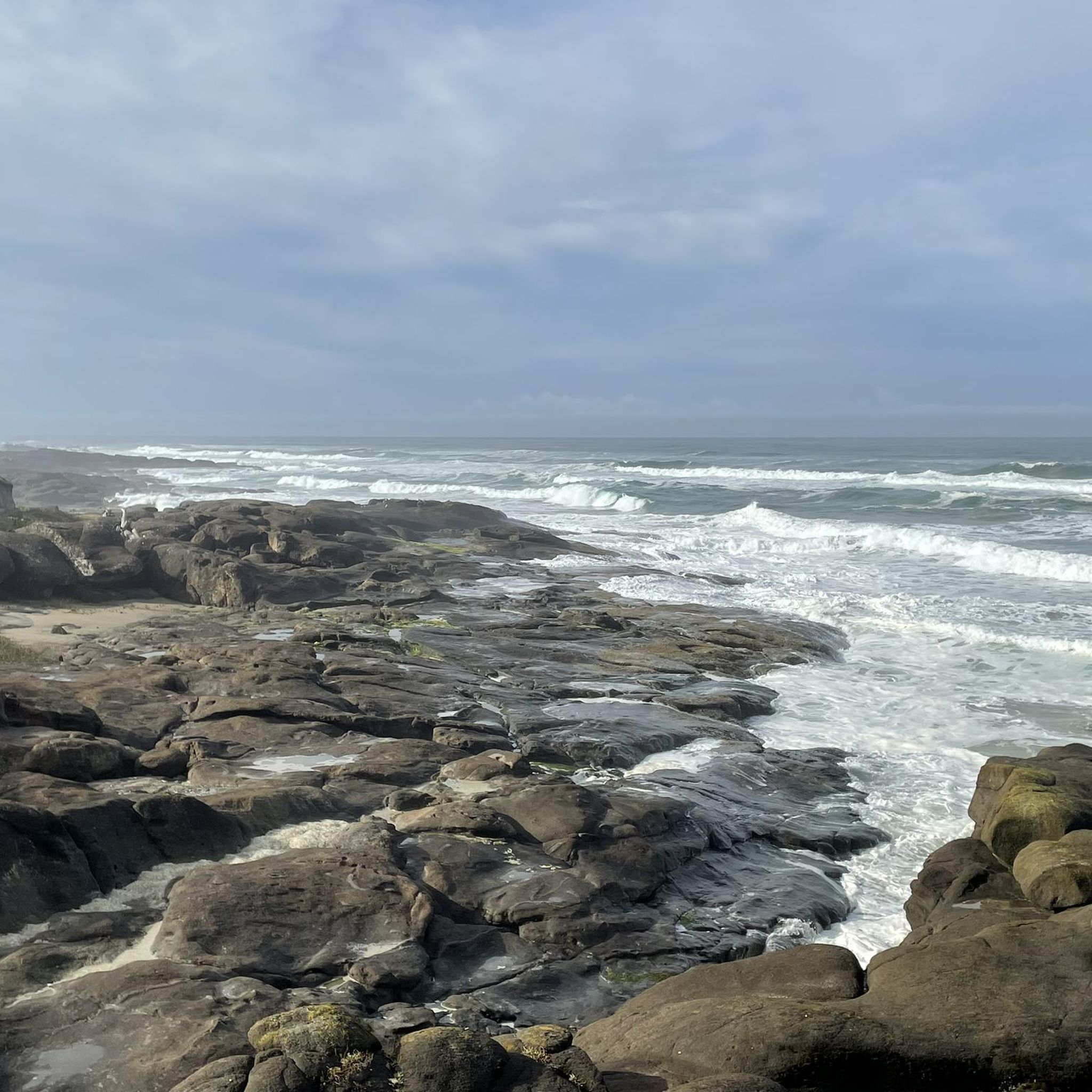
The waves whip against the rocks constantly and with incredible force - in the Cape Perpetua Scenic Area nature never comes to rest. At 800 feet above sea level, this cape south of Yachats is the highest viewing point along the Central Oregon Coast. The much-praised “Best View on Oregon’s Coast” can be debated; in our opinion, there are more beautiful ones, but the spectacle that awaits you directly below the parking lot at the Captain Cook Trailhead is mostly brilliant. At low tide the waves crash against the large rocky steps, at high tide the water shoots over them, gushing out of all the holes and even bringing “geysers” to life.
0
0
For at least 6,000 years, Native Americans hunted for clams, crabs, sea urchins, and clams along the coast near Cape Perpetua. Cape Perpetua was part of the southern territory of the Alsea. In their language the cape was called Halqaik, which could mean something like "exposed place". Evidence of their life can still be found in the huge piles of discarded mussel shells lying on the shore near the Cape Perpetua Visitor Center.
0
0

On a clear day, observers standing at the crest of Cape Perpetua can see as far as 37 miles (60 km) out to sea.
0
0
On a clear day, observers standing at the crest of Cape Perpetua can see as far as 37 miles (60 km) out to sea.
0
0
Frequently Asked Questions
Are there many dog-friendly hiking trails in the Yachats area?
Yes, many trails around Yachats are dog-friendly, but they must be kept on a leash. The trails within the Siuslaw National Forest and along the coast are great options for you and your canine companion. Always check specific regulations for the area you plan to hike, especially in the Cape Perpetua Scenic Area.
What are the best options for easy, family-friendly hikes near Yachats?
For a gentle and scenic walk suitable for all ages, the Giant Spruce Trail is an excellent choice. This easy 2-mile (3.3 km) path leads to a magnificent 300-year-old Sitka spruce tree and is a wonderful way to experience the coastal forest without a strenuous climb.
Which trails offer the best ocean views?
The coastline around Yachats provides stunning ocean vistas. For a dedicated viewpoint hike, the St. Perpetua Scenic Viewpoint trail offers panoramic views from the highest point on the Oregon Coast accessible by car. The path itself winds through beautiful coastal woodland before revealing the expansive Pacific.
What is Thor's Well and how can I see it?
Thor's Well is a famous natural landmark, a collapsed sea cave that creates a dramatic spectacle as ocean waves fill it from below and then erupt from the top. It's located in the Cape Perpetua Scenic Area and is most impressive during high tide or storms. You can access it via the Cook's Chasm to Devil's Churn trail, which also passes other dramatic coastal features. Be extremely cautious of waves and slippery rocks when viewing.
Are there any good loop hikes available?
Yes, the area has several excellent loop trails. For a more challenging day out, the Cook's Ridge & Gwynn Creek Loop Trail is a popular 6-mile (9.6 km) moderate hike. It takes you on a beautiful journey through an old-growth forest within the Cape Perpetua Scenic Area, offering a complete immersion in the region's lush landscape.
What is the best time of year to hike around Yachats?
Hiking is possible year-round in Yachats, with each season offering a different experience. Summer provides the warmest and driest weather, ideal for clear ocean views. Spring brings blooming wildflowers, while autumn offers cooler temperatures and fewer crowds. Winter is the storm-watching season, which can be dramatic, but be prepared for rain and wind. Always check the weather forecast before you go.
Where are the best places for tide pooling?
Yachats is renowned for its fantastic tide pools. For the best experience, go during low tide. Yachats State Recreation Area is a highly-regarded and easily accessible spot where you can find a variety of sea life like anemones and starfish. The rocky shores within the Cape Perpetua Scenic Area also offer excellent tide pooling opportunities.
What is the Amanda Trail like?
The Amanda Trail from Yachats is a significant and rewarding moderate hike. It combines beautiful coastal scenery with forested climbs and has historical importance, commemorating a blind Native American woman forced on a death march. The trail features a statue and a memorial, offering a powerful connection to the area's history alongside its natural beauty.
How many hiking trails are there around Yachats?
There are over a dozen curated hiking routes available around Yachats, ranging from easy coastal walks to difficult forest treks. The trail network in and around the Siuslaw National Forest and Cape Perpetua Scenic Area provides a wide variety of options to explore the unique landscape where the forest meets the sea.
What do other hikers say about the trails in Yachats?
The hiking routes in Yachats are highly rated by the komoot community, with an average score of 4.8 stars. Hikers frequently praise the stunning combination of rugged coastline and lush, old-growth forests. The well-maintained trails and the dramatic natural features like Thor's Well and Devil's Churn are often mentioned as highlights.
Where can I find a short hike with interesting scenery?
The Ya'Xaik Trail is a great option for a shorter hike. This 2.1-mile loop is considered a local gem, winding through a beautiful coastal forest and the Gerdemann Botanical Preserve. It's a peaceful and relatively easy walk that showcases the region's diverse plant life.
What kind of terrain should I expect on the trails?
The terrain varies significantly. You'll find relatively flat, paved, or gravel paths along the coast, such as the 804 Trail. Inland trails in the Siuslaw National Forest often involve significant elevation gain, with dirt paths, tree roots, and sometimes muddy sections, especially after rain. Sturdy hiking shoes are recommended for most forest trails.
Most popular routes around Yachats
Most popular attractions around Yachats

Get inspired with the komoot mobile app


Explore more
Browse the best Hikes in other regions.
