The best road cycling routes around Saint Helens
4.0
(1)
37
riders
4
rides
Road cycling around Saint Helens offers routes through diverse landscapes, from the banks of the Columbia River to areas influenced by the Mount St. Helens National Volcanic Monument. The region features a mix of paved roads suitable for various skill levels, with some routes providing significant elevation gains. Cyclists can expect to encounter dense forests, river views, and open terrain, particularly in areas further from the immediate volcanic blast zone.
Best road cycling routes around Saint Helens
- The most popular…
Last updated: July 9, 2026
12
riders
95.4km
03:41
1,070m
1,070m
Hard road ride. Very good fitness required. Mostly well-paved surfaces and easy to ride.
13
riders
93.1km
04:39
1,180m
1,180m
Hard road ride. Very good fitness required. Some segments of this route may be unpaved and difficult to ride.

Sign up for free
4
riders
112km
05:06
1,290m
1,290m
Hard road ride. Very good fitness required. Mostly well-paved surfaces and easy to ride.
4.0
(1)
2
riders
Moderate road ride. Good fitness required. Some segments of this route may be unpaved and difficult to ride.
6
riders
138km
06:39
1,310m
1,310m
Hard road ride. Very good fitness required. Some segments of this route may be unpaved and difficult to ride.
Our route recommendations are based on thousands of hikes, rides, and runs completed by other people on komoot.
Start today with a free account
Your next adventure awaits.
Login or Signup
Popular around Saint Helens
Tips from the Community

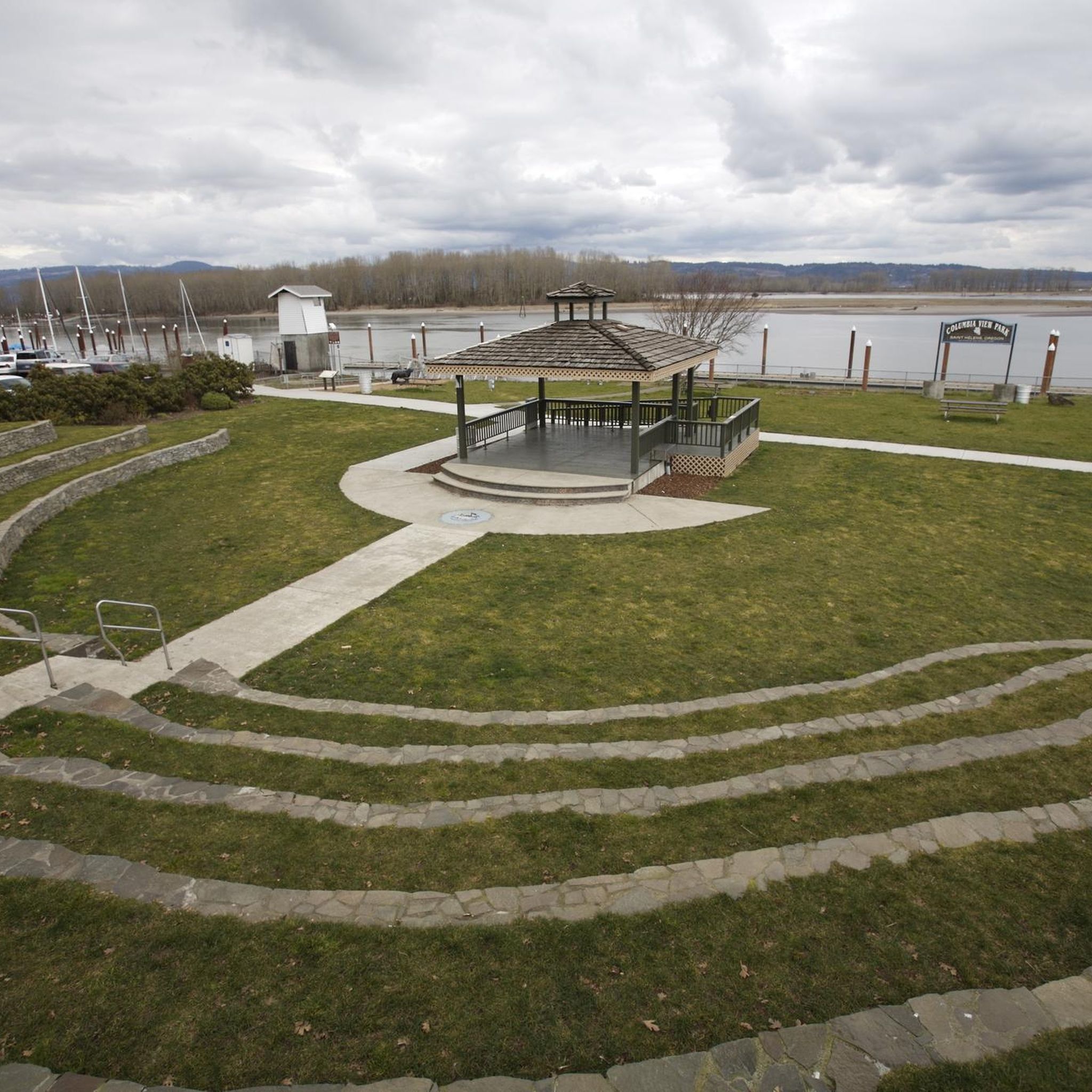
Chapman Landing is a small park with great views of the Columbia Channel. It also is a trailhead for the Crown Zellerbach Trail.
0
0
The Wayne Naillon Memorial Rest Area is a small picnic area on the Crown Zellerbach Trail. It was created in memory of Wayne Naillon, an integral member of the team that helped to set up the Crown Zellerbach Trail. There is a commemorative sign for Wayne at this spot as well.
0
0
The Crown Zellerbach Trail is a 27-mile-long trail that runs between Scappoose and Vernonia. The trail is built on an old railway right of way and is a mix of asphalt and gravel. This section is paved and takes you through dense forest.
0
0
The Old Mill Area is a great green space off the Banks-Vernonia Trail. It is an old industrial area that has been reclaimed by nature. There is an old mill building in the center, which has now been decorated with street art.
0
0

Scappoose Bay is very popular with birders and kayaking enthusiasts. It's a peaceful place to ride your bike.
0
0
This beautiful lake is a popular trout fishing destination. It's also the perfect spot for a lovely break when riding your bike around Vernonia!
0
0
Frequently Asked Questions
How many road cycling routes are available around Saint Helens?
There are over 5 road cycling routes around Saint Helens listed on komoot, offering diverse experiences from easy riverside rides to challenging climbs with significant elevation.
What kind of terrain can I expect on road cycling routes in the Saint Helens area?
Road cycling routes around Saint Helens feature a mix of terrain. You'll find paved roads suitable for various skill levels, including riverfront paths, forested sections, and rolling hills. Routes closer to the Mount St. Helens National Volcanic Monument, like the Spirit Lake Highway or Forest Road 99, offer significant elevation gains and dramatic transitions from lush forests to stark, volcanic landscapes.
Are there any easy road cycling routes suitable for beginners or families?
Yes, for an easier ride, consider the Chapman Landing loop from Pisgah. This 17.7-mile route is classified as easy with minimal elevation, making it a gentle option for those looking for a less strenuous experience.
Which routes offer the most scenic views of Mount St. Helens or other natural features?
For breathtaking views, routes leading towards the Mount St. Helens National Volcanic Monument are unparalleled. The Spirit Lake Highway (State Route 504) offers stunning vistas of the mountain and its blast zone. Similarly, the east side of Mount St. Helens, leading to Windy Ridge Observatory via Forest Road 99, provides dramatic views of Spirit Lake, the debris avalanche deposits, and the pumice plain.
Are there any circular road cycling routes in the Saint Helens region?
Yes, many routes in the Saint Helens area are designed as loops. For example, the Scappoose Bay Loop and the South Royle Road loop from Pioneer St & S 47th Ave are popular circular options, allowing you to start and end at the same point.
What are some notable landmarks or attractions along the road cycling routes?
The region is rich with natural and historical landmarks. Along routes near the Mount St. Helens National Volcanic Monument, you can see the dramatic blast zone, Coldwater Lake, and Spirit Lake. Educational attractions like the Mount St. Helens Visitor Center at Silver Lake and the Forest Learning Center offer insights into the volcano's history. The town of St. Helens, Oregon, itself features a charming riverfront district on the Columbia River.
Where can I find parking for road cycling routes in Saint Helens?
Parking availability varies by route. For routes starting in or near the town of St. Helens, Oregon, you can often find public parking in the town center or at local parks like McCormick Park. For routes venturing into the Mount St. Helens National Volcanic Monument, designated parking areas are available at visitor centers and trailheads, though it's advisable to check specific route details for the most convenient spots.
What is the best time of year for road cycling around Saint Helens?
The best time for road cycling around Saint Helens is typically from late spring through early autumn (May to October). During these months, the weather is generally milder, and roads leading to higher elevations, especially within the Mount St. Helens National Volcanic Monument, are more likely to be clear of snow and ice. Always check local weather and road conditions before heading out.
Are there any challenging road cycling routes for experienced riders?
Absolutely. Experienced riders seeking a challenge will find routes like the Scappoose Bay Loop and the South Royle Road loop from Pioneer St & S 47th Ave to be demanding, both classified as 'difficult' with significant elevation gains. The Spirit Lake Highway also offers substantial climbing and distance for a rigorous ride.
What do other road cyclists enjoy most about cycling in Saint Helens?
The road cycling experience in Saint Helens is highly rated by the komoot community, with an average score of 4.0 stars. Cyclists often praise the diverse landscapes, from serene riverfronts to the dramatic, unique scenery of the Mount St. Helens blast zone, and the variety of routes catering to different fitness levels.
Are there opportunities for cafe or pub stops along the road cycling routes?
While routes within the Mount St. Helens National Volcanic Monument are more remote, the town of St. Helens, Oregon, offers various cafes and pubs. For longer routes, it's advisable to plan your stops in advance or carry sufficient supplies, as amenities can be sparse in more rural or mountainous sections.
Can I access road cycling routes in Saint Helens using public transport?
Public transport options directly to the starting points of many rural road cycling routes, especially those deep within the Mount St. Helens area, are limited. However, the town of St. Helens, Oregon, has some public transport connections. For accessing specific routes, it's generally recommended to travel by car to a suitable starting point with parking.
Most popular routes around Saint Helens

Get inspired with the komoot mobile app


Explore more
Browse the best Road cycling routes in other regions.
