The best road cycling routes around Montrose-Ghent
5.0
(2)
216
riders
12
rides
Road cycling around Montrose-Ghent, Ohio, offers access to extensive trail networks and scenic landscapes, particularly within Summit County. The area is characterized by its proximity to Cuyahoga Valley National Park, providing diverse habitats including woodlands and wetlands. Cyclists can explore mostly flat, accessible paths along the Ohio & Erie Canal Towpath Trail, which features both paved and hard-packed crushed limestone sections. Additionally, the paved Bike & Hike Trail offers varied landscapes and wildlife, with some routes in the broader Cuyahoga…
Last updated: August 22, 2026
48.2km
02:04
370m
370m
This moderate 30.0 miles (48.2 km) road cycling loop in Cuyahoga Valley National Park offers scenic views and historic trails.
3
riders
52.9km
02:36
570m
580m
Cycle the moderate 32.9-mile High Point loop in Cuyahoga Valley National Park, gaining 1886 feet in elevation over 2 hours and 35 minutes.

Sign up for free
23
riders
36.1km
01:36
240m
240m
Moderate road ride. Great for any fitness level. Some segments of this route may be unpaved and difficult to ride.
22
riders
202km
09:45
1,080m
1,080m
Hard road ride. Very good fitness required. Some segments of this route may be unpaved and difficult to ride.
10
riders
39.8km
01:54
210m
210m
Moderate road ride. Great for any fitness level. Some segments of this route may be unpaved and difficult to ride.
Get access to more routes and recommendations from other explorers.
Sign up for free
Already have an account?
Our route recommendations are based on thousands of hikes, rides, and runs completed by other people on komoot.
Start today with a free account
Your next adventure awaits.
Login or Signup

Tips from the Community

Good alternative parking spot for the towpath if Peninsula lots are full
0
0
nice little farmers market. They do not accept cash, but there is an ATM on sight. Store sits right next to towpath trail
0
0

Cuyahoga Valley National Park sits between the cities of Cleveland and Akron along the Cuyahoga River. The park consists of 33,000 acres of deep forests, waterfalls, rolling hills, and farmland.
0
0

At this spot on the Ohio & Erie Canal Townpath Trail, you pass under I-80. You get a truly unique view of the underside of the highway and of the Cuyahoga River.
0
0
Lock 4 Park, located about 20 miles south of Akron, features the historic "Fulton Lock," the fourth lock south of the Akron summit on the Ohio & Erie Canal. Built in 1827, this sandstone structure is one of 146 lift locks —mechanisms that raised or lowered boats between stretches of water at different elevations — enabling navigation along the canal's 1,000 feet of vertical relief from Lake Erie to the Ohio River. Though no longer operational, the lock and surrounding park has long been a favored local picnic and fishing spot. The park also provides access to the Ohio & Erie Towpath Trail and includes amenities like a historic mill, picnic areas, a handicap-accessible fishing dock, and parking.
0
0

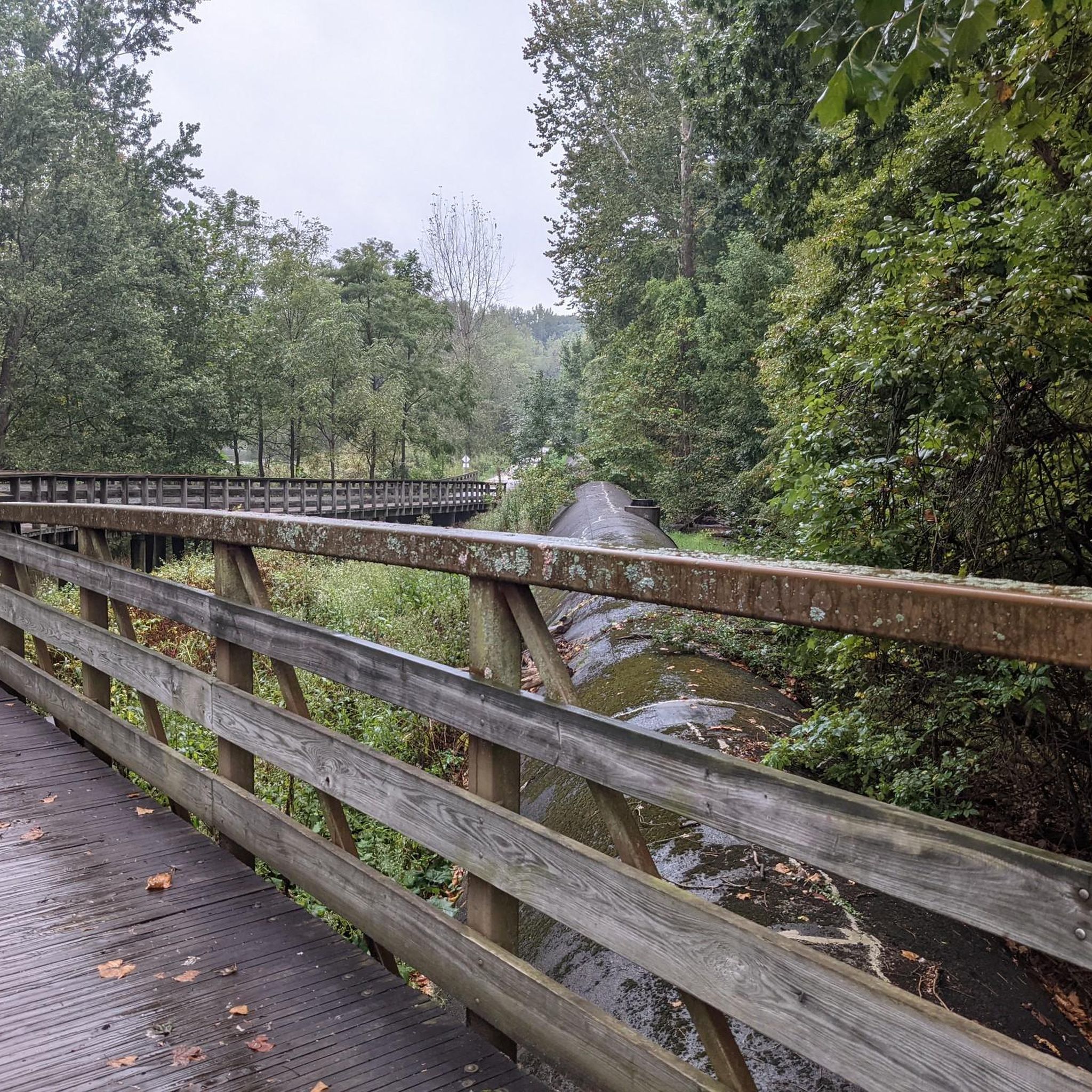
The Ohio & Erie Canal Towpath Trail, spanning over 90 miles as of 2022, is set to reach 101 miles upon completion. Stretching from Canal Basin Park in Cleveland to Canal Lands Park in New Philadelphia, Ohio, this trail traces the historic path where mules once pulled canal boats between 1827 and 1913. Today, the trail aligns with the historic towpath as closely as possible, guided by old maps and remaining traces. Visitor centers along the route offer insights into the cultural, historic, natural, and recreational significance of the trail. This section of the trail is compacted dirt. Although the ride is comfortable, use caution when wet.
0
0

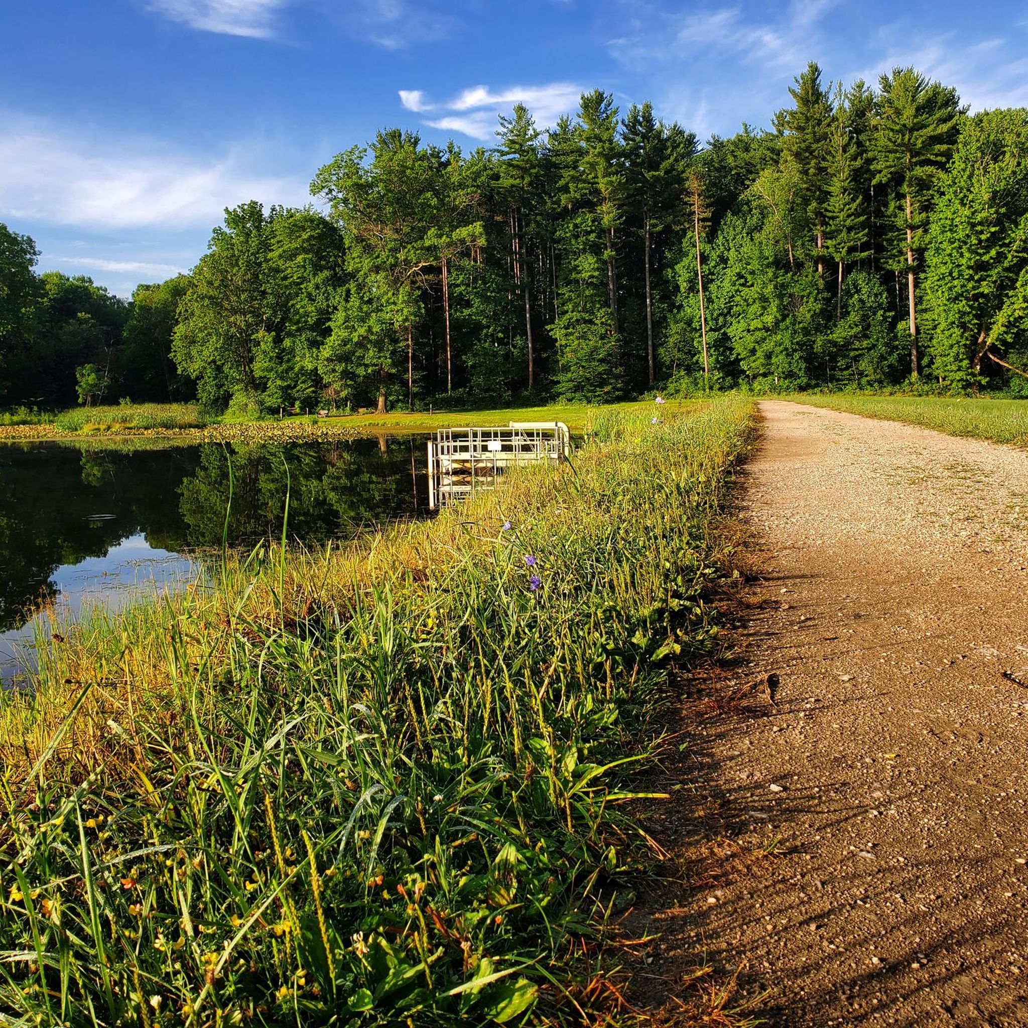
This park gets its name from the historic canal lock located here, the fourth lock south of Summit County. It features picnic tables, grills, a fishing dock, and restrooms, making it a great spot for a break.
0
0
great stop along the trail. Refreshments, flush facilities, water
0
0
Frequently Asked Questions
What kind of terrain can I expect on road cycling routes around Montrose-Ghent?
Road cycling around Montrose-Ghent offers a mix of terrain. The Ohio & Erie Canal Towpath Trail is mostly flat and accessible, with sections of paved and hard-packed crushed limestone. Other routes in the broader Cuyahoga Valley area, such as the High Point loop, feature varied terrain and significant elevation gain, catering to more experienced riders.
Are there any family-friendly road cycling routes in the Montrose-Ghent area?
Yes, the Montrose-Ghent area is well-suited for family-friendly road cycling, especially along the Ohio & Erie Canal Towpath Trail. This trail offers mostly flat and accessible paths, ideal for all ages. Additionally, the paved Bike & Hike Trail provides another excellent option for a smooth, enjoyable ride with diverse landscapes.
What natural features and landmarks can I see while cycling around Montrose-Ghent?
Cyclists can enjoy a variety of natural features and landmarks. The routes often pass through Cuyahoga Valley National Park, offering woodlands and wetlands. Notable attractions include the Ledges Overlook for scenic views, the thriving wildlife sanctuary of Beaver Marsh, and the Cuyahoga River Bridge. You might also encounter impressive features like Brandywine Falls and the Sharon Conglomerate rock walls of the Boston Ledges along the Bike & Hike Trail.
Are there any circular road cycling routes available?
Yes, there are several circular road cycling routes. For example, the Cuyahoga Valley loop is a popular 30-mile route that showcases the national park's diverse natural features. Another option is the Szalay's Farm & Market – Cuyahoga River Bridge loop from Summit Mall, which leads through scenic areas near the Cuyahoga River.
Where can I park my car when accessing road cycling routes?
Many trailheads and access points for the Ohio & Erie Canal Towpath Trail and the Bike & Hike Trail offer parking facilities. For routes like the Szalay's Farm & Market – Cuyahoga River Bridge loop or the Beaver Marsh loop, you can often find parking near Summit Mall or other designated trail access points.
Is public transport available to reach the cycling trails?
Yes, the Cuyahoga Valley Scenic Railroad offers a seasonal 'Bike-Aboard' service, allowing cyclists to ride one way on the train and cycle the other way along the Ohio & Erie Canal Towpath Trail. This provides a convenient public transport option for accessing and exploring parts of the trail network.
What is the best time of year for road cycling in Montrose-Ghent?
The Montrose-Ghent area is enjoyable for road cycling across multiple seasons. Spring and fall offer pleasant temperatures and beautiful scenery, with changing foliage in autumn. Summer is also popular, though it can be warmer. Always check local weather forecasts before heading out.
Are there any cafes or markets along the cycling routes?
Yes, cyclists can find places to stop and refuel. Szalay's Farm & Market is a popular stop for cyclists, offering fresh food and seasonal activities. Many routes pass through or near towns where additional cafes and eateries can be found.
How many road cycling routes are there around Montrose-Ghent?
There are over 15 road cycling routes around Montrose-Ghent documented on komoot, offering a wide range of options for different skill levels and preferences. These routes provide access to extensive trail networks and scenic landscapes within Summit County.
What do other road cyclists enjoy most about cycling in Montrose-Ghent?
Road cyclists frequently praise the diverse trail networks and scenic landscapes, particularly the access to Cuyahoga Valley National Park. The variety of terrain, from the flat Ohio & Erie Canal Towpath Trail to routes with more elevation, is also highly appreciated, catering to both casual riders and those seeking a challenge.
Are there any routes suitable for advanced road cyclists seeking a challenge?
Yes, for experienced riders seeking more challenging terrain, routes like the High Point loop offer significant elevation gain and varied landscapes. While the Towpath Trail is generally flat, some routes in the broader Cuyahoga Valley area provide varying degrees of elevation, suitable for different fitness levels.
Can I bring my dog on the road cycling trails?
While road cycling itself isn't always ideal for dogs, many trails in the Montrose-Ghent area, such as the Ohio & Erie Canal Towpath Trail, permit leashed dogs. It's always best to check specific trail regulations for the section you plan to ride to ensure a safe and enjoyable experience for both you and your pet.
Most popular routes around Montrose-Ghent
Most popular attractions around Montrose-Ghent

Get inspired with the komoot mobile app


Explore more
Browse the best Road cycling routes in other regions.
