The best cycling routes around New Albany
4.8
(33)
192
riders
23
rides
Touring cycling routes around New Albany feature an extensive network of trails and rural roads, offering diverse landscapes for cyclists. The region is characterized by picturesque scenery, including farms, cornfields, and tree-lined forest roads. Cyclists can explore areas around Hoover Reservoir and along the Alum Creek corridor, which provide varied terrain from flat paths to routes with moderate elevation gains.
Best touring cycling routes around New Albany
- The most popular touring cycling route is Hoover Reservoir Park loop, a 12.5 miles (20.1 km) trail that takes 1 hour 10 minutes to complete. This easy route offers scenic views and opportunities for wildlife spotting.
- Another top favourite among local touring cyclists is Alum Creek – Char-Mar Ridge Park loop from Easton, a difficult 57.3 miles (92.2 km) path. This route connects to regional trail systems and follows a scenic river corridor.
- Local touring cyclists also love the Alum Creek Trail – Alum Creek loop from Westerville North High School, a 16.4 miles (26.4 km) trail leading through a scenic river corridor, often completed in about 1 hour 30 minutes.
- Touring cycling around New Albany is defined by extensive trail networks, rural roads, and natural features like Hoover Reservoir and Alum Creek. The network offers options for different ability levels, from easy loops to more challenging rides.
- The routes in New Albany are highly rated by the komoot community with an average score of 4.5 stars from over 20 reviews. More than 150 touring cyclists have used komoot to explore New Albany's varied terrain.
Last updated: June 28, 2026
2
riders
20.1km
01:11
110m
110m
Easy bike ride. Great for any fitness level. Mostly paved surfaces. Suitable for all skill levels.
5.0
(5)
31
riders
92.2km
05:15
250m
250m
Hard bike ride. Very good fitness required. Mostly paved surfaces. Suitable for all skill levels.

Sign up for free
5.0
(3)
22
riders
42.6km
02:30
130m
130m
Moderate bike ride. Good fitness required. Mostly paved surfaces. Suitable for all skill levels.
5.0
(3)
13
riders
22.7km
01:17
60m
60m
Easy bike ride. Great for any fitness level. Mostly paved surfaces. Suitable for all skill levels.
3.0
(2)
9
riders
Easy bike ride. Great for any fitness level. Mostly paved surfaces. Suitable for all skill levels.
Get access to more routes and recommendations from other explorers.
Sign up for free
Already have an account?
Our route recommendations are based on thousands of hikes, rides, and runs completed by other people on komoot.
Start today with a free account
Your next adventure awaits.
Login or Signup
Popular around New Albany


Tips from the Community

This almost 30-acre park has restrooms, picnic tables and grills, a playground, cornhole, outdoor fitness equipment and great trail access.
0
0
This used to be a railroad line — now it's four miles of pavement, nicely separated from the road and shaded by a line of trees.
0
0

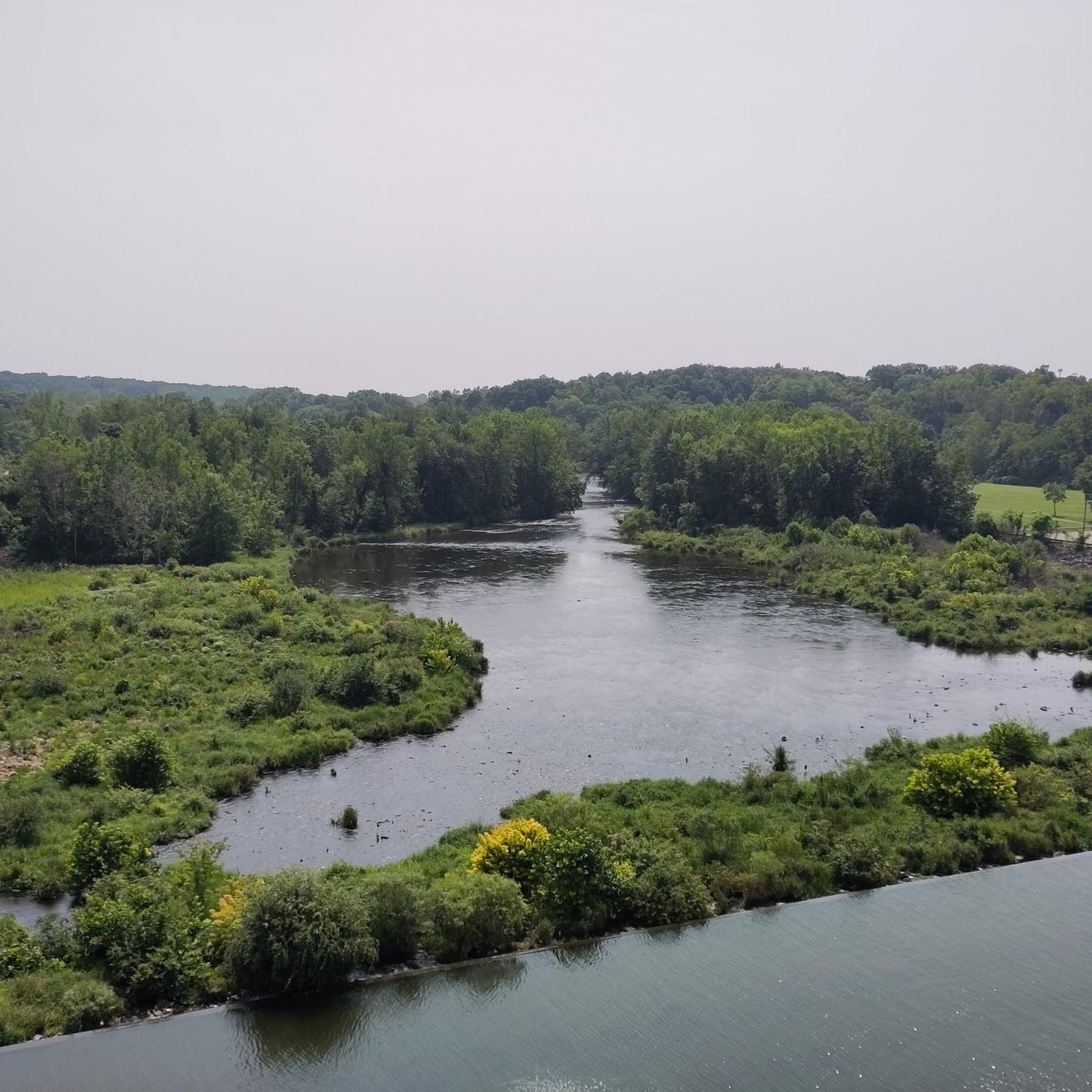
Here, you'll find a path along Big Walnut Creek, offering stunning views of the creek, the impressive Hoover Dam, and the reservoir as you make your way along the trail.
0
0

The Westerville Sports Complex is a spacious, family-friendly park featuring soccer fields, basketball courts, a playground, a shelter house, and paved multi-use paths. There is outdoor seating with views of the green space and 2 miles of paths encircling the complex, ideal for walking, running, or biking.
0
0
Alum Creek streches 58 miles until it drains into the Scioto River. The creek porvides drinking water source for Westerville, and historicly 2,000 years ago, the Adena built mounds along its valley, later inhabited by the Lenape tribe. During the War of 1812, locals built defensive blockhouses, such as Fort Cheshire, a vital role in the Underground Railroad, with the Sycamore Trail aiding escaped slaves. Today, Alum Creek flows through Alum Creek Lake, Westerville, and Columbus before joining Big Walnut Creek at Three Creeks Metro Park.
0
0
The Heart of Ohio Trail crosses US 36 about 2 miles northeast of Centerburg, where a monument marks the highest point on the trail at 1,285 feet—also the highest point along the entire Ohio to Erie Trail. The monument, shaped as an obelisk that marks this point, is about 5 feet high. This 15.7-mile trail starts in Mount Vernon and heads southwest through Mount Liberty and Centerburg, ending at Huffman Road. For much of its route, the trail runs parallel to US-36 between Mount Vernon and Sunbury.
0
0
Here, you'll find a path along Big Walnut Creek, offering stunning views of the creek, the impressive Hoover Dam, and the reservoir as you make your way along the trail.
0
0

Hoover Reservoir is a 2,052-acre reservoir and water source for the City of Columbus. The reservoir offers plenty of opportunities for boating, fishing, and birding.
0
0
Frequently Asked Questions
How many touring cycling routes are available around New Albany?
New Albany offers a wide variety of touring cycling routes, with over 20 options documented on komoot. These routes cater to all skill levels, including 18 easy, 3 moderate, and 1 difficult trail.
What kind of terrain can I expect on touring cycling routes in New Albany?
The touring cycling routes around New Albany feature diverse terrain. You'll find extensive trail networks and rural roads, with many routes featuring mostly paved surfaces. Cyclists can transition from urban areas into picturesque rural landscapes with farms and cornfields, as well as tree-lined forest roads offering shaded canopies. Options range from flat paths to routes with moderate elevation gains.
Are there any easy, family-friendly touring cycling routes in New Albany?
Yes, New Albany has many easy routes suitable for families. For example, the Hoover Reservoir Park loop is an easy 12.5-mile (20.1 km) trail that offers scenic views and opportunities for wildlife spotting. Another easy option is the Alum Creek Trail – Alum Creek loop from Westerville North High School, which is 16.4 miles (26.4 km) and leads through a scenic river corridor.
What are some scenic viewpoints or natural features to look out for on New Albany's cycling paths?
New Albany's cycling routes offer several scenic highlights. You can enjoy the expansive Hoover Reservoir Park, known for wildlife spotting, including American Bald Eagles. The Alum Creek corridor provides a scenic river experience. Rural roads often feature picturesque farms, cornfields, and tree-lined sections, where you might spot hawks and eagles overhead.
Are there any challenging routes for experienced touring cyclists?
Yes, for experienced touring cyclists seeking a challenge, the Alum Creek – Char-Mar Ridge Park loop from Easton is a difficult 57.3-mile (92.2 km) path. This route connects to regional trail systems and follows a scenic river corridor, offering a more demanding ride.
What do other touring cyclists say about the routes in New Albany?
The touring cycling routes in New Albany are highly regarded by the komoot community, holding an average rating of 4.5 stars from over 20 reviews. Cyclists often praise the extensive trail networks, the variety of landscapes from rural farms to shaded forest roads, and the opportunities for wildlife viewing.
Are there any circular touring cycling routes in the New Albany area?
Yes, many of the touring cycling routes around New Albany are designed as loops. A popular example is the Hoover Reservoir Park loop, which offers a complete circuit for cyclists. Another is the Hoover Reservoir Park – Big Walnut Creek Path loop from Blendon Township, providing another circular option.
What parks or attractions are near the touring cycling routes in New Albany?
Beyond the cycling routes themselves, New Albany offers several parks and attractions. You can explore Hoover Reservoir Park, which is great for wildlife spotting. The Alum Creek Trail and Big Walnut Creek Path are also popular. Other nearby parks include Bevelhymer Park, New Albany Wetland and Nature Preserve, Rose Run Streamside Park, and Rocky Fork Metro Park, many of which feature their own walking or multi-use trails.
Is New Albany a good destination for cycling events or group rides?
New Albany is recognized as a central point for cycling, hosting numerous cycling clubs and events. Initiatives like the "Bike New Albany" plan actively promote cycling, and the city is part of the planned US Bike Route 50. Local clubs, such as The Cycling Club, offer diverse weekly group rides, fostering a strong cycling community.
What is the best time of year to go touring cycling in New Albany?
While specific seasonal recommendations are not provided, the diverse landscapes of New Albany, including tree-lined forest roads and open fields, suggest that spring and autumn would offer pleasant temperatures and beautiful scenery. Summer can also be enjoyable, especially on shaded routes, while winter conditions would depend on snow and ice.
Are there any routes that connect to larger regional trail systems?
Yes, New Albany's cycling infrastructure is designed to connect to regional trail systems. The Alum Creek – Char-Mar Ridge Park loop from Easton is an example of a route that connects to these broader networks, and the city is also part of the planned US Bike Route 50, which will further enhance regional connectivity.
Can I find routes that offer a mix of urban and rural scenery?
Absolutely. Many routes in New Albany allow cyclists to easily transition from the city into rural areas. You can start in a more developed area and quickly find yourself amidst farms, cornfields, and tree-lined roads, offering a varied and engaging touring cycling experience.
Most popular routes around New Albany
Most popular attractions around New Albany

Get inspired with the komoot mobile app


Explore more
Browse the best Cycling routes in other regions.
