The best walks and hikes around Hoopers Creek
4.8
(7)
247
hikers
15
hikes
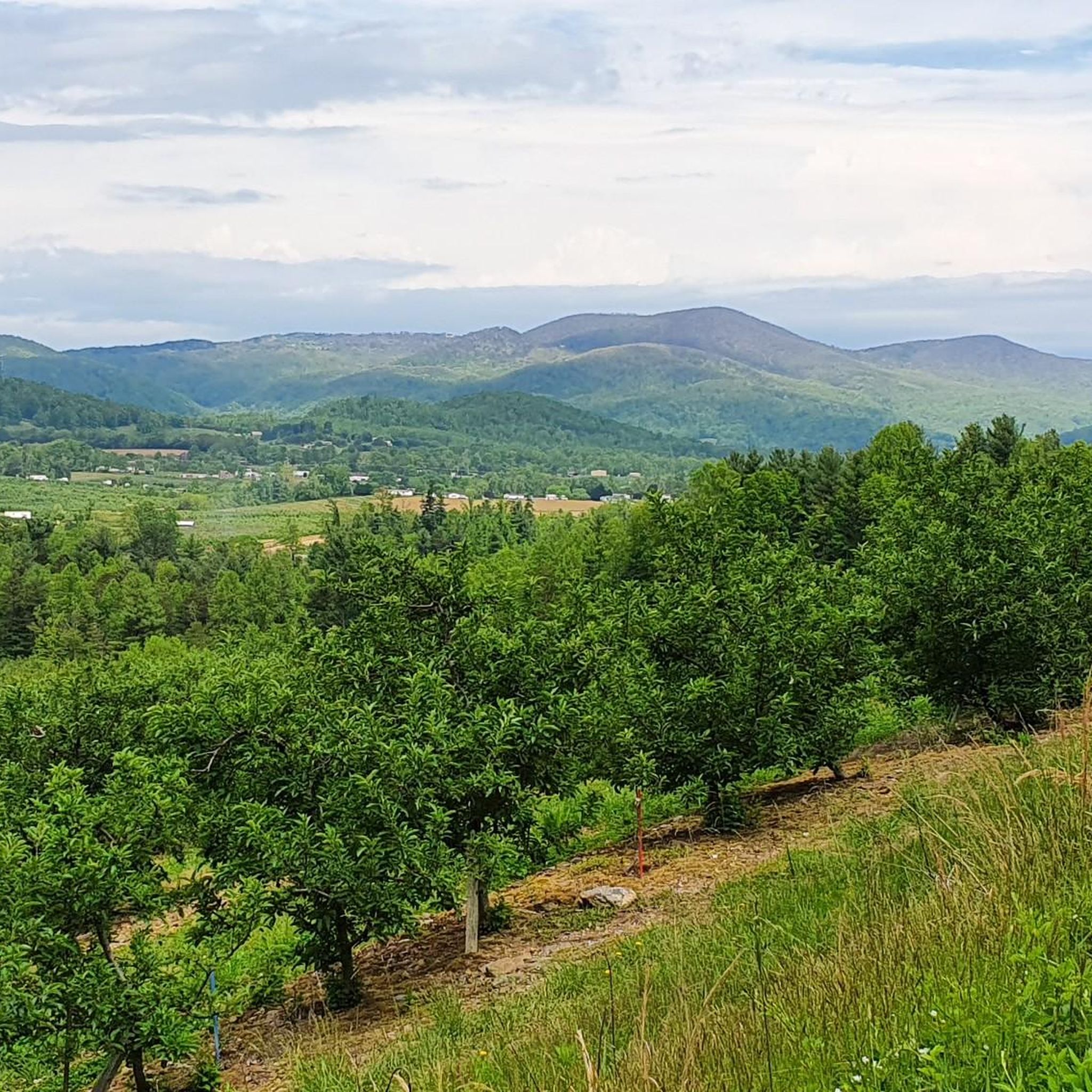
Hiking around Hoopers Creek, North Carolina, is characterized by its setting within the Blue Ridge Mountains, offering a diverse landscape for outdoor enthusiasts. The region features forested ascents, open mountain balds, and serene pastoral valleys. This varied terrain provides a range of hiking experiences, from gentle routes through pastures to more strenuous climbs into the surrounding forests.
Best hiking trails around Hoopers Creek
- The most popular hiking route is Bearwallow Mountain Loop Trail, a 2.1 miles (3.4 km) trail that takes 1 hour 7 minutes to complete. This easy hike leads to a grassy, open summit with panoramic views.
- Another top favourite among local hikers is Strawberry Gap Trail, a moderate 4.9 miles (7.8 km) path. The route involves a steady ascent through the forest to a scenic overlook.
- Local hikers also love the Trombatore Trail, a 5.1 miles (8.2 km) trail leading through forested terrain, often completed in about 2 hours 32 minutes.
- Hiking around Hoopers Creek is defined by forested ascents, open mountain balds, and pastoral valley scenery. The trail network provides options for both easy walks and more moderate hikes with significant elevation gain.
- The routes in Hoopers Creek are highly rated by the komoot community with an average score of 4.8 stars from over 7 reviews. More than 200 hikers have used komoot to explore Hoopers Creek's varied terrain.
Last updated: June 28, 2026
19
hikers
3.85km
00:58
10m
10m
The Fletcher Park Trail offers a delightful, easy escape into nature, perfect for a relaxed afternoon. You'll wander through a varied landscape, from peaceful, shady tree canopies to open areas with views of Cane Creek and Hoopers Creek. The trail also features a charming arboretum garden and a serene pond, providing a pleasant mix of natural and cultivated scenery over its 2.4 miles (3.8 km) length. With only 18 feet (5 metres) of elevation gain, it's a genuinely accessible route for everyone.
Planning your visit to Fletcher Park is straightforward, with ample parking available at Fletcher Community Park. The park is well-equipped with amenities like restrooms and picnic areas, making it a great spot for families. However, be aware that due to past hurricane damage, the Cane Creek bridge is currently impassable, and some outer greenway trails are closed; always check for current conditions and respect any posted closures.
This easy, 58-minute hike is consistently rated as suitable for all skill levels, including families with children and those with leashed pets. It's a fantastic option if you're looking for a gentle introduction to hiking or simply a tranquil walk without the challenge of significant climbs, offering a refreshing outdoor experience in a convenient park setting.
2
hikers
1.86km
00:39
170m
0m
The Bearwallow Mountain Trail offers a delightful journey through shaded woodlands before opening up to a vast, grassy summit. You'll navigate well-built rock steps and switchbacks on your way up, with the option to descend via a gravel service road for a slightly different experience. The real magic happens at the top, where nearly 360-degree views stretch across the Hickory Nut Gorge, revealing distant peaks like Mount Mitchell and Mount Pisgah, often shared with grazing cattle.
This easy 1.2-mile (1.9 km) hike involves a steady 573 feet (175 metres) of elevation gain, typically taking around 39 minutes to reach the top. It's a popular choice for families and dog owners, though dogs must be leashed due to the free-roaming cows. The trail is located about 19 miles from Asheville, making it a convenient and rewarding outing for a quick dose of mountain air and stunning scenery.
Bearwallow Mountain is part of a working farm, giving it a unique character with its friendly, free-range cows. The mountain is also protected by Conserving Carolina, ensuring its natural beauty and public access for years to come. It connects to the larger Hickory Nut Gorge State Trail System, including trails like the Trombatore Trail, offering options for longer hiking adventures if you're looking to explore further.

Sign up for free
4.5
(2)
64
hikers
3.36km
01:07
170m
170m
The Bearwallow Mountain Loop Trail offers a delightful journey through varied terrain to a spectacular summit. You can choose between a woodland path with switchbacks and rock steps or a more gradual gravel road, both leading to an open, grassy meadow at the top. Here, you'll be treated to nearly 360-degree panoramic views, often shared with grazing cows, stretching from Mount Mitchell to the Great Smoky Mountains.
This easy 2.1-mile (3.4 km) hike involves 559 feet (170 metres) of elevation gain and typically takes about 1 hour and 6 minutes. Be sure to check for current road closures, as storm damage has affected access, particularly from Gerton. It's currently recommended to approach the trailhead from the Edneyville side of Bearwallow Mountain.
Bearwallow Mountain is a unique destination, sitting on privately-owned land that functions as a working farm while generously allowing public access. It also serves as the initial segment of the developing Upper Hickory Nut Gorge Trail, connecting to other routes like the Trombatore Trail for those seeking longer adventures.
4.5
(2)
24
hikers
7.82km
02:28
320m
320m
Hike the moderate Strawberry Gap Trail for 4.9 miles (7.8 km) through boulder-strewn forests to panoramic views at Blue Ridge Pastures.
5.0
(2)
23
hikers
8.23km
02:32
310m
310m
Hike the moderate Trombatore Trail for 5.1 miles (8.2 km) through varied terrain to Blue Ridge Pastures, offering 360-degree views.
Get access to more routes and recommendations from other explorers.
Sign up for free
Already have an account?
Our route recommendations are based on thousands of hikes, rides, and runs completed by other people on komoot.
Start today with a free account
Your next adventure awaits.
Login or Signup
Popular around Hoopers Creek


Frequently Asked Questions
Are the hiking trails near Hoopers Creek dog-friendly?
Yes, many trails in the Hoopers Creek area are suitable for hiking with dogs, provided they are kept on a leash. The region's mix of forested paths and open spaces offers great variety for you and your canine companion. Always check specific regulations for nature preserves before you go.
What are some good easy hikes for families in the area?
The area is well-suited for family outings, with several accessible trails. A great choice is the Bearwallow Mountain Trail loop. It's a relatively short hike leading to a wide, grassy summit with plenty of space for kids to run around and enjoy the panoramic views. It's an excellent spot for a family picnic.
Are there any trails with waterfalls near Hoopers Creek?
While the immediate Hoopers Creek valley is known more for its pastoral scenery and mountain vistas, the broader region is rich with waterfalls. For some of the best waterfall hikes, you may need to venture a short drive into areas like the nearby Pisgah National Forest, which is famous for its numerous cascades.
What is the best time of year to hike around Hoopers Creek?
Hiking is popular year-round, but spring and fall are particularly spectacular. Spring brings blooming wildflowers, while autumn offers brilliant fall foliage against the backdrop of the Blue Ridge Mountains. Summer is also beautiful, though it can be warm and humid. Winter hikes can be rewarding on clear, crisp days, but be sure to check for icy conditions on the trails.
Where can I find the best scenic viewpoints on a hike?
For a stunning perspective of the surrounding landscape, the hike to Wildcat Rock Overlook is an excellent option. This trail leads you to a prominent rock outcrop that provides expansive views over the Hickory Nut Gorge and the rolling hills below.
Are there any circular walks available?
Yes, you can find several loop trails. For a rewarding circular route through a protected area, consider the Florence Nature Preserve & Rattlesnake Knob loop. This trail offers a varied experience, taking you through diverse forest environments within the preserve.
How should I prepare for hiking in Hoopers Creek?
Trails in this area often involve ascents into the mountains, so sturdy footwear with good grip is essential. Weather can change quickly, so dressing in layers and carrying a waterproof jacket is wise. Always bring enough water and some snacks, especially for longer routes. A downloaded map on your phone is also recommended as cell service can be unreliable in the valleys.
What are some popular places for hiking near Hoopers Creek?
The area is full of highly-regarded hiking destinations. Key spots include:
- Bearwallow Mountain Trail: A local favorite known for its accessible path and incredible 360-degree summit views.
- Pisgah National Forest: A vast and popular forest offering countless trails, from riverside walks to challenging mountain climbs.
- Strawberry Gap Trailhead: The starting point for a well-maintained trail leading to a beautiful scenic overlook, praised by hikers for its rewarding views.
What is the terrain like on the trails around Hoopers Creek?
The terrain is quite varied. You'll find gentle paths through pastoral valleys and rolling hills, as well as more strenuous trails that climb steeply through dense forests. Many routes feature a combination of dirt paths, rocky sections, and tree roots. Some trails, like the Trombatore Trail, require good fitness to manage the steady ascent to the summit.
How does hiking in Hoopers Creek compare to DuPont State Forest?
Hoopers Creek offers a more intimate, pastoral hiking experience focused on rolling hills and mountain balds with panoramic views. The trails here often feel quieter. DuPont State Forest, while also immensely popular, is best known for its spectacular waterfalls and wider, more accessible trail network, which can attract larger crowds.
Is there parking available at the trailheads?
Most popular trailheads, such as the Strawberry Gap Trailhead and the access point for Bearwallow Mountain, have designated parking areas. However, these lots can fill up quickly, especially on weekends and holidays. It's always a good idea to arrive early to secure a spot.
Most popular routes around Hoopers Creek

Get inspired with the komoot mobile app


Explore more
Browse the best Hikes in other regions.
