The best road cycling routes around Weaverville
4.9
(36)
1,476
riders
53
rides
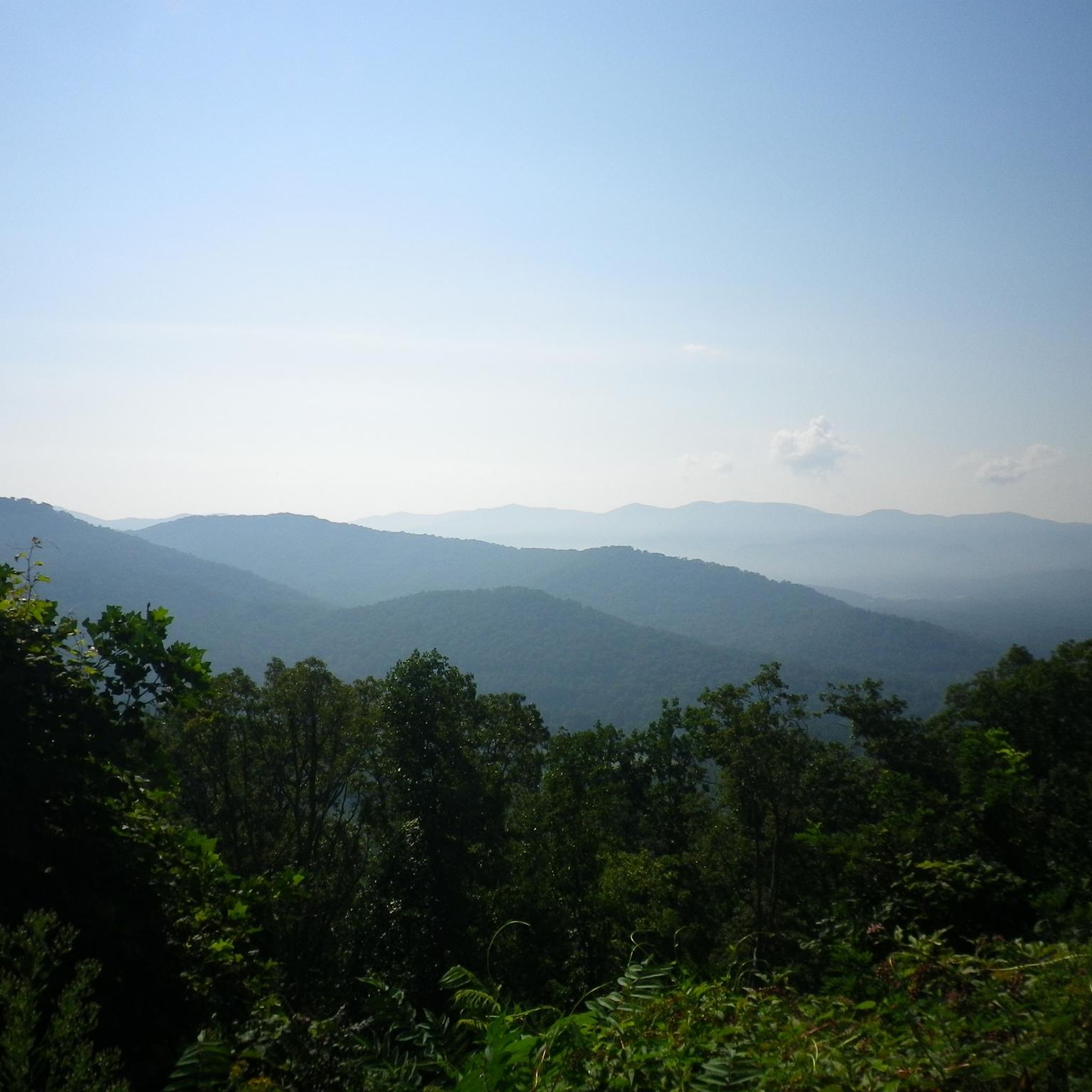
Road cycling around Weaverville features a diverse landscape characterized by rolling hills, mountain passes, and scenic overlooks. The region offers routes that navigate through forested areas and along ridge lines, providing varied terrain for cyclists. Elevation changes are common, with many routes including significant climbs and descents. Weaverville is situated within the Blue Ridge Mountains, offering panoramic views and varied terrain.
Best road cycling routes in Weaverville
- The most popular road cycling route is Craven Gap – Tanbark Ridge Overlook loop from Park and Ride, a 39.3 miles (63.2 km) trail that takes 3 hours 27 minutes to complete, featuring steady climbs to scenic viewpoints.
- Another top favourite among local road cyclists is Lake Louise Park Waterfall – Marshall Nature Sanctuary loop from Park and Ride, a moderate 49.4 miles (79.5 km) path. This route leads through a mix of natural landscapes and park areas.
- Local road cyclists also love the Roadbike loop from Ledges Whitewater Park, a 27.7 miles (44.5 km) trail leading through varied terrain, often completed in about 2 hours 15 minutes.
- Road cycling around Weaverville is defined by mountain passes, ridge overlooks, and forested roads. The network offers options for different ability levels, from moderate loops to challenging long-distance routes.
- The routes in Weaverville are highly rated by the komoot community with an average score of 5.0 stars from over 15 reviews. More than 1,100 road cyclists have used komoot to explore Weaverville's varied terrain.
Last updated: October 12, 2026
127
riders
45.4km
02:29
820m
820m
Moderate road ride. Good fitness required. Mostly well-paved surfaces and easy to ride.
101
riders
73.2km
04:13
1,530m
1,530m
Hard road ride. Very good fitness required. Some segments of this route may be unpaved and difficult to ride.

4.4
(8)
90
riders
42.5km
02:38
370m
370m
Moderate road ride. Good fitness required. Mostly well-paved surfaces and easy to ride.
5.0
(1)
44
riders
Moderate road ride. Good fitness required. Some segments of this route may be unpaved and difficult to ride.
41
riders
124km
06:46
2,120m
2,120m
Hard road ride. Very good fitness required. Mostly well-paved surfaces and easy to ride.
Get access to more routes and recommendations from other explorers.
Already have an account?
Our route recommendations are based on thousands of hikes, rides, and runs completed by other people on komoot.
Start today with a free account
Your next adventure awaits.
Popular around Weaverville


Tips from the Community

Located at the confluence of Hominy Creek and the French Broad River, this park offers a wide range of recreation opportunities. For runners, it has access to the western stretch of the French Broad River Greenway, an excellent path to log a few miles with the river at your side.
0
0

There is a pretty great view of Elk Mountain from here. The entirety of Elk Mountain Scenic Highway has pretty good views, and it's much less trafficked with motorists compared to the Blue Ridge Parkway.
0
0

Asheville, located at the confluence of the French Broad and Swannanoa rivers, is the largest city in Western North Carolina. Surrounded by the Blue Ridge Mountains, this charming city blends urban living with a rural atmosphere, featuring historic architecture, a vibrant art scene, and a dynamic food culture. With a population of under 100,000, Asheville offers 11 farmers' markets, renowned cheese makers, and more than 50 breweries.
1
0

This is the famous "Helen's Bridge." There are local legends involving ghosts that surround this bridge.
0
0

Pleasant city for an afternoon.
1
0
Located at the confluence of Hominy Creek and the French Broad River, Hominy Creek River Park offers a load of boating, watersport, and riverside lounging opportunities. This is pretty much the main launch/exit site for the majority of boating trips on this section of the French Broad. There are vendors in Asheville who can help with your boating and rental needs.
0
0
The bike path along the French Broad River is entirely paved and is a perfect spot for a bike ride. You can ride out and back on the greenbelt, or you can use the path to connect different roads and routes around town. You pass through a bunch of parks along the course of the bike path.
0
0
Carrier Park offers a lot of amenities to the public. There is lots of parking, bathrooms, picnic areas, basketball courts, a playground, and many other features. You can access the water and the French Broad River Greenway from the park. This is usually a pretty busy area for those who like to be outdoors.
0
0
Frequently Asked Questions
How many road cycling routes are available around Weaverville?
Weaverville offers a wide selection of road cycling routes, with over 40 routes available for exploration. These routes cater to various skill levels, from moderate loops to challenging long-distance rides.
Are there road cycling routes suitable for beginners or those looking for an easier ride?
Yes, while many routes feature significant elevation changes, there are options for less experienced riders. The region includes routes with moderate difficulty, allowing beginners to enjoy the scenic landscape without overly strenuous climbs. For example, the Craven Gap – Tanbark Ridge Overlook loop from Silver Line Station is a moderate 28.2-mile route with steady climbs to scenic viewpoints.
What are the most challenging road cycling routes in Weaverville?
For experienced cyclists seeking a challenge, Weaverville offers several difficult routes with substantial elevation gain. The Helen's Bridge – Craven Gap loop from Silver Line Station is a difficult 45.5-mile path with challenging ascents and descents. Another demanding option is the Dryman Mountain – Marshall Nature Sanctuary loop from Silver Line Station, which spans nearly 80 miles and features over 7,400 feet of climbing.
Are there any scenic viewpoints or attractions along the road cycling routes?
Absolutely. The routes often lead to stunning overlooks and natural features. You can find scenic spots like Tanbark Ridge Overlook and Haw Creek Valley Overlook. Some routes also pass by natural landmarks such as the Lake Louise Park Waterfall, which is part of the Lake Louise Park Waterfall – Marshall Nature Sanctuary loop from Park and Ride.
What is the best time of year for road cycling in Weaverville?
Weaverville's diverse landscape, characterized by rolling hills and mountain passes, is generally enjoyable for road cycling during spring, summer, and fall. These seasons offer pleasant temperatures and vibrant scenery. While winter cycling is possible, conditions can vary, especially at higher elevations, so checking local weather forecasts is advisable.
Are there loop road cycling routes available in Weaverville?
Yes, many of Weaverville's road cycling routes are designed as loops, offering varied scenery without retracing your path. Examples include the popular Craven Gap – Tanbark Ridge Overlook loop from Silver Line Station and the Roadbike loop from Ledges Whitewater Park.
What kind of elevation gain can I expect on road cycling routes in Weaverville?
Road cycling in Weaverville is known for its significant elevation changes. Routes frequently include steady climbs and descents, navigating through forested areas and along ridge lines. Even moderate routes can feature over 2,000 feet of climbing, while difficult routes can exceed 7,000 feet of elevation gain.
Are there any historical sites or cultural points of interest accessible by road bike?
Yes, some routes may pass near historical areas. For instance, the region includes highlights like the Chestnut Hill Historic District and Pack Square, offering glimpses into the area's heritage as you cycle.
What do other road cyclists say about the routes in Weaverville?
The road cycling routes in Weaverville are highly regarded by the komoot community, holding an average rating of 5.0 stars from numerous reviews. Cyclists frequently praise the diverse terrain, the challenge of the mountain passes, and the stunning ridge overlooks.
Are there options for long-distance road cycling in Weaverville?
Weaverville is well-suited for long-distance road cycling, with several routes extending over 40 miles. The Lake Louise Park Waterfall – Marshall Nature Sanctuary loop from Park and Ride is nearly 50 miles long, and the Dryman Mountain – Marshall Nature Sanctuary loop from Silver Line Station offers an even longer ride at almost 80 miles.
Are there any routes that feature waterfalls?
Yes, the Lake Louise Park Waterfall – Marshall Nature Sanctuary loop from Park and Ride specifically highlights the Lake Louise Park Waterfall, providing a scenic natural attraction along your ride.
Most popular routes around Weaverville
Most popular attractions around Weaverville

Get inspired with the komoot mobile app


Explore more
Browse the best Road cycling routes in other regions.
