The best walks and hikes around West Babylon
4.5
(13)
93
hikers
27
hikes
Hiking around West Babylon primarily features routes through an interconnected network of parks and nature preserves. The landscape is characterized by level paths connecting serene lakes, ponds, and woodlands, with some gentle elevation changes. Natural features include Belmont Lake, Southards Pond, and the hill of Jaynes Hill. This terrain offers a range of activities, from short walks to longer, continuous hikes.
Best hiking trails around West Babylon
- The most popular hiking route is Argyle Lake to Belmont Lake — Belmont Lake State Park, a 7.7 miles (12.3 km) trail that takes 3 hours 5 minutes to complete. This route connects multiple parks on a continuous path.
- Another top favourite among local hikers is Home Trail, an easy 4.8 miles (7.7 km) path. This trail offers a varied experience through local parkland.
- Local hikers also love the Bethpage Bikeway, a 4.7 miles (7.6 km) trail leading through park systems and natural surroundings, often completed in about 1 hour 55 minutes.
- Hiking around West Babylon is defined by lakeside paths, flat woodland trails, and interconnected greenways. The network of routes provides options for hikers of different ability levels.
- The routes in West Babylon are highly rated by the komoot community with an average score of 4.5 stars from over 13 reviews. More than 90 hikers have used komoot to explore West Babylon's varied terrain.
Last updated: May 12, 2026
4.2
(5)
8
hikers
7.69km
01:57
10m
10m
Embark on the Home Trail for an easy hike through a natural, wooded environment, perfect for a relaxed outing. This route spans 4.8 miles (7.7 km) with a gentle elevation gain of just 41 feet (13 metres), making it accessible for most. You can expect to complete this pleasant journey in approximately 1 hour and 56 minutes, enjoying the serene atmosphere and the unpaved path as you go. Keep an eye out for the tranquil waters of Belmont Lake and Southards Pond, and the view of the waterfall at the Belmont Lake outlet.
Planning your visit to the Home Trail is straightforward, as it's located within Belmont Lake State Park. Parking is generally available at the park, providing a convenient starting point for your adventure. This easy route is an excellent option for family-friendly hikes, offering a peaceful escape without requiring extensive preparation. Consider visiting during off-peak hours to fully appreciate the quiet natural surroundings.
The Home Trail offers a wonderful opportunity to connect with nature in a local state park setting. It's designed for those seeking a gentle introduction to hiking or a leisurely stroll amidst trees and water features. The trail's easy difficulty and minimal elevation make it a standout choice for beginners or anyone looking for a refreshing outdoor experience without a strenuous challenge. It provides a lovely glimpse into the natural beauty of the area, making it a notable option for a quick escape.
2
hikers
7.60km
01:57
40m
20m
Embark on an easy hike along the Bethpage Bikeway, a 4.7-mile (7.6 km) route that offers a gentle 128 feet (39 metres) of elevation gain. You can expect to complete this pleasant journey in about 1 hour and 56 minutes. The paved path winds through diverse scenery, including the tranquil Massapequa Preserve where you will find tree-lined sections, serene lakes, and marshland. Keep an eye out for ducks and swans enjoying the Massapequa Creek as you pass by.
The Bethpage Bikeway is generally accessible and easy to navigate, with clear mile markers guiding your way. Road crossings are typically well-marked, often featuring traffic signals or flashing lights for your safety. For your convenience, restrooms and water fountains are available in certain areas, including the picnic area within Bethpage State Park and near the Massapequa Preserve.
This route offers a unique blend of natural beauty and historical glimpses. While enjoying the natural settings, you will also encounter remnants of the past, such as a banked turn from the historic Vanderbilt Motor Parkway near Bethpage State Park. The trail's varied landscape provides a refreshing outdoor experience, combining natural elements with touches of local history.

Sign up for free
1
hikers
2.36km
00:36
0m
0m
Hike the easy 1.5-mile Belmont Lake State Park Loop, gaining 10 feet in 35 minutes, with scenic lake views and a waterfall.
5.48km
01:23
0m
10m
Embark on an easy hike along the Massapequa Lake Trail, a 3.4-mile (5.5 km) route that offers a refreshing escape. You will follow a predominantly paved and flat path, enjoying views of the Massapequa Reservoir and Massapequa Creek. This trail involves a minimal elevation gain of just 11 feet (3 metres), making it accessible for nearly everyone. Plan for a relaxed walk that takes about 1 hour and 22 minutes to complete, winding through woodlands and freshwater wetlands.
This trail is easily accessible and suitable for all levels, including families with strollers and wheelchair users. Parking is generally available near the trailhead, making your visit convenient. Dogs are welcome to join you on your adventure, but please remember to keep them on a leash. You will not need any special permits or have to pay fees to enjoy this popular route.
Located within the Massapequa Preserve, the route provides a natural setting that feels far removed from the surrounding suburban areas. As you hike, keep an eye out for local wildlife such as birds, squirrels, and rabbits. The area is also known for its waterfowl, often seen on the reservoir, and if you time your visit right, you might catch a beautiful sunset over the lake.
5.14km
01:19
20m
10m
Explore the Bethpage Red Trail, an easy hiking route that guides you through a pleasant mix of dense woodlands and open fields. This 3.2-mile (5.1 km) path offers a gentle experience, with some sections featuring unpaved woodland trails and exposed roots, while others are paved multi-use areas. You will encounter gentle rolling hills throughout the journey, gaining 74 feet (22 metres) in elevation over an estimated 1 hour and 18 minutes. The varied terrain provides a refreshing natural escape, perfect for a relaxed outing.
When planning your visit, you will find the Bethpage Red Trail accessible throughout the entire year, allowing for hiking in any season. If you wish to bring your dog along, they are welcome to join you on the trail, but remember to keep them on a leash at all times and clean up after them. This ensures a pleasant experience for everyone enjoying the park. Consider starting your hike earlier in the day to fully appreciate the tranquility of the surroundings.
Located within the expansive Bethpage State Park, the Red Trail stands out as an accessible option for those seeking a straightforward outdoor adventure. It provides a wonderful opportunity to immerse yourself in nature without requiring extensive preparation or advanced hiking skills. The trail's design makes it suitable for various fitness levels, offering a peaceful environment away from the city bustle. This route is a great choice for a quick nature break or a leisurely stroll.
Get access to more routes and recommendations from other explorers.
Sign up for free
Already have an account?
Our route recommendations are based on thousands of hikes, rides, and runs completed by other people on komoot.
Start today with a free account
Your next adventure awaits.
Login or Signup

Tips from the Community

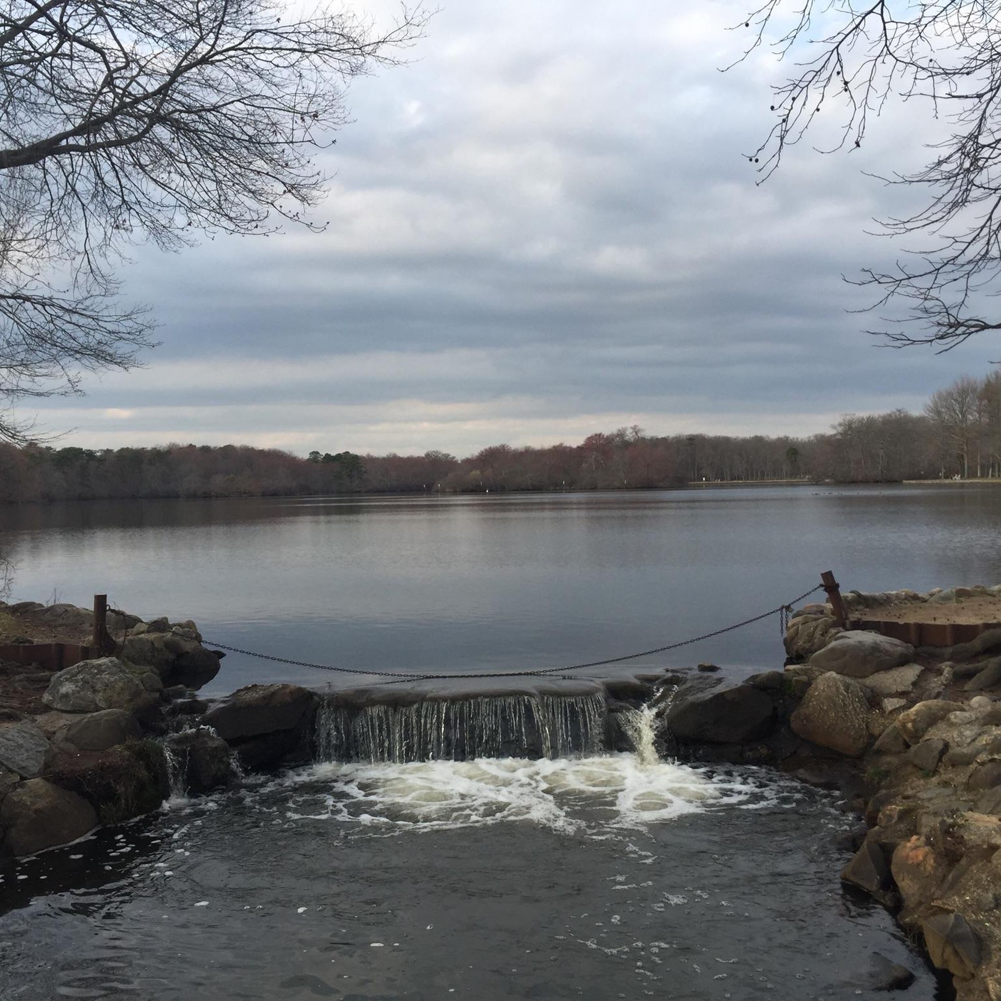
From this spot you get a nice view of a small waterfall flowing out of Belmont Lake into Carl's River. This is a pleasant spot to pause as you ride around Belmont Lake State Park and the surrounding area.
0
0

Bethpage State Park is home to 5 world-class golf courses, some of which have hosted the likes of the PGA Championship and the U.S. Open Championship.
0
0

Belmont Lake State Park and the path running through it makes a perfect spot to cycle through off of the road and enjoy the green scenery. With the Carlis River running through it, there is plenty to see along the way.
0
0

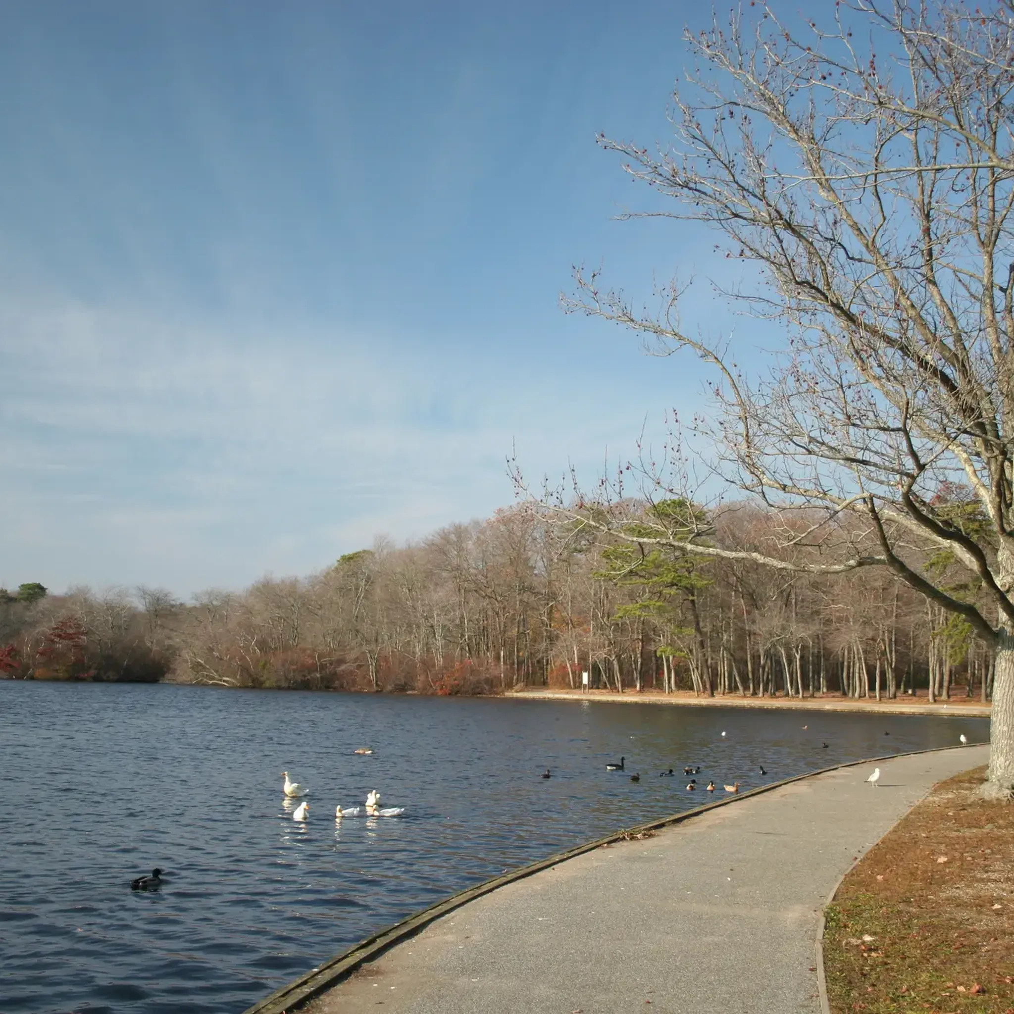
Southards Pond Park is a popular spot for easy hiking in Babylon, New York. There is a dirt hiking loop that circles the Southards Pond (the centerpiece of the park) and a couple other paths that follow the Carlls River south.
0
0

If you are looking for a scenic and relaxing trail run, you might want to check out Southards Pond Park in Babylon, New York. This park features a 1.4-mile loop trail that circles around a large pond, where you can enjoy the views of the water and the wildlife. The trail is mostly flat and easy, with some dirt footpaths and wooden bridges. You can access the trail from many points around the pond, but the south shoreline offers the easiest access. The park is open from dawn to dusk. Southards Pond Park is a great place to enjoy nature and get some fresh air while running.
0
0
The area where Belmont Lake funnels back into the Carlls River at the southern end of the reservoir is a popular viewing spot of the water. There is a bridge crossing the creek with a head-on view of the small cascade formed by the lake flowing into the tight waterway.
0
0
Belmont Lake is fed by the Carlls River and features a few tiny islands in the middle of the reservoir. There are docks, benches, picnic tables, and a small pier on the east side of the water. The dam on the south side of the lake is another popular hiking destination.
0
0

This place is a highly popular fishing spot, regularly stocked with trout, drawing a considerable crowd on weekends. The area is rich in wildlife, with various species such as birds, squirrels, chipmunks, snakes, raccoons, and rabbits. It also serves as a peaceful retreat for those looking to relax and enjoy the natural surroundings.
0
0
Frequently Asked Questions
How many hiking trails are there around West Babylon?
There are nearly 20 hiking trails to explore around West Babylon. The majority of these are easy routes, perfect for a casual day out, with a few moderately challenging options for those seeking a bit more of a workout.
Are there any dog-friendly hiking trails in the area?
Yes, many parks in and around West Babylon welcome dogs, but they must be kept on a leash. The interconnected trail system through Southards Pond Park and Belmont Lake State Park is a popular choice for dog walkers, offering plenty of space and varied scenery.
What are the best parks for hiking near West Babylon?
West Babylon is surrounded by excellent parks for hiking. Belmont Lake State Park is a local favorite, known for its lakeside paths and extensive facilities. Southards Pond Park is also highly regarded for its scenic beauty and firm trails that connect to other parks.
For a different landscape, consider visiting Connetquot River State Park Preserve, which is celebrated for its rare birds and plants along the river.
Can I find any easy, family-friendly hikes?
Absolutely. The area is well-suited for families. A great option is the Belmont Lake loop from Baywood. It's a relatively short and flat walk around the lake, with playgrounds and picnic areas nearby, making it ideal for a day out with children.
Are there any circular or loop trails available?
Yes, if you prefer a hike that starts and ends in the same place, the Massapequa Reservoir loop from North Massapequa is an excellent choice. This easy, flat trail circles the reservoir, offering consistent lakeside views throughout the walk.
What do other hikers enjoy about the trails around West Babylon?
The trails are highly rated by the komoot community. Hikers often praise the well-maintained, interconnected park system that allows for long, continuous walks through varied scenery, from serene lakesides at Southards Pond to the woodlands of Belmont Lake State Park.
Are there any paved trails suitable for strollers or wheelchairs?
Many of the main paths within the larger parks, such as Belmont Lake State Park, are paved and well-maintained, making them accessible for strollers and wheelchairs. The trail system connecting Argyle Lake, Southards Pond, and Belmont Lake also features long stretches of firm, flat paths suitable for a smooth ride.
Where can I find good spots for bird watching while hiking?
Southards Pond Park is a fantastic destination for birdwatchers, with recent sightings of ospreys and owls. For an even more dedicated experience, Connetquot River State Park Preserve is a 3,473-acre preserve known for housing rare birds and offering guided nature walks.
What is the terrain like on the trails?
The hiking terrain around West Babylon is generally flat and accessible. Most trails are level paths that wind through woodlands and along the shores of local ponds and lakes. You will find some gentle elevation changes on routes like the Jaynes Hill Loop — West Hills County Park, but the area is largely free of strenuous climbs.
How can I get to the trailheads and is there parking?
Most trailheads are located within state or county parks that have designated parking areas. Major parks like Belmont Lake State Park and West Hills County Park offer ample parking, though a vehicle fee may apply, especially during peak season. Some trail access points in smaller parks like Argyle Park may have limited street parking.
Can I go for a long-distance hike in this area?
Yes, the interconnected nature of the local parks makes longer hikes possible. The Argyle Lake to Belmont Lake route is a prime example, offering a continuous 7.7-mile (12.3 km) path that connects several scenic spots without needing to travel between trailheads.
Are there any unique landscapes to explore besides lakes and woods?
For a change of scenery from the typical lakeside trails, the Edgewood Oak Brush Plains Preserve loop offers a unique experience. This trail takes you through a rare type of habitat characterized by scrub oaks and grassy plains, providing a different perspective on Long Island's natural beauty.
Most popular attractions around West Babylon

Get inspired with the komoot mobile app


Explore more
Browse the best Hikes in other regions.
