The best walks and hikes around Myers Corner
4.6
(40)
586
hikers
25
hikes
Hiking around Myers Corner offers routes through the scenic Hudson Valley, characterized by rolling hills and significant waterways like Wappinger Creek and Wappinger Lake. The area features a network of trails connecting local parks and nature preserves, winding through a mix of woodlands, fields, and waterfront areas. Some routes provide views over the Hudson River, with terrain including ascents to hills overlooking the Hudson Valley.
Best hiking trails around Myers Corner
- The most popular hiking route is North & South…
Last updated: May 16, 2026
5.0
(2)
14
hikers
3.22km
01:17
370m
10m
Hike the challenging 2.0-mile Casino Trail in Mount Beacon, gaining 1202 feet of elevation in just over an hour for rewarding views.
7.19km
02:16
210m
400m
Embark on the Fishkill Ridge and Bald Hill Loop, a moderate hike that takes you through varied terrain within Hudson Highlands State Park Preserve. You will experience cool, green forests…

Sign up for free
1
hikers
3.19km
01:11
290m
20m
Embark on the Overlook Trail, an easy hike spanning 2.0 miles (3.2 km) with a notable elevation gain of 967 feet (295 metres). You can anticipate completing this route in…
1
hikers
2.92km
00:47
40m
40m
Hike the easy 1.8-mile Vassar Farm Loop through diverse ecosystems, spotting wildflowers and wildlife in the Vassar Farm and Ecological Pres
1
hikers
17.0km
04:40
280m
280m
Hike the 10.6-mile Wappinger Greenway Trail in Bowdoin Park, a moderate route with waterfront views and diverse scenery.
Get access to more routes and recommendations from other explorers.
Sign up for free
Already have an account?
Our route recommendations are based on thousands of hikes, rides, and runs completed by other people on komoot.
Start today with a free account
Your next adventure awaits.
Login or Signup
Popular around Myers Corner
Tips from the Community

If you're in New York and want to go hiking, this is the ideal place. Easily accessible by train, scenically beautiful, and interwoven with many trails of varying difficulty.
1
0

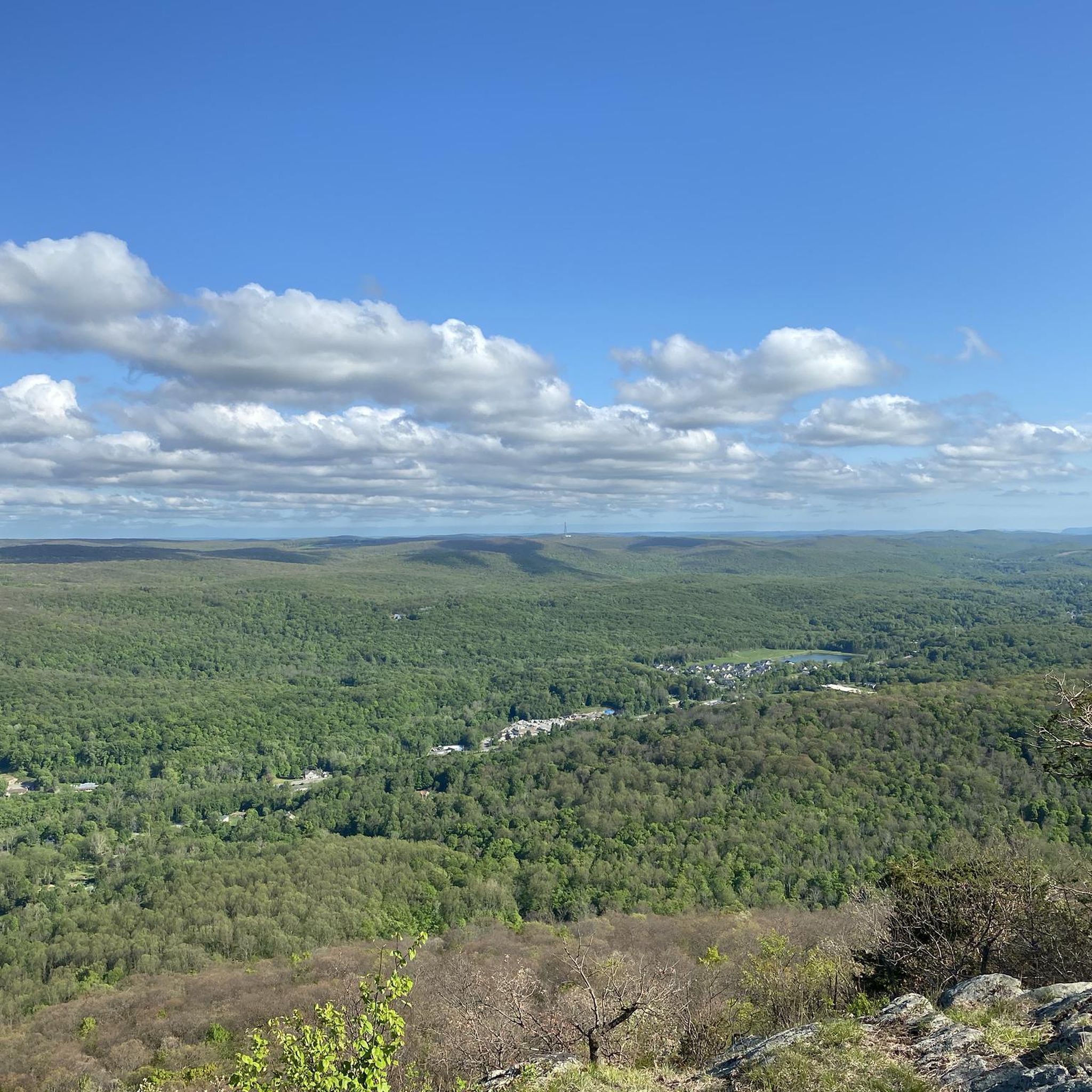
Mount Beacon Park, part of the Hudson Highlands State Park Preserve, is beautiful, with fantastic hiking trails and spectacular panoramic views. The park's trails, which range from moderate to challenging, lead to the summit of South Beacon Mountain, with a restored 60-foot fire tower, offering breathtaking vistas that stretch from the Manhattan skyline to the Catskill Mountains, especially on a clear day. The park is also home to the remnants of the historic Mount Beacon Incline Railway, once the world's steepest, and the foundations of an old casino and hotel, adding a unique historical dimension to the natural beauty of this area.
0
0
This junction, where the Blue Trail (an unnamed trail) intersects with the Fishkill Ridge Trail (White), gets its name for the abandoned bulldozer that sits here. It's a great point of reference, as the trail can be tricky to follow as it winds through this shady area of the forest.
0
0

View of the Newburgh Beacon Bridge over the Hudson River
0
0

From Bald Hill, you can enjoy great views of the surrounding hills. It's a very peaceful spot!
0
0
Only the outer walls of the cable car building have been preserved, the roof is completely missing. On the other hand, it is easy to get to the remains of the machines, which are quite well preserved. Two large electric motors where you can still see the wire windings, huge gears with a few teeth missing. I find it remarkable that the foundations are concreted, but the bases for the machinery were built from bricks on top of them. These bricks are likely to have had a rather poor quality, because they are almost completely weathered, which means that the complex has settled a lot.
6
0

The incline railway, built in 1902, was a funicular that carried passengers to the hotel and casino atop Mount Beacon. When it opened, this was the steepest funicular in the world. The Great Depression eventually led to the closing of the mountaintop resort, and the increased use of cars made the incline railway obsolete. It closed in 1978, and fires later destroyed much of the buildings and track, leaving behind eerie ruins for exploration.
2
0
The name of the stream is "Dry Brook", and it has a lovely waterfall of about 400 ft. The best way to get to it is to take the trailhead at the end of Pocket Road instead of the actual Mt. Beacon parking lot.
0
0
Frequently Asked Questions
Are the hiking trails around Myers Corner suitable for dogs?
Many parks in the Hudson Valley are dog-friendly, but rules can vary. For example, Franny Reese State Park is a popular spot for dog walkers, offering peaceful trails and views of the Mid-Hudson Bridge. Always check the specific regulations for each park or preserve before you go and keep your dog on a leash where required.
Where can I find hikes with waterfalls?
The region has several trails featuring waterfalls. Reese Park Town Nature Preserve is known for the majestic waterfalls in the Hunter Creek. For a trail that specifically incorporates a waterfall, consider the Brook Falls – Stairs loop from Beacon, which guides you through the local landscape to a beautiful cascade.
Are there easy, family-friendly hikes in the area?
Yes, the area offers several options for families. Bowdoin Park has about 5 miles of marked trails through fields and forests that are great for a family outing. Madam Brett Park is another excellent choice, offering tranquil walking paths along Fishkill Creek to a wetland observation area, which can be exciting for kids.
What are some good options for a long or challenging hike?
For those seeking a challenge, the area has several difficult routes. The Stairs – Ridge views loop from City of Beacon is a demanding hike of nearly 12 miles (over 19 km) with significant elevation gain, rewarding hikers with expansive views. It's best suited for experienced hikers with good fitness.
What is the landscape like around Myers Corner?
The landscape is classic Hudson Valley. You'll find a mix of woodlands, riverside paths along Wappinger Creek and the Hudson River, and rolling hills. Many trails connect local parks and nature preserves, offering a journey through both natural scenery and historic areas, with some routes climbing to rewarding scenic overlooks.
Are there any circular or loop trails available?
Yes, many trails in the area are loops, which is convenient for hikers. A great example is the Beacon Reservoir – Brook Falls loop from City of Beacon. This moderate 5-mile (8 km) circuit takes you past a reservoir and a waterfall, offering a varied experience without needing to backtrack.
Where can I find hikes with great scenic views?
For spectacular views, Carnwath Farms Historic Site & Park is an excellent choice. Its trail network sits high above the Hudson River, providing magnificent, sweeping vistas of the valley. Similarly, Peach Hill Park is highly regarded for its trails that offer beautiful glimpses of the surrounding countryside from the highest point in the Town of Poughkeepsie.
What do other hikers say about the trails near Myers Corner?
The trails are highly rated by the komoot community, with an average score of 4.7 stars. Hikers often praise the mix of riverside paths, woodland trails, and the rewarding climbs that lead to scenic views over the Hudson Valley. The well-maintained trail network connecting various parks is also a frequently mentioned highlight.
Can I go hiking in the Myers Corner area during winter?
Yes, hiking is a year-round activity in Dutchess County, but preparation is key for winter hikes. Trails can be icy or snow-covered, so proper footwear with good traction, like microspikes, is essential. Parks like Bear Mountain State Park remain popular in winter, offering a different kind of beauty, but always check conditions before you head out.
What should I pack for a day hike in this region?
For a day hike, you should carry water, snacks, a map of the area, and a fully charged phone. Weather in the Hudson Valley can change, so wearing layers is a good idea. Sturdy hiking shoes are recommended as many trails, like those in Bowdoin Park, can be rocky and uneven. A small first-aid kit is also a wise addition.
How can I find trail maps for the area?
The komoot app provides detailed route information and maps for all the trails listed in this guide. For specific parks, you can often find maps on their official websites. For instance, a detailed map of Bowdoin Park's trails is available online from the Dutchess County government website: Bowdoin Park Trails Map.
Most popular routes around Myers Corner
Most popular attractions around Myers Corner

Get inspired with the komoot mobile app


Explore more
Browse the best Hikes in other regions.
