The best walks and hikes around Hartsdale
4.8
(50)
604
hikers
59
hikes
If you've ever tried to plan a hiking trip around Hartsdale, you know how quickly the options can feel overwhelming. With so many trails and parks, it's tough to tell which routes are genuinely worth your time and effort, and which are just filler. We get it – you want to hit the trails that deliver the best views and experiences, not spend your precious outdoor time guessing.
That's where komoot comes in. Our community of local hikers has walked, mapped, and reviewed these routes, giving you an honest, curated shortlist of the trails that truly stand out. We've sifted through the data to save you the guesswork, so you can lace up your boots with confidence.
Hiking around Hartsdale means immersing yourself in a landscape of dense forests, open meadows, and tranquil river pathways. It's a region defined by its varied ecosystems, offering everything from easy strolls to longer, moderate excursions. While many trails are accessible year-round, the woodlands of places like Hart's Brook Park are particularly lovely for snowshoeing or cross-country skiing in winter, offering a different kind of quiet beauty.
If you're looking for a straightforward, scenic path, we'd point you towards the Bronx River Pathway: Kensico Dam to County Center, an easy 3.4 miles (5.5 km) route that’s perfect for a relaxed afternoon. For a slightly more varied woodland experience with a bit more elevation, the White Trail offers 3.9 miles (6.3 km) of easy hiking through natural terrain. With over 600 hikers having explored these paths and an average rating of 4.8 stars, you know you're in good company. Start exploring with komoot and discover your next favorite Hartsdale hike!
Last updated: June 1, 2026
4.0
(1)
17
hikers
6.31km
01:43
100m
70m
The White Trail offers a pleasant, easy hike, perfect for a quick escape into nature. You'll cover 3.9 miles (6.3 km) with a modest 337 feet (103 metres) of elevation gain, making it a comfortable journey for most. Expect a well-marked path, likely indicated by white blazes, guiding you through the local landscape for about 1 hour and 42 minutes.
Planning your visit to the White Trail is generally straightforward due to its easy difficulty. While specific parking details aren't provided, it's always a good idea to confirm trailhead access locally before heading out. This route is suitable for most seasons, but checking White Trail weather today will help you prepare for current conditions.
This trail is an excellent choice for beginner White Trail hiking routes or anyone seeking a relaxed outdoor experience. Its accessibility and gentle profile make it a good option for a casual walk, offering a refreshing break without demanding significant physical exertion.
5.0
(4)
9
hikers
3.70km
01:01
50m
70m
The Blue Loop offers a delightful escape into nature, guiding you through serene wooded areas that often feature mature trees and a quiet, remote atmosphere. Many sections of this trail wind along scenic streams or past interesting rock outcroppings, providing a pleasant visual journey. It's a perfect route for those seeking a tranquil experience without demanding terrain.
Planning your visit is straightforward for this easy 2.3-mile (3.7 km) hike, which typically takes about 1 hour to complete with its gentle 175 feet (53 metres) of elevation gain. Trailhead parking is generally available, but consider an early start on busy days. This loop is suitable for all seasons, though spring and autumn provide the most comfortable hiking conditions.
Located in Westchester County, New York, near the Village of Irvington, the Blue Loop is a great option for beginner hikers or families looking for a short, accessible outing. Its multi-use nature in some locations means you might share the path with horses or bikes, adding to the varied experience. It's a true hidden gem for a quick dose of nature.

5
hikers
5.47km
01:24
20m
30m
The Bronx River Pathway from Kensico Dam to County Center offers a delightful escape into nature, tracing the revitalized Bronx River. You'll wander along a mostly paved path, enjoying the sight of changing trees and charming wooden footbridges that crisscross the water. Keep an eye out for diverse bird species like geese, ducks, and egrets that call this river corridor home, especially as you pass through the scenic Bronx River Valley.
Planning your visit is straightforward, with parking available at the Kensico Dam, making it easy to start your adventure. The trail's accessibility is further enhanced by its proximity to the Metro-North Harlem Line, offering convenient public transport options for a one-way hike. This easy 3.4-mile (5.5 km) route, with a gentle 79 feet (24 metres) of elevation gain, takes approximately 1 hour and 24 minutes, making it a perfect choice for a leisurely outing.
This segment is part of the historically significant Bronx River Parkway Reservation, one of the nation's first linear parks, opened in 1925. The journey begins near the imposing Kensico Dam and concludes at the distinctive Art Deco Westchester County Center, providing a unique blend of natural beauty and architectural interest. It's a family-friendly trail that offers a refreshing experience, particularly recommended during autumn for its stunning fall foliage.
1
hikers
5.45km
01:30
90m
90m
The Glenville Woods Loop is a delightful, easy hike that winds through a diverse landscape of woods and wetlands, offering a serene escape. You'll encounter undulating terrain, pass by a lovely pond with a wooden footbridge, and even traverse the site of an old quarry, revealing scarred rock faces. The trail is celebrated for its rich variety of flora and wildlife, providing a peaceful natural retreat.
This 3.4-mile (5.4 km) route features a gentle 300 feet (92 metres) of elevation gain and can be completed in about 1 hour and 29 minutes, making it an ideal choice for a low-intensity outing. The trails are well-maintained and clearly blazed, suitable for hiking, trail running, or mountain biking. While there are no specific parking warnings, arriving earlier in the day can ensure a quieter experience.
Glenville Woods is a 44.7-acre preserve that connects to a larger 580-acre unbroken forest, serving as a vital link to other regional trail systems like the North County Trailway and Tarrytown Lakes Trails. The area also holds historical significance, with extensive stone retaining walls built during the Great Depression, adding a unique layer to your exploration of this hidden gem.
2.23km
00:36
20m
40m
The Silver Lake Preserve White Trail offers a delightful, varied experience, winding through woodlands and open fields. You'll traverse diverse terrain, from sections with uneven stone steps and rugged rock outcrops to gentler paths hugging the lake shore, all while enjoying views of Silver Lake and the surrounding greenery. Keep an eye out for old stone foundations that hint at the area's past, and listen for the sounds of various bird species that call this preserve home.
Planning your visit to the Silver Lake Preserve is straightforward; admission is free, and no county park pass is required. The preserve is generally less trafficked than other local spots, offering a more peaceful hiking experience. Just remember that dogs are not permitted on the trails, so leave your furry friends at home for this one.
This easy 1.4-mile (2.2 km) hike, with a modest 70 feet (21 metres) of elevation gain, takes about 35 minutes to complete, making it ideal for a quick nature break. The trails, including the distinctive stone steps, were constructed by the Work Projects Administration and Civilian Conservation Corps in the 1930s, adding a layer of historical significance to your walk. You can also connect to other marked trails like the Yellow and Blue trails for longer, customizable loops.
Get access to more routes and recommendations from other explorers.
Already have an account?
Our route recommendations are based on thousands of hikes, rides, and runs completed by other people on komoot.
Start today with a free account
Your next adventure awaits.



Tips from the Community

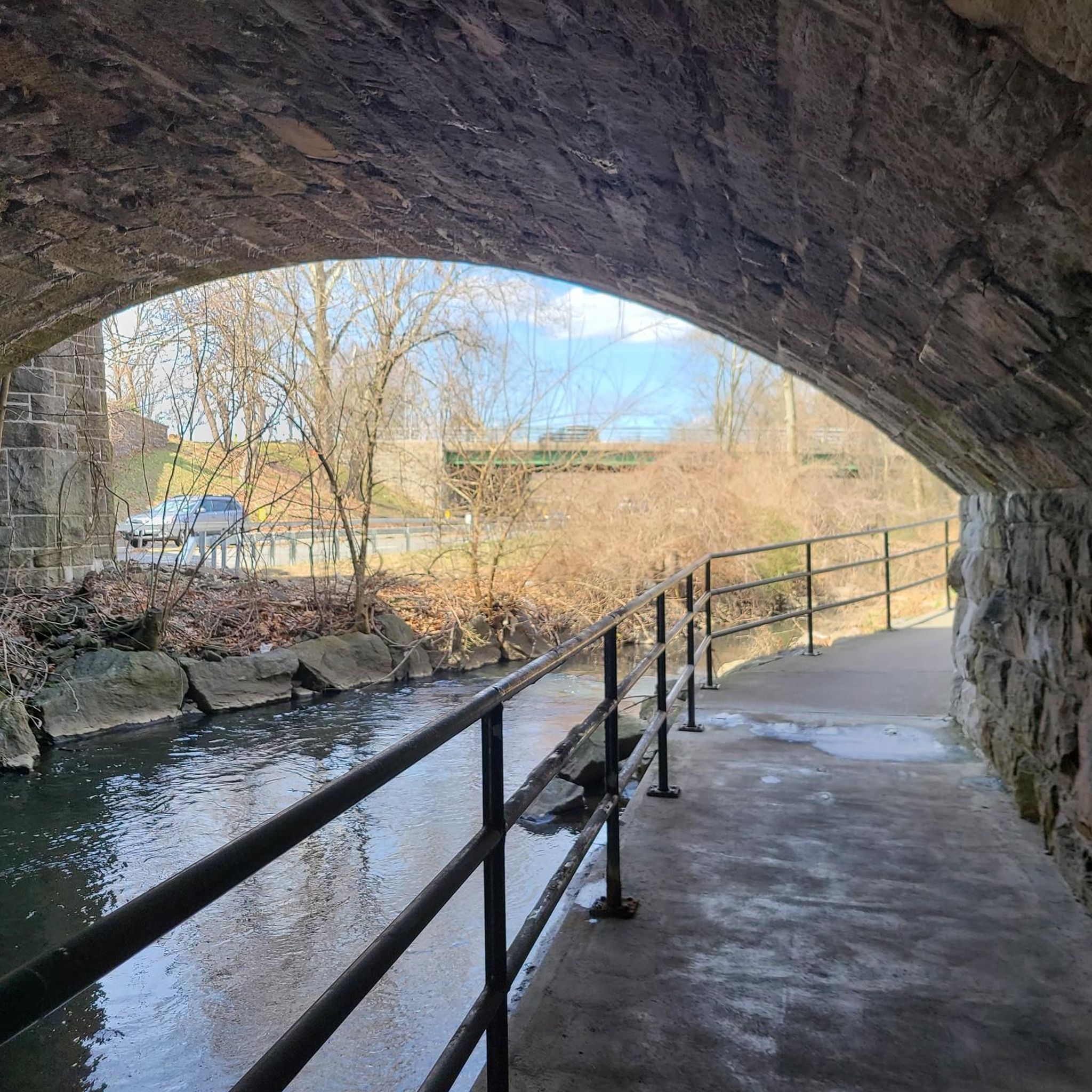
Nice view of the Bronx River from the trail. The river used to be extremely polluted, but in recent years it has been cleaned up and is now a very beautiful place.
0
0

Once a dumping ground, the Bronx River has transformed into a haven for wildlife and fish. Today, it stands as both a recreational area and bikeway, showcasing the remarkable revival of nature.
1
1
Frequently Asked Questions
How many hiking trails are available around Hartsdale?
There are over 30 hiking routes around Hartsdale, offering a diverse range of outdoor experiences. These trails traverse forests, meadows, and wetlands, providing varied scenery for exploration.
Are there any easy hiking trails suitable for beginners or families?
Yes, Hartsdale offers several easy trails perfect for beginners or families. For instance, the Cranberry Lake – Kennelwood Hill loop from Valhalla is an easy option. Additionally, the Greenburgh Nature Center, located nearby, features five marked trails that are great for relaxing strolls through dense forest and meadows, suitable for all ages. You can find more information about the nature center here.
What kind of natural landscapes can I expect to see while hiking in Hartsdale?
Hiking in Hartsdale allows you to experience a rich mix of natural landscapes. You'll find dense forests with high canopy pines and oaks, open meadows, and wetlands. Notable features include vernal ponds, diverse flora like dogwoods and wildflowers, and opportunities to observe local wildlife.
Are there any circular hiking routes in the Hartsdale area?
Yes, there are circular routes available. The Cranberry Lake – Kennelwood Hill loop from Valhalla is a great example of a circular hike. Ridge Road Park and Hart's Brook Park also offer interconnected trails that can be combined for extended loop experiences through wooded paths and meadows.
Are hiking trails in Hartsdale dog-friendly?
Many trails in the Hartsdale area are dog-friendly, but it's always best to check specific park regulations before you go. Generally, parks like Ridge Road Park and Hart's Brook Park welcome leashed dogs on their trails, offering ample space for you and your canine companion to enjoy the outdoors.
What are some interesting landmarks or attractions I might encounter on a hike?
While hiking around Hartsdale, you might come across several interesting natural and man-made features. The Kensico Reservoir is a prominent landmark, and you can hike along its pathway. For a scenic natural feature, consider visiting Peanut Leap Cascade, a beautiful waterfall. There are also several lakes like Tarrytown Reservoir and Woodlands Lake that offer picturesque views.
What do other hikers enjoy most about the trails in Hartsdale?
The hiking routes in Hartsdale are highly rated by the komoot community, with an average score of 4.9 stars from over 40 reviews. Hikers frequently praise the quiet woodlands, well-maintained paths, and the diverse scenery that includes forests, meadows, and river pathways. The variety of options for different ability levels is also a common highlight.
Are there hiking trails accessible by public transportation in Hartsdale?
Yes, some hiking areas around Hartsdale are accessible via public transportation. The Bronx River Pathway, which features routes like Kensico Reservoir via Bronx River Pathway, often runs parallel to Metro-North train lines, making certain sections reachable by train. The South County Trailway is another popular route that can be accessed from various points, some of which are near public transport stops.
What is the best season to go hiking in Hartsdale?
Hartsdale offers enjoyable hiking experiences throughout the year. Spring brings blooming wildflowers and lush greenery, while summer provides warm weather for exploring. Fall is particularly stunning with vibrant foliage, making it a popular time for scenic walks. Even winter hiking can be beautiful, with snow-covered landscapes offering a peaceful experience.
Are there any cafes or places to eat near the hiking trails in Hartsdale?
Yes, Hartsdale and its surrounding towns offer various dining options. For a quick stop, you might find local cafes like 9W Market. The area has a selection of restaurants and pubs where you can refuel after your hike, particularly in the village centers close to the parks and trailheads.
Are there any trails that offer significant elevation changes for a more challenging hike?
While many trails in Hartsdale are relatively gentle, the region does offer routes with some elevation changes. For example, the Tibbetts Brook Park via South County Trailway, while moderate, covers a longer distance and includes some gradual ascents and descents, providing a good workout. For more significant challenges, you might explore the wider Westchester County area.
Most popular attractions around Hartsdale

Get inspired with the komoot mobile app


Explore more
Browse the best Hikes in other regions.
