The best cycling routes around Mamaroneck
4.5
(77)
578
riders
72
rides
Touring cycling around Mamaroneck offers diverse landscapes, from coastal paths along the Long Island Sound to tranquil woodland trails. The region features significant natural elements such as salt marshes, wooded wetlands, and riverine corridors. Terrain varies, providing both smooth, paved surfaces and unpaved sections with elevation changes. This mix of environments caters to a range of cycling preferences and fitness levels.
Best touring cycling routes around Mamaroneck
- The most popular touring cycling route is City Island Road bike path – Shore Road Bridge loop from Mamaroneck, a 28.1 miles (45.2 km) trail that takes 2 hours 40 minutes to complete. This moderate route offers varied scenery, including coastal views.
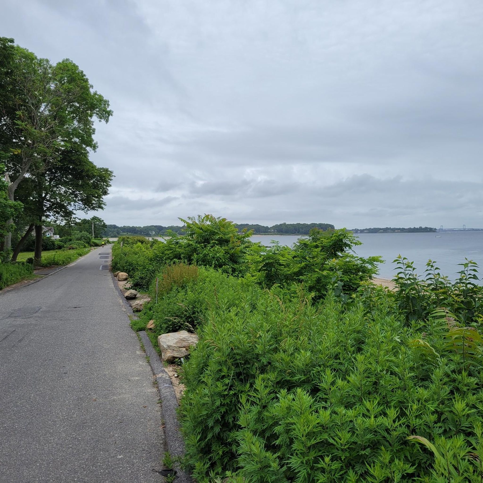
- Another top favourite among local touring cyclists is View of the Long Island Sound – Sunset View at Kirby Lane loop from Mamaroneck, an easy 17.4 miles (28.0 km) path. This route provides scenic views of the Long Island Sound.
- Local touring cyclists also love the View of the Long Island Sound loop from Harrison, a 27.9 miles (45.0 km) trail leading through coastal areas, often completed in about 2 hours 45 minutes.
- Touring cycling around Mamaroneck is defined by coastal paths, salt marshes, and woodlands. The network offers options for different ability levels, from easy rides to more challenging routes with elevation gain.
- The routes in Mamaroneck are highly rated by the komoot community with an average score of 4.3 stars from over 70 reviews. More than 500 touring cyclists have used komoot to explore Mamaroneck's varied terrain.
Last updated: July 2, 2026
16
riders
44.9km
02:39
220m
220m
Moderate bike ride. Good fitness required. Mostly paved surfaces. Suitable for all skill levels.
9
riders
45.7km
02:50
400m
400m
The View of the Long Island Sound – Byram River Marina loop from Harrison offers a delightful touring cycling experience, blending coastal vistas with peaceful stretches of road. You'll spend much of your 28.4-mile (45.7 km) journey enjoying views of the Long Island Sound, with a particularly scenic stop on Forest Ave overlooking a small inlet. The route winds through areas dotted with trees and quiet fields, providing a serene backdrop for your ride.
This moderate route, with its 1323 feet (403 metres) of elevation gain, is best suited for cyclists with good fitness who are comfortable with some climbing. The estimated duration of 2 hours and 50 minutes makes it a substantial outing. As a road ride, it's generally well-paved and accessible, making planning relatively simple; just ensure you're prepared for the elevation changes.
This loop is a fantastic way to explore the coastal and riverine landscapes around Byram, connecting existing paths and offering a fresh perspective on the region. While the route itself is a road cycling adventure, the surrounding area boasts nature trails near beaches and marinas, hinting at further exploration opportunities if you have more time.

Sign up for free
11
riders
Moderate bike ride. Good fitness required. Mostly paved surfaces. Suitable for all skill levels.
8
riders
35.8km
02:10
210m
210m
Moderate bike ride. Good fitness required. Mostly paved surfaces. Suitable for all skill levels.
3.0
(1)
7
riders
36.7km
02:15
280m
280m
Moderate bike ride. Good fitness required. Mostly paved surfaces. Suitable for all skill levels.
Get access to more routes and recommendations from other explorers.
Sign up for free
Already have an account?
Our route recommendations are based on thousands of hikes, rides, and runs completed by other people on komoot.
Start today with a free account
Your next adventure awaits.
Login or Signup
Popular around Mamaroneck
Tips from the Community

Nice view. I ride over that a lot going to orchard, Pelham, love the trail along the shore rd
0
0

Pelham Bridge spans the Hutchinson River at the edge of Pelham Bay Park, with beautiful views of tidal marshes and passing barges. Its historic bascule design lifts for marine traffic, making it one of the most frequently opened drawbridges in New York City. From the pathway, you might spot great egrets and blue herons wading near the marsh or catch an occasional osprey circling overhead, especially in spring and summer.
1
0

In NYC through the Bronx along the Bronx River it is not a nice situation. This take about 20-25 Km up to Takahou. But in the city some nice stages like this on the foto
2
0

This is a nice area for walking. There are a few trail close by the boardwalk. I saw signs that say bicycles are not allowed on the broadwalk area but that is okay because the stones are incredibly bumpy. The boardwalk will give you access to Kazimiroff Nature trail and Twin Island trail which are great places to hike.
1
0
If you want to get to the end of City Island (Belden Point) once going over the bridge there is no bicycle path on the main road and it is narrow. The cars will have to go around you. Be careful.
0
0
The Mosholu-Pelham Greenway path that runs along Pelham Parkway has a lot of cracks. For walking it is okay for biking it is not pleasant. If you are on a bicycle I would avoid it.
0
0

Pelham Bay Park is one of NYC’s best-kept secrets. It's massive, historic, and full of hidden gems. At nearly 2,800 acres, it’s more than three times bigger than Central Park and it's packed with everything from beaches and golf courses to quiet nature trails and colonial landmarks. It also many historic landmarks, from Anne Hutchinson’s ill-fated settlement to Revolutionary War battle sites. Pelham Bay Park is the kind of place that surprises you every time you visit.
1
0

Martine’s Fine Bake Shoppe is a European style bakery that is a great stop for breakfast, lunch or a mid-ride pastry. It has outdoor seating, so you can keep an eye on your bike while you eat.
2
0
Frequently Asked Questions
What types of landscapes can I expect to see while touring cycling in Mamaroneck?
Mamaroneck offers a diverse range of landscapes for touring cyclists. You can expect picturesque waterfront views along the Long Island Sound, tranquil salt marshes like those found at Otter Creek Preserve, and serene woodland trails, such as the Sheldrake River Trails. The region's topography provides a mix of coastal beauty and natural wooded areas.
How many touring cycling routes are available in Mamaroneck?
There are over 60 touring cycling routes available in Mamaroneck, catering to various preferences and fitness levels. These include 23 easy routes, 30 moderate routes, and 15 more challenging options.
Are there any family-friendly touring cycling routes in Mamaroneck?
Yes, Mamaroneck offers several family-friendly cycling options. Many routes feature smooth, well-paved sections suitable for all ages. An easy route that provides scenic views of the Long Island Sound is the View of the Long Island Sound – Sunset View at Kirby Lane loop from Mamaroneck, which is 28.0 km long.
What kind of terrain should I expect on Mamaroneck's touring cycling routes?
The terrain in Mamaroneck is varied. You'll find smooth, well-paved surfaces ideal for relaxed rides, particularly along coastal paths and within parks. However, some routes also include unpaved sections and elevation changes, requiring good to very good fitness for those seeking more challenging experiences. The region's extensive trail systems, like the Bronx River Pathway and South County Trailway, offer a mix of open and wooded scenery.
What do other touring cyclists enjoy most about cycling in Mamaroneck?
The touring cycling routes in Mamaroneck are highly rated by the komoot community, with an average score of 4.3 stars from over 70 reviews. Cyclists often praise the diverse scenery, which includes coastal paths, salt marshes, and woodlands, as well as the variety of routes suitable for different ability levels.
Are there any notable landmarks or points of interest along the touring cycling routes?
Yes, Mamaroneck's routes pass by several interesting landmarks and natural features. You can cycle along the South County Trailway, cross the Shore Road Bridge, or visit the Pelham Bay Park Golden Eagle Monument. Natural attractions include Bronxville Lake and Playland Lake.
Can I find routes that offer views of the Long Island Sound?
Absolutely. Mamaroneck is situated along the Long Island Sound, and many routes offer stunning waterfront views. A popular moderate route that includes coastal scenery is the View of the Long Island Sound loop from Harrison, which is approximately 45.0 km long.
Are there any longer touring cycling routes for experienced cyclists?
For experienced cyclists looking for longer distances, Mamaroneck offers several options. The St. Catherine of Siena Church – Greenwich Point Beach loop from Mamaroneck is a moderate route spanning 57.8 km, providing a substantial ride through varied landscapes.
Are there routes that explore the Sheldrake River area?
Yes, the region features the Sheldrake River Trails, which traverse a 23-acre woodland parcel along the east branch of the Sheldrake River. While specific komoot routes might vary, you can find information about the conservation area on the Town of Mamaroneck website for further exploration.
Are there any routes that connect to larger trail systems?
Yes, Mamaroneck's cycling routes can connect to broader regional greenways. For example, the Bronx River Pathway is a significant trail system in Westchester County, and the South County Trailway extends 14.4 miles through parks and along rivers. The Leatherstocking Trail also connects to the Colonial Greenway, offering interconnected touring opportunities.
What is a good moderate route for touring cycling in Mamaroneck?
A well-regarded moderate route is the City Island Road bike path – Shore Road Bridge loop from Mamaroneck. This 45.2 km trail offers varied scenery, including coastal views, and typically takes around 2 hours 40 minutes to complete.
Can I find routes that include views of the Bronx River?
Yes, you can find routes that offer views of the Bronx River. A moderate option is the Bronx River view – Bronxville Lake loop from Mamaroneck, which covers 36.4 km and includes scenic river sections.
Most popular routes around Mamaroneck
Most popular attractions around Mamaroneck

Get inspired with the komoot mobile app


Explore more
Browse the best Cycling routes in other regions.
