The best running trails around West Swanzey
30
runners
11
runs
Jogging around West Swanzey offers diverse landscapes, from serene riverside paths to challenging hill climbs. The region is characterized by the Ashuelot River, historic covered bridges, and extensive woodlands, providing varied terrain for runners. Trails often feature views of lakes and ponds, alongside routes through forests and up hills like Mount Caesar. The area's network of paths, including the Cheshire Rail Trail, caters to different preferences and fitness levels.
Best jogging routes around West Swanzey
- The most popular jogging route…
Last updated: May 16, 2026
2
runners
22.2km
02:39
150m
150m
Hard run. Very good fitness required. Mostly paved surfaces. Suitable for all skill levels.
8.95km
01:11
240m
240m
Moderate run. Good fitness required. Mostly paved surfaces. Suitable for all skill levels.

Sign up for free
7.57km
01:00
200m
200m
Moderate run. Good fitness required. Mostly paved surfaces. Suitable for all skill levels.
10.3km
01:21
270m
270m
Moderate run. Good fitness required. Mostly paved surfaces. Suitable for all skill levels.
4
runners
5.77km
00:37
20m
20m
Moderate run. Good fitness required. Mostly paved surfaces. Suitable for all skill levels.
Get access to more routes and recommendations from other explorers.
Sign up for free
Already have an account?
Our route recommendations are based on thousands of hikes, rides, and runs completed by other people on komoot.
Start today with a free account
Your next adventure awaits.
Login or Signup


Tips from the Community

The Hubbard Hill Trail is a great, wooded path. It leads up to the peak of Hubbard Hill, so there is a sustained incline. Due to the elevation gain, the trail is considered to be moderate difficulty.
0
0

At the base of Pisgah ridge, you can look out over scenic Pisgah Reservoir, the western lobe of which is also known as Round Pond. The trail east of here crosses Pisgah Brook, which connects the chain of reservoirs along the east side of the ridge.
0
0
Nice, easy trail that runs next to a beautiful pond. The path is normally not too busy, so there is a good chance you might get the whole trail to yourself.
0
0
The Cheshire Rail Trail is a 42-mile long multiuse trail. It passes through beautiful wood land. It is completely off-road, so it is a great place for a peaceful run.
1
0
Mount Pisgah is the highest point in Pisgah state park at around 1300 feet. From here you get a great view of the forest, the reservoirs, and over into Vermont.
0
0
At the base of Pisgah ridge you can look out over scenic Pisgah Reservoir, the western lobe of which is also known as Round Pond. The trail east of here crosses Pisgah Brook, which connects the chain of reservoirs along the east side of the ridge.
0
0
Frequently Asked Questions
How many running routes can I explore around West Swanzey?
There are over 10 dedicated running routes available in the West Swanzey area, catering to various fitness levels. These include paths along the Ashuelot River, through forests, and up hills.
Are there any easy or beginner-friendly jogging paths in West Swanzey?
While the guide primarily features moderate to difficult routes, the Running loop from Keene is a moderate option that is relatively flat, making it suitable for those looking for a less strenuous run. The Cheshire Rail Trail also offers long, car-free sections that can be enjoyed at an easier pace.
What kind of terrain can I expect on the running trails in West Swanzey?
The terrain around West Swanzey is quite varied. You'll find everything from flat, multi-use rail trails like the Cheshire Rail Trail to more challenging ascents on routes like Mount Pisgah via Parker Trail. Many paths wind through woodlands, offering a mix of natural surfaces and some paved sections.
Are there any jogging routes that feature scenic views or natural landmarks?
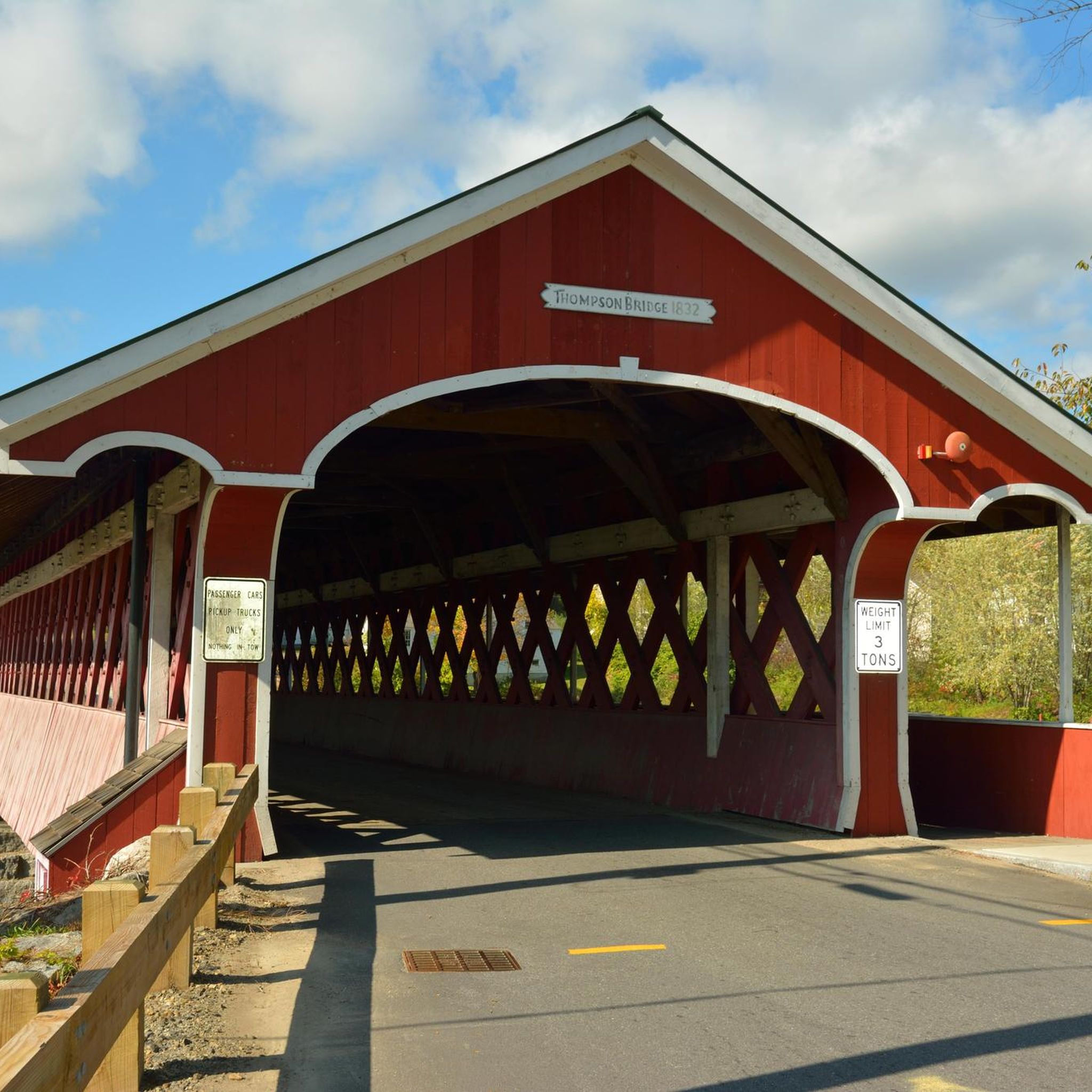
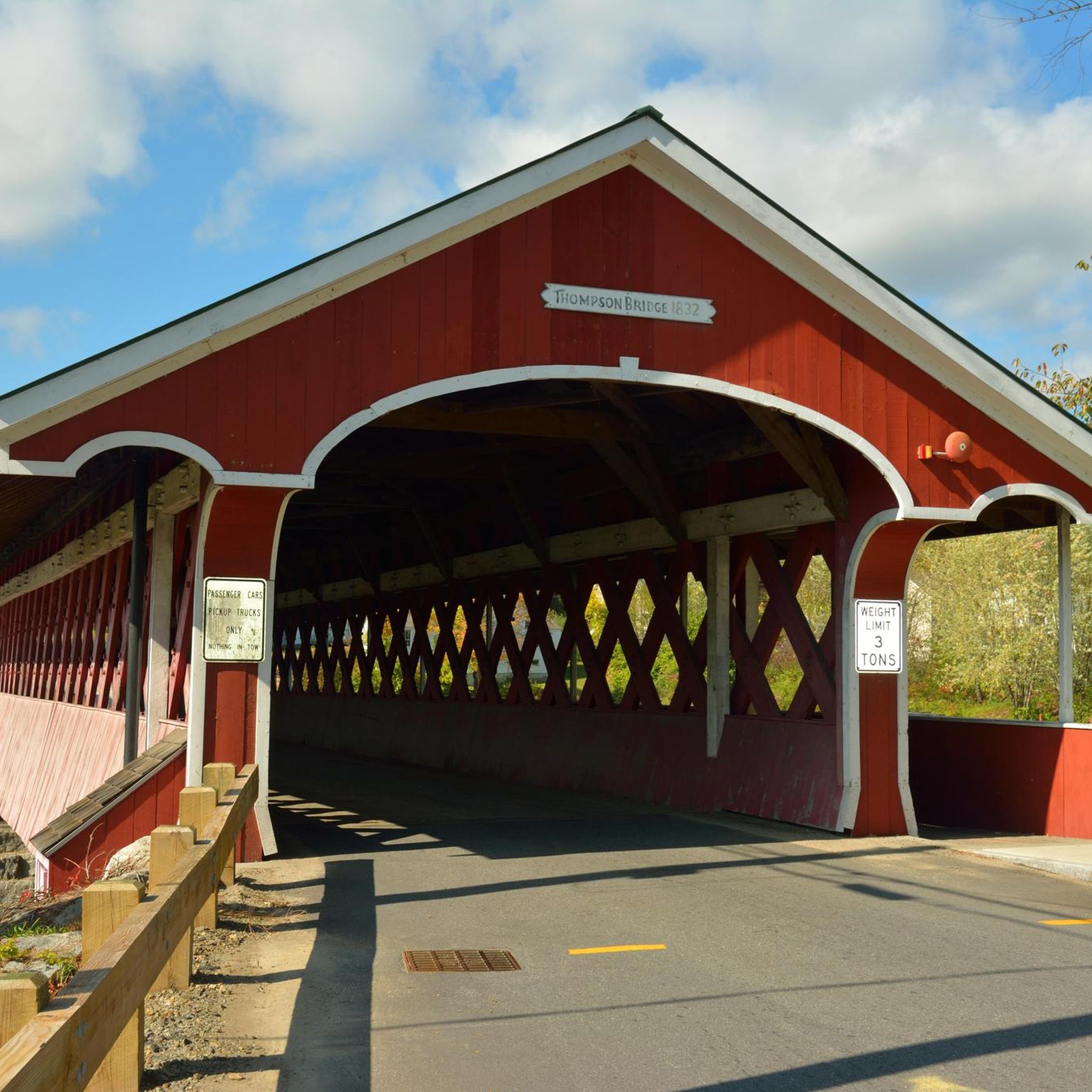
Absolutely! Many routes offer picturesque scenery. The Ashuelot River provides tranquil riverside paths, and you can often spot historic covered bridges, such as the West Swanzey Covered Bridge. Trails around Spofford Lake and Goose Pond offer beautiful water views. For panoramic vistas, routes ascending Mount Caesar or Honey Hill provide rewarding outlooks, sometimes even glimpses of Mount Monadnock.
Can I bring my dog on the running trails in West Swanzey?
Many trails in the West Swanzey area, especially those in state parks and rail trails like the Cheshire Rail Trail, are generally dog-friendly. However, it's always recommended to keep your dog on a leash and check specific trail regulations before heading out to ensure a pleasant experience for everyone.
Are there any family-friendly jogging paths suitable for children or strollers?
For families, the car-free sections of the Cheshire Rail Trail are an excellent choice, offering a safe and relatively flat surface. While specific stroller-friendly routes aren't highlighted, wider, well-maintained sections of the rail trail would be the most suitable option for strollers.
Where can I find parking for the running trails in West Swanzey?
Parking is generally available near popular trailheads, especially for well-known routes like the Cheshire Rail Trail. For specific trail access points and parking information, it's best to check local signage or detailed maps for individual routes before your visit.
What are some notable attractions or points of interest near the jogging routes?
Beyond the natural beauty, West Swanzey is known for its historic charm. You can incorporate runs that pass by the iconic Sawyer's Crossing Covered Bridge or the West Swanzey Covered Bridge. The region also features several beautiful lakes like Spofford Lake and Goose Pond, which are great for post-run relaxation or incorporating into longer scenic routes.
Are there any loop running routes in the area?
Yes, there are several loop options for runners. For example, the Chestnut Hill, Reservoir, and North Ponds Trail Loop offers a varied landscape, and the Hubbard Hill Loop Trail provides a moderate challenge with significant elevation changes.
What do other runners say about jogging in West Swanzey?
The running routes in West Swanzey are highly regarded by the komoot community. Over 30 runners have explored the area using komoot, often praising the diverse terrain, from serene riverside paths to challenging hill climbs, and the scenic beauty of the historic covered bridges and woodlands.
Is public transportation available to access the running trails?
While West Swanzey is primarily accessed by car, local public transportation options might be limited directly to trailheads. It's advisable to check local bus schedules or ride-sharing services if you plan to rely on public transport to reach specific starting points for your runs.
What is the best time of year to go jogging in West Swanzey?
The spring, summer, and fall months generally offer the most pleasant conditions for jogging in West Swanzey. Fall is particularly scenic with the changing foliage. While winter jogging is possible, be prepared for snow and ice, especially on less maintained trails, and check local conditions before heading out.
Most popular routes around West Swanzey
Most popular attractions around West Swanzey

Get inspired with the komoot mobile app


Explore more
Browse the best Running Trails & Routes in other regions.
