The best road cycling routes around East Merrimack
4.4
(9)
436
riders
131
rides
Road cycling around East Merrimack New Hampshire features a diverse landscape of scenic waterways, conservation areas, and dedicated pathways. The region is characterized by its mix of flat rail trails, such as the Nashua River Rail Trail, and routes with varying elevation gains through pine and hardwood forests. Cyclists can explore areas along the Merrimack River and around natural features like Mill Pond, offering a range of terrain for different abilities.
Best road cycling routes around East Merrimack
- The most…
Last updated: October 1, 2026
10
riders
45.4km
01:57
330m
330m
Moderate road ride. Good fitness required. Some segments of this route may be unpaved and difficult to ride.
4
riders
50.9km
02:11
350m
350m
Moderate road ride. Good fitness required. Some segments of this route may be unpaved and difficult to ride.

8
riders
26.6km
01:09
210m
210m
Easy road ride. Great for any fitness level. Mostly well-paved surfaces and easy to ride.
5
riders
40.5km
01:49
420m
420m
Moderate road ride. Good fitness required. Mostly well-paved surfaces and easy to ride.
4
riders
Moderate road ride. Good fitness required. Some segments of this route may be unpaved and difficult to ride.
Get access to more routes and recommendations from other explorers.
Already have an account?
Our route recommendations are based on thousands of hikes, rides, and runs completed by other people on komoot.
Start today with a free account
Your next adventure awaits.


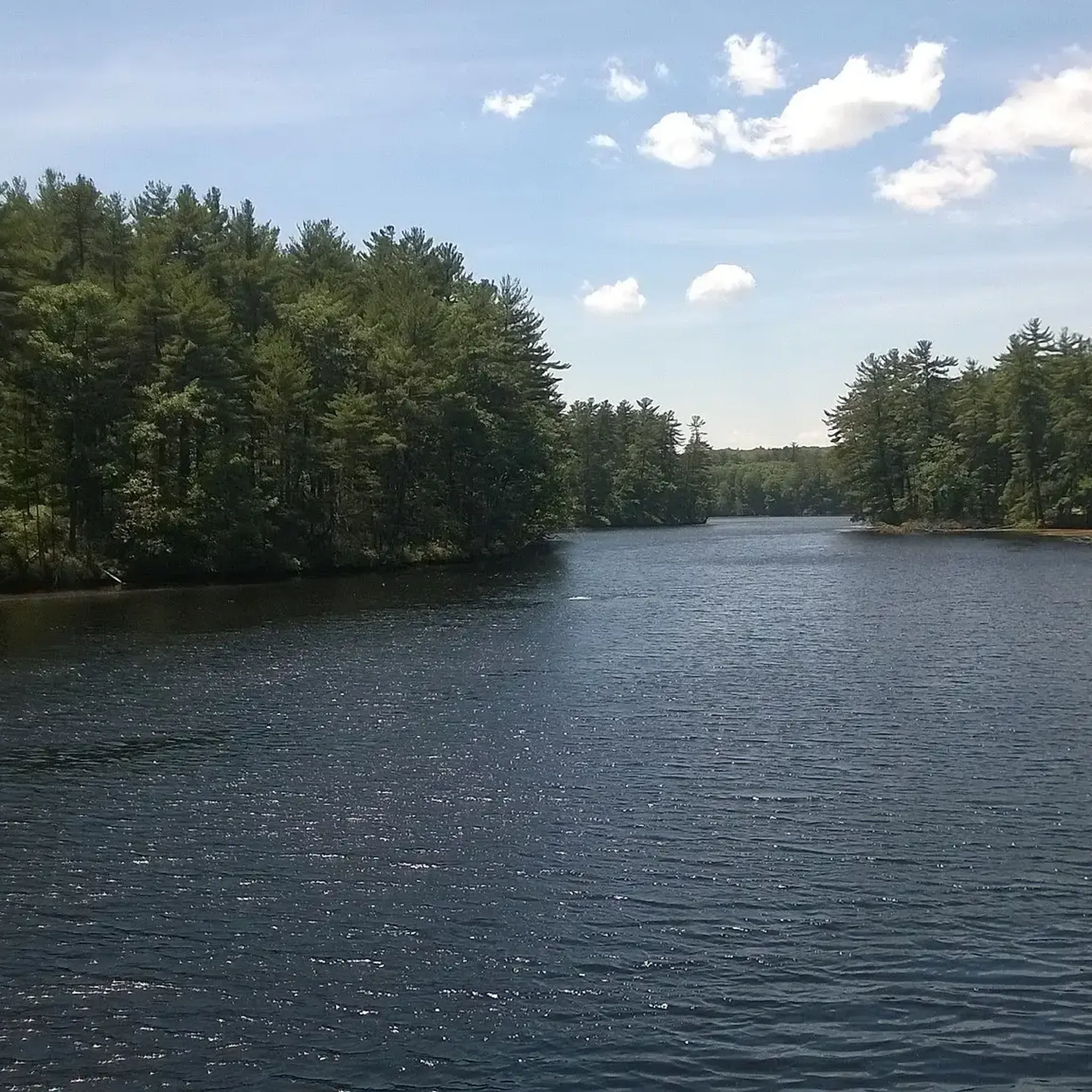

Tips from the Community

Manchester Water Works Watershed Land is a great green space on the outskirts of Manchester. There are several ponds throughout the land and several paved roads that cut through.
0
0

Little Massabesic Brook and Sucker Brook come together to form a 1.9-mile-long stream. They are under the New Hampshire Comprehensive Shoreland Protection Act due to their importance in the watershed. Look down from Manchester Road in the quaint town of Auburn and check out this nice view of Sucker Brook.
0
0
The Londonderry Rail Trail is a 4.5-mile multiuse trail. It is fully paved and well-graded, so it is not a difficult path. It is popular with cyclists, walkers and runners.
1
0

The Wason Pond, or Chester, Covered Bridge is a beautiful, wooden covered bridge that spans the stream flowing out of the southern end of Watson Pond. Although this bridge was erected in 2011, the Timber Framers Guild used historic techniques to build it. From this spot on the road, you get great views of this bridge.
0
0

Naticook Lake is 66 acres with nearly two miles of shoreline. It is a beautiful tree lined lake and has Blueberry Island as its charming centerpiece. You will get glimpses of its beauty through its tree lined shore here.
0
0
The Stowell Road Covered Bridge is a newer covered bridge, as it was constructed in 1990. It spans the Baboosic Brook and is open to traffic. There is no parking next to the bridge, but you can pull off the road and go onto the grass nearby if you want to stop and get a closer look of the bridge.
0
0
Massabesic Lake is a lake that covers over 2,500 acres. The lake is surrounding by woodland, but there are several locations where you can get a great view of the water. As the lake is the main source of drinking water for the Manchester area, swimming in the lake is prohibited.
1
0
Great views of Naticook Lake as you pass by. The park is located in the Wasserman Conservation Area. There is a small island that is located within the lake.
0
0
Frequently Asked Questions
How many road cycling routes are available in East Merrimack?
East Merrimack offers a wide variety of road cycling routes, with over 120 options available. These routes cater to different skill levels, from easy to difficult, ensuring there's something for every road cyclist.
What types of terrain can I expect on road cycling routes in East Merrimack?
The region features a diverse landscape. You'll find relatively flat rail trails, such as sections of the Nashua River Rail Trail, as well as routes with varying elevation gains through pine and hardwood forests. Some routes, like the Naticook Lake – Stowell Road Covered Bridge loop, include significant elevation for a more challenging ride.
Are there any easy or family-friendly road cycling routes in the area?
Yes, East Merrimack has numerous easy routes suitable for beginners or family outings. The Nashua River Rail Trail, for instance, is a paved, relatively flat path ideal for all ages and abilities. For a specific easy loop, consider the Roadbike loop from Mitchell Woods, which covers about 15.5 miles (24.9 km) with moderate elevation.
Where can I find paved bike paths suitable for road cycling?
The most prominent paved path in the region is the Nashua River Rail Trail, which extends from northern Massachusetts into southern New Hampshire. This trail offers a smooth surface ideal for road cycling, passing through scenic wetlands, ponds, and forests. The Rockingham Recreational Rail Trail, though further afield, also provides a paved surface for cycling.
What natural features or landmarks can I see while cycling in East Merrimack?
Road cycling routes in East Merrimack often pass by significant natural features. You can explore areas along the Merrimack River, enjoy views of Mill Pond, or cycle near Naticook Lake. The Wildcat Falls Conservation Area also offers trails and the scenic Wildcat Falls.
Are there any routes with significant elevation gain for more challenging rides?
Absolutely. For experienced road cyclists seeking a challenge, routes like the Naticook Lake – Stowell Road Covered Bridge loop from Wasserman Conservation Area feature substantial elevation gain, reaching over 649 meters (2,129 feet) over its 31.3 miles (50.4 km). Another challenging option is the Forest Road – Antrim Road loop, which covers over 75 miles (121 km) with more than 1,000 meters (3,280 feet) of climbing.
What is the best time of year to go road cycling in East Merrimack?
The autumn months are particularly vibrant for road cycling in East Merrimack, as the region's maples, oaks, beeches, and birches display stunning fall foliage. Spring and summer also offer pleasant conditions, with lush greenery and comfortable temperatures. Winter cycling is possible but requires appropriate gear and awareness of road conditions.
Where can I park my car when accessing road cycling trails?
Access points with parking are available for many trails in the East Merrimack area. For instance, the Nashua River Rail Trail has parking available at Gilson Road in Nashua, NH, and at various points along its length in Massachusetts. It's advisable to check specific trailheads for designated parking areas.
Are there any circular road cycling routes in East Merrimack?
Yes, many of the road cycling routes in East Merrimack are designed as loops, allowing you to start and end at the same point. Examples include the Roadbike loop from Cohas Brook and the Massabesic Lake – Londonderry Rail Trail loop, offering convenient circular journeys.
What do other cyclists say about road cycling in East Merrimack?
The road cycling routes in East Merrimack are highly rated by the komoot community, with an average score of 4.5 stars from numerous reviews. Cyclists often praise the diverse terrain, scenic waterways, and well-maintained paths that make for an enjoyable riding experience.
Is the Nashua River Rail Trail suitable for road cycling?
Yes, the Nashua River Rail Trail is an excellent choice for road cycling. It is a 12.5-mile (20.1 km) paved, mixed-use trail that offers a relatively flat and scenic route. It's suitable for all ages and abilities, providing views of the Nashua River, wetlands, and forests. You can find more information about the trail on Wikipedia.
Are there any routes that pass by lakes or offer water views?
Many routes in East Merrimack feature beautiful water views. The Naticook Lake – Stowell Road Covered Bridge loop passes directly by Naticook Lake. Additionally, the Massabesic Lake – Londonderry Rail Trail loop takes you near Massabesic Lake, offering picturesque vistas.
Most popular routes around East Merrimack
Most popular attractions around East Merrimack

Get inspired with the komoot mobile app


Explore more
Browse the best Road cycling routes in other regions.
