The best cycling routes around Mogul
4.6
(9)
272
riders
47
rides
Touring cycling around Mogul, Nevada, offers routes through the Sierra Nevada foothills, characterized by varying terrains from rolling hills to gentle ascents. The region features a high desert climate with rocky and gravelly soils, providing a distinct cycling experience. Its proximity to Reno allows for access to both natural landscapes and urban amenities. Cyclists can expect scenic mountain views throughout the area.
Best touring cycling routes around Mogul
- The most popular touring cycling route is Steamboat Ditch Trail, a 8.8 miles (14.2 km) trail that takes 1 hour 24 minutes to complete. This moderate path follows a historic ditch, offering views of the surrounding high desert landscape.
- Another top favourite among local touring cyclists is Tahoe-Pyramid Bikeway, a moderate 14.9 miles (24.0 km) path. This route connects Lake Tahoe to Pyramid Lake, showcasing diverse scenery along the Truckee River.
- Local touring cyclists also love the Mayberry to Downtown Loop, a 12.2 miles (19.7 km) trail leading through urban and natural areas, often completed in about 1 hour 9 minutes.
- Touring cycling around Mogul is defined by Sierra Nevada foothills, high desert terrain, and mountain views. The network offers options for different ability levels, from easy loops to more challenging moderate routes.
- The routes in Mogul are highly rated by the komoot community with an average score of 4.6 stars from over 10 reviews. More than 250 touring cyclists have used komoot to explore Mogul's varied terrain.
Last updated: May 11, 2026
5.0
(2)
14
riders
14.2km
01:25
190m
190m
Embark on a moderate touring bicycle ride along the Steamboat Ditch Trail, a route known for its varied scenery and generally gentle gravel path. You will cover 8.8 miles (14.2 km) and gain 620 feet (189 metres) in elevation, typically taking about 1 hour and 24 minutes to complete. As you cycle, you can expect panoramic vistas of the Truckee Meadows and downtown Reno, with distant views of Verdi Peak and Peavine Peak. The trail often parallels the historic irrigation ditch, leading you past unique features like the 'Hole In The Wall' where water flows through a carved hill. Enjoy sections with occasional tree cover and lush greenery, especially when the ditch is full.
When planning your visit, consider the time of year for the best experience on the Steamboat Ditch Trail. During summer months, shade is limited, so riding in the early morning or evening is advisable to avoid the heat. In winter, be prepared for potential snow, mud, or ice on the path, which can affect riding conditions. Always ensure you stay on designated public sections of the trail, as some older parts of the ditch may cross private property.
The Steamboat Ditch Trail offers a unique blend of natural beauty and historical significance. It follows an irrigation ditch that has played a vital role in the region's development, providing water to the Truckee Meadows. This route provides an excellent opportunity to experience the local landscape, transitioning from developed areas to more open, natural settings. The presence of the ditch itself, with its occasional tree-lined banks, creates a distinct atmosphere for your touring bicycle adventure.
2.0
(1)
11
riders
24.0km
01:25
160m
160m
Embark on a moderate touring bicycle ride along the Tahoe-Pyramid Bikeway, a scenic route that stretches for 14.9 miles (24.0 km). You will experience beautiful views of the Truckee River as you cycle through diverse landscapes, gaining 509 feet (155 metres) in elevation. This section takes about 1 hour and 25 minutes to complete, offering a pleasant journey past Mayberry Park and over the iconic Bridge Over the Truckee River.
To begin your adventure, you can find parking conveniently located at Mayberry Park, which serves as the starting point for this route. While this specific section of the bikeway does not require any special permits, it is always wise to plan ahead for essentials like food and water, especially if you consider exploring longer segments of the full bikeway. Always check local conditions before you head out.
This segment of the Tahoe-Pyramid Bikeway provides a wonderful glimpse into the varied ecosystems found along the entire route, showcasing a mix of forested areas and dramatic river canyon views before you reach Crystal Peak Park. It's a notable part of a much larger project, designed to connect Lake Tahoe to Pyramid Lake, offering a unique opportunity to explore the region's natural beauty by bike.

Sign up for free
5.0
(1)
6
riders
19.7km
01:10
120m
120m
Embark on the Mayberry to Downtown Loop, an easy touring cycling route spanning 12.3 miles (19.7 km) with a gentle 388 feet (118 metres) of elevation gain. You can complete this pleasant ride in about 1 hour and 9 minutes, making it ideal for a relaxed outing. The trail offers a unique transition from the serene natural beauty of the Truckee River's cottonwood groves to the vibrant urban landscape of downtown Reno.
When planning your ride, you will find convenient access points and parking available at various city parks along the route. While the path is generally smooth, be aware that some urban stretches closer to downtown Reno have been noted for occasional debris or broken glass. If you plan to explore any unpaved areas near Mayberry Park, a hybrid or gravel bike is a good choice for comfort and traction.
This route stands out for its dynamic scenery, allowing you to experience both the peaceful riparian environment and the energetic city center. As you approach downtown, keep an eye out for the iconic Reno Arch, a notable landmark that signals your arrival into the heart of the city. It's a great way to see different facets of the area in one accessible ride.
14.6km
00:55
150m
150m
This moderate 9.1-mile touring cycling loop combines the Tahoe-Pyramid and Steamboat Ditch Trails, offering diverse terrain and views.
34.1km
02:09
250m
250m
Cycle the moderate 21.2-mile North Reno Bike Loop, enjoying diverse scenery from urban paths to high desert views and the Sparks Marina.
Get access to more routes and recommendations from other explorers.
Sign up for free
Already have an account?
Our route recommendations are based on thousands of hikes, rides, and runs completed by other people on komoot.
Start today with a free account
Your next adventure awaits.
Login or Signup

Tips from the Community

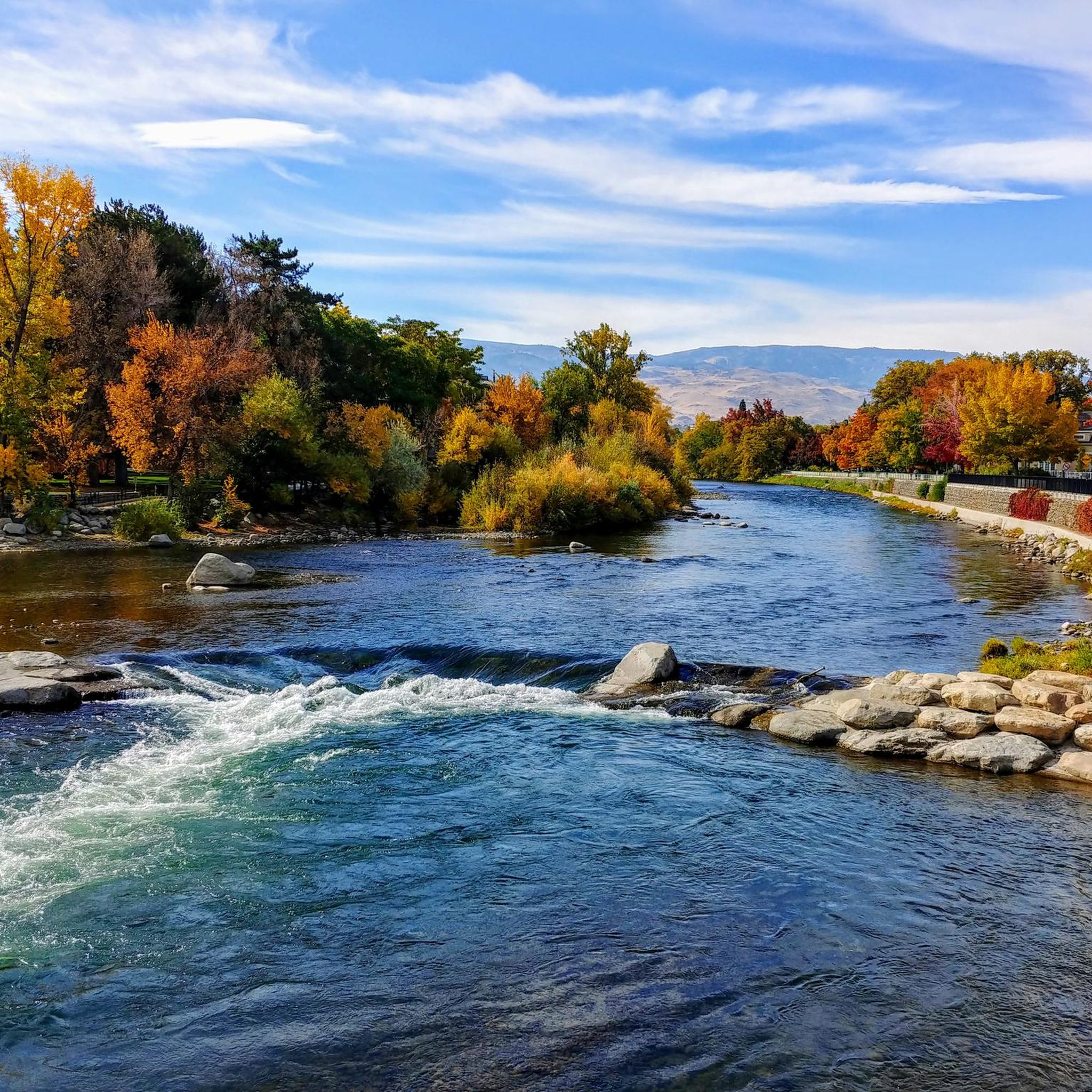
Really cool bridge across the Truckee river. There's picnic tables just off the bridge in a nice shaded area. You can access the river here as well which is a great way to cool off in the summer. The colors in the fall are stunning as well!
1
0
This popular riverside park has a wide paved path, river access, and many more trails across the river leading to Steamboat Ditch & beyond. Mayberry Park also lies along the Tahoe to Pyramid Cycleway which connects the two lakes while mostly paralleling the Truckee River.
0
0
Riverside Drive runs along the Truckee River through a historic neighborhood in West Reno. The treelined paths and sidewalks are stunning in autumn and busy with events and festivals throughout the summer. It can get crowded in summer so going for a morning or evening run will afford you more space.
0
0
Beautiful riverside park with shaded picnic areas and river access. Wonderful place to stop on a ride for a water break and to enjoy the scenery. Even on busier days there's enough room to not feel crowded.
0
0
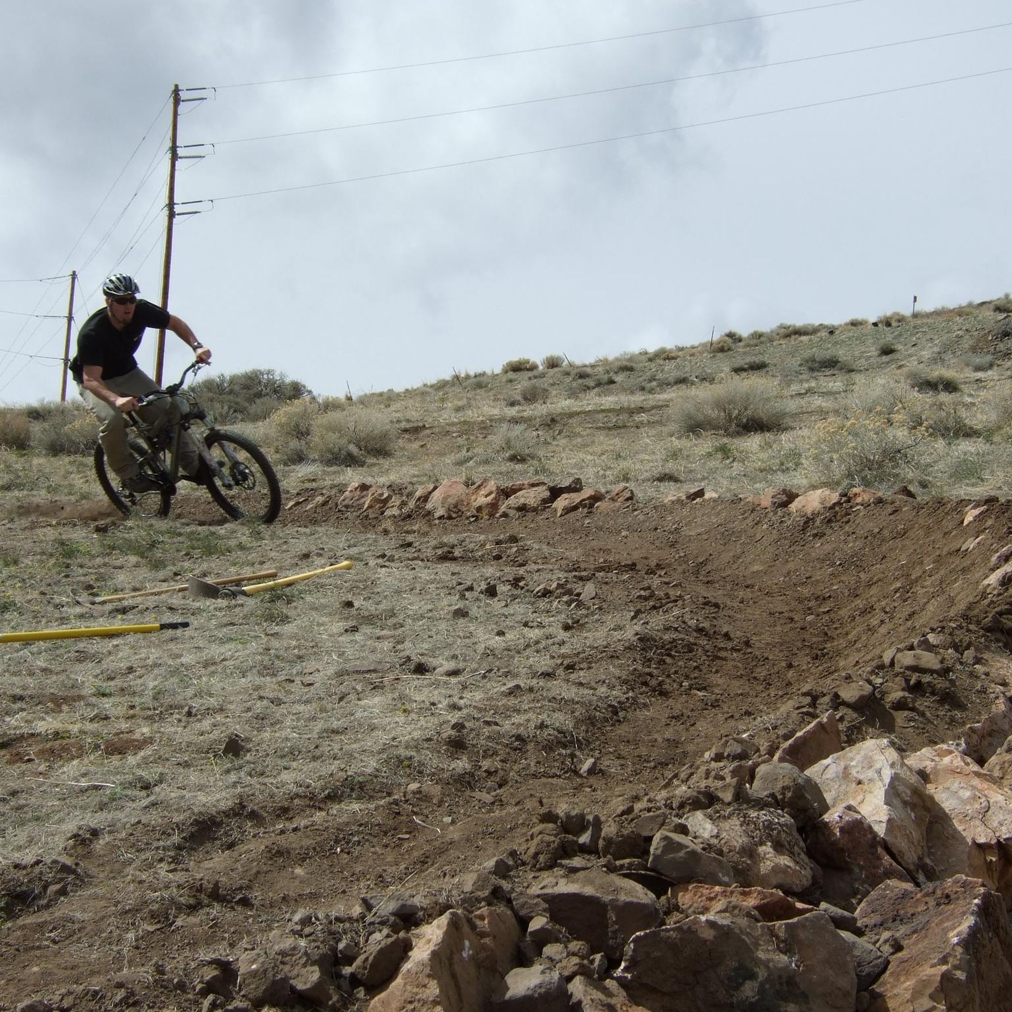
The Tom Cooke Trail connect Mayberry Park with the Steamboat Ditch Trail. It can be accessed by bike but there are some steep technical sections that may be walk-a-bike depending on the bike you're riding. Great views of Peavine and the Truckee River.
0
0
Nice little park with a playground, skatepark, covered picnic/bbq area, and large field to let the kids and/or dogs run. There are toilets and water fountains here but they're usually closed during winter.
0
0
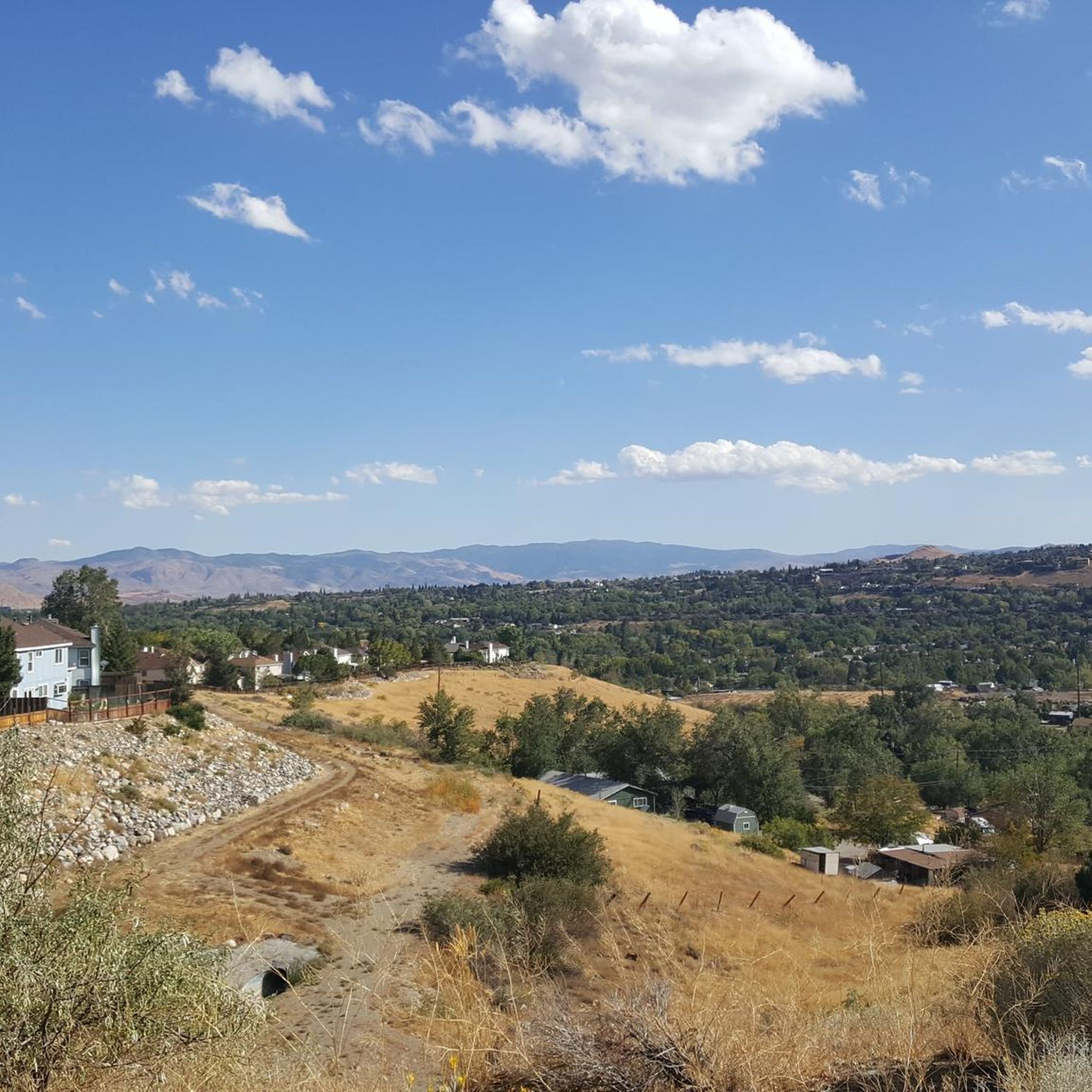
Idyllic is the perfect word to describe Caughlin Ranch. The landscaping is immaculate, the parks are quiet, and the surrounding scenery is beautiful. Perfect spot for a family ride and/or picnic.
0
0
At the intersection of Mayberry & McCarran you'll find a large park on one side of the road and Walden's Coffee House on the other. Just behind Walden's is a small horse pasture that's also home to a few alpacas.
0
0
Frequently Asked Questions
How many touring cycling routes are available around Mogul?
There are over 45 touring cycling routes around Mogul, offering a variety of options for different skill levels and preferences. These routes have been explored by more than 250 touring cyclists using komoot.
What is the best time of year for touring cycling in Mogul?
Mogul experiences a high desert climate with cold winters and hot, dry summers. The most pleasant times for touring cycling are typically spring and fall when temperatures are milder. Summers can be very hot, and winters may bring snow, making some routes less accessible.
What kind of terrain can I expect on touring cycling routes near Mogul?
Touring cycling routes near Mogul are primarily situated in the Sierra Nevada foothills. You can expect varying terrains, from rolling hills to gentle ascents. The region is characterized by rocky and gravelly soils, providing a distinct high desert cycling experience.
Are there touring cycling routes suitable for families in Mogul?
Yes, Mogul offers several easy touring cycling routes that are suitable for families. For example, the Mayberry to Downtown Loop is an easy 12.2-mile path that takes you through both urban and natural areas, perfect for a family outing.
Can I bring my dog on touring cycling routes in Mogul?
While many outdoor areas in the Sierra Nevada foothills are dog-friendly, it's always best to check specific trail regulations before heading out. Some trails may require dogs to be on a leash, and others might have restrictions. Always ensure your dog is well-behaved and that you clean up after them.
Are there any circular touring cycling routes around Mogul?
Yes, there are several circular touring cycling routes available. The McCarran Boulevard Loop is a moderate 23.2-mile circular route, and the Tahoe-Pyramid and Steamboat Ditch Trail Loop offers another moderate 9.1-mile option for a scenic round trip.
What are the difficulty levels of touring cycling routes in Mogul?
The touring cycling routes in Mogul cater to various skill levels. There are 9 easy routes, 24 moderate routes, and 12 difficult routes. This variety ensures that both beginners and experienced cyclists can find suitable paths.
Where can I find scenic viewpoints or landmarks along the touring cycling routes?
The routes around Mogul offer numerous scenic mountain views. You can also explore nearby attractions such as Keystone Canyon, the picturesque Hunter's Creek Waterfall, or the Bridge Over the Truckee River. The Riverside Drive also offers pleasant views along the river.
Are there options for electric bikes on Mogul's touring cycling routes?
Most touring cycling routes in Mogul are suitable for electric bikes, especially those with varying terrains and some ascents. E-bikes can help you cover more ground and enjoy the scenic Sierra Nevada foothills with less effort. Always check specific trail rules regarding e-bike usage if you are unsure.
What do other touring cyclists say about the routes in Mogul?
The touring cycling routes around Mogul are highly rated by the komoot community, with an average score of 4.6 stars. Cyclists often praise the diverse scenery, from high desert landscapes to mountain views, and the well-maintained paths that connect natural beauty with urban amenities.
Is parking available near the touring cycling routes in Mogul?
Given Mogul's proximity to Reno and its role as a gateway to the Sierra Nevada foothills, parking is generally available at various trailheads and public access points. It's advisable to check specific starting points for designated parking areas before your ride.
Can I access touring cycling routes in Mogul using public transport?
Mogul's close proximity to Reno means that some routes, particularly those closer to urban areas like the Mayberry to Downtown Loop, might be accessible via public transport connections from Reno. For routes further into the foothills, personal transport is generally recommended.
What are some longer touring cycling routes for more advanced riders?
For more advanced riders seeking longer distances, the Tahoe-Pyramid Bikeway offers a moderate 14.9-mile path showcasing diverse scenery along the Truckee River. Another option is the McCarran Boulevard Loop, a moderate 23.2-mile route with significant elevation changes.
Are there any permits or regulations I should be aware of for touring cycling in Mogul?
Generally, no specific permits are required for touring cycling on public trails around Mogul. However, it's always good practice to respect local regulations, stay on marked paths, and be mindful of private property. For specific areas, especially those managed by state or federal agencies, it's wise to check their official websites for any particular rules or advisories.
Most popular routes around Mogul
Most popular attractions around Mogul

Get inspired with the komoot mobile app


Explore more
Browse the best Cycling routes in other regions.
