The best road cycling routes around West Glacier
4.5
(2)
163
riders
10
rides
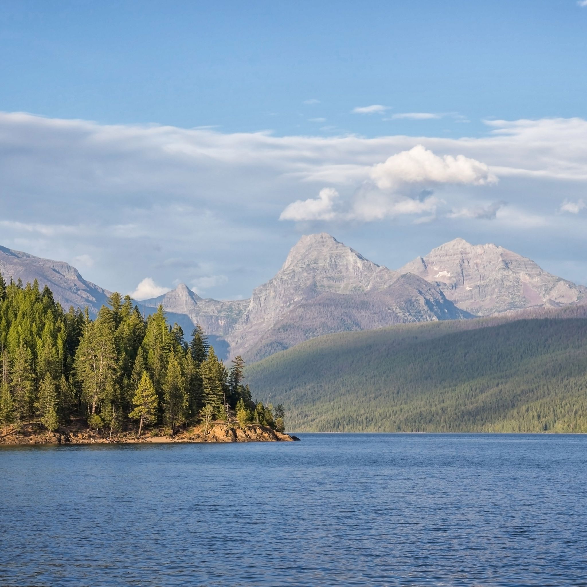
Road cycling routes around West Glacier offer access to Glacier National Park's diverse landscapes, characterized by towering mountains, glacier-carved valleys, and pristine lakes. The region features alpine forests, meadows, and significant elevation changes, providing varied terrain for cyclists. Key natural features include Lake McDonald and McDonald Creek, with routes often following waterways or traversing mountain passes.
Best road cycling routes around West Glacier
- The most popular road cycling route is Going-to-the-Sun Road, a 100.4 miles (161.5 km) trail that…
Last updated: May 27, 2026
16
riders
162km
09:24
2,670m
2,670m
Hard road ride. Very good fitness required. Mostly well-paved surfaces and easy to ride.
4.5
(2)
63
riders
125km
06:51
1,650m
1,650m
Hard road ride. Very good fitness required. Mostly well-paved surfaces and easy to ride.

Sign up for free
11
riders
11.4km
00:33
40m
40m
Easy road ride. Great for any fitness level. Mostly well-paved surfaces and easy to ride.
9
riders
109km
05:07
740m
740m
Hard road ride. Very good fitness required. Some segments of this route may be unpaved and difficult to ride.
9
riders
Moderate road ride. Good fitness required. Mostly well-paved surfaces and easy to ride.
Get access to more routes and recommendations from other explorers.
Sign up for free
Already have an account?
Our route recommendations are based on thousands of hikes, rides, and runs completed by other people on komoot.
Start today with a free account
Your next adventure awaits.
Login or Signup
Popular around West Glacier
Tips from the Community

This area is really so incredibly beautiful.
3
0

Large campground directly on the lake with good swimming, operating for over 100 years, with rustic RV and camp sites, and rustic log cabins built in the 1920s. Located just outside Glacier National Park on Lake Five, three miles west of West Glacier
0
0

Despite this lake's glacier-fed nature, the area gets warm enough for there to be a designated swimming area at this little sandy beach. There's also a shade area, gazebos, picnic tables and docks.
0
0
Just what the name suggests; moose love this sort of terrain, as they're built to navigate it. If you look on the opposite side of the road you'll catch a glimpse of the far prettier McDonald Creek.
0
0

Big Bend is one of the most iconic curves on Going-to-the-Sun Road, where the pavement sweeps in a dramatic arc beneath towering peaks and open sky. Located just west of Logan Pass, it offers a breathtaking vantage point of the upper Garden Wall and the valley far below. There’s a small pullout where you can pause to take in the view—or catch your breath if you're climbing by bike. In summer, wildflowers often blanket the slopes, and waterfalls thread down the cliffs in the distance. It’s a classic Glacier National Park scene, and one of the road’s most photographed spots.
0
0
Red Rocks Point is a scenic pullout along Going-to-the-Sun Road, just west of McDonald Creek’s tumbling cascades. It’s an easy place to miss—but worth a pause. Park (or dismount your bike) and follow the short path down to broad, rust-colored rocks that give the spot its name. From here, you’ll get a striking view of the creek as it rushes through carved channels, especially vibrant in early summer. It’s a peaceful spot for a quick rest or a picnic, with the layered peaks of Glacier National Park rising in the distance and the sound of water all around.
0
0
Reaching the summit of Logan Pass by bike is a true high point—literally and figuratively—of any ride in Glacier National Park. At 6,646 feet, the pass straddles the Continental Divide and offers sweeping views of alpine meadows, rugged peaks, and likely some mountain goats. The visitor center at the top has restrooms, water, interpretive displays, and rangers on hand to answer questions. It’s also a jumping-off point for iconic hikes like the Hidden Lake Overlook and Highline Trail.
0
0
Frequently Asked Questions
How many road cycling routes are available around West Glacier?
There are 4 road cycling routes detailed for West Glacier, offering a range of experiences from easy to difficult. These routes are highly rated by the komoot community, with an average score of 4.75 stars.
Are there easy road cycling routes suitable for beginners or families in West Glacier?
Yes, for an easy and family-friendly ride, consider the Apgar Visitor Center – McDonald Creek loop from Apgar Campground. This 7.1-mile paved trail is relatively flat and winds through scenic areas near Lake McDonald, perfect for a relaxed outing. The McDonald Creek Bike Path and Apgar Bike Trail are also excellent options for easy rides, connecting West Glacier to the Apgar Visitor Center and offering opportunities for wildlife viewing.
Which road cycling routes offer the most challenging climbs in West Glacier?
For a significant challenge, the Going-to-the-Sun Road is an iconic choice. This difficult 100.4-mile route traverses the Continental Divide at Logan Pass, featuring steep climbs and breathtaking views of glacier-carved valleys. Another challenging option is the Upper McDonald Creek Overlook – Logan Pass loop from Coram, which also includes substantial elevation gain.
Are there any loop road cycling routes in the West Glacier area?
Yes, several routes offer a loop experience. The Apgar Bike Trail – Moose Country Pond loop from West Glacier is a moderate 28.6-mile path that winds through Apgar Village and along McDonald Creek. Another option is the Apgar Visitor Center – McDonald Creek loop from Apgar Campground, a shorter 7.1-mile loop.
When is the best time of year for road cycling in West Glacier?
The late spring to early summer (typically May to mid-June) is an exceptional time for road cycling, especially on the iconic Going-to-the-Sun Road. During this period, portions of the road are exclusively accessible to hikers and bikers before fully opening to vehicle traffic, offering a unique, car-free experience. Summer months also provide excellent conditions, though popular routes will be busier.
What scenic attractions can I see along the road cycling routes in West Glacier?
Road cycling routes in West Glacier offer access to stunning natural beauty. You can enjoy views of Lake McDonald, known for its crystal-clear waters and colorful 'rainbow rocks'. The Going-to-the-Sun Road Trail itself provides panoramic vistas of glacier-carved valleys and alpine meadows. The Apgar Bike Trail winds through Apgar Village and along McDonald Creek, with opportunities to spot wildlife.
Are there less crowded road cycling options available in West Glacier?
While the Going-to-the-Sun Road is popular, especially during car-free periods, you can find less crowded options. Camas Road offers a scenic alternative with wide shoulders and beautiful mountain views, particularly in early spring. The Gateway to Glacier Trail, with its completed sections, also provides a scenic off-highway experience. For more solitude, consider exploring roads around Whitefish Lake or Star Meadows Road in the wider Flathead Valley.
What should I know about cycling on the Going-to-the-Sun Road?
The Going-to-the-Sun Road is a 50-mile engineering marvel that traverses the Continental Divide. It features steep climbs, narrow sections, and exhilarating descents. Before its full opening to vehicles (typically May to mid-June), sections are often open exclusively to cyclists, providing a unique opportunity to experience its beauty without car traffic. Always check the current road status and restrictions on the NPS website before planning your ride.
What do other road cyclists enjoy most about cycling in West Glacier?
The area is highly rated by the komoot community, with an average score of 4.75 stars from over 3 reviews. Cyclists often praise the breathtaking landscapes, the unique experience of riding the Going-to-the-Sun Road, and the diverse terrain that caters to various skill levels. The opportunity for wildlife viewing and the pristine natural environment are also frequently highlighted.
Are there any road cycling routes that pass by lakes or water features?
Yes, many routes in West Glacier feature stunning water views. The Apgar Visitor Center – McDonald Creek loop from Apgar Campground leads through scenic areas near Lake McDonald, the largest and most popular lake in Glacier National Park. The Apgar Bike Trail also winds along McDonald Creek, offering views of its tumbling cascades and opportunities to see beavers at Oxbow Bend.
Are there any long-distance road cycling options in the region?
For long-distance cycling, the full Going-to-the-Sun Road route is approximately 100 miles (161.5 km) and takes considerable time and effort to complete. Beyond the immediate West Glacier area, the wider Flathead Valley offers an 80-mile loop around Lake Koocanusa, providing another excellent option for extended rides.
Where can I find information about road conditions or park access for cyclists?
For the most up-to-date information on road conditions, opening dates, and specific regulations for cyclists within Glacier National Park, it is best to consult the official National Park Service website. You can find detailed bicycling information and alerts at nps.gov/glac/planyourvisit/bicycling.htm.
Most popular routes around West Glacier
Most popular attractions around West Glacier

Get inspired with the komoot mobile app


Explore more
Browse the best Road cycling routes in other regions.
