The best cycling routes around Chesterfield
4.8
(44)
686
riders
18
rides
Touring cycling around Chesterfield, Missouri, offers a network of routes primarily along river floodplains and former railway lines. The region is characterized by flat to gently rolling terrain, with routes often following the Missouri River and its tributaries. Cyclists can explore greenways and levee trails, providing accessible paths through natural areas and connecting to larger trail systems. The landscape features open river views, wooded sections, and parklands, making it suitable for various cycling experiences.
Best touring cycling routes around Chesterfield
…Last updated: November 7, 2026
4
riders
41.1km
02:31
160m
150m
Moderate bike ride. Good fitness required. Mostly paved surfaces.
3
riders
62.6km
03:47
320m
320m
Moderate bike ride. Good fitness required. Mostly paved surfaces.

34
riders
Moderate bike ride. Good fitness required. Mostly paved surfaces.
30
riders
Moderate bike ride. Good fitness required. Mostly paved surfaces.
5.0
(1)
41
riders
Moderate bike ride. Good fitness required. Mostly paved surfaces.
Get access to more routes and recommendations from other explorers.
Already have an account?
Our route recommendations are based on thousands of hikes, rides, and runs completed by other people on komoot.
Start today with a free account
Your next adventure awaits.



Tips from the Community

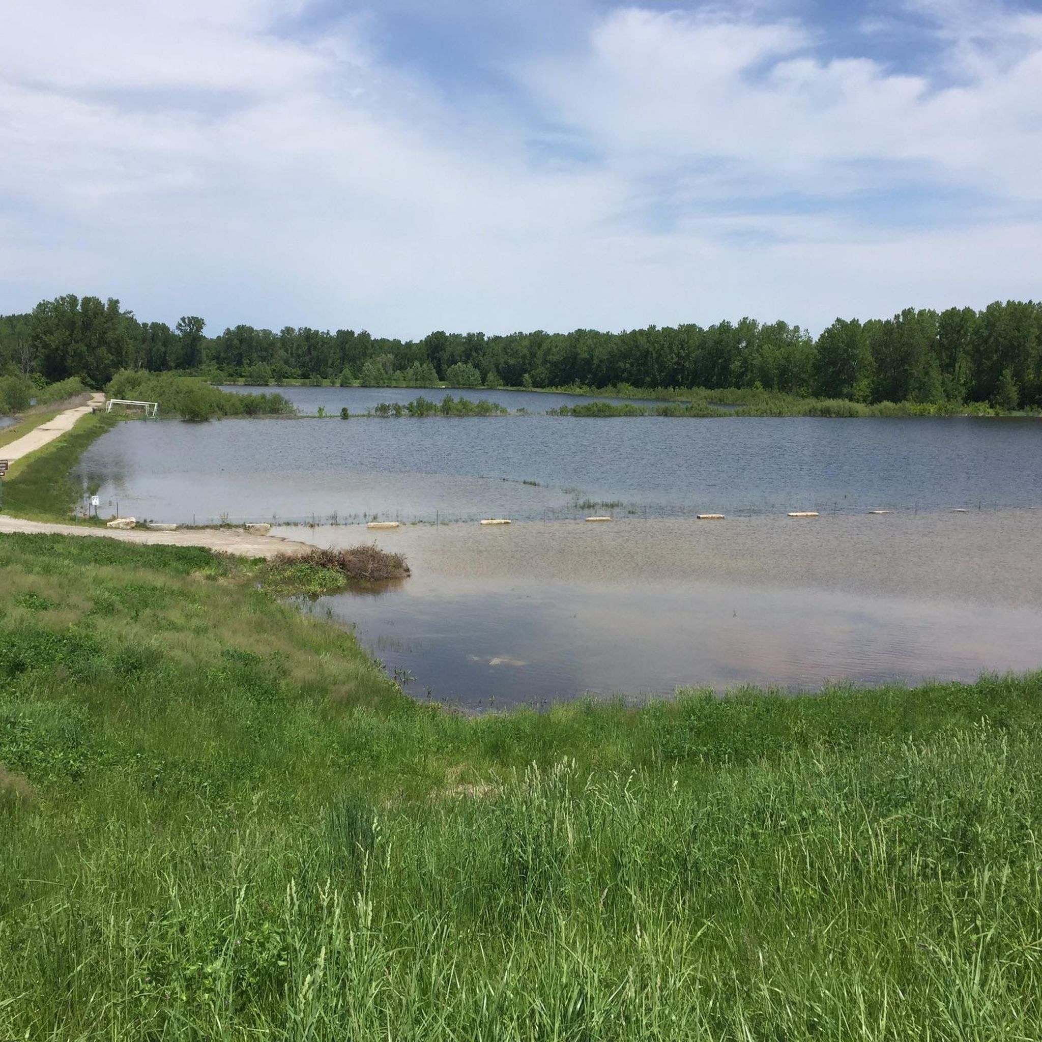
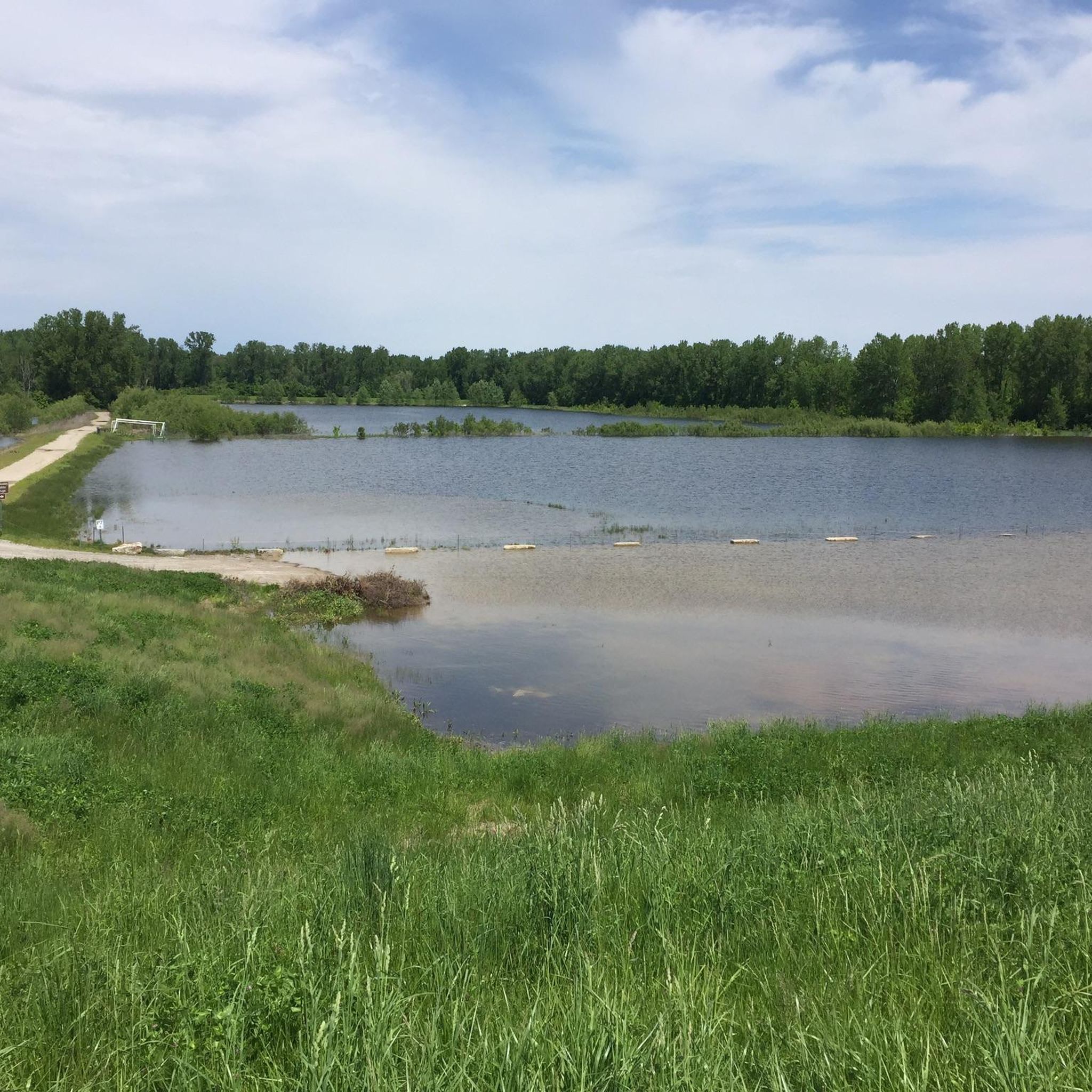
This is a paved trail that runs on top of the Levee that protects the Chesterfield Valley from the flood waters of the Missouri River. It is well-used and you can expect to encounter other cyclists, runners, in line skaters, and folks just out for a walk. The Monarch Levee Trail is linked to the World Famous KATY Trail via a separated bike lane on the Interstate 64 bridge across the Missouri River. There are plenty of parking areas along the trail length. I chose the trail head parking off of the Centaur Road. Expect to see wildlife such as foxes, turkey, deer, raccoons, and other critters mainly on the river side of the trail. On the Valley side is an airport, outlet mall, shopping centers, and entertainment venues. If you are looking for a peaceful serene ride this is NOT it. On a historical note, this levee was built after the devastating floods of 1993. This levee is nearly twice as high as the original levee. If you can imagine when you are looking out over the valley, the airport and all the buildings there, that in 1993 there was nearly 20 feet of water covering all of it! Rescue personnel used the interstate, which crosses the valley, as a boat ramp. All in all this is a well maintained wide trail that you will enjoy riding.
0
0
Had to include this very unusual find. I am assuming that this was a family cemetery and when the new levee, on top of which this bike trail runs, was built it must been over the old cemetery. So they relocated the cemetery to the top of the levee. These are very old, dating back to the 1890's. Be respectful and do not desecrate this place.
0
0

take the time to stop and enjoy the view while crossing the bridge
1
0
One of 3 major highway bridges over the Missouri between Weldon and St Charles, MO. The KATY trail through here is as smooth as concrete and the scenery is beautiful!
1
0

Fantastic bike path over the Daniel Boone Bridge. Great views of the Missouri.
1
0

Here you will reach a historic iron bridge that spans over Femme Osage Creek just before entering Defiance. This is a particularly significant part of the Katy Trail, adding to its historical charm.
0
0
This section of the Katy Trail extends from Greens Bottom Road to Missouri Research Trail. Here, you'll discover a shady, compact gravel road with views of the Missouri River.
1
0
The Katy Trail from Matson to Augusta or vice versa offers mostly shaded paths, providing views of bluffs, wooden bridges, and glimpses of Klondike Park and the surrounding rural area along the way.
0
0
Frequently Asked Questions
How many touring cycling routes are available around Chesterfield, Missouri?
There are over 20 touring cycling routes around Chesterfield, Missouri, listed on komoot. These routes primarily follow river floodplains and former railway lines, offering a mix of flat to gently rolling terrain.
Are there easy touring cycling routes suitable for beginners or families in Chesterfield?
Yes, Chesterfield offers several easy touring cycling routes perfect for beginners or families. These routes often utilize greenways and levee trails, providing accessible paths. One example is the Pittman Hill Trailhead – Greens Bottom Road loop from Daniel Boone Bridge, which is an easy 20-mile (32.1 km) ride.
What kind of terrain can I expect on touring cycling routes in Chesterfield?
Touring cycling routes in Chesterfield are characterized by flat to gently rolling terrain. Many routes follow the Missouri River and its tributaries, utilizing greenways and levee trails. You can expect open river views, wooded sections, and parklands, making for varied scenery.
Are there any challenging routes for experienced touring cyclists?
Yes, for experienced touring cyclists looking for a longer challenge, there is at least one difficult route available. The Katy Trail – Katy Trail loop from Chesterfield is a demanding 66.6-mile (107.2 km) route that takes approximately 7 hours 42 minutes to complete, offering an extensive exploration of the Katy Trail.
What are the most popular touring cycling routes in Chesterfield?
Among the most popular routes, the Katy Trail and Monarch-Chesterfield Levee Loop is a top choice. This moderate 25.5-mile (41.1 km) route combines sections of the famous Katy Trail with the Monarch-Chesterfield Levee, offering diverse scenery and river views.
Are there circular touring cycling routes around Chesterfield?
Yes, many routes around Chesterfield are designed as loops, providing convenient circular journeys. Examples include the popular Monarch-Chesterfield Levee and Babler Park Loop, a moderate 38.9-mile (62.6 km) path, and the Katy Trail – Frontier Park loop from Monarch Chesterfield Levee Trail Parking, which is a 49.4-mile (79.5 km) route.
What can I see or explore along the touring cycling routes in Chesterfield?
Along the touring cycling routes, you can explore various natural and recreational areas. Highlights include the Katy Trail itself, offering extensive riverfront views, and the Missouri River Overlook. You might also pass by Mallard Lake and the Veterans Memorial Bridge.
What do other touring cyclists enjoy most about cycling in Chesterfield?
The area is highly rated by the komoot community, with an average score of 4.8 stars from over 38 reviews. Reviewers often praise the extensive levee trails, scenic river views, and the connections to the Katy Trail, which provide diverse options for different ability levels.
Are there any specific parks or natural areas accessible by bike?
Yes, several parks and natural areas are integrated into the cycling network. Routes like the Monarch-Chesterfield Levee and Babler Park Loop take you through areas like Babler Park. You can also find highlights such as Weldon Spring Conservation Area and Kirkwood Park nearby.
What is the typical duration for a touring cycling route in Chesterfield?
The duration of touring cycling routes in Chesterfield varies significantly depending on the distance and your pace. Easy routes, such as the Pittman Hill Trailhead – Greens Bottom Road loop, can take around 2 hours. Moderate routes like the Katy Trail and Monarch-Chesterfield Levee Loop typically take about 2 hours 30 minutes, while longer, more difficult routes can extend to 7 hours or more.
Are there good options for parking near the cycling trails?
Yes, many routes are designed with convenient access points that include parking. For instance, the Katy Trail – Frontier Park loop specifically mentions starting from the Monarch Chesterfield Levee Trail Parking, indicating dedicated facilities for cyclists.
Most popular routes around Chesterfield
Most popular attractions around Chesterfield

Get inspired with the komoot mobile app


Explore more
Browse the best Cycling routes in other regions.
