The best walks and hikes around Auburn Hills
4.0
(25)
325
hikers
41
hikes
Hiking around Auburn Hills offers diverse natural landscapes, characterized by extensive green spaces, woodlands, and wetlands. The region features a network of trails, often following waterways like the Clinton River and Black Creek, providing varied terrain. Hikers can explore areas with gentle elevations and a mix of natural paths, crushed stone, and asphalt surfaces. These features contribute to a range of hiking experiences suitable for different preferences.
Best hiking trails around Auburn Hills
- The most popular hiking route is Bald Mountain Red Loop, a 3.8 miles (6.1 km) trail that takes 1 hour 33 minutes to complete. This easy route explores the natural environment of Bald Mountain State Recreation Area.
- Another top favourite among local hikers is Clinton River Trail, an easy 2.0 miles (3.2 km) path. This trail follows the Clinton River, offering scenic views along the waterway.
- Local hikers also love the Innovation Hills Park, a 1.9 miles (3.1 km) trail leading through wetlands and offering river views, often completed in about 48 minutes.
- Hiking around Auburn Hills is defined by its diverse trail systems, rivers and creeks, and extensive green spaces. The network offers options for different ability levels, from easy walks to moderate treks.
- The routes in Auburn Hills are highly rated by the komoot community with an average score of 4.1 stars from over 20 reviews. More than 300 hikers have used komoot to explore Auburn Hills's varied terrain.
Last updated: August 22, 2026
6
hikers
3.11km
00:49
20m
20m
Innovation Hills Park in Rochester Hills offers a unique blend of natural beauty and thoughtful design, making it a standout easy hike. This 1.9-mile (3.1 km) route, with a gentle 64 feet (20 metres) of elevation gain, takes around 48 minutes to complete. You'll wander through wooded areas and open meadows, but the real highlight is the one-mile wooden boardwalk that stretches over wetlands, offering intimate views of the ecosystem and the Clinton River.
The park is designed for wide accessibility, with many paths, including the boardwalk, being wheelchair-friendly. Consider an evening stroll; the glowing pavement and solar lighting on the boardwalk create a magical atmosphere after dark. Parking is available at the park, which is well-equipped with amenities.
Beyond the trails, Innovation Hills Park is known for its modern, sustainable design and family-friendly features. It boasts an award-winning, nature-themed playground, one of Michigan's largest, and educational signage along the boardwalk to learn about local ecosystems. Keep an eye out for birds, deer, and muskrats, especially around the wetlands and river.
2
hikers
3.23km
00:49
10m
10m
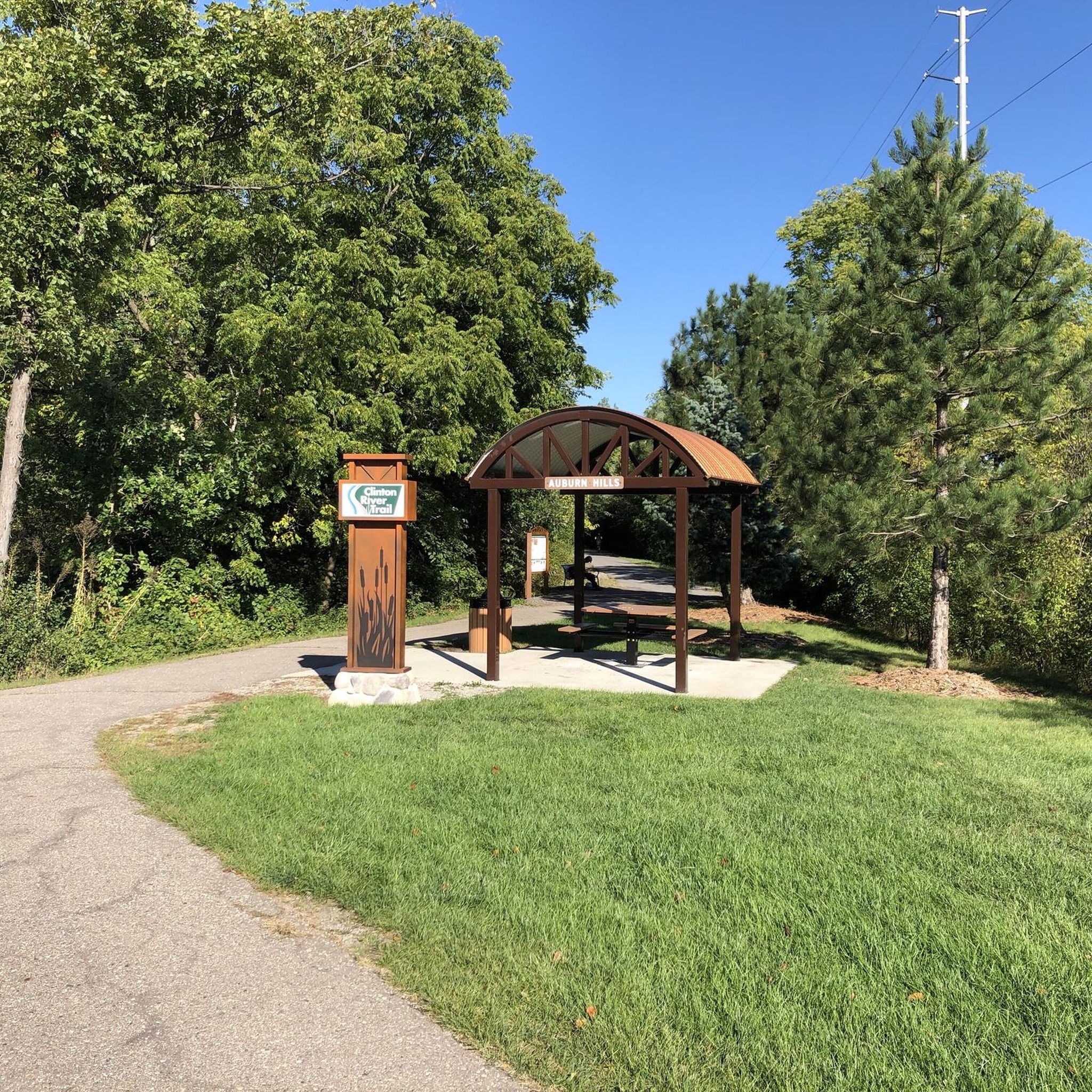
Embark on an easy hike along the Clinton River Trail, a 2.0-mile (3.2 km) route that takes approximately 49 minutes to complete. You will experience a gentle elevation gain of just 30 feet (9 metres) as you follow the river's course. The trail winds through tranquil wooded areas and natural landscapes, offering a peaceful atmosphere. Look for Lake Norcentra Park, a notable visual landmark that adds to the scenic diversity of your journey.
Before you plan your visit, be aware that sections of the Clinton River Trail have experienced temporary closures. As of early 2026, parts of the trail, specifically between the Letica Trailhead and 24 Mile Road, were closed due to washout damage. These closures also affected portions of the connected Macomb Orchard Trail. Repairs are currently underway, so it is advisable to check local conditions and trail status updates before you set out to ensure a smooth hike.
The Clinton River Trail is known for its diverse scenery, with much of the route paralleling the Clinton River. This natural setting provides excellent opportunities to observe local wildlife, such as deer and various waterfowl. Beyond Lake Norcentra Park, you can also enjoy the peaceful surroundings of Harding Green Space, which contributes to the trail's varied natural appeal.

Sign up for free
2
hikers
25.2km
06:30
130m
130m
Embark on the Bald Mountain Red Loop, a difficult hiking route spanning 15.6 miles (25.2 km) with an elevation gain of 427 feet (130 metres). This challenging trail typically takes around 6 hours and 29 minutes to complete. As you hike, you will experience a diverse landscape, moving through deep forests, marshlands, and open fields. The route winds through rolling hills, offering varied scenery and passing several ponds and marsh areas, including a notable crossing of Spring Creek. You will find yourself surrounded by a mix of hardwoods and conifers, providing ample shade during warmer months. Look out for the Lower Trout Lake Picnic Area, a good spot to pause and rest.
Before you head out, be aware that this is a multi-use trail, meaning you will share the path with mountain bikers and cross-country skiers. It is important to remain vigilant and courteous to all users. Additionally, some sections of the trail may be open to hunting during specific seasons, so always check local regulations before your visit to ensure your safety. The Michigan Department of Natural Resources maintains the trail, ensuring a well-kept path for your adventure.
The Bald Mountain Red Loop offers a comprehensive exploration of the Bald Mountain State Recreation Area's varied ecosystems. You will traverse areas rich in natural diversity, from dense woodlands to open marshlands, providing a dynamic backdrop for your hike. The presence of Spring Creek and multiple ponds highlights the area's wetland habitats, which are crucial for local wildlife. This trail stands out for its extensive length and the opportunity to immerse yourself in a wide range of natural settings within a single outing.
1
hikers
2.71km
00:41
0m
10m
The Drayton Plains Nature Trail offers a delightful, easy loop through a surprising array of ecosystems, from white pine forests to wetlands and meadows, all within the Drayton Plains Nature Center. As you follow the 1.7-mile (2.7 km) path, which takes about 41 minutes to complete with only 12 feet (4 metres) of elevation gain, you'll meander past old fish hatchery ponds and the Clinton River, providing a peaceful experience perfect for wildlife spotting.
This accessible trail is open year-round from dawn to dusk, making it a reliable option for a quick outdoor escape. It's a fantastic spot for families and dog owners, just remember to keep your furry friends on a leash. The center also features an interpretive building with exhibits and educational programs, adding another layer to your visit.
Historically a fish hatchery, the site now serves as a vital educational hub and a significant birding location, with over 196 species recorded. It's a testament to how diverse ecosystems can thrive even within a suburban area, offering a quiet, natural refuge and a chance to connect with local ecology.
1.0
(1)
27
hikers
6.05km
01:33
30m
30m
The Bald Mountain Red Loop offers a delightful journey through southeastern Michigan's varied terrain, showcasing landscapes shaped by ancient glaciers. You'll wander through tranquil mixed forests of hardwoods and conifers, skirt marshlands, and pass several serene ponds, including a crossing of Spring Creek. The path meanders over gentle rolling hills and through open fields, providing a refreshing escape into nature with plenty of shade and diverse scenery.
This easy 3.8-mile (6.1 km) hiking loop, with a minimal 87 feet (27 metres) of elevation gain, takes about 1 hour and 33 minutes to complete. It's a multi-use trail, so expect to share the path with mountain bikers and cross-country skiers. The Lower Trout Lake Picnic Area offers a nice spot to pause. Always check for current Bald Mountain Red Loop trail conditions and be aware that hunting may be permitted in certain areas during specific seasons.
Part of the larger Bald Mountain State Recreation Area, this particular Red Loop is found in the South Unit, known for its generally flatter trails compared to the more rugged North Unit. While other, longer versions of a "Red Loop" exist, this shorter route is perfect for those seeking a less strenuous outing. It's an excellent option for wildlife observation and experiencing the region's diverse ecosystems without committing to a full-day trek, making it a popular choice for families.
Get access to more routes and recommendations from other explorers.
Sign up for free
Already have an account?
Our route recommendations are based on thousands of hikes, rides, and runs completed by other people on komoot.
Start today with a free account
Your next adventure awaits.
Login or Signup

Tips from the Community

This picnic area is fantastic, featuring shaded tables and grassy spots by the water. It's perfect for a relaxing outdoor lunch with scenic views of the lake and easy access to the hiking trails that circle its perimeter. It's a lovely place to spend an afternoon away from the city.
0
0
Harding Green Space is a beautiful 26.8-acre natural preserve tucked between Harding Avenue and the Clinton River with scenic bluffs, hiking trails, dense woodlands, and a variety of local wildlife. it's an ideal spot for a quiet refuge in the heart of the city.
0
0

With barbecue facilities and plenty of parking and sanitary facilities.
3
0

Lake Norcentra Park is located on the Great Lake-to-Lake Trails. The lake is part of Rochester University and is open to the public. This is a lovely tranquil spot which has been transformed by an old gravel pit. There are numerous benches where you can sit and enjoy a rest on your ride.
0
0
Lake Norcentra Park is located on the Great Lake-to-Lake Trails. The lake is part of Rochester University and is open to the public. This is a lovely tranquil spot which has been transformed by an old gravel pit. There are numerous benches where you can sit and enjoy a rest on your ride.
0
0

This very narrow path along the Red Trail is lined with grass and has high green hedges on the sides.
0
0
This forest road is immersed in the silence and green of the woods.
0
0
Frequently Asked Questions
How many hiking trails are available in Auburn Hills?
Auburn Hills offers around 30 hiking routes, catering to various preferences. Most of these, about 21, are considered easy, while 9 are moderate. There are no difficult routes listed, making the area accessible for a wide range of hikers.
What types of terrain can I expect on Auburn Hills hiking trails?
The trails in Auburn Hills feature diverse surfaces, including natural paths through woodlands and marshlands, crushed stone, and asphalt. You'll find routes along rivers like the Clinton River and Black Creek, offering varied scenery and gentle elevations.
Are there any family-friendly hiking options in Auburn Hills?
Yes, many trails in Auburn Hills are suitable for families. The area is known for its easy routes and diverse green spaces. For example, the Kingswood Lake loop — Cranbrook Educational Community is an easy 3.4 km trail through woodlands, perfect for a family outing.
Are dogs allowed on hiking trails in Auburn Hills?
While specific dog policies can vary by park or trail section, many green spaces and trails in the Auburn Hills area, such as parts of the Clinton River Trail, are generally dog-friendly. It's always best to check individual park regulations, but you'll often find opportunities to hike with your leashed dog.
What are some notable natural features or attractions to see while hiking?
Auburn Hills' trails often follow the Clinton River and Black Creek, providing scenic views of waterways. You can also explore areas like the Hawk Woods Nature Center with its woods, ponds, and wetlands. Highlights like the Paint Creek Trail and Dinosaur Hill Nature Preserve offer unique natural experiences.
Are there any circular hiking routes in Auburn Hills?
Yes, Auburn Hills offers several circular routes. A popular option is the Bald Mountain State Recreation Area – Red Trail loop, an easy 6.1 km trail that allows you to explore the natural environment and return to your starting point.
What do other hikers say about the trails in Auburn Hills?
The hiking routes in Auburn Hills are highly regarded by the komoot community, holding an average rating of 4.3 stars from over 20 reviews. More than 200 hikers have explored the area, often praising the diverse terrain and well-maintained paths.
Can I find trails that connect to larger regional networks?
Yes, Auburn Hills' trails are often part of or connect to broader regional systems. For instance, the Clinton River Trail, which runs through the area, links to other green spaces and trails like the Rochester Riverwalk, allowing for extended hiking adventures and varied scenery.
Are there any trails suitable for beginners or those looking for an easy walk?
Absolutely. A significant portion of the trails in Auburn Hills, about 21 out of 30, are rated as easy. Routes like the Rochester Riverwalk — Rochester Municipal Park offer a gentle 3.0 km path, perfect for a relaxed stroll.
Are there any lakes or ponds accessible from the hiking trails?
Yes, the region features several beautiful water bodies. You can find highlights like the Pond with Fountain in Rochester Municipal Park, Quarton Lake Park, and Lower Trout Lake near various hiking routes, offering picturesque spots for a break.
What is the best season for hiking in Auburn Hills?
Auburn Hills offers enjoyable hiking experiences across multiple seasons. Fall is particularly popular for its vibrant foliage, while spring brings blooming wildflowers. Summer provides lush green landscapes, and even winter hiking can be beautiful, especially on well-maintained paths.
Are there any longer, more challenging routes for experienced hikers?
While most routes are easy, there are moderate options for those seeking a longer trek. The Rochester Riverwalk loop from Rochester is a moderate 10.9 km trail, offering a more extended experience through the area's natural beauty.
Most popular attractions around Auburn Hills

Get inspired with the komoot mobile app


Explore more
Browse the best Hikes in other regions.
