The best walks and hikes around Milford
4.4
(11)
184
hikers
45
hikes
Hiking around Milford, Massachusetts, offers a network of trails primarily within conserved woodlands and town forests. The region is characterized by mixed hardwood trees, wetlands, open meadows, and seasonal streams, providing diverse natural settings for outdoor activities. Hikers can explore paths that feature views of river valleys and pass through areas with varied wildlife. The terrain generally includes gentle elevation changes suitable for a range of abilities.
Best hiking trails around Milford
- The most popular hiking route is Peppercorn Hill…
Last updated: September 28, 2026
5.0
(2)
11
hikers
4.21km
01:10
80m
70m
Hike the easy 2.6-mile Peppercorn Hill trail, gaining 270 feet, and explore glacial boulders and historic stone walls.
4
hikers
2.96km
00:47
30m
30m
Hike the easy 1.8-mile College Rock Run in Hopkinton, MA, featuring forested paths, rock formations, and the notable College Rock.

4
hikers
6.12km
01:34
20m
30m
Embark on an easy hike through the Wenakeening Woods and Idylbrook Loop, a route that winds through varied landscapes including dense forests, open pine groves, and wetlands. You will encounter…
4.0
(2)
2
hikers
9.23km
02:27
90m
90m
The New, Top Down and Long Run Trail Loop offers a compelling hike through diverse landscapes, featuring both challenging ascents and smoother, runnable sections. You'll navigate varied terrain, from potentially…
1
hikers
49.6km
12:50
290m
280m
The Upper Charles Trail offers a unique journey through Massachusetts' MetroWest suburbs, blending natural beauty with historical infrastructure. You'll traverse varied terrain, from paved sections in Milford to crushed stone…
Get access to more routes and recommendations from other explorers.
Already have an account?
Our route recommendations are based on thousands of hikes, rides, and runs completed by other people on komoot.
Start today with a free account
Your next adventure awaits.

Tips from the Community

Here is the beginning of The Adams Street Conservation Land. The property has 1.5 miles of public trails and it is owned by the Town of Holliston Conservation Commission. It is 71 acres and was purchased on 2008.
0
0

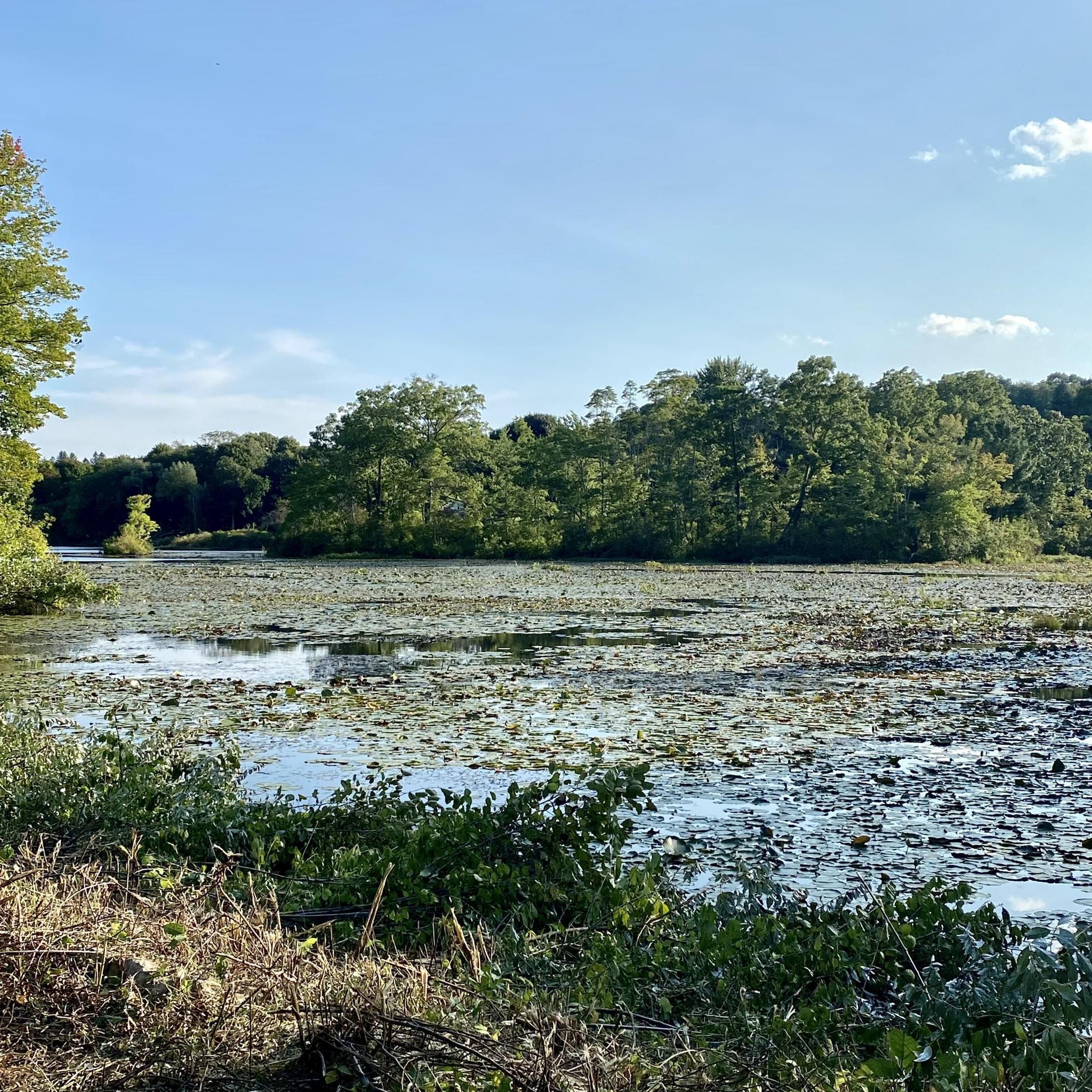
There is a bit of everything here at Louisa Lake. It is a very scenic area and along with nearby Milford Pond, it provides a great venue for a variety of recreational activities, especially bicycling. Nearby is the Upper Charles Trail, a super good cycling trail.
0
0

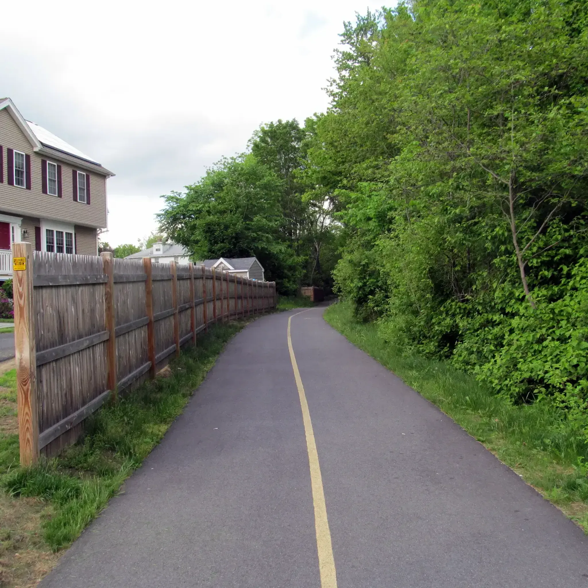
The Upper Charles Trail in Massachusetts offers cyclists a scenic route through historic mill towns, verdant woodlands, and along the Charles River. This multi-use trail spans diverse landscapes, showcasing the region's industrial heritage.
0
0

Louisa Lake offers a scenic haven for non-motor boating, fresh water fishing, and various recreational activities like bicycling, walking, and running.
0
0
Town Forest is a forested recreation area in the quaint town of Milford. It should not be mixed up with its nearby namesake Town Forest Nature Reserve. Town Forest recreation area is situated near to the two cemeteries of North Purchase Street Cemetery and Pine Grove Cemetery. You can hike and run here but as far as cycling is concerned you can cycle through it on the Upper Charles Trail.
0
0
There is a bit of everything here at Louisa Lake. It is very scenic area and along with nearby Milford Pond, it provides a great venue for a variety of recreational activities, especially bicycling. Nearby is the Upper Charles Trail, a super good cycling trail.
0
0

Although it's not very high in elevation, 571-foot (174 m) Peppercorn Hill still offers very nice views over the conservation area of the same name. The best views near the summit are sometimes accompanied by a bit of road noise, but it feels much quieter when you're down in the valley below.
0
0
The Kelly Property in Peppercorn Hill Conservation Area is actually divided into four distinct parcels, but they all lie fairly close to each other. All together, they are made up of wetlands, mature upland forest, and some nice rocky outcroppings that give you great views.
0
0
Frequently Asked Questions
How many hiking trails are available in Milford, Massachusetts?
Milford, Massachusetts, offers a good selection of hiking opportunities, with over 25 trails available for exploration. These routes are primarily found within conserved woodlands and town forests, providing diverse natural settings for outdoor activities.
Are there easy hiking trails suitable for beginners or families in Milford?
Yes, Milford has many easy trails perfect for beginners or families. Out of the 27 available routes, 23 are rated as easy. A popular choice is the Peppercorn Hill loop from Camp St Site, an easy 3.1-mile path that explores woodlands. Another easy option is the Peppercorn Hill loop from Walleston Conservation Area, which is 2.5 miles long.
Can I bring my dog on the hiking trails in Milford?
Many trails in Milford's conserved woodlands and town forests are dog-friendly, but it's always best to check specific trail regulations before heading out. Generally, dogs are welcome on leash in areas like the Milford Town Forest and other conservation lands, allowing you and your canine companion to enjoy the natural surroundings together.
Are there any circular hiking routes in Milford?
Yes, Milford offers several circular hiking routes. A notable one is the Whitehall State Park – Whitehall Reservoir loop from Forestside, an 8.5-mile moderate trail that provides a comprehensive loop around the Whitehall Reservoir. Other popular loops include the Peppercorn Hill loop from Camp St Site and the Peppercorn Hill loop from Walleston Conservation Area.
What kind of natural features or landscapes can I expect to see while hiking in Milford?
Hiking in Milford, Massachusetts, will immerse you in diverse natural landscapes. You can expect to encounter mixed hardwood trees, wetlands, open meadows, and seasonal streams. Many trails offer scenic overlooks of the Blackstone River Valley, and areas like the Milford Town Forest feature varied wildlife. You might also find beaver ponds and small waterfalls, such as Tucker Brook Falls.
What are some notable landmarks or points of interest near the hiking trails in Milford?
Around Milford, you can explore several interesting landmarks and natural features. The Upper Charles Trail offers a multi-use pathway, while Adams Street Conservation Land provides beautiful forest scenery. You can also visit Hopedale Pond and Parklands, Ashland Reservoir Dam, and Louisa Lake, which are popular spots for recreation and enjoying the water.
What do other hikers say about their experience on Milford's trails?
The hiking trails in Milford are highly regarded by the komoot community, holding an impressive average rating of 4.8 out of 5 stars from over 15 reviews. Hikers often praise the well-maintained paths, the peaceful conserved woodlands, and the variety of landscapes, including river valley views and diverse wildlife.
Where can I find parking for the hiking trails in Milford?
Parking is generally available at trailheads and designated access points for Milford's hiking areas. For example, trails like the Peppercorn Hill loop from Camp St Site and the Peppercorn Hill loop from Walleston Conservation Area typically have parking facilities nearby. It's advisable to check specific trail information or local conservation commission websites for detailed parking instructions.
What is the typical duration and distance of hikes in Milford?
The hiking trails in Milford vary in duration and distance to suit different preferences. You can find shorter, easy paths like the 2.5-mile Peppercorn Hill loop from Walleston Conservation Area, which takes about an hour. For a longer outing, the moderate Whitehall State Park – Whitehall Reservoir loop from Forestside covers 8.5 miles and typically takes around 3 hours and 30 minutes.
Are there any trails that offer scenic viewpoints in Milford?
Yes, several trails in Milford provide scenic viewpoints. The Milford Town Forest, for instance, has trails with overlooks of the Blackstone River Valley. Additionally, the Peppercorn Hill loop from Camp St Site offers views from Peppercorn Hill itself, providing picturesque vistas of the surrounding woodlands.
What is the best time of year to go hiking in Milford?
Milford, Massachusetts, offers pleasant hiking experiences throughout much of the year. Spring brings lush greenery and blooming wildflowers, while autumn showcases vibrant fall foliage, making these seasons particularly popular. Summer is also great, though some trails may be more shaded. Winter hiking is possible, especially for those who enjoy snowy landscapes, but conditions can vary.
Are there any specific preparations or gear recommendations for hiking in Milford?
For hiking in Milford, it's recommended to wear comfortable, sturdy footwear suitable for varied terrain, as trails can include dirt paths, roots, and some gentle elevation changes. Bringing water, especially on longer routes, is always a good idea. Depending on the season, insect repellent and layers of clothing are also advisable. Always check weather forecasts before you head out.
Can I find places to eat or drink near the hiking trails in Milford?
Milford, Massachusetts, has various amenities, including cafes and restaurants, within or close to the town center. While specific eateries might not be directly at every trailhead, you'll find options for refreshments and meals a short drive away from the main hiking areas, allowing you to refuel after your outdoor adventure.
Most popular attractions around Milford

Get inspired with the komoot mobile app


Explore more
Browse the best Hikes in other regions.
