The best cycling routes around Yarrowsburg
4.8
(18)
362
riders
14
rides
Touring cycling around Yarrowsburg offers routes through a landscape shaped by Elk Ridge Mountain and the scenic Pleasant Valley. This unincorporated community in Washington County, Maryland, provides a rural setting for cycling. The area features varying terrain, from the foothills of Elk Ridge Mountain to the flat, riverside paths of the C&O Canal Towpath, which runs along the Potomac River. These natural features create diverse cycling opportunities for different skill levels.
Best touring cycling routes around Yarrowsburg
- The most popular…
Last updated: June 28, 2026
5.0
(4)
76
riders
Moderate bike ride. Good fitness required. Mostly paved surfaces. Suitable for all skill levels.
5.0
(3)
41
riders
115km
09:53
400m
400m
Hard bike ride. Very good fitness required. Mostly paved surfaces. Suitable for all skill levels.

Sign up for free
17
riders
33.2km
03:04
130m
130m
Moderate bike ride. Good fitness required. Mostly paved surfaces. Suitable for all skill levels.
7
riders
10.6km
00:42
100m
100m
Easy bike ride. Great for any fitness level. Mostly paved surfaces. Suitable for all skill levels.
5
riders
Moderate bike ride. Good fitness required. Mostly paved surfaces. Suitable for all skill levels.
Get access to more routes and recommendations from other explorers.
Sign up for free
Already have an account?
Our route recommendations are based on thousands of hikes, rides, and runs completed by other people on komoot.
Start today with a free account
Your next adventure awaits.
Login or Signup

Tips from the Community

One of my favorite rides! The trail is well maintained and smooth. So many spots to rest and take breathtaking pics
1
0

28 Sept 2025: staircase closed as they rebuild it
0
0

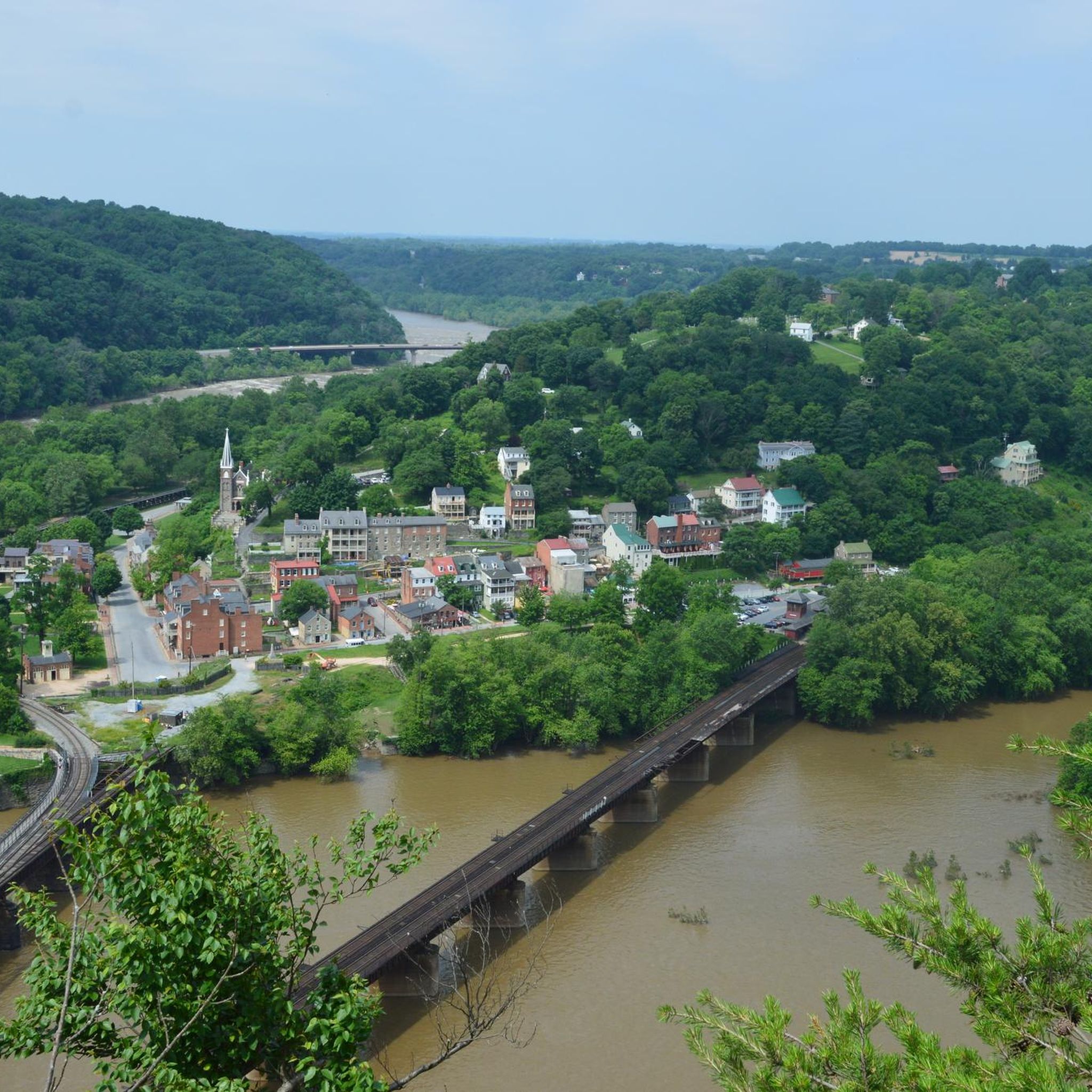
A paved elevated boardwalk stretches out along the water, giving you a fantastic view of the Potomac River. This spot can get pretty popular on summer weekends.
0
0
The Antietam Aqueduct was built in 1834 to carry canal boats over Antietam Creek. It is over 140 feet long and is one of many such aqueducts along the C&O Canal.
0
0

The Antietam Aqueduct, located at mile 69.4 of the C&O Canal Towpath, is a three-arch stone aqueduct that once carried the canal over Antietam Creek. Built in 1834, it is constructed from limestone quarried nearby and remains one of the best-preserved aqueducts along the canal. During the Civil War, it was near the site of Confederate troop movements before and after the Battle of Antietam in 1862. Though it suffered some damage over the years, it has been fully restored and now serves as a scenic and historic stop along the towpath, offering great river views and picnic spots.
0
0

to get from trail to Harper's Ferry, you have to go up these stairs. There are bike racks at the base, or you carry your bike up with you
0
0

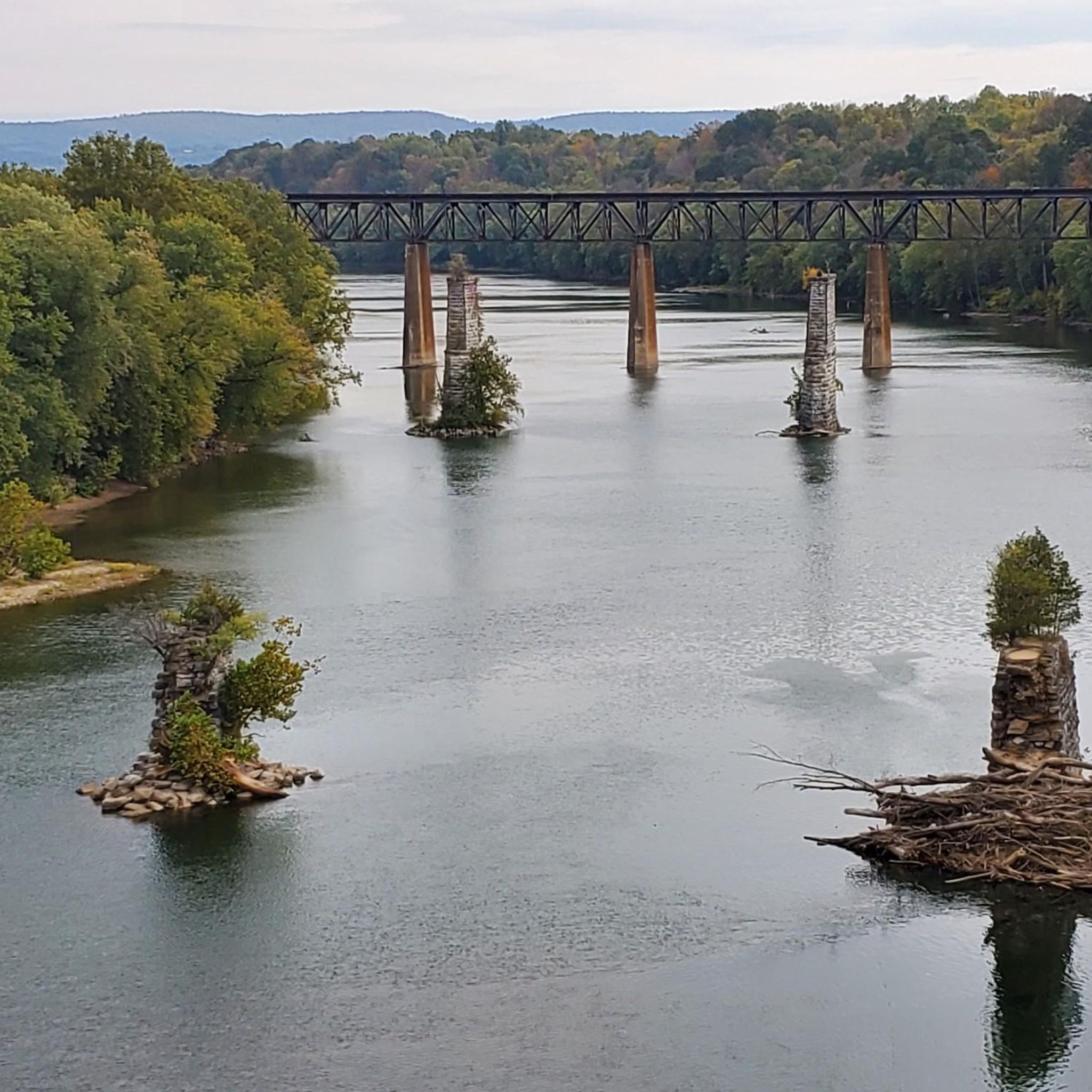
The Potomac River has a mix of flatwater and whitewater, visible as you pedal along the C&O Canal bike trail; this is a great spot to stop and watch some of those rapids.
0
0
From this spot near McMahon’s Mill, you get great views of Big Slackwater. McMahon’s Mill used a steel wheel in the early 20th century to generate electricity. The mill closed in 1922 after a flood but was later restored by the National Park Service. Downstream from McMahon’s Mill, Big Slackwater marks where canal boats entered the Potomac River, avoiding the rocky cliffs by using pools behind Dam 4 and Dam 5. In 1996, flooding damaged the towpath, making this section impassable for over 15 years. Reconstruction began in 2010, and by 2012, the missing towpath section was restored, allowing visitors to travel the entire 184.5 miles of the C&O Canal once again.
0
0
Frequently Asked Questions
How many touring cycling routes are available around Yarrowsburg?
Yarrowsburg offers a selection of 18 touring cycling routes. These routes cater to various skill levels, with 7 easy, 6 moderate, and 5 difficult options to explore the region's diverse terrain.
What kind of terrain can I expect on touring cycling routes near Yarrowsburg?
The terrain around Yarrowsburg is quite varied. You'll find routes that traverse the foothills of Elk Ridge Mountain, offering challenging climbs, as well as flatter, scenic rides through the open spaces of Pleasant Valley. Access to the C&O Canal Towpath also provides opportunities for largely car-free riding on a dirt trail along the Potomac River.
Are there any easy touring cycling routes suitable for beginners in Yarrowsburg?
Yes, Yarrowsburg has 7 easy touring cycling routes. These routes are generally less demanding, allowing beginners to enjoy the scenic rural landscapes without significant elevation challenges. While specific easy routes are not detailed here, komoot offers options to suit those new to touring cycling in the area.
Are there any long-distance touring cycling routes around Yarrowsburg?
For those seeking a longer challenge, Yarrowsburg offers several routes, including the difficult 71.5-mile (115.1 km) Big Slackwater – Big Slackwater View loop from Dargan. This route features significant elevation gain and takes nearly 10 hours to complete, providing an extensive touring experience.
What are some notable landmarks or points of interest I can see along the touring cycling routes?
Many routes pass by historical and natural attractions. You might encounter sites like the Maryland Heights Stone Fort, the scenic Jefferson Rock, or the historic Goodloe E. Byron Memorial Pedestrian Walkway. The area is also close to Harpers Ferry National Historical Park, offering rich Civil War-era history.
Are there any circular touring cycling routes available in Yarrowsburg?
Yes, many of the touring cycling routes around Yarrowsburg are designed as loops. For example, the moderate 30.8-mile (49.6 km) Antietam Aqueduct – Huckleberry Hill Campsite loop from Chestnut Grove Park is a popular circular option that explores the historic Antietam Aqueduct area.
What do other touring cyclists say about the routes in Yarrowsburg?
The touring cycling routes in Yarrowsburg are highly regarded by the komoot community, holding an average rating of 5.0 stars from over 19 reviews. Cyclists often praise the diverse terrain, from challenging mountain foothills to serene riverside paths, and the access to historical sites.
What is a good route for experienced touring cyclists looking for a challenge?
Experienced touring cyclists might enjoy the difficult 56.1-mile (90.3 km) Antietam Aqueduct – Horseshoe Bend campsite loop from Chestnut Grove Park. This route includes significant elevation changes and takes approximately 7 hours and 30 minutes to complete, offering a substantial workout and scenic views.
Is there a moderate touring cycling route that offers a good balance of distance and difficulty?
A good moderate option is the 34.3-mile (34.3 km) Antietam Aqueduct – Horseshoe Bend campsite loop from Antietam. This route provides a balanced challenge with some elevation, typically completed in just over 3 hours, making it suitable for a half-day ride.
Are there any touring cycling routes that feature the Antietam Aqueduct?
Several routes incorporate the historic Antietam Aqueduct. One challenging option is the 58.2-mile (58.2 km) Horseshoe Bend campsite – Antietam Aqueduct loop from Dargan, which is rated difficult and takes around 5 hours and 20 minutes to complete.
What is the best season for touring cycling in Yarrowsburg?
While specific seasonal data isn't provided, the region's location at the foot of Elk Ridge Mountain and within Pleasant Valley suggests that spring and fall would offer the most pleasant cycling conditions. These seasons typically provide milder temperatures and beautiful foliage, enhancing the scenic experience. Summers can be warm and humid, while winters may bring colder temperatures and potential for snow or ice, especially on higher elevations.
Can I find routes that offer views of the Potomac River?
Yes, Yarrowsburg's proximity to the C&O Canal Towpath means you can access routes that run along the Potomac River. This historic towpath offers extensive car-free riding with continuous riverside views, providing a unique touring cycling experience.
Most popular attractions around Yarrowsburg

Get inspired with the komoot mobile app


Explore more
Browse the best Cycling routes in other regions.
