The best cycling routes around Owings Mills
4.5
(10)
103
riders
9
rides
Best cycling routes Owings Mills offers a diverse landscape for touring cyclists, characterized by dense woodlands, serene reservoirs, and extensive trail networks. The region features varied terrain, from gentle, level paths around water bodies to more challenging routes with elevation changes. These natural features provide a range of options for different cycling preferences and skill levels.
Best touring cycling routes around Owings Mills
- The most popular touring cycling route is Jones Falls Trail – Druid Lake loop from Rogers Avenue…
Last updated: October 2, 2026
5.0
(4)
25
riders
36.9km
02:23
400m
400m
Moderate bike ride. Good fitness required. Mostly paved surfaces. Suitable for all skill levels.
4.0
(2)
14
riders
34.6km
02:15
370m
370m
Moderate bike ride. Good fitness required. Mostly paved surfaces. Suitable for all skill levels.

13
riders
Moderate bike ride. Good fitness required. Mostly paved surfaces. Suitable for all skill levels.
4.0
(1)
8
riders
41.3km
02:40
310m
310m
Moderate bike ride. Good fitness required. Mostly paved surfaces. Suitable for all skill levels.
7
riders
8.54km
00:48
120m
120m
Easy bike ride. Great for any fitness level. Mostly paved surfaces. Suitable for all skill levels.
Get access to more routes and recommendations from other explorers.
Already have an account?
Our route recommendations are based on thousands of hikes, rides, and runs completed by other people on komoot.
Start today with a free account
Your next adventure awaits.


Tips from the Community

Leakin Park, in Baltimore, is a vast urban oasis featuring wooded trails, historic structures, and scenic streams. It offers diverse recreational activities, including hiking, birdwatching, biking, and the ideal environment for a family day out.
0
0

This large urban park is a wonderful place to relax in northwest Baltimore. Opened in 1860, it's one of the oldest public parks in the US. Throughout the year there are various events and markets, like the Druid Hill Farmers' Market. There's also plenty of monuments, fountains, woodland and Druid Lake to explore.
0
0

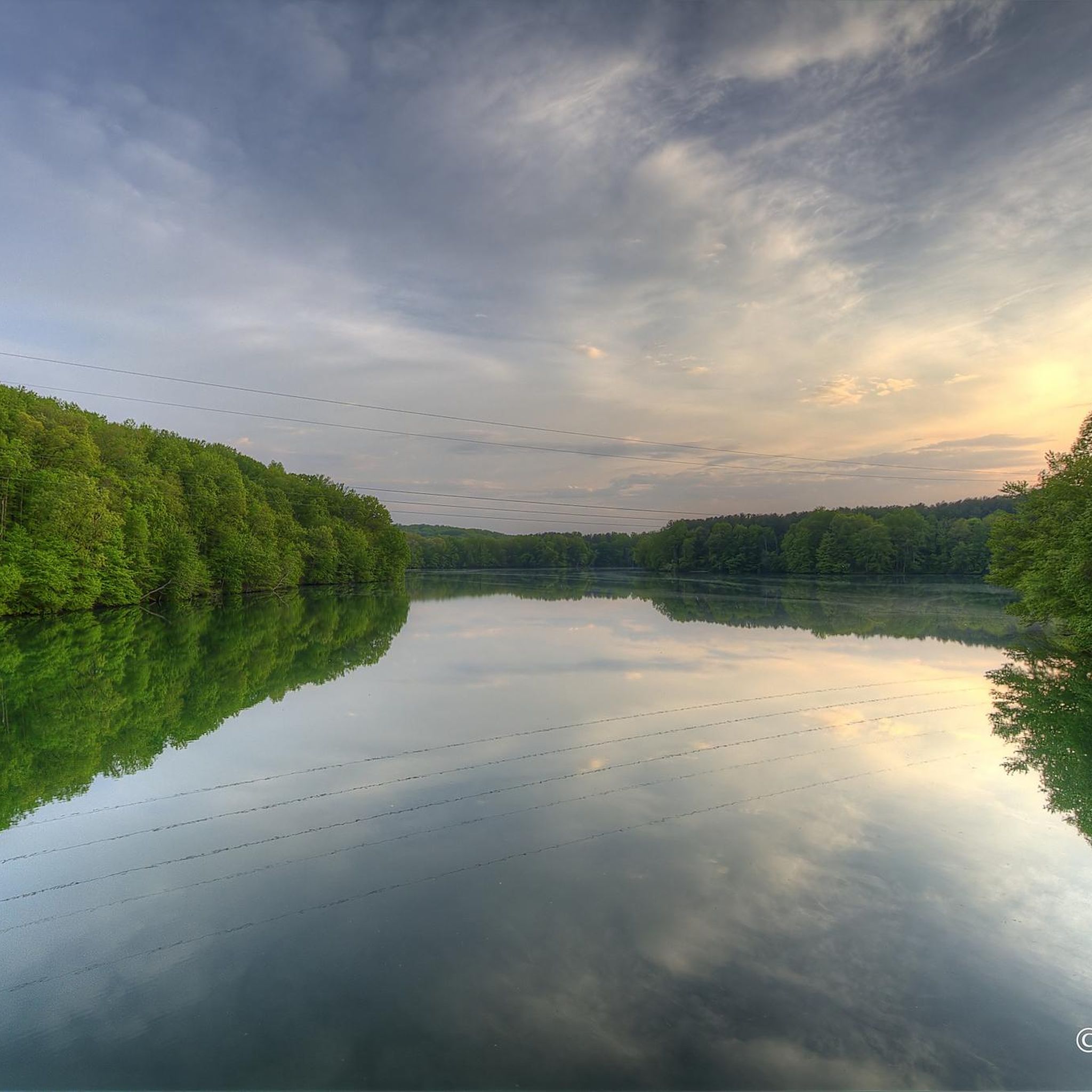
The lake is small and fully encircled by the trail. The wall of the quarry stands high on the far side from the viewpoint. In the summer the vegetation crowding the water makes it feel like quite the lush watering hole.
0
0
The trail is marked with white blazes and runs along the scenic Patapsco River. The trail is moderately technical with some roots and rocks and in most places has room enough to pass.
0
0

As part of the Patapsco Valley State Park, the Woodstock Area is characterized by its scenic woodlands and riverbanks along the trails. While exploring the area you can enjoy a peaceful retreat.
0
0

Between Hooper Rockrose Park and Coldsprings Park the Jones Falls Trail curves suddenly and comes very close to the Jones Falls River. The reason for this curve is Bend Hill which is on the other side of the river. It really does cause a bend in the river. It is one of the highest natural points around Baltimore. I have heard there is a trail to the top but I am not sure how you would get to it because it is between the river and the train lines.
0
0

Druid Hill Park is a gem for runners in the Baltimore area, and Druid Lake is one of the highlights within the park. There is a 1.5-mile paved path circling the water and access to other paths in the same area.
0
0
Step back in time to 1919 when the War Mothers of World War I crafted the poignant Grove of Remembrance in Druid Hill Park. A testament to sacrifice, this arboretum, graced by a substantial pavilion near the Jones Fall Trail, stands as a timeless memorial.
0
0
Frequently Asked Questions
How many touring cycling routes are available around Owings Mills?
Owings Mills offers a selection of 10 touring cycling routes. These routes vary in difficulty and length, providing options for different preferences and skill levels.
Are there any easy or family-friendly touring cycling routes in the area?
Yes, there are 2 easy touring cycling routes around Owings Mills. The Old Quarry Lake – Patapsco River loop from Patapsco Valley State Park is a great option, covering 6.2 miles (10.1 km) through scenic Patapsco Valley State Park. The Torrey C. Brown Trail (Northern Central Railroad Trail) is also known as a family-friendly option, offering a leisurely experience on an old railroad bed.
What kind of terrain can I expect on touring cycling routes near Owings Mills?
The terrain around Owings Mills is quite diverse. You'll find everything from gentle, level paths around reservoirs like Loch Raven and Liberty, to more challenging routes with significant elevation changes through dense woodlands, especially within areas like Patapsco Valley State Park. Some routes feature paved surfaces, while others utilize crushed stone or fire roads.
Are there any challenging touring cycling routes for experienced riders?
Yes, for experienced riders seeking a challenge, there are 3 difficult touring cycling routes. One notable option is the Camel's Den Cave – Views of Patapsco River loop from Mount Hebron, which covers 28.9 km with considerable elevation gain, offering a robust workout and scenic views.
What natural attractions can I see along the touring cycling routes?
Many routes pass through or near significant natural attractions. You can explore areas like Patapsco Valley State Park Alberton Area and Patapsco Valley State Park (Woodstock Area), which feature dense woodlands and riverbanks. You might also encounter McKeldin Falls or enjoy Views of Patapsco River. The trails around Loch Raven and Liberty Reservoirs offer serene water views.
Are there any circular touring cycling routes in Owings Mills?
Yes, many of the touring cycling routes around Owings Mills are designed as loops. For example, the popular Druid Lake – Druid Hill Park loop from Rogers Avenue offers scenic views around a historic park and lake, making it a convenient option for a round trip.
Can I bring my dog on the touring cycling trails?
Many trails in the Owings Mills area are dog-friendly, particularly those in Patapsco Valley State Park, Loch Raven Reservoir, and the Red Run Valley Trail. However, it's always best to check specific park regulations or trail signage for any restrictions, especially regarding leash requirements.
What do other touring cyclists enjoy most about cycling in Owings Mills?
The touring cycling routes in Owings Mills are highly rated by the komoot community, with an average score of 5.0 stars. Cyclists often praise the diverse landscapes, from quiet woodlands to serene reservoirs, and the variety of trail surfaces that cater to different abilities. The interconnectedness of the trail networks also allows for varied and extended rides.
Are there any specific landmarks or points of interest to look out for?
Beyond natural features, you can find interesting points like the Switchback Trail and the Gasline Cut, which offers a viewpoint. The Torrey C. Brown Trail passes through historic communities, and the Patapsco Valley State Park areas like Woodstock and Alberton contain remnants of the cotton textile industry, blending nature with history.
What is the best time of year to go touring cycling in Owings Mills?
Spring and fall generally offer the most pleasant conditions for touring cycling in Owings Mills, with mild temperatures and beautiful foliage. Summer can be warm and humid, while winter may present colder temperatures and potential for snow or ice, especially on unpaved trails. Always check local weather conditions before heading out.
Are there options for public transport to access the cycling routes?
While some routes, like the Jones Falls Trail – Druid Lake loop from Rogers Avenue, are accessible from urban areas, direct public transport links to all trailheads may vary. It's advisable to research specific routes and their proximity to bus or metro stops in advance. Many cyclists opt to drive and park near trail access points.
Where can I find parking for the touring cycling trails?
Parking is generally available at various access points for major trail networks and parks. For instance, Patapsco Valley State Park has designated parking areas, and trails around Loch Raven and Liberty Reservoirs also offer parking. For specific routes, checking the trailhead information on komoot or local park websites is recommended to find the most convenient parking.
Are there any cafes or restaurants near the cycling routes?
Yes, depending on the route, you can find amenities nearby. Routes that venture closer to urban centers or pass through communities will have more options for cafes and restaurants. For trails within larger parks or more remote areas, it's best to pack your own refreshments or plan stops in nearby towns like Owings Mills itself.
Most popular attractions around Owings Mills

Get inspired with the komoot mobile app


Explore more
Browse the best Cycling routes in other regions.
